GO AD-FREE. Get 2 Months Digital Subscription for ONLY £1! Use code 2FOR1
GET STARTEDMore on KentOnline
GO AD-FREE. Get 2 Months Digital Subscription for ONLY £1! Use code 2FOR1
GET STARTEDMore on KentOnline
Home Canterbury News Article
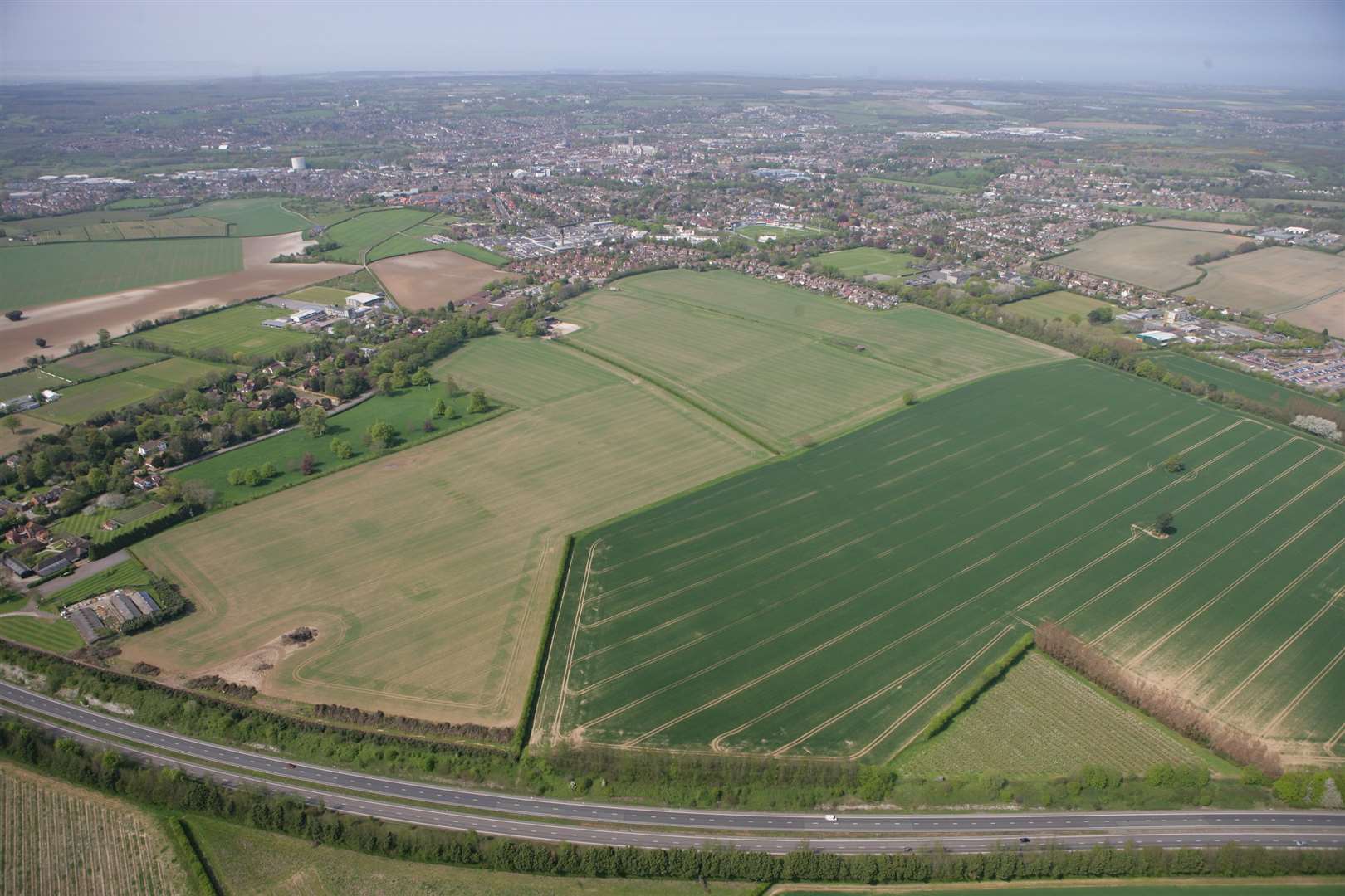
A massive transformation of the Canterbury district has been revealed in the new Local Plan with thousands of homes and radical relief roads set to be built.
The city council’s vision is to approve the building of 780 homes a year for the next 15 years across six main sites, which it says are needed to meet government criteria, demand and create economic growth.
By far the biggest and most controversial is a new garden city-style development of 4,000 homes in south Canterbury with schools, a business park, community facilities and a new junction onto the A2.
The council says it wants to create communities, not housing estates, but already it has been branded “urban sprawl” by the Campaign to Protect Rural England.
The closure of the Sturry level crossing to traffic and the building of a new relief road through ancient woodland between Sweechgate and the A28 is also proposed.
Also planned are:
* 1,000 homes on land in Sturry and Broad Oak.
* 800 homes on land behind the existing Hersden estate.
* 1,000 homes at Hillborough, Herne Bay.
* 800 homes at Strode Park, Herne Bay, and a new relief road for Herne.
* 600 homes on land at Greenhill.
* 400 homes at Herne Bay Golf Club.
* 400 homes off the Thanet Way at Whitstable and an extension to the Duncan Down public space.
* A possible new relief road linking Sturry Road with Littlebourne Road through Howe Barracks land.
Details of each of the schemes have now been published in the draft Local Plan, which will go out to formal public consultation next month.
South Canterbury will bear the brunt of the new homes on farmland largely owned by Mounts, which is in negotiations with a consortium of developers called Corinthian.
The council envisages a garden city-style development which will include relocating Simon Langton Girls Grammar School to behind the Chaucer Hospital, moving the Park and Ride site, a new primary school, a business park and areas of woodland and public space.
The council’s head of planning Ian Brown says that by concentrating larger developments in fewer locations, compared to a “scattergun approach”, better quality schemes with infrastructure and community facilities could be achieved.
Council leader John Gilbey also rejects suggestions the authority could opt for fewer homes, putting less strain on the countryside.
He said: “We have no choice. If we put in for 500 homes a year, it will not get past the first stage of the planning inspection and be bounced straight back, just wasting money.
“We need a plan otherwise it will be a free-for-all for developers and we will lose appeals.”
He said Howe Barracks site had been put into to the plan at the last minute.
He said: “We have had discussions with the Ministry of Defence but it now appears that only the main barracks buildings towards the front of the site are available for redevelopment and only provide a maximum of 300 to 400 homes.”
Cllr Gilbey says the figure of 780-a-year had been reached after considerable research, including a MORI poll and an independent study on what would provide “sustainable growth” for the district.
For more information visit www.canterbury.gov.uk.
What do you think? Email kentishgazette@thekmgroup.co.uk, call 01227 475985 or write to Gazette House, Estuary View Business Park, 5-8 Boorman Way, Wraik Hill, Whitstable, CT5 3SE.