GO AD-FREE. Get 2 Months Digital Subscription for ONLY £1! Use code 2FOR1
GET STARTEDMore on KentOnline
GO AD-FREE. Get 2 Months Digital Subscription for ONLY £1! Use code 2FOR1
GET STARTEDMore on KentOnline
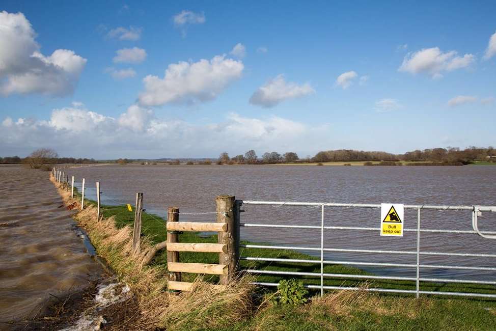
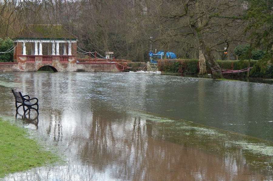
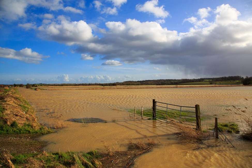
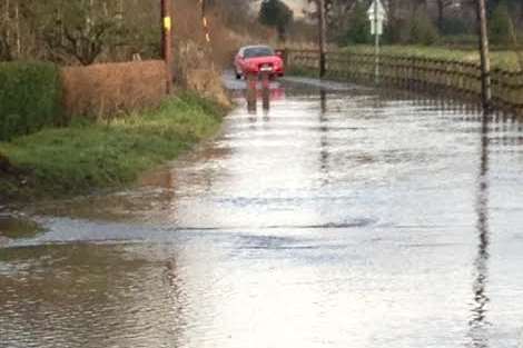
Kent is today being warned to prepare for more flooding - as the county continues to be battered by a winter of extreme weather.
The Met office has issued two amber warnings, with heavy rain expected to be coupled with strong gusts of up to 70mph over the next few days.
Three Environment Agency flood warnings are also in force on parts of the River Stour, Little Stour and Nailbourne.
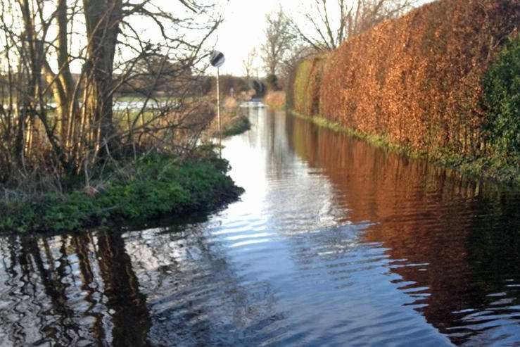
It warned people to remain vigilant to the threat of river, coastal and groundwater flooding.
The alerts follow the wettest January on record in some places - with more rainfall on saturated ground and high river levels adding to the problem.
Experts fear strong winds and high waves could also cause an increased risk of flooding along the whole of the south coast over the next few days.
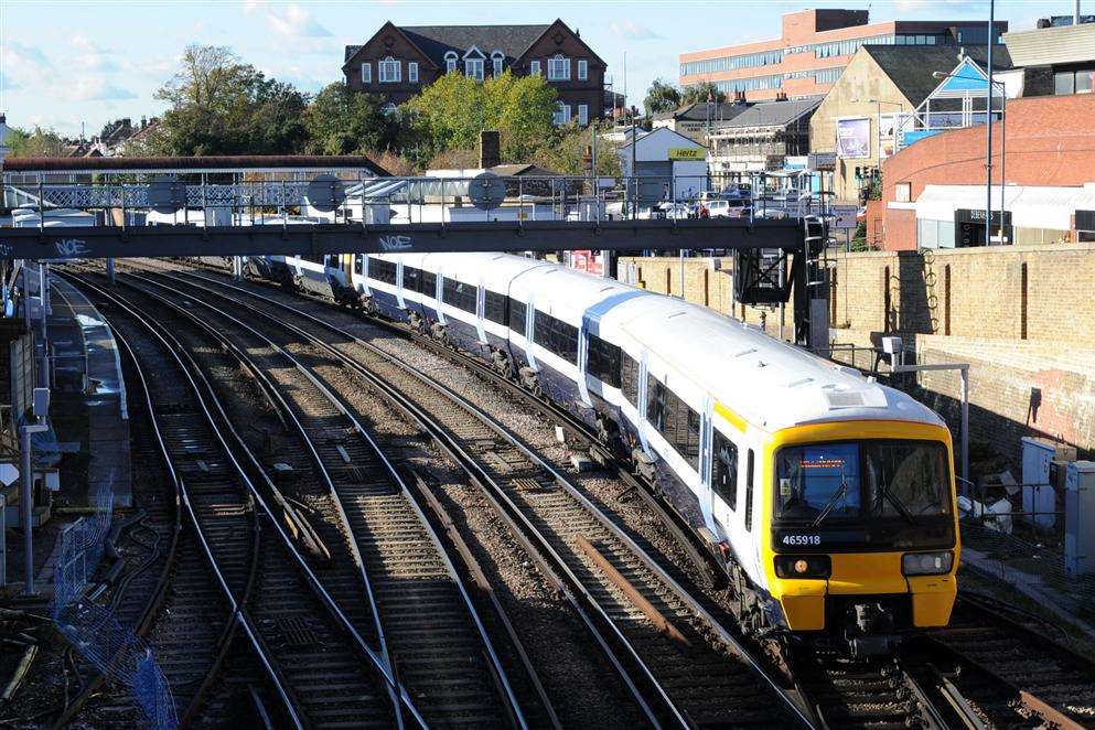
Rail operator Southeastern is also this afternoon reporting of delays and cancellations to services because of the weather.
David Bedlington, from the Environment Agency, said: "Strong gales and high waves along the coast could cause tidal flooding issues to coastal communities today.
"This risk coupled with further bands of heavy rain and high groundwater and river levels could lead to further flooding throughout this week.
"We urge people to again stay away from coastlines and tidal areas and not drive through flood water..." - David Bedington, Environment Agency
"We urge people to again stay away from coastlines and tidal areas and not drive through flood water.
"With further severe weather conditions expected all week, the Environment Agency is likely to issue further warnings so people should check their flood risk and get early warnings so they can take action to protect their property.
"Environment Agency teams continue to work around the clock to prepare for the rainfall by operating pumping stations, issuing flood warnings, and checking that flood banks, walls, and barriers are all working effectively.
"We are ready to deploy pumps to affected areas and our flood ambassadors remain out in communities affected by flooding.
"We will continue to monitor the situation very closely and we urge communities to be aware of their flood risk for the rest of the week."
Meanwhile, the Met Office has issued an amber warning for wind with strong gusts of up to 70mph along the Kent coast.
It also has an amber warning for rain from 3pm tomorrow until 11pm on Saturday.
Kent County Council said parts of the county could see another 10mm of rain today, coupled with strong gusts - up to 60mph inland and up to 70mph along the coast.
The Highways Agency urged drivers to take extra care on the county's roads, while some Southeastern trains have been running slower than normal in case of fallen trees.
The rail operator said the disruption comes after Network Rail introduced speed restrictions from 11pm yesterday amid fears of falling trees and damaged infrastructure.
Michelle Ulyatt, customer relations manager for Southeastern, said: "We've seen the wettest January in a century and the forecast of more heavy rain on top of this brings a real risk of further landslips, flooding and falling trees.
"For safety reasons, Network Rail has advised us to run trains at a reduced speed.
"We’ll work hard to provide the best possible service, but it is likely that journeys will be disrupted.
"Our customers should check before they travel and plan ahead to avoid potential delays. We'll be providing further advice later in the week as the forecast for Friday and the weekend becomes clearer."
Services have also been cancelled between London Cannon Street and Hastings via Tonbridge because of a landslip between Robertsbridge and Battle.
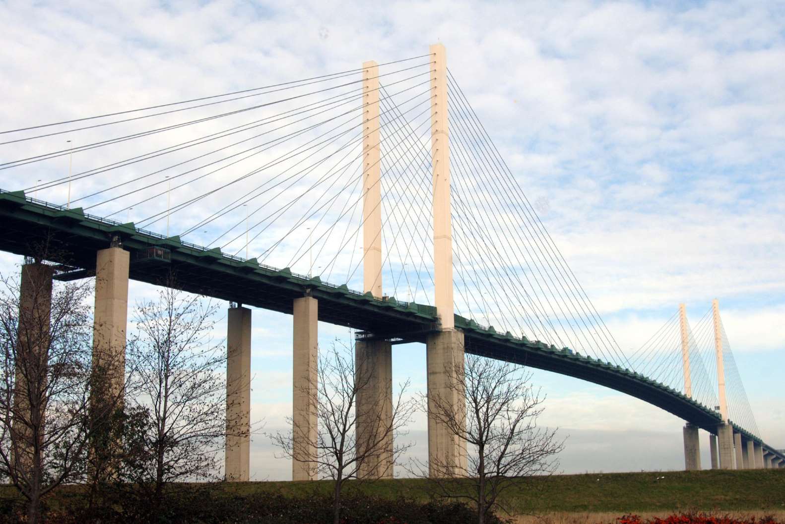
Meanwhile, the Highways Agency urged vulnerable drivers - with high-sided vehicles, motorcycles or towing caravans - to check weather conditions and follow speed restrictions.
It suggested extra care on the:
• A2 Jubilee Way close to Dover
• M2 bridge between junctions two to three at Rochester
• A249 Sheppey Crossing
• QEII Bridge at Dartford
It said the public should be aware of the risk of disruption from strong winds, which might bring down trees and leave debris on the roads.
Dom McLeman, Highways Agency emergency planning manager in the south east, said: "We are asking drivers to check traffic and weather conditions before setting out and to allow extra time for their journeys.
"In the event of persistent high winds we may need to close certain bridges to traffic for a period.
"If you are driving, please be aware of sudden gusts of wind and give high-sided vehicles, caravans, motorbikes and bicycles plenty of space."
The Port of Dover said the ferry terminal is operating normally, but with delays because of the weather.
Passengers are advised to contact their shipping operator for further information.