GO AD-FREE. Get 2 Months Digital Subscription for ONLY £1! Use code 2FOR1
GET STARTEDMore on KentOnline
GO AD-FREE. Get 2 Months Digital Subscription for ONLY £1! Use code 2FOR1
GET STARTEDMore on KentOnline
Kent got a soaking today as the Met Office issued a weather warning for rain.
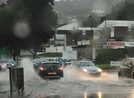
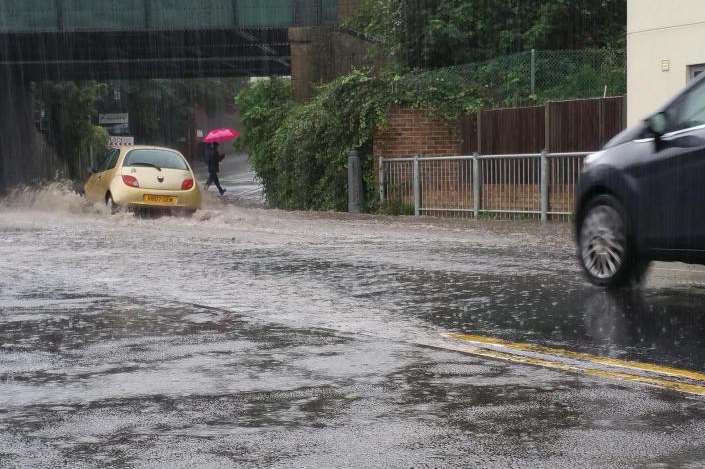
There was surface flooding and disruption on the roads as heavy and thundery showers moved across the county.
The warning came into force at 7am but was lifted by 3pm eased.
The miserable conditions caused problems on the roads, with crashes on both carriageways of the M20 near Maidstone, and the coast-bound Thanet Way near Dargate.
Elsewhere, in Maidstone, two lanes were blocked due to flooding on A20 London Road Rocky Hill at the A26 Tonbridge Road.
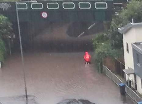
Roads in Dover, Deal and Sandwich were also hit by floods, making some routes impassable.
The above photos were taken by Angela Barron in Lord Warden Avenue in Deal.
And in Margate, a postman was pictured wading through knee-deep water in All Saints Avenue after removing his shoes and rolling up his trousers.
A Met Office spokesman said: "Bands of heavy and occasionally thundery showers may become slow-moving in parts of south east England this morning.
"This is most likely across Essex and Kent and may result in longer periods of heavy rain with potential for some flooding. The showers will slowly move away southeast into the Channel this afternoon.
"Rainfall accumulations from heavy showers across some parts of the south east are likely to increase this morning as the showers become slow-moving to bring more persistent rain in places."
Up to 20mm of rain is expected to fall in the space of an hour, with up to 50mm as the day develops - although most places will see less than this.