GO AD-FREE. Get 2 Months Digital Subscription for ONLY £1! Use code 2FOR1
GET STARTEDMore on KentOnline
GO AD-FREE. Get 2 Months Digital Subscription for ONLY £1! Use code 2FOR1
GET STARTEDMore on KentOnline
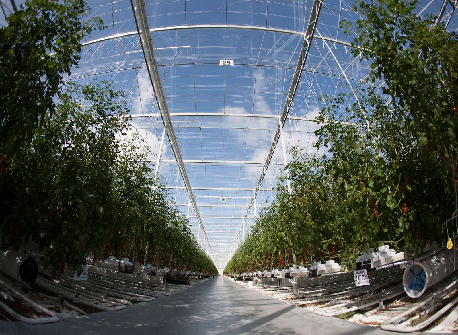
The UK's largest greenhouse complex - based in Thanet - pushes out more light pollution than almost anywhere else in England, it's been revealed.
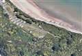
Only the giant Tata Steel complex in Rotherham causes more light pollution than Thanet Earth - the 220-acre food "factory" in Birchington.
The Campaign to Protect Rural England (CPRE) has released detailed maps, which show the location of light hotspots around the country.
Scroll down for audio
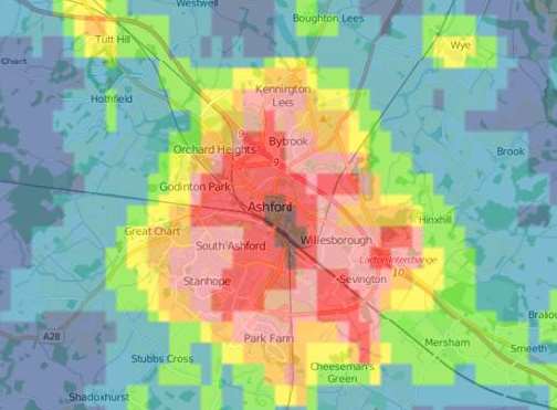
The images were captured by monitoring the skies at 1.30am throughout September 2015 - showing just how late into the night England’s lighting floods.
A satellite captured visible and infrared imagery to determine the levels of light emanating into British skies.
In the infrared images of the map, blue represents the darkest skies and red shows the brightest skies.
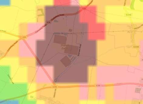
It revealed Thanet Earth's maximum brightness is brighter than anywhere else in the south east, including London.
Thanet as a whole is 241st in the rankings, with 34% of its skies in the lightest categories.
Meanwhile Dartford has Kent’s lightest skies, ranked 260th out of all the 326 districts in England.
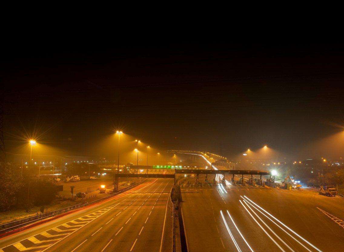
That is mostly caused by the area's major transport networks, including the Dartford Crossing.
Ashford has the darkest skies in Kent, ranking 68th of 326 districts.
It came after Ashford Borough Council adopted a specific Dark Skies Policy in 2015 to create awareness about light pollution and to raise the profile of dark skies as an environmental asset.
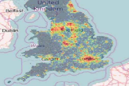
Kent as a whole is the 29th darkest county of 41 in England.
The research aims to increase awareness of the harmful effects light pollution can have on the health of people and wildlife.
CPRE Kent is calling on Kent’s local authorities to use these maps to identify areas with severe light pollution and take action to reduce it, as well as identifying existing dark skies that need protecting.
Hilary Newport, director of CPRE Kent said: “Our view of the stars is obscured by artificial light. It is known that dark skies are beneficial to our wellbeing.
"Light pollution can disturb our sleep, prevent our enjoyment of the countryside and affect wildlife, by interrupting natural rhythms including migration, reproduction and feeding patterns.”