GO AD-FREE. Get 2 Months Digital Subscription for ONLY £1! Use code 2FOR1
GET STARTEDMore on KentOnline
GO AD-FREE. Get 2 Months Digital Subscription for ONLY £1! Use code 2FOR1
GET STARTEDMore on KentOnline
A car mapping the streets of the UK has been spotted in Kent.
The vehicle is used by technology giant Apple for their Maps app, and has been seen driving around Ashford in the last two days.
It was spotted by resident Sarah Jupe in Arcon Road at lunchtime today.
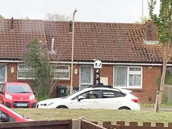
But it was also sighted in Canterbury Road A28 approaching the Conningbrook hotel, and near the junction of Canterbury Road and Ashford Road near Chilham.
In November 2018, Apple revealed its plans to improve its mapping service and deployed mapping cars throughout the US and the UK to gather its own data and extra information.
The cars have a 360-degree camera on their roofs which collects the data. It is a similar set up to those used by Google.
Apple's website states that it is committed to protecting people's privacy while it collects its data.
It says: "Apple is conducting ground surveys around the world to collect data which will be used to improve Apple Maps.
"Some of this data will be published in future Apple Maps updates.
"We will also periodically revisit some locations to gather new data in an effort to maintain a high-quality, up-to-date map.
"We are committed to protecting your privacy while conducting these surveys. For example, we will blur faces and license plates on collected images prior to publication."