GO AD-FREE. Get 2 Months Digital Subscription for ONLY £1! Use code 2FOR1
GET STARTEDMore on KentOnline
GO AD-FREE. Get 2 Months Digital Subscription for ONLY £1! Use code 2FOR1
GET STARTEDMore on KentOnline
Campaigners want the dredging licence for the Goodwin Sands to be halted after the discovery of a possible wartime bomber.
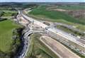
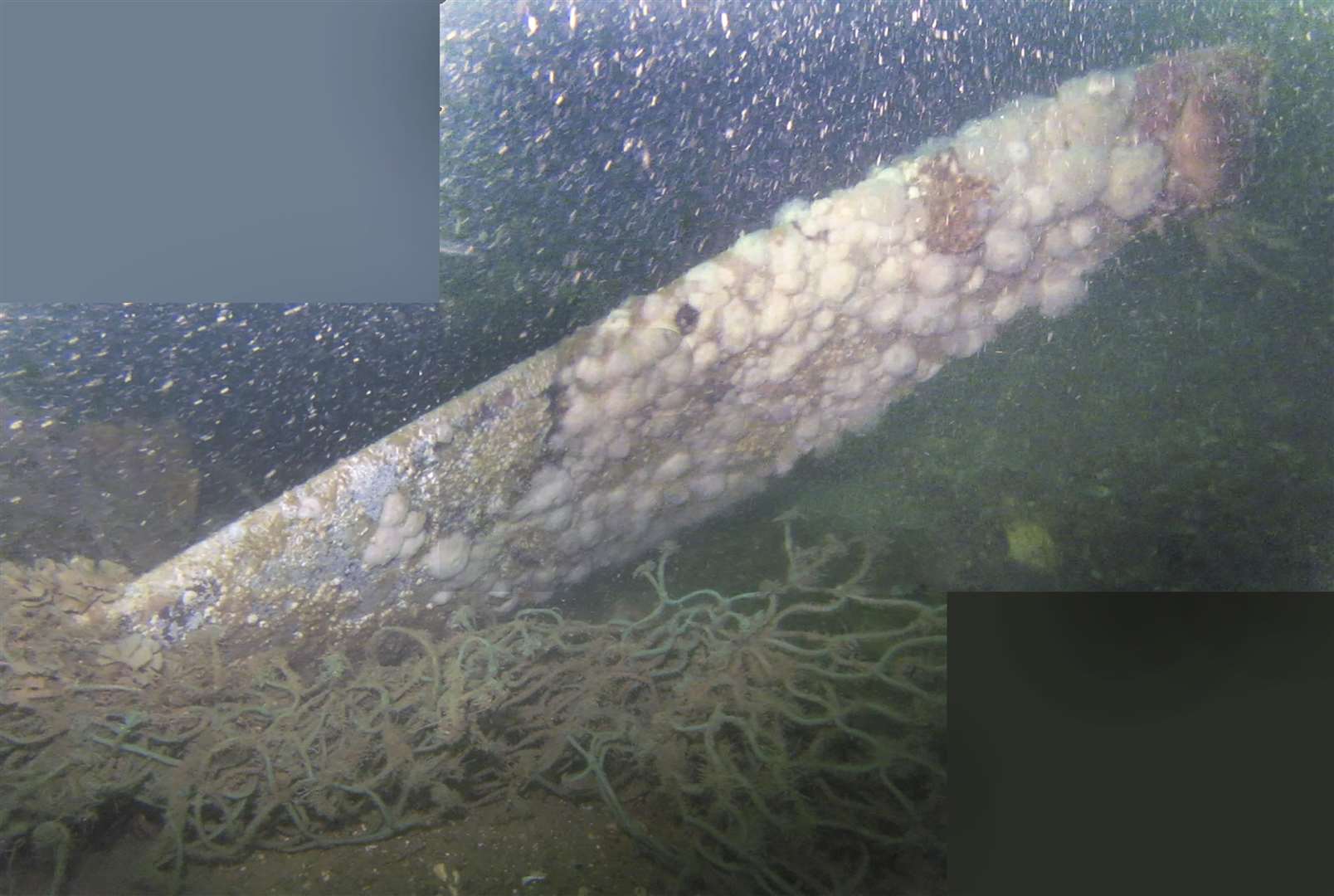
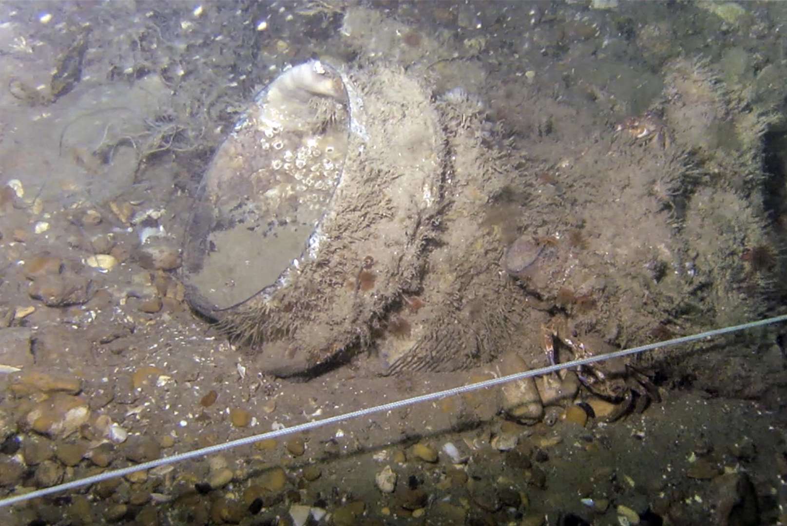
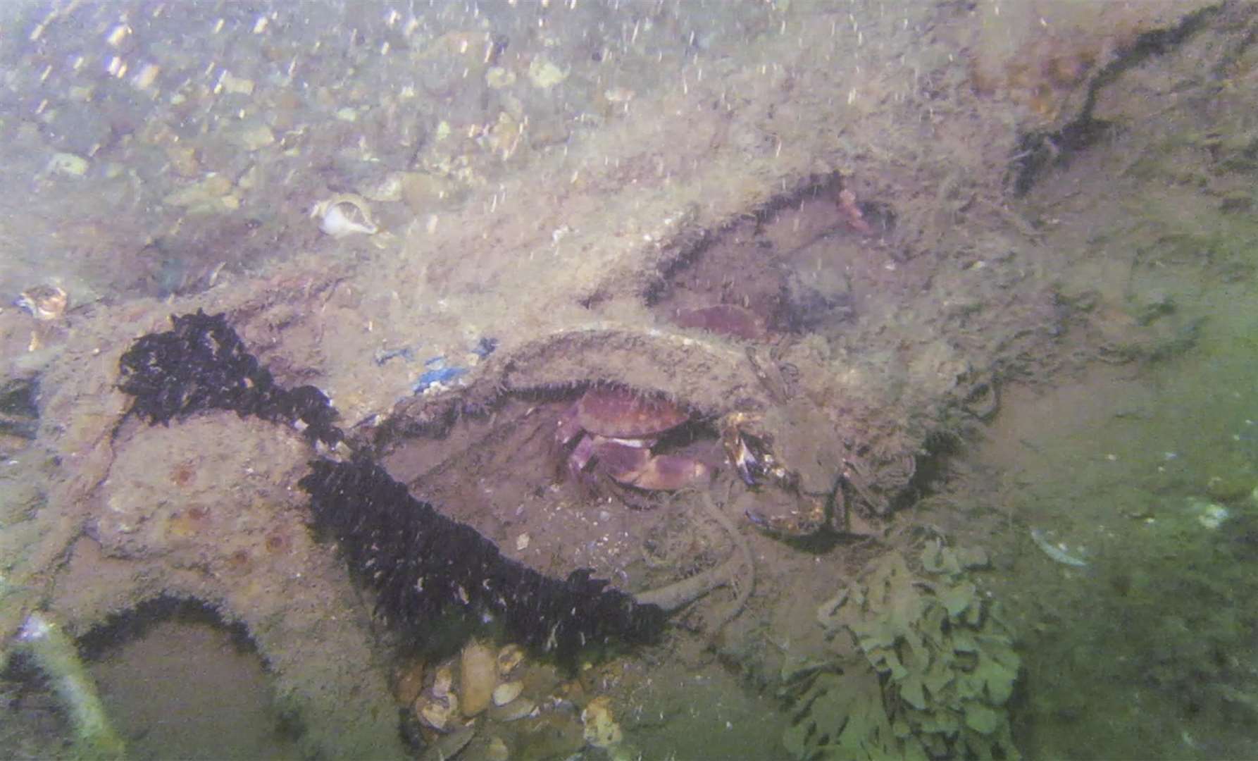
A diver has produced pictures of what is thought to be the remains of a Second World War aircraft including a propeller, engine, part of a fuselage and unexploded bombs.
The news has broken on the eve of Battle of Britain Day tomorrow.
Anti-dredging group Goodwin Sands SOS (Save Our Sands) says the wreckage is lying in the buffer zone of the newly-licensed area of Deal.
Now GSSOS has written directly to Defence Secretary Gavin Williamson asking him to get Defra (Department for Environment, Food and Rural Affairs) to revoke or at least suspend the licence.
Campaign co-ordinators Joanna Thomson and Fiona Punter said in a joint letter: "We are asking you to request that Defra revokes or at least suspends Dover Harbour Board's dredging licence until all anomalies have been thoroughly investigated and excluded from being military crash sites with or without human remains present."
In July the government's Marine Management Organisation granted the port authority a licence to dredge part of the sands for aggregates for its massive Dover Western Docks Revival development.
During surveys beforehand more than 300 seabed abnormalities, or anomalies, were located in the proposed dredge area and its 250-metre buffer zone.
GSSOS stresses that these have not been further investigated and the perceived aircraft crash site was not identified despite that area being surveyed twice.
Video and photographs of the wreckage was taken by Ramsgate-based commercial diver Vince Woolsgrove on August 25.
GSSOS and others have specifically fought the allowance of dredging in the area over fears of disturbing war graves and well as because of possible risk to the environment.
Ms Punter said: "These photographs confirm what we have been saying to the MMO, Historic England and the Ministry of Defence for two years.
"That military aircraft crash sites cannot be reliably detected by geophysics alone."
If aircraft crash sites are confirmed they would be safeguarded by the Protection of Military Remains Act 1986 and it would be a criminal offence to disturb them in any way.
Ms Thompson said: “It would be hugely embarrassing for the British government, that is currently protesting loudly about the behaviour of foreign countries towards our marine war graves in the Far East, if it was found to be allowing similar activities to happen on their own doorstep just a few miles from Dover, by a British organisation.
“As we celebrate Battle of Britain Day it is especially hypocritical that the government is taking no steps whatsoever to prevent the desecration of marine graves within UK waters of those who gave their lives to protect our nation.”
A spokesman for the MMO said:“We were made aware in late August of materials the group identified near the proposed dredge site.
“Having reviewed the information we noted these features were outside the dredge area – both the original area proposed by DHB and the one later revised to avoid anomalies identified to the west.
"It also appears that the features referenced were identified as anomalies in the surveys used to inform the marine licence application.
“We believe it was appropriate to grant the licence because we were satisfied that sufficient mitigation measures are included in the marine licence. This is on the basis of evidence provided, which has demonstrated there are no definite features of archaeological interest in the licensed dredge area that are not protected.
“If this relates to something we’ve not already been notified about then we’re keen to discuss further with the group.”
A DHB spokesman said: " We made all survey data available to the protest group GSSOS and they submitted their conclusions to the MMO during the consultation period.
"The shape, size and location of the proposed dredge area within the south Goodwin Sands has been subsequently further refined to have the minimum impact by avoiding seal haul-out sites, protected and charted wrecks and sensitive seabed habitats."
Battle of Britain Day focuses on the three-month aerial battle from July to October 1940 as Hitler tried to invade this country.
The RAF saw off the Luftwaffe and this was said to be the first major military campaign fought entirely by air forces.