GO AD-FREE. Get 2 Months Digital Subscription for ONLY £1! Use code 2FOR1
GET STARTEDMore on KentOnline
GO AD-FREE. Get 2 Months Digital Subscription for ONLY £1! Use code 2FOR1
GET STARTEDMore on KentOnline
It's set to be another scorcher across the county, prompting health authorities to issue warnings to vulnerable patients.
The Met Office has raised its heat alert level to three as Kent prepares to bask in another day of sunshine.
Clear skies and sunny weather saw people flock to beaches in huge numbers despite social distancing measures remaining in place.
But while enjoyable for some, health authorities have encouraged those most vulnerable – many of whom have been shielding during lockdown – to protect themselves amid the “exceptionally hot weather forecast this week”.
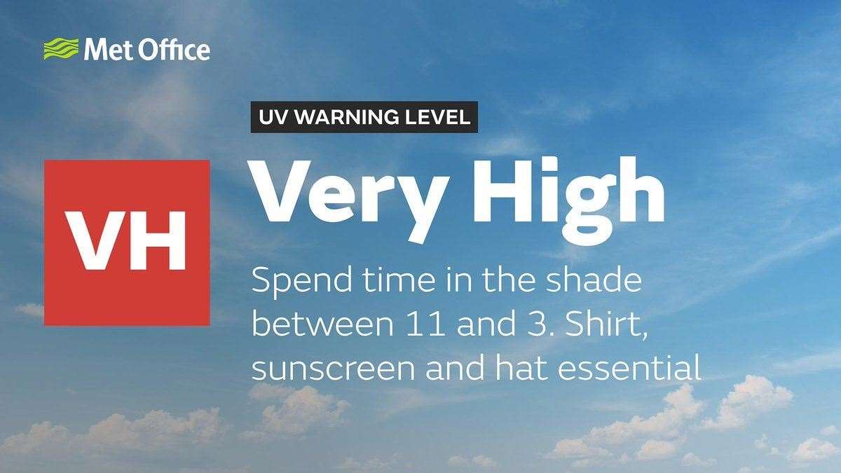
Temperatures are set to exceed thirty degrees today with high levels of UV forecast.
It has prompted the NHS to issue a level 3 heat-health watch alert meaning there is a 90% probability of the criteria being met for the weather to pose health risks to patients.
Public Health England (PHE) said older people, those with underlying health conditions, and very young children were all more at risk from the higher temperatures.
People have been advised to keep cool and stay hydrated where possible.
Meanwhile the Met Office said UV levels were expected to remain at eight across many parts of the UK on Thursday.
Shoppers have also been advised to be aware they could be forced to spend extra time in the sun as a result of social distancing measures.
And dog owners have been urged to avoid exercising their pets during the hottest part of the day.
Vets Now, a provider of emergency veterinary care, warned that the average survival rate of a dog diagnosed with heatstroke was 50%.
But the Met Office has also warned Kent residents thunderstorms from tomorrow will likely bring the sunshine to an abrupt halt.
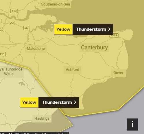
It said there is a small chance that homes and businesses could be flooded quickly, with damage to some buildings from floodwater, lightning strikes, hail or strong winds.
There could be a direct impact on roads and public transport with delays likely to train and bus services.
There is also a small chance some communities may be cut off by flooded roads and power cuts could occur.
The Met Office forecast said: "Heavy showers and thunderstorms are likely to break out on Friday afternoon and evening.
"Many places will miss the storms, but where they do occur, torrential downpours could bring 30-50mm rain in an hour, with hail and lightning."
Are you enjoying the sunshine today? Send your pictures to news@thekmgroup.co.uk