GO AD-FREE. Get 2 Months Digital Subscription for ONLY £1! Use code 2FOR1
GET STARTEDMore on KentOnline
GO AD-FREE. Get 2 Months Digital Subscription for ONLY £1! Use code 2FOR1
GET STARTEDMore on KentOnline
As more and more housing is given the green light, our landscapes are forever changed in pursuit of progress.
But, as your local council gives the nod to yet development, there is a website which allows you to peek behind history's curtain and see just what your town or village looked like almost 100 years ago.
Britain From Above offers access to tens of thousands of images, providing a glimpse from the skies of moments in time captured forever on film.
Scroll down and we'll show you all of Kent's main towns as they once were.
From our industrial past to the hey-day of classic British seaside resorts, all all captured in remarkably detailed aerial images.
"It is an amazing collection," explains Neil Fraser from Britain From Above. "Some of the views are so familiar and picture areas which have barely changed over the years and in other cases where whole communities are unrecognisable."
The images were acquired, in 2007, by the key heritage organisations in England, Scotland and Wales - today known as Historic England, Historic Environment Scotland and the, slightly more of a mouthful, Royal Commission on the Ancient and Historical Monuments of Wales.
The pictures were originally gathered by Aerofilms Ltd - a pioneering company born in 1919 and the earliest days of manned flight.
As the UK's first commercial aerial photography company, it took to the skies and cornered a niche market - one today cluttered by the rise in drone photography.
Explains Neil Fraser: "I just think the images chronicle so much of the country, whether its rural or urban.
"Of course lots of people today use it just to compare how much their local area has changed over the years.
"And those who register can not only zoom in on the images, gaining far greater detail, but can also put flags on the images to share memories of particular areas to share with other users."

The good news is there's more to come too. All three of the heritage partners who own the collection are keen to digitalise more of the images "but as yet there is no timescale for this work". Have a careful look through and you can find some more recent images dating from the 1960s and 70s.
Below are a sample of the images - it is well worth registering on the site - it's free - as it allows you to zoom in on the images, which reveal far more detail.
So let's take a look at some of those areas we know best....
Margate
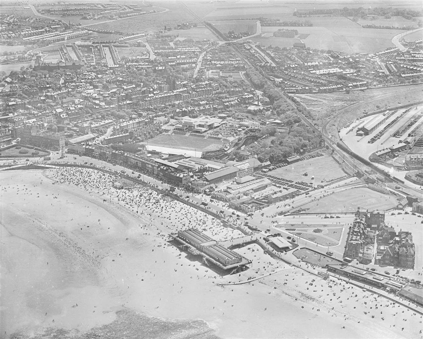
Pre-war Margate was a Mecca for the holiday-maker. In an era before cheap plane tickets and all-inclusive foreign jaunts, if you wanted fun in the sun, then you headed to Thanet.
The picture captures a scene from 1931, looking at the town from above the coastline.
And while much of the town is instantly recognisable - Dreamland and the Scenic Railway rollercoaster clearly visible - there are a few sites worth noting.
Firstly, if you've ever wondered what the seafront would look like without Arlington House towering above everything, here's your opportunity. Or, for that matter, life before the Premier Inn arrived next to the railway station building.
Also visible is the old Marine Bathing Pavilion, jutting out over the beach. The tidal bathing pool would eventually be built immediately in front of it. A once popular destination - it included penny arcades and cafés - it fell into disrepair and was eventually demolished in 1990 (the tidal bathing pool is still there today).
Whitstable
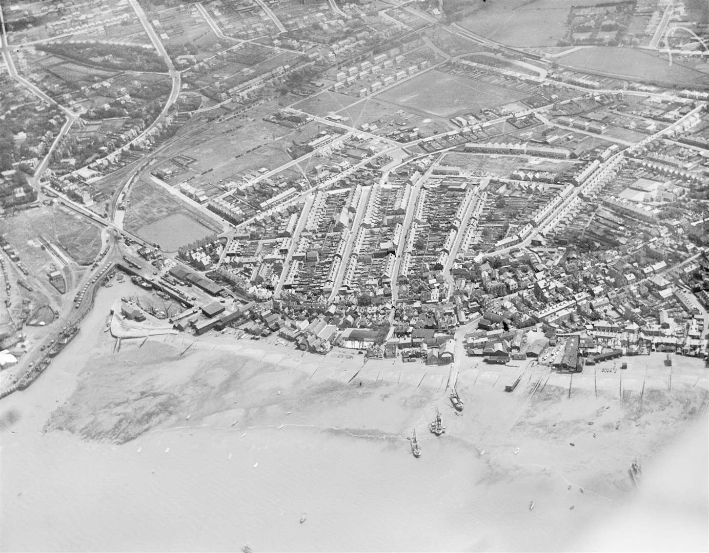
In truth, a picture of Whitstable from the sky 20 years ago would look very different than today - so there's much to admire in this aerial image captured in 1927.
Firstly, spot the harbour on the left - looking much like now - but alongside it are railway carriages, with the track visible where it once crossed what is today Harbour Street before stopping at what was once another station.
What is today the Gorrell Tank car park was then the reservoir it was intended to be to help prevent flooding at exceptional high tides. Today huge water storage tanks sit beneath the car park.
Much of the housing in the town centre is still under construction, and one side of Acton Road can be seen (centre right) - its facing houses still yet to be built and waste ground in front of them. Westmeads Recreation Ground can be seen, top centre, and behind it what is now the town's only railway station.
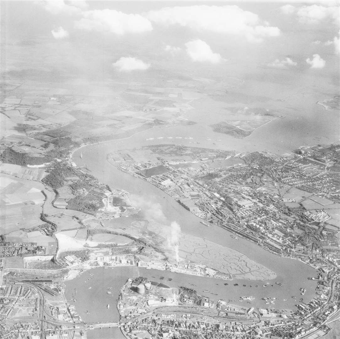
Rochester
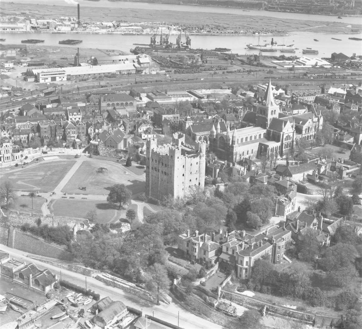
There's something rather engaging about this photograph, taken looking down upon Rochester Castle and the cathedral in 1947 - just two years after the end of the Second World War.
Firstly, there is something reassuringly familiar about the former city's two most historic sites. But the second is the view across to the Medway and the industry which once thrived along the riverside.
From the boats and barges making their way along the river to the huge cranes on its banks which were once so familiar a sight on Medway's horizon, top centre, to the higgledy-piggledy boats and boat sheds down by the water's edge at the very front of the image.
And for those who have ever wondered what the Medway City Estate once looked like before becoming a mass of industrial units - it's at the very top of the picture.
Canterbury
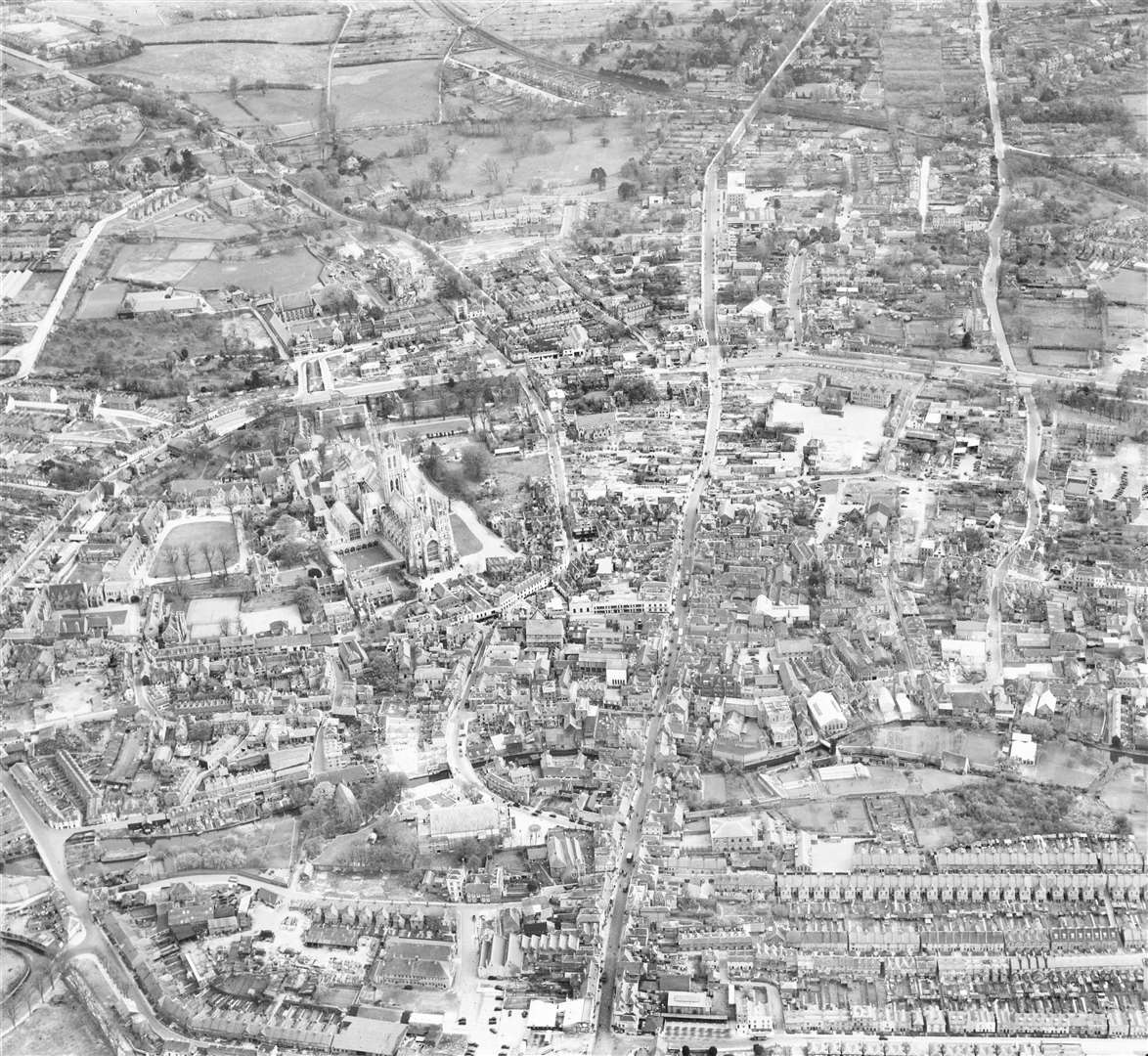
With the cathedral looming large on the left, this image from 1947 has plenty to note. Firstly, the city's popular pedestrianised high street has cars flowing up and down it - while there's also no Whitefriars shopping complex either.
Just a few years earlier, the city had been subject to some ferocious bombing during the Second World War - most notably the notorious Baedeker Blitz in 1942.
What is perhaps most interesting to those living and working there now is the lack of development outside the city walls. Canterbury Prison can be seen near the top left of the image, but the universities, schools and colleges which now surround the building are nowhere to be seen.
The old Marlowe Theatre - now rebuilt - can be seen near the front centre of the image, with the river Stour cutting from bottom left to right.
Faversham
The historic market town, captured in 1950, shows the railway station in the foreground and Faversham Recreation Ground just to the right.
Reassuringly, much of the town's centre looks unchanged over the years...but it's further out where the change is most notable.
The St Mary of Charity Church looms near the top of the image, from which, to its left, you can see what was then the Fremlin brewery - it had taken the plant over from Rigden's the year before. Today the building is the town's Tesco superstore.
In the middle of the image, you can see Faversham Creek meander across the town, with the Shepherd Neame brewery, as it is today, on its south bank.
But look at the bridge across to the road on the road leading up to Davington - almost empty then - now packed with houses.
Gravesend
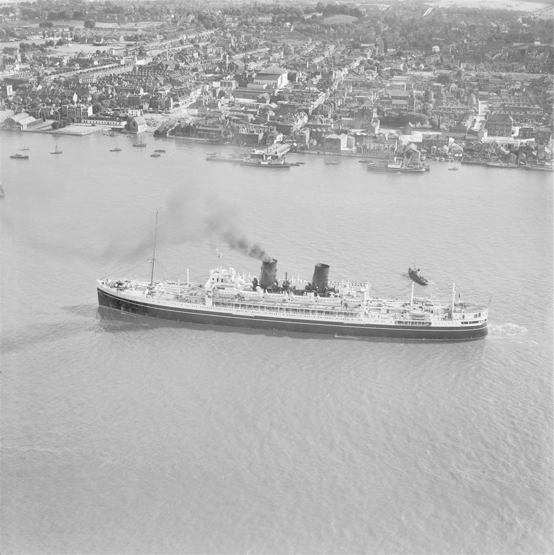
The SS Chitral sails majestically along the Thames - zoom in on the original image on the website and you can even make out the passengers on board - while a far more industrial looking Gravesend stretches out behind it.
The image was taken in 1950. The Chitral was owned by P&O and ferried passengers from the UK to Australia - most taking advantage of the post-war £10 ticket to emigrate.
Behind the vessel is Gravesend Pier, with the Pier Hotel and Three Dawes pub flanking it.
Just behind that and to the left, the rear of the Majestic cinema can be seen - it's the prominent white building with the pitched roof. Just in front of that can also be spotted Gravesend market.
Sheerness
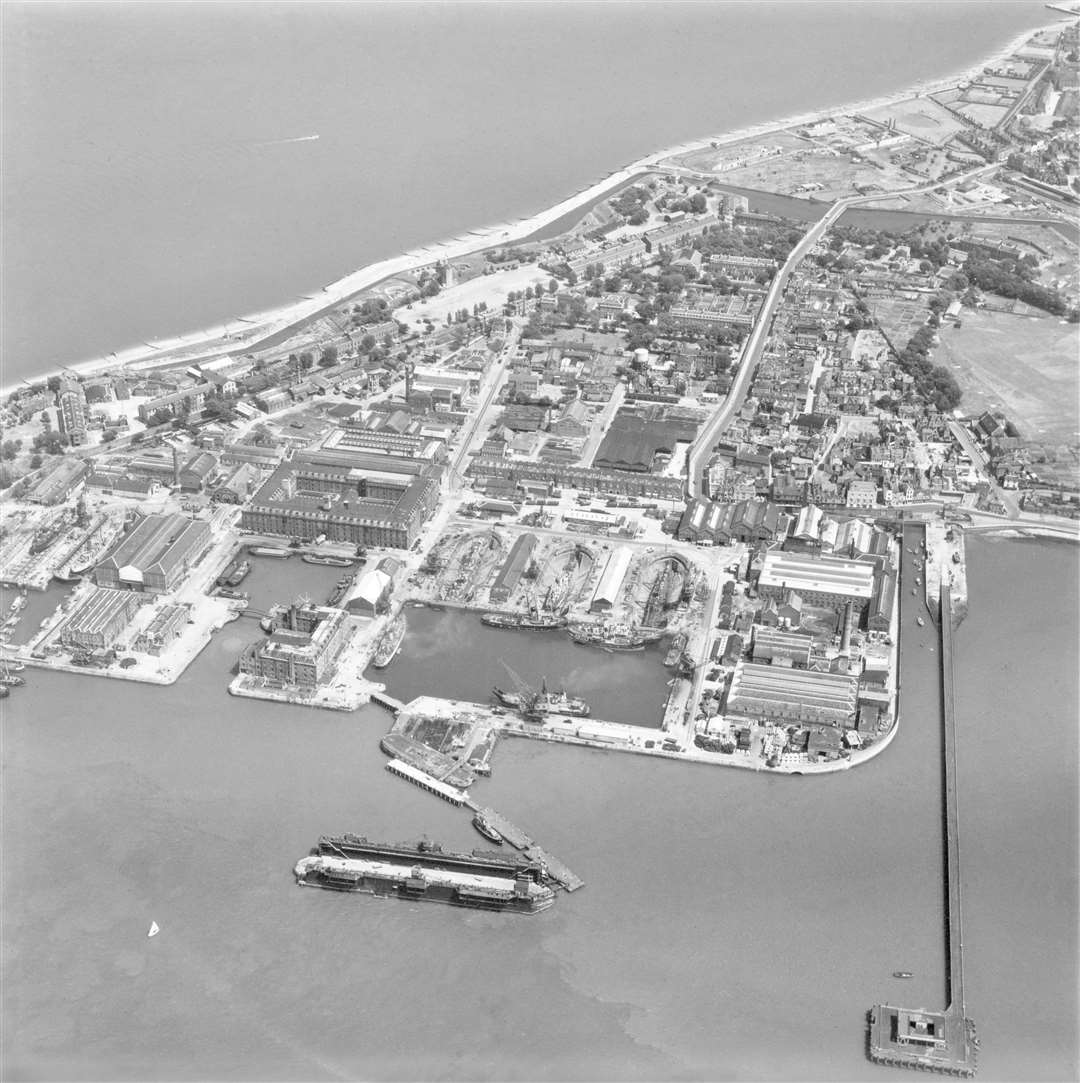
Sheerness docks had a great strategic importance for many years and was a key shipbuilding and repairs site.
This image, captured in 1951 underlines that, with some fascinating detail available including five dry docks clearly visible along with a flurry of industrial activity which surrounds them.
Of note to many will be Sheerness Pier stretching out from the coast on the right-hand side of the image and once a pick-up and drop-off point for steam ship passengers. Its entrance stood near the junction of West Street and Brielle Way.
It was closed four years after the image. Much of the sea over which it stretched was later reclaimed as land as the docks expanded over the years, making for an interesting comparison with today's layout of the area.
Tunbridge Wells
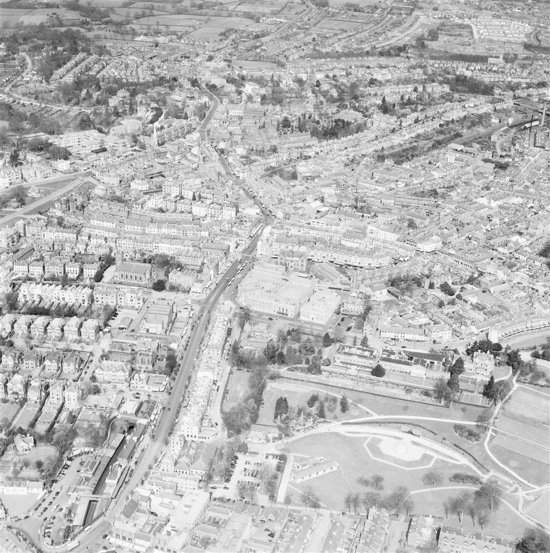
The spa town owes a great deal to the architect Decimus Burton, whose distinctively designed buildings in the mid-19th century has given much of it a timeless quality over the years.
This view was taken in 1953 - the year of the Queen's Coronation. The Town Hall is in the centre of the image - still relatively new back then, having been built just 14 years earlier - with the town's railway station at the bottom left.
Calverley Grounds stretches out to the right of the image with the rear of what is now the Hotel du Vin stood looking over it.
You can also spot the rear of the old ABC cinema at the top of Mount Pleasant Road.
There's no Royal Victoria Place shopping centre, or Crescent Road multi-storey car park - or, for that matter, Phillips House, opposite the civic complex which now houses AXA Healthcare.
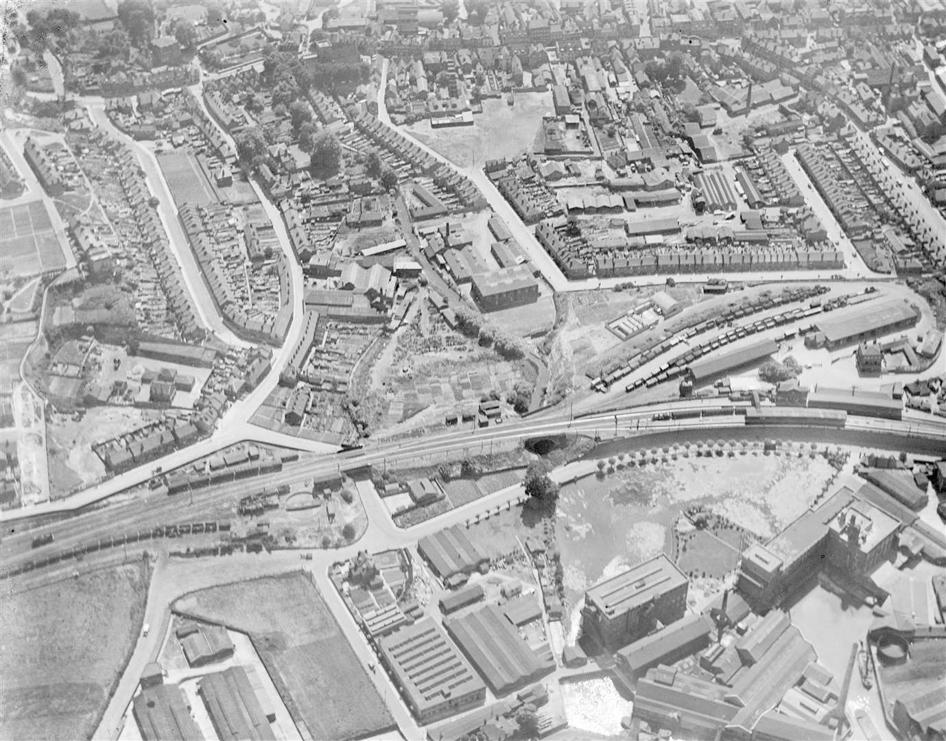
Chatham
Chatham Dockyard in 1953 was, as you can imagine, a hive of industry. And this image, following the Medway as it cuts through the Towns, gives a good sense of the nature of an area which was built up around the jobs and prosperity it provided.
Many of the buildings which now form the Historic Dockyard can be spotted too.
But perhaps the biggest sign of how the area has been transformed since the docks closed in 1984 is at the top of the picture.
Yes, that is St Mary's Island - now packed with housing.
Rochester Bridge is bottom left and in the centre is what is, today, the Medway City Estate.
Dover
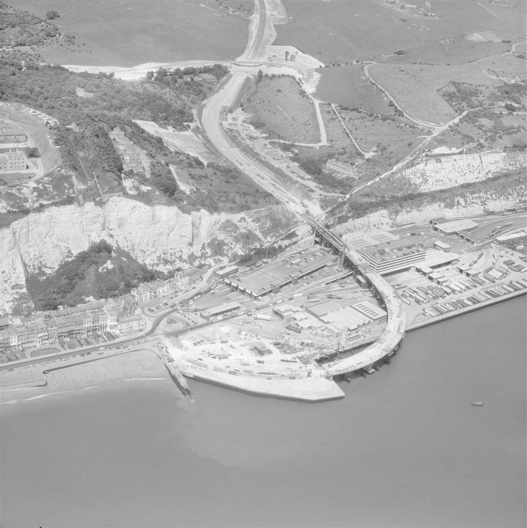
Among the many images on Britain From Above are a handful from more recent times - and this one, taken in 1976 looking back at the Eastern Docks - provides a fantastic view of the construction of a road many of us will be familiar with.
It captures work taking place on the elevated section of the A2, Jubilee Way, as it comes down the hill and reveals the port below it. The road at the foot of the hill, emerging on to the roundabout by the port's entrance, still yet to be built.
Interesting is to note how the road once swung out over the sea before the land was reclaimed to extend the port's footprint.
The surrounding area still looks remarkably similar over the 40 years which have passed.
Folkestone
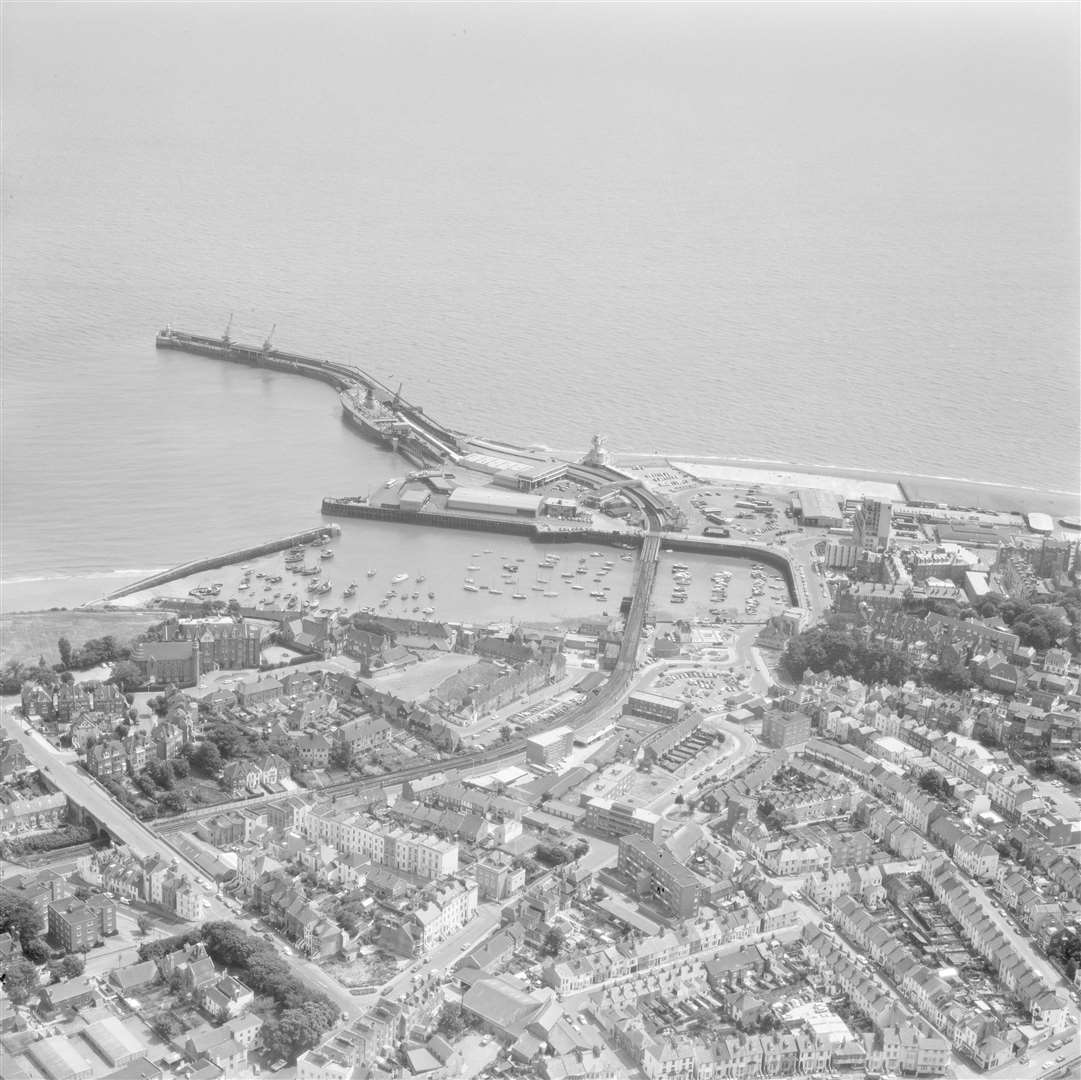
Another image from more recent times - this vista takes in Folkestone and out to its harbour. It too was taken in 1976.
What it does capture, however, are some key changes. Firstly, you can follow the then still operational railway line all the way into the harbour - ideal for those catching cross-Channel ferries. And, just to hammer home the point, there's a Sealink ferry docked as the picture was being taken along what is now the Harbour Arm.
The Hotel Burstin - as it was then known - can be seen next to the grand looking Royal Pavilion Hotel - the foundations of which would be used for Burstin's expansion as can be seen today.
And for those who spent many a happy night on the town, to the top right of the image, you can see the building which would become the old La Parisienne nightclub. It's long since been pulled down with the seafront being redeveloped.
Ashford
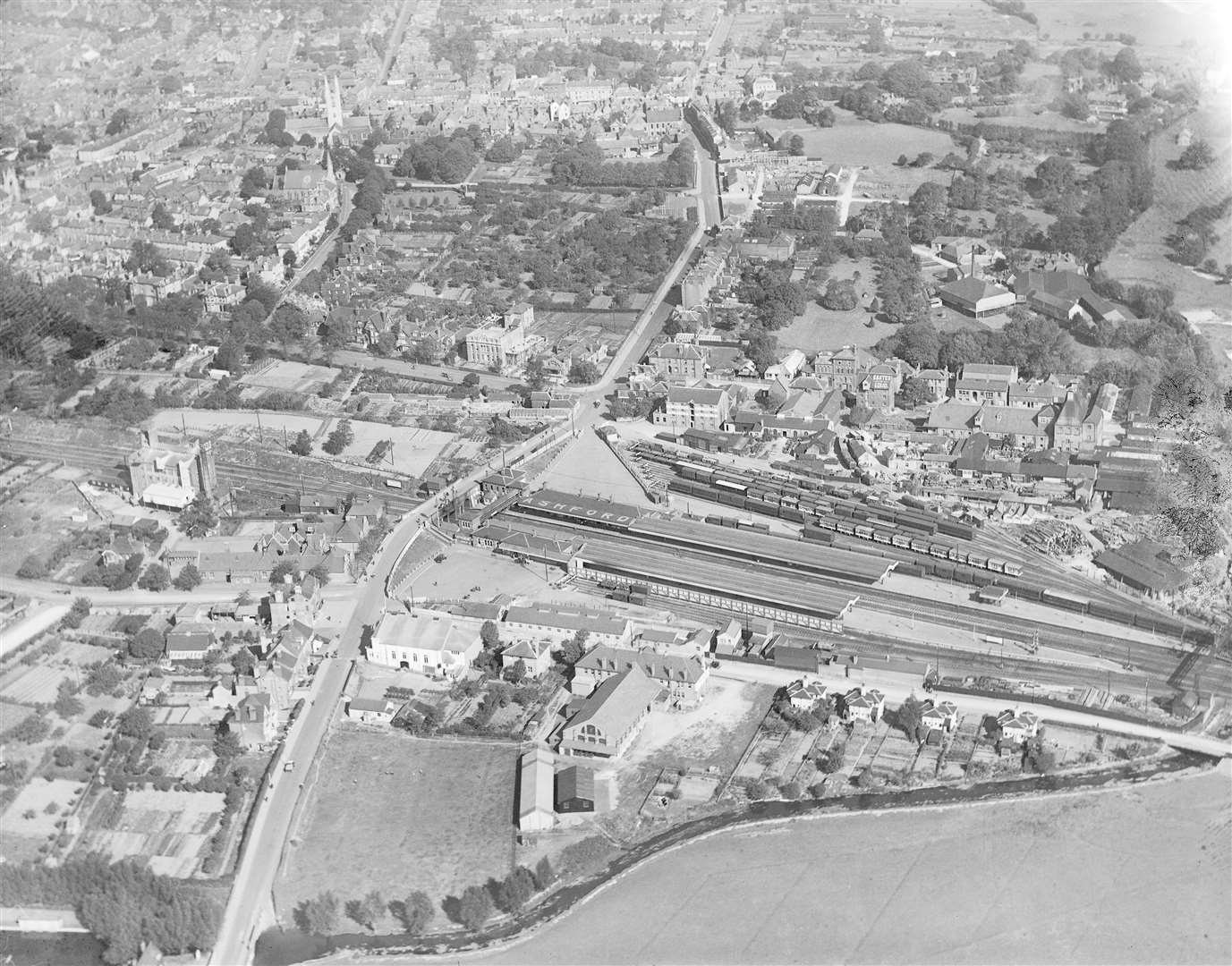
Now, if you wanted to see a town centre which has undergone dramatic development over the years, step forward Ashford.
Pictured here in 1921, the railway station in the centre of town is recognisable - but not the sidings which once surrounded it.
Perhaps most worthy of note is the town's landscape not being dominated by what was once Charter House - today known rather more grandly as The Panorama - and, perhaps, the lack of traffic on what would become the town's ring road.
In fact, the land south of the town centre remains gloriously green and, mostly, undeveloped.
You can also spot the original buildings on the corner of the land now occupied by Ashford Colllege, as well as the old town centre cinema - knocked down to make way for the international station.
Dartford
While we're talking about town's transformed, let's take a look at Dartford - with this picture taken in 1924.
To get your bearings, about midway up the image on the right is the town's railway station...the rest bears little resemblance to today.
The former Wellcome pharmaceuticals site can be seen at the bottom of the image - with the site now the home to homes and apartments off Mill Pond Road.
Just behind the station is today the civic centre, while to its left is the sprawling Prospect Place shopping area.
Sandwich
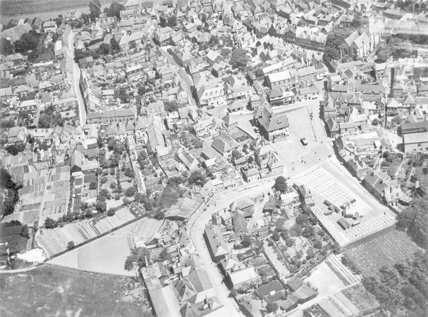
Taken from the skies above Sandwich in 1925, this image shows the Guildhall just to the right of centre and St Peter's Church to the top right.
The old market square has long since been built upon, while the Guildhall itself has been extended now to include the likes of the town council and Citizens Advice bureau.
While the town has been left pretty much untouched over the years, if you follow Moat Sole from the Guildhall, it will take you past what is now the Red Cow pub and towards the land where the Co-op supermarket is now situated.
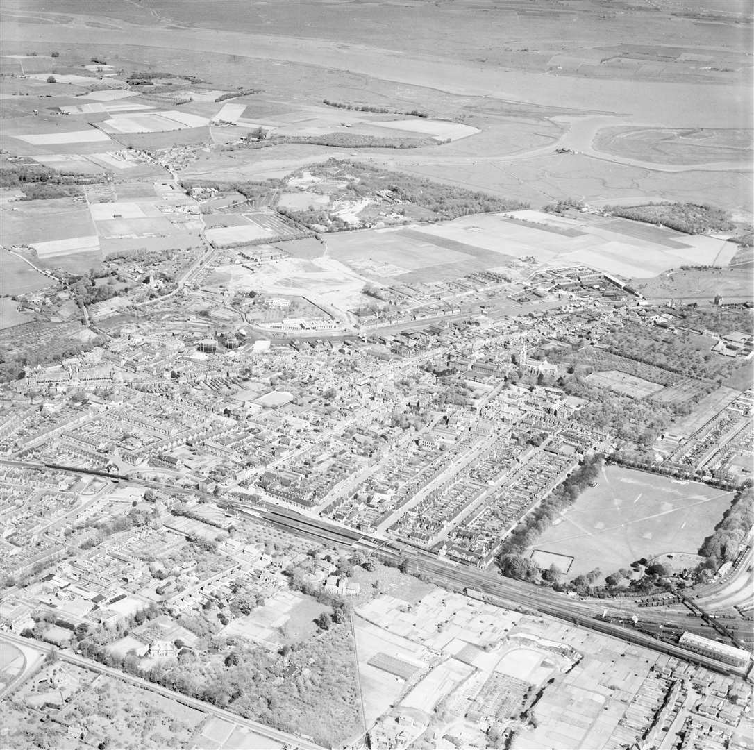
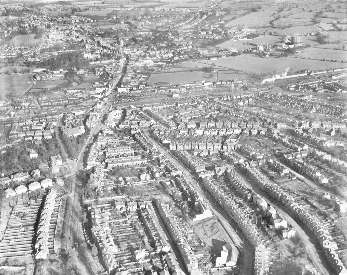
Sittingbourne

Where is this sparsely populated town I hear you ask? Well, what you're looking at here is a view across Sittingbourne, with the rail station at its centre, and lots of open space nearby.
How things change.
In front of the station now, at the foot of the image, are a host of industrial estates. While if you cast your eye to the top of the image you should be able to make out Borden Grammar School.
And just look at the open fields to the right of the school - today it is predominantly housing.
Deal
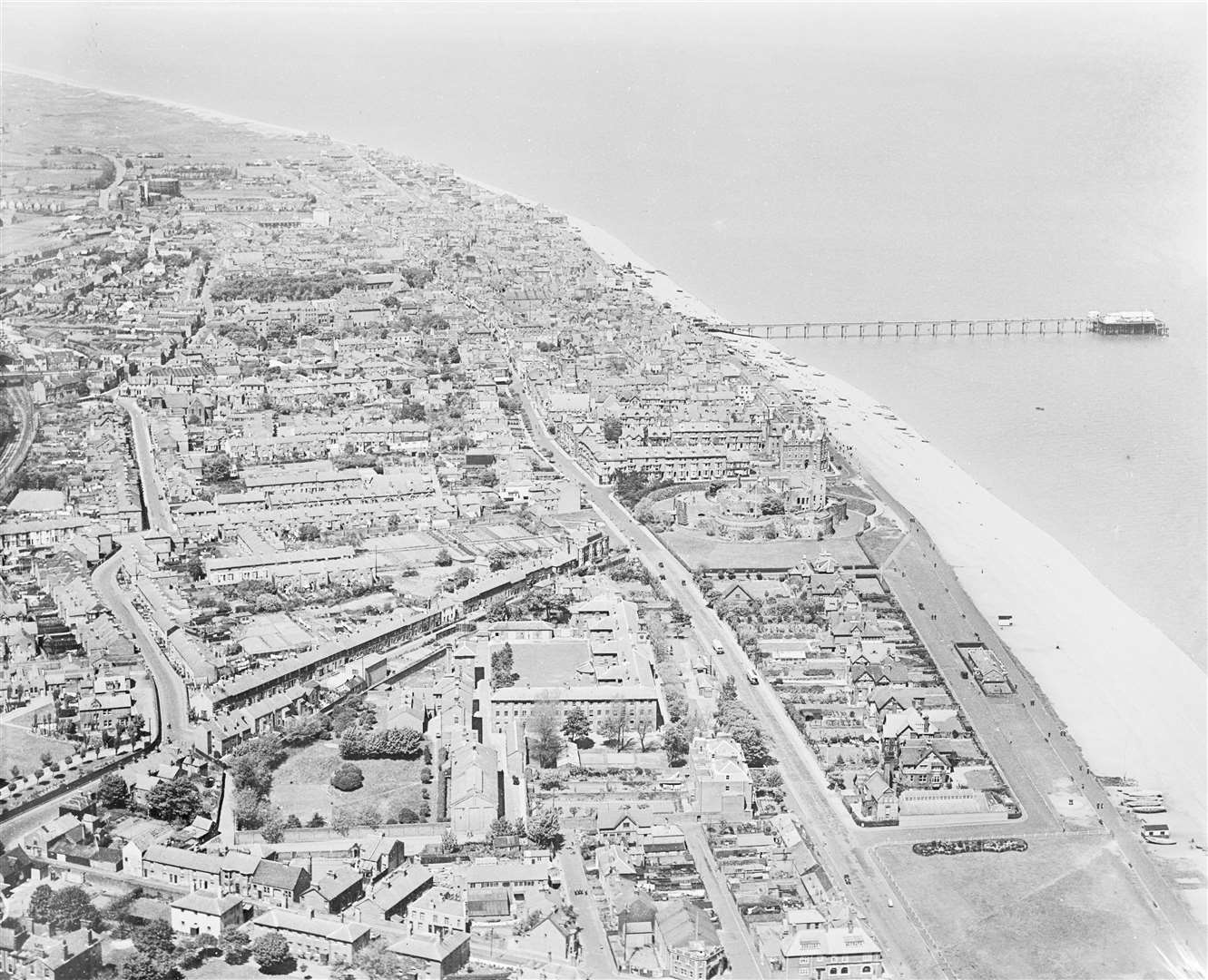
Rather refreshingly, Deal looks much the same today as it did when this image was taken in 1931.
The town's famous long-reaching pier should allow you to centre yourself, while Deal Castle can be seen a little down the picture.
Cast your eye to the middle of the image, near the bottom, and you can see what were once the barracks - many of the historic buildings which formed it have since been turned into apartments or housing.
The green at the bottom right of the image leads down to what is today the memorial bandstand.
Tonbridge
Last, but by no means least, is Tonbridge - looking down the High Street - in 1939.
Follow the railway line which cuts across the centre of the picture, and you should be able to make out the railway station. Let your eyes head up the road leading to the main town centre, and the sports field on the right is what would, eight years after this image was taken, become the home of the then newly formed Tonbridge Football Club. At this stage it was a cricket pitch.
Today it is better known as the site of the Sainsbury's supermarket.
Keep following up the High Street and the castle is visible to the left and Tonbridge School a little behind it.
To view more images from Britain From Above, click here.
To read more of our in-depth features click here.