GO AD-FREE. Get 2 Months Digital Subscription for ONLY £1! Use code 2FOR1
GET STARTEDMore on KentOnline
GO AD-FREE. Get 2 Months Digital Subscription for ONLY £1! Use code 2FOR1
GET STARTEDMore on KentOnline
A second yellow weather warning has been issued for Kent this weekend.
The Met Office says 'high, gusty winds' will be accompanied by 'heavy showery rain' between midday and 8pm today.
Dark pink and purple shades show strong winds due to hit Kent
The alert could see delays on the roads and ferries, with some bus and train journeys also taking longer than usual.
It could also mean some short term loss of powers in homes, and large waves along the coast.
A statement reads: "Conditions across the south of England will turn windier this afternoon and early evening.
"The windiest conditions will be in coastal areas where gales or severe gales are expected along with gusts of 50 to 60 mph for many and perhaps as high as 60 to 70 mph in a few spots.
"Parts of southwest England are likely to see the highest winds during early to mid afternoon whilst peak winds over parts of southeast England will probably not be until later this afternoon and early evening.
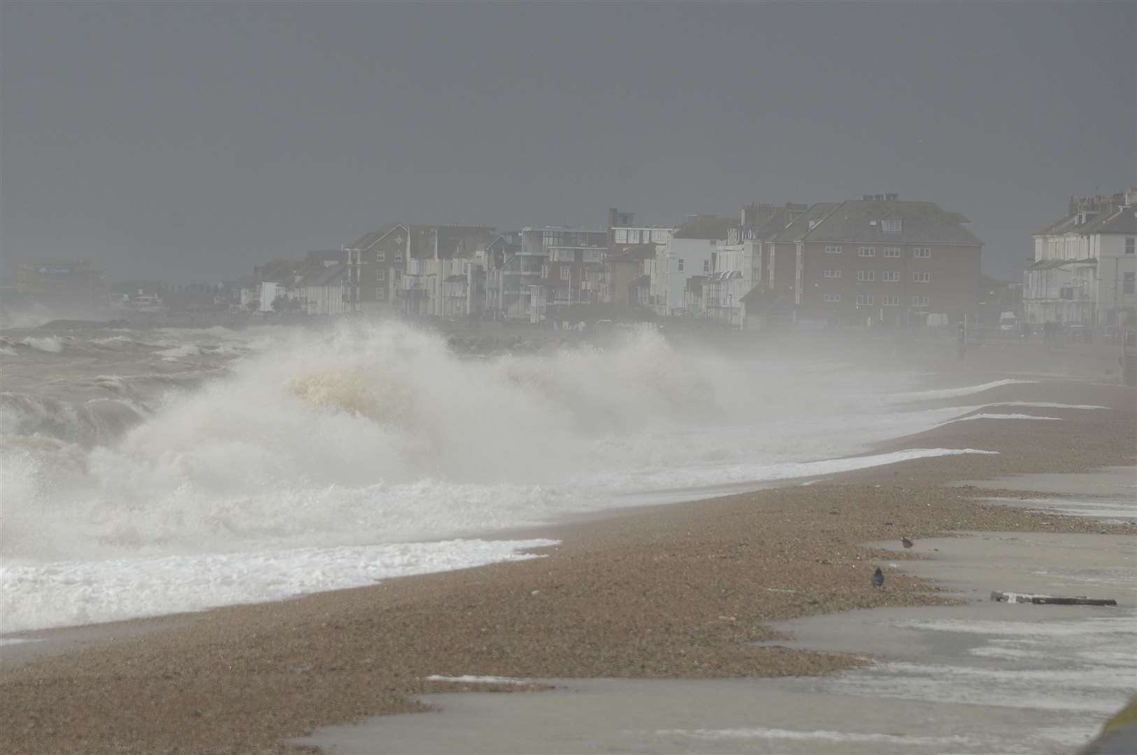
"Meanwhile, these high winds will be accompanied by further showers and spells of rain, heavy at times."
The weather warning has been issued for the whole of the south coast of England.
It is the second alert to be issued by the Met Office this weekend - a yellow weather warning was put in place this morning as heavy rain caused flooding to some parts of the county.
It has also resulted in delays on the M2 and M20.
Read more: All the latest news from Kent
For all the forecasts, warnings and weather related news, click here