GO AD-FREE. Get 2 Months Digital Subscription for ONLY £1! Use code 2FOR1
GET STARTEDMore on KentOnline
GO AD-FREE. Get 2 Months Digital Subscription for ONLY £1! Use code 2FOR1
GET STARTEDMore on KentOnline
Brace yourself for yet another day of hot temperatures and thunderstorms as the Met Office issues a yellow warning for the county.
After flash flooding last week and warnings across the weekend – with severe disruption in London – more heavy showers are expected from 10am until 5pm.

That means there could be disruption and flooding bringing delays or cancellations to public transport, power cuts and the chance of hail.
There will be as much as 5cm of rain fall in as little as two hours, more than the average for the whole of July.
The Met Office forecast says: "Although less likely and fewer in number than on Sunday, there is still the possibility of a few very heavy downpours and thunderstorms through the day, particularly during the early afternoon. Where this occurs, 20 to 30 mm of rain may fall in an hour or less, with 40 or 50 mm in 2 to 3 hours."
Meanwhile the Environment Agency has issued a flood alert for the River Beult from Pluckley and Bethersden to Hampstead Lock at Yalding, while in Ashford a burst water main on Canterbury Road, has closed a busy lane.
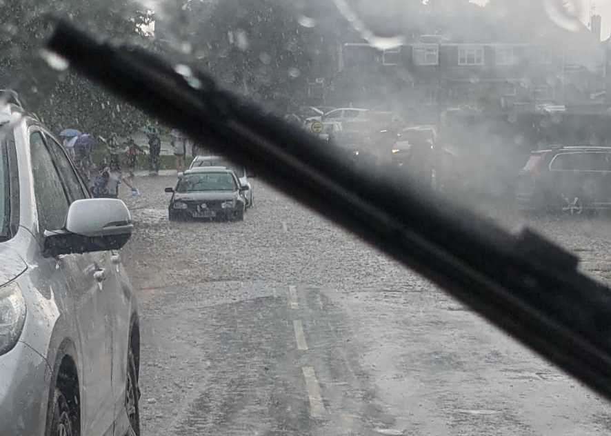
It comes after flash flooding hit parts of central Kent last week, with monsoon-like conditions turning roads into rivers in moments.
Temperatures soared across the county, nudging towards 30C.
For all the forecasts, warnings and weather related news, click here