GO AD-FREE. Get 2 Months Digital Subscription for ONLY £1! Use code 2FOR1
GET STARTEDMore on KentOnline
GO AD-FREE. Get 2 Months Digital Subscription for ONLY £1! Use code 2FOR1
GET STARTEDMore on KentOnline
One year on from the storms that battered Kent last October, can the county expect the same this year? We decided to find out.
The short answer, you’ll be pleased to know, is probably not – last year’s storm was the worst in a decade, and while there have been stronger winds more recently, there’s unlikely to be an equally damaging tempest any time soon.
Jeff Knight, manager of the climate variability modelling group at the Met Office, said: “For the UK as a whole last year was a huge record, so it’s very unlikely this year will match those levels of storminess.
Scroll down for a video

“It’s perfectly possible that we will experience storms and rainfall this winter but not to the extent we did last winter.”
Last year’s storm caused serious damage and disruption across the county, and tragically claimed the life of schoolgirl Bethany Freeman, who was crushed when a tree fell on the static caravan in which she was sleeping.
Two things in particular made last year’s storm particularly damaging – its course, and its timing.
Scotland and Northern Ireland are more prone to Atlantic storms, with winds of 60 or 70mph not that unusual.
This means these areas are more prepared for stormy weather when it strikes.
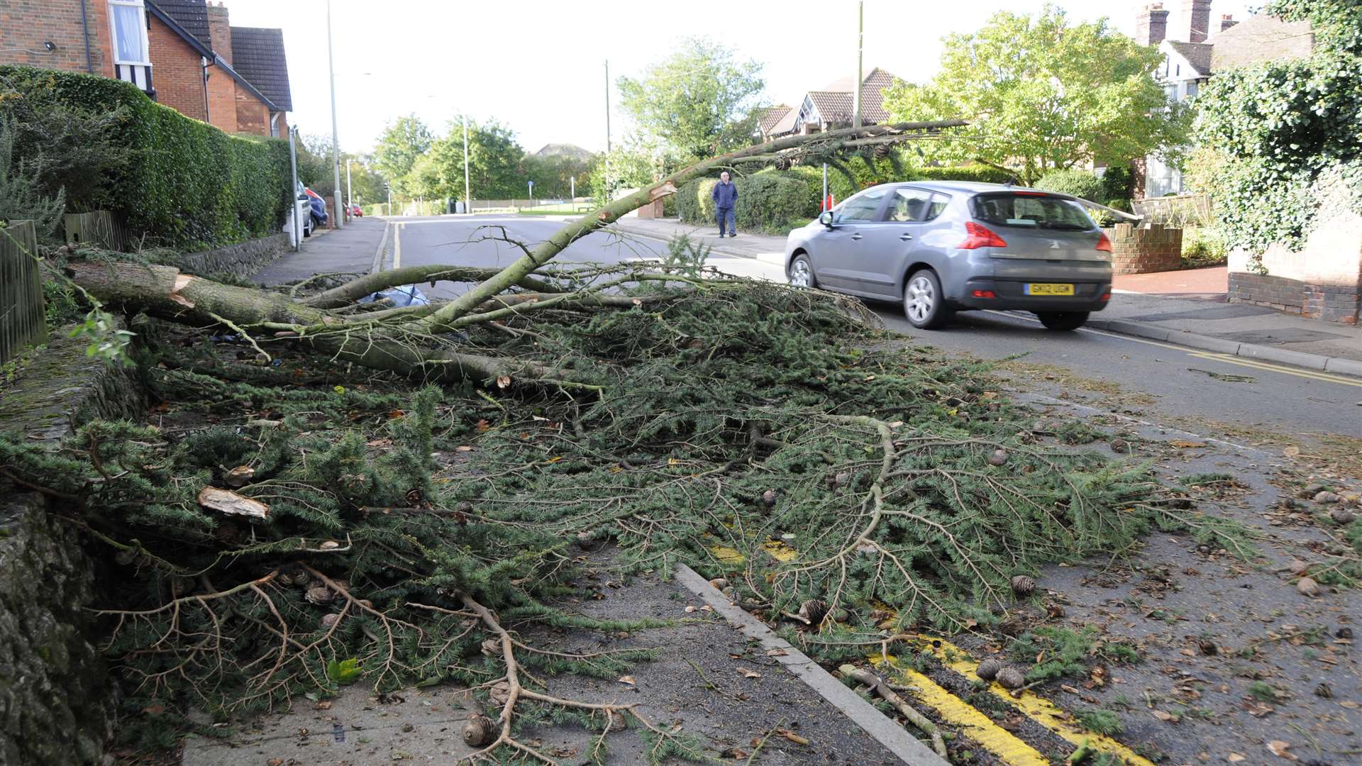
But according to the Met Office, because the October 2013 storm tracked across southern England, it struck areas that do not normally experience such extreme weather.
When it hit also exacerbated the effect – many trees had not yet lost their leaves, making them far more vulnerable to high winds.
As a result, much of the devastation experienced in Kent was due to large trees coming down, striking buildings and vehicles, and blocking roads and railway lines.
The Met Office is still investigating the causes of the freak weather, but several factors are thought to be implicated.
Video: Satellite images from the Met Office show the storm moving across the UK
The jet stream, which is the main variable affecting the UK’s weather patterns, was particularly active over that period, and had shifted southwards, according to Dr Knight.
This move was caused by higher than normal ocean temperatures in the Pacific, in turn caused by a persistent heavy rainfall over Indonesia.
And conditions in the Atlantic also contributed to the storms.
Dr Knight explained: “Another factor is the quasi biennial oscillation, which is an alternation in the winds in the tropical stratosphere which flip back and forth every 27 months.
“Over that period the winds above the equator were more westerly than usual and we know that can affect storminess.
"That was another factor that pushed us towards more stormy and wet weather.”
These two unusual climactic events combined to cause the shift in the jet stream, which produced the powerful storm last October, and was also responsible for heavy rain and subsequent flooding over winter.