GO AD-FREE. Get 2 Months Digital Subscription for ONLY £1! Use code 2FOR1
GET STARTEDMore on KentOnline
GO AD-FREE. Get 2 Months Digital Subscription for ONLY £1! Use code 2FOR1
GET STARTEDMore on KentOnline
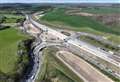
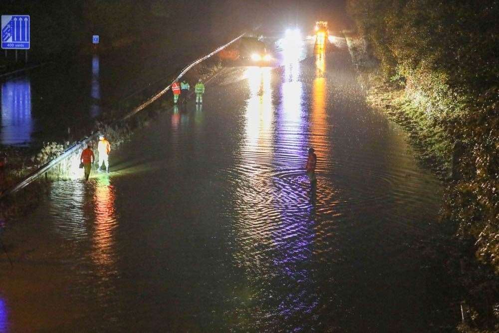
A number of flood alerts have been issued after heavy rain and flash flooding brought disruption to roads and railway last night.
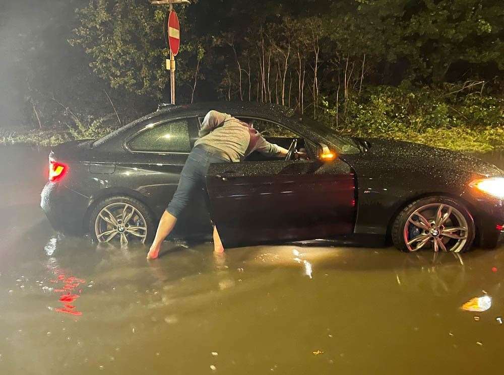
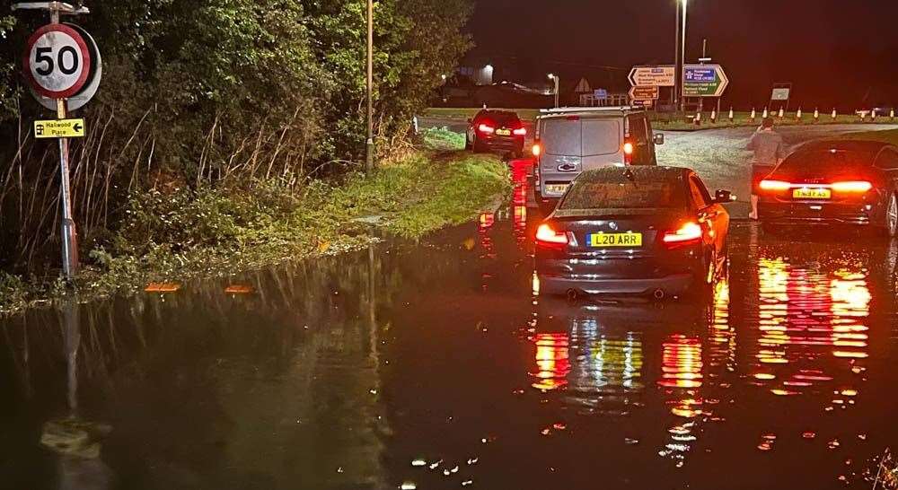
Torrential rain which lashed parts of Kent left drivers stranded on the M26 at Wrotham and the M23 further afield.
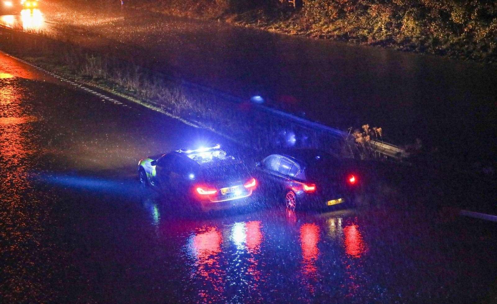
Police officers had to clear nearby drains and tow cars out of the flooded road at about 11pm.
Meanwhile, the Environment Agency has issued flood alerts for several areas including the 'Middle River Medway'.
It says flooding is possible for the Medway from Penshurst to Hampstead Lock at Yalding, including the Leigh Flood Storage area, the Ensfield Road, Tonbridge, Paddock Wood, the Hop Farm, East Peckham, Branbridges and Hale Street.
Flooding of roads and low lying land is expected until noon today, with flooding expected to affect Tonbridge playing fields, town centre car parks and low lying land and roads from Tonbridge through Tudeley and East Peckham. This is likely to include the sports pitches, also known as the racecourse, and Postern Lane in Tonbridge.
A flood alert has also been issued for the Rivers Eden and Eden Brook, with flooding possible from Blindley Heath to Penshurst including Edenbridge and Hever.
The agency expects flooding to affect low lying land and roads close to the rivers, particularly on and around Water Lane and Haxted Road.
A further flood alert is in force for Plenty, Swalecliffe and West Brooks; with flooding possible for Plenty Brook from Eddington to the sea, including Herne Bay, the Swalecliffe Brook from near Court Lees to the sea, including Chestfield and Swalecliffe and the West Brook from the railway line to the sea including Studd Hill and Hampton.
Flooding is expected to affect low lying land and roads along Swalecliffe Brook in Swalecliffe and low lying land and roads along rivers in the area, particularly around Herne Bay.
A separate alert has also been issued for the River Darent from Westerham to Dartford, with flooding possible for the River Darent from Westerham to Dartford, including Brasted, Sundridge, Chipstead, Dunton Green, Otford, Eynsford and South Darenth.
Flooding is likely in multiple areas along the River Darent, particularly to low land near the river between Westerham and Otford.
There are also flood alerts in place for the coast from Ramsgate to Kingsdown, from St Margaret's at Cliffe to Sandgate, and for the Upper River Stour.
Further alerts have been issued for Tidal Medway, Medway estuary and Isle of Grain with particular areas of concern in Canal Road, Strood and Upnor.
A spokesman for the Environment Agency said: "Our incident response staff are out on the ground checking and clearing any blockages and debris from rivers and actively monitoring the situation and are prepared to respond if required. Please stay aware in case further warnings are issued."
There has also been disruption to railway services today.
Network Rail shared a photo of the line at Greenhithe, just east of the tunnel, this morning, where it estimated about 30t of muck had slid down
It comes after the Met Office warned that flooding, interruption to power supplies and possible travel disruption could hit Kent.
The weather experts issued a yellow weather warning for heavy rainfall, which came into force at 4pm yesterday.
It added that the rain might be accompanied by coastal gales and, even, thunder.
One man in Cliffe, near Rochester, reported strong winds described as a "mini tornado" battering the area overnight, ripping up a 30ft olive tree and hurling it at his house.
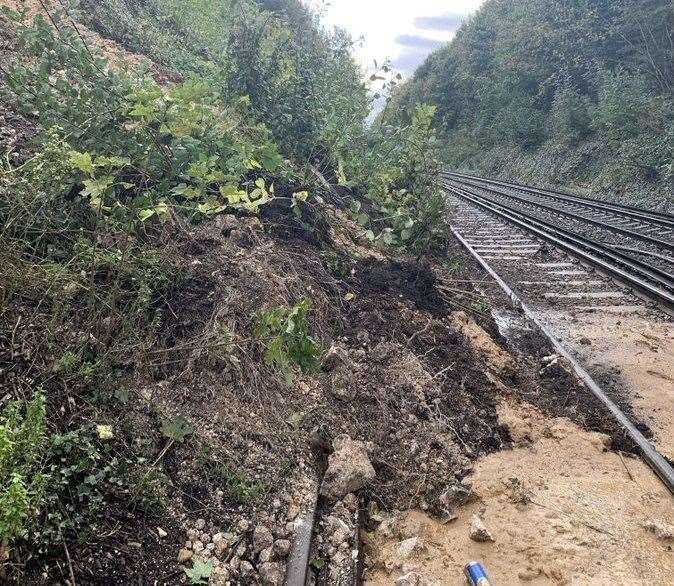
Elsewhere Southeastern and Thameslink train services between Dartford and Gravesend are being held due to a landslip at Greenhithe for Bluewater.
Network Rail said its plan was to clear the muck, once the slip had stopped moving, and shore it up with temporary walls made of bags full of stone.
It added: "We don't have time scales yet, but they will come today."
There are delays of up to one hour on DFDS Seaways between Dover and Dunkirk due to poor weather conditions.
Meanwhile debris is being cleared on Hollingbourne Hill, which is closed as a result, and many other routes in the county are impacted by flooding and fallen trees.
For all the forecasts, warnings and weather related news, click here.