GO AD-FREE. Get 2 Months Digital Subscription for ONLY £1! Use code 2FOR1
GET STARTEDMore on KentOnline
GO AD-FREE. Get 2 Months Digital Subscription for ONLY £1! Use code 2FOR1
GET STARTEDMore on KentOnline
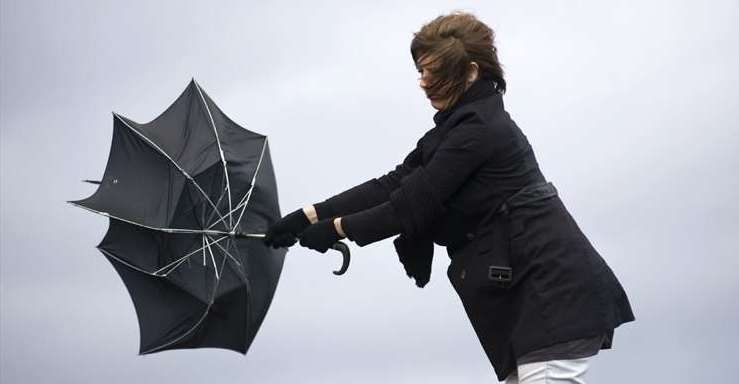
Heavy rain and strong winds are expected to batter Kent later this week.
After what has already been a 'wetter than average month' the showers are only predicted to continue throughout today and tomorrow and with forecasters saying they are not ruling out imposing weather warnings.
Met Office meteorologist Craig Snell said the heaviest rain in the UK yesterday had fallen in Goudhurst, with 16mm recorded over 12 hours.
Mr Snell added that a deep band of unseasonable low pressure will bring more wet and windy weather on Thursday and Friday, with some coastal areas likely to be hit with 60mph gusts.
He added: “This time of year, with the trees in full leaf, it could potentially bring some small branches down and because there’s a lot more outdoor furniture, we advise people that it is a bit vulnerable to strong winds and to tie it down.”
The heaviest rain will be in the north with up to 70mm of rainfall on the high ground.
Mr Snell said that while no weather warnings were currently in force, the Met Office will keep a close watch on conditions.
He added: “We are keeping a very close eye on it, I don’t think any warnings will be issued today but there’s a possibility as we go into tomorrow.”
This month could be one of the wettest Mays on record, surpassing 1967, when 131.7mm of rain fell across the UK.
Mr Snell said that while it was too early to predict if May will break any records, it had already been a “wetter than average month”, with 70mm of rainfall in the UK up to Monday.
For all the forecasts, warnings and weather related news, click here.