Unlimited Digital Access / Get £25 off your Annual Digital Subscription! Use code 25OFF
GET STARTEDMore on KentOnline
Unlimited Digital Access / Get £25 off your Annual Digital Subscription! Use code 25OFF
GET STARTEDMore on KentOnline
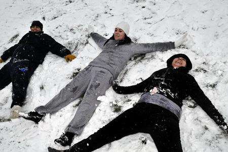
Will there be scenes like this in Kent later today and tomorrow?
by Jo Sword
It may not look like it now but snow is expected to form a white blanket over the county during the next 24 hours.
Kent is expected to see some of the heaviest snowfall in the country.
John Hammond, a forecaster at the Met Office, said: "By the time we get towards tomorrow morning we could see anything up towards 5 to 10 cm and even more on the hills where we could get up to 15 to 20cm on the North Downs."
Disruption is expected on Kent's road and rail network.
Southeastern says it is working hard with industry partners to ensure that a normal service will run "but the snow may unfortunately cause some disruption to services".
Kent Police have also urged motorists to travel only if absolutely necessary.