GO AD-FREE. Get 2 Months Digital Subscription for ONLY £1! Use code 2FOR1
GET STARTEDMore on KentOnline
GO AD-FREE. Get 2 Months Digital Subscription for ONLY £1! Use code 2FOR1
GET STARTEDMore on KentOnline
The worst of Storm Eleanor may have passed, but Kent faces more strong winds and travel disruption today.
Forecasters say a spell of strong and gusty winds will move through the county today, causing possible delays to road, rail, air and ferry transport.
A spokesman said: "There is also the potential for some short term loss of power supplies.
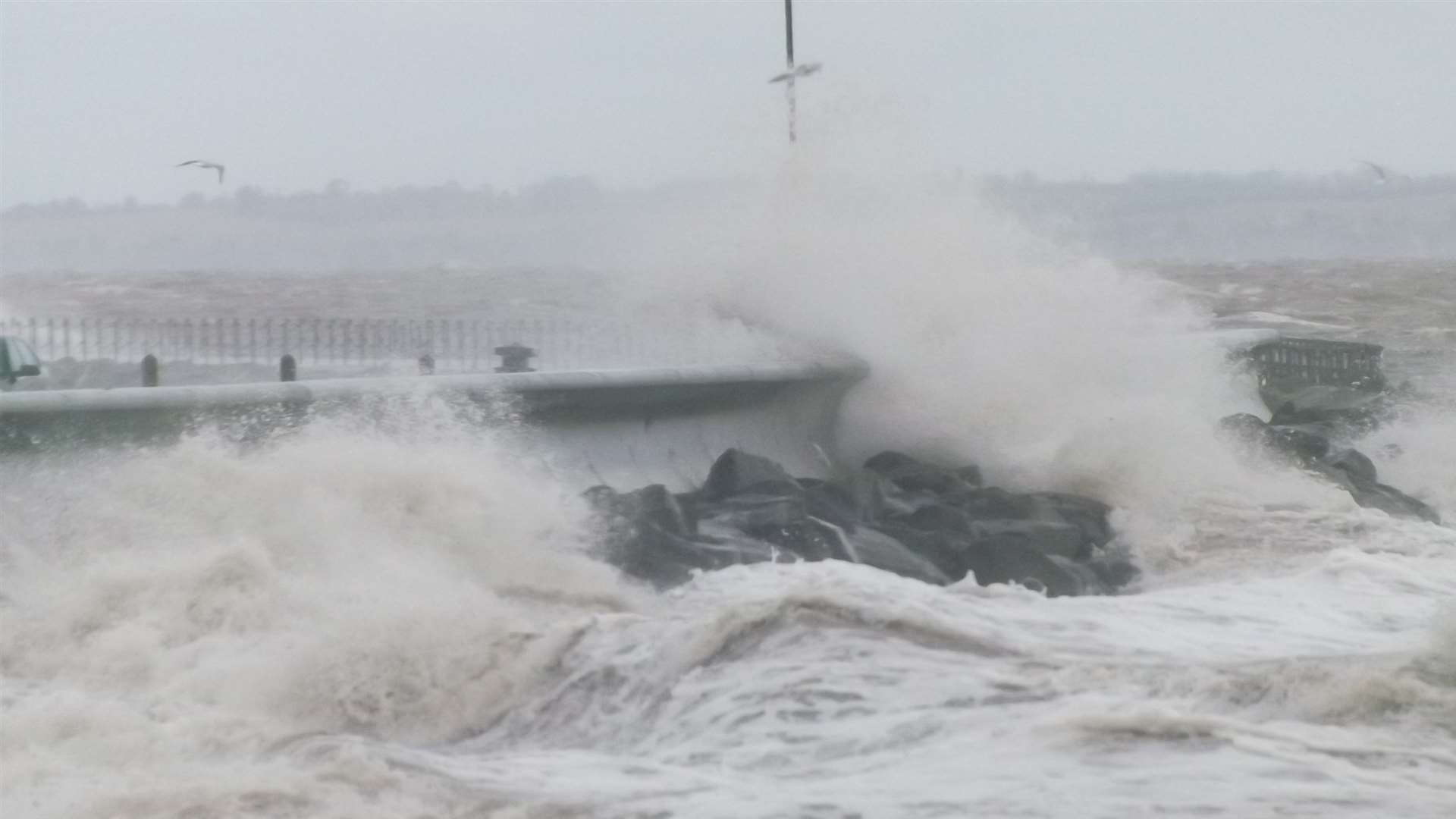
"It is likely that some coastal routes, seafronts and coastal communities exposed to these winds will be affected by spray and/or large waves."
A yellow "be aware" weather warning for wind is in place until 7pm.
The Environment Agency has also issued flood alerts as strong winds and large waves threaten areas along rivers and the coast.
An alert along the River Medway affecting Aylesford, the Medway Towns, Lower Halstow, Middle Stoke and Lower Stoke comes into force at high tide at 2pm, when minor flooding of low lying coastal land and roads is possible.
Another alert covering the coast from Sandgate to Dungeness will be in place from 12.33pm.
The EA says: "People are advised to stay away from the coastal areas at risk and to remain aware of your surroundings if near to the coast."
There are also severe delays on P&O Ferries between Dover and Calais, with passengers facing a wait of up to 85 minutes.
Yesterday, the county was lashed with strong gusts and heavy rain, causing road closures, power cuts and fallen trees.
Listen to kmfm for travel and weather updates.