GO AD-FREE. Get 2 Months Digital Subscription for ONLY £1! Use code 2FOR1
GET STARTEDMore on KentOnline
GO AD-FREE. Get 2 Months Digital Subscription for ONLY £1! Use code 2FOR1
GET STARTEDMore on KentOnline
Home Romney Marsh News Article
Residents were greeted with a dramatic sight in the sky this morning after a funnel cloud formed over Kent.
The cloud is the start of what forms a tornado and are a common sight when rainclouds in cold weather fronts form but don't release the moisture as rain.
People took to social media this morning showing the cloud over the Romney Marsh.

Julie Pout took one of the photos from her garden in Lydd as it passed from west to north shortly before 11am
Meanwhile motorists also saw the strange sight from Brenzett.
Funnel clouds are usually formed when condensed water droplets in clouds meet with a rotating column of wind and extend from the base of the main cloud.
They do not reach the ground or sea but if they did this is what forms a tornado.
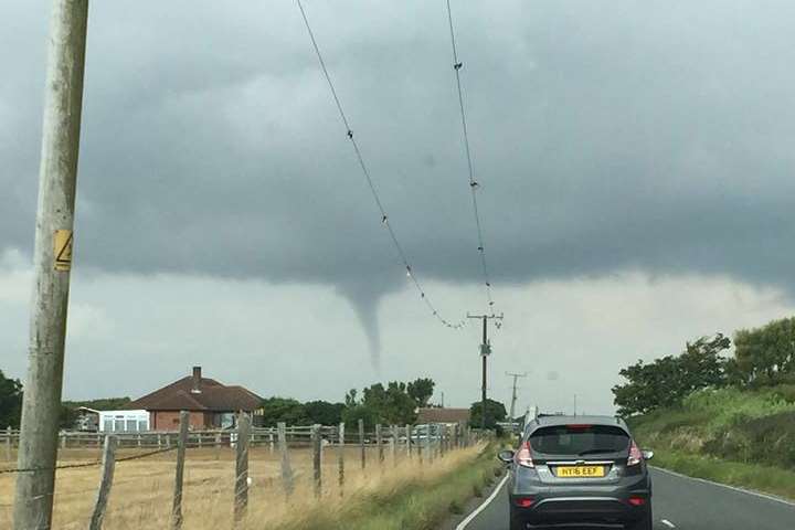
Most frequently they are visible as a cone-shape or needle and are most often associated with supercell thunderstorms.
Tornados mainly begin as funnel clouds but invariably most funnel clouds do not make contact with the ground and therefore do not become a tornado.