GO AD-FREE. Get 2 Months Digital Subscription for ONLY £1! Use code 2FOR1
GET STARTEDMore on KentOnline
GO AD-FREE. Get 2 Months Digital Subscription for ONLY £1! Use code 2FOR1
GET STARTEDMore on KentOnline
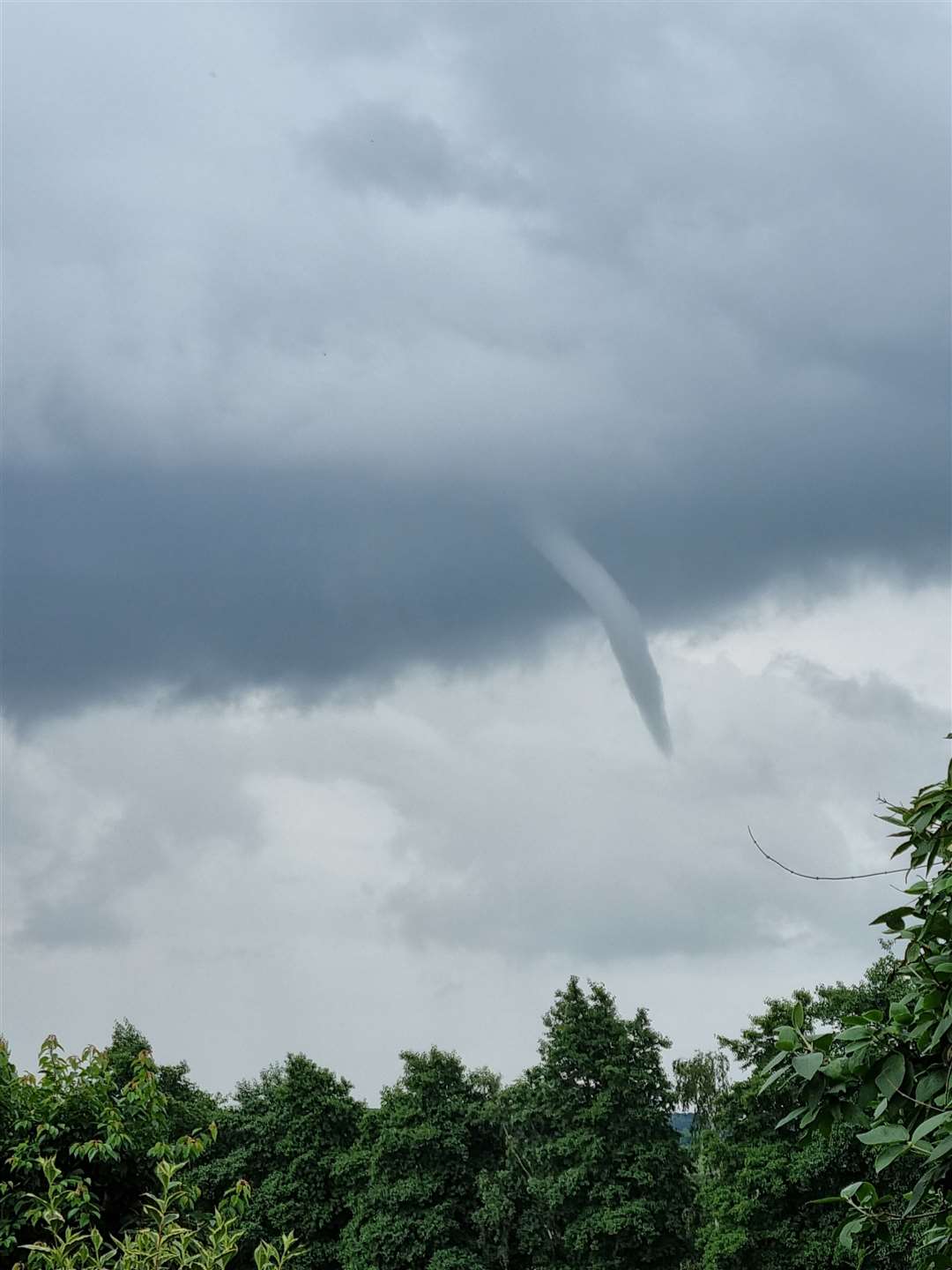
Funnel clouds were spotted forming again in the skies above Kent this afternoon.
The normally rare phenomenon has become a regular sighting across the county and the latest was spotted close to the M2 near Chatham.
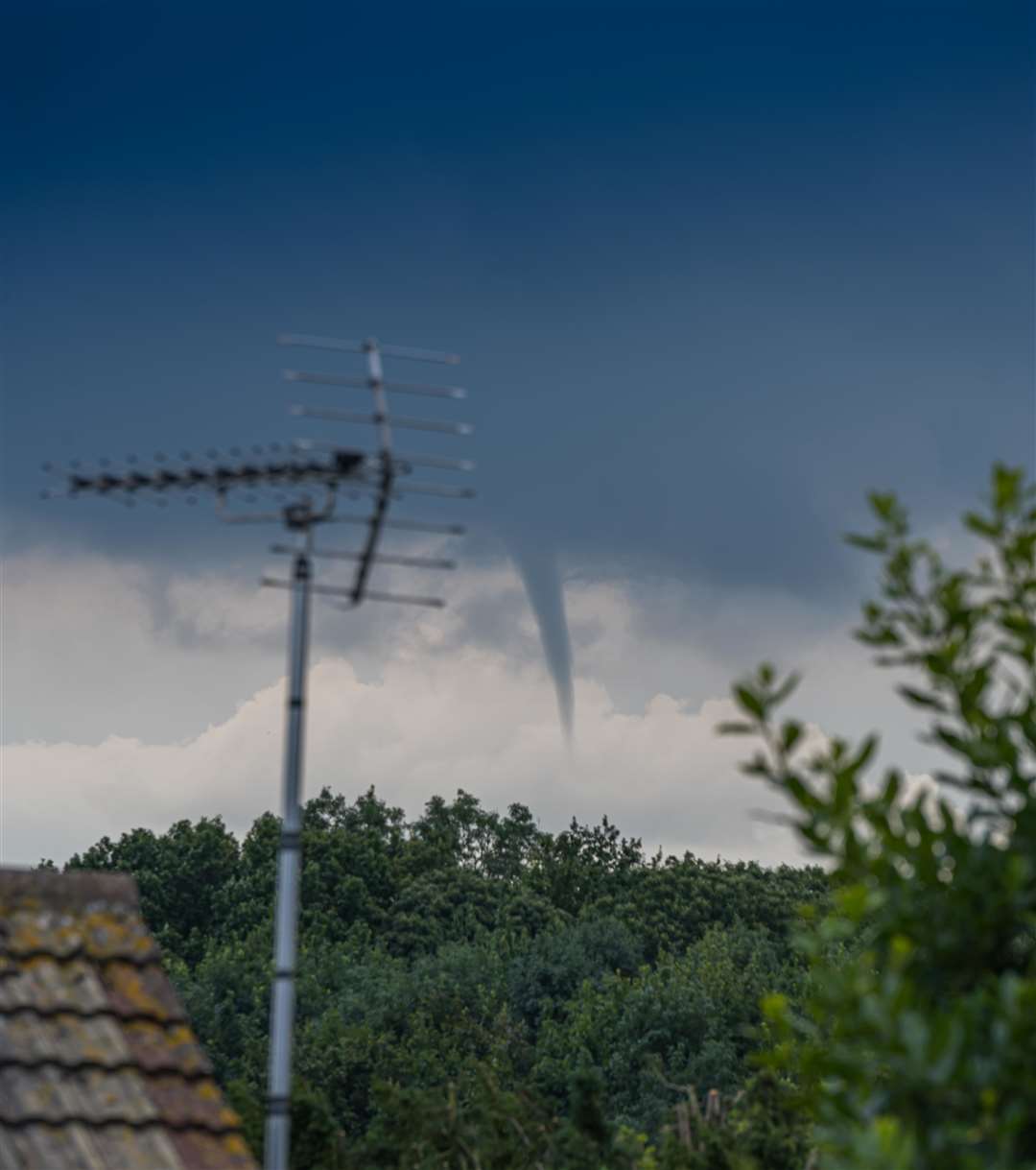
David English spotted the phenomenon from his Rainham home and says it was one of "two or three" which appeared in the sky towards Bredhurst.
"They were around for about 15 or 20 minutes and came down and looked as though they were about to touch the ground," he said.
"It's really interesting to watch.
"It started quite small but you could see it forming."
The clouds become tornadoes when they reach the ground and are called waterspouts when they touch water.
Kelvin Carr, airport manager at Rochester Airport, said while pilots in the skies would need to be wary of the clouds, operations at the aerodrome close to the motorway had not been affected.
"They would be a concern for anybody flying but we've not had any issues," he said.
"Pilots would see them and should be able to avoid them."
The latest sighting at about 1.15pm today is the most recent after numerous ones were seen in the skies on Sunday afternoon.
There have been plenty of funnel clouds forming in the Kent skies during changeable weather so far this summer.
The cone-shaped clouds, known as tuba, are created when a rotating column of wind draws in cloud droplets making an intense patch of low pressure.
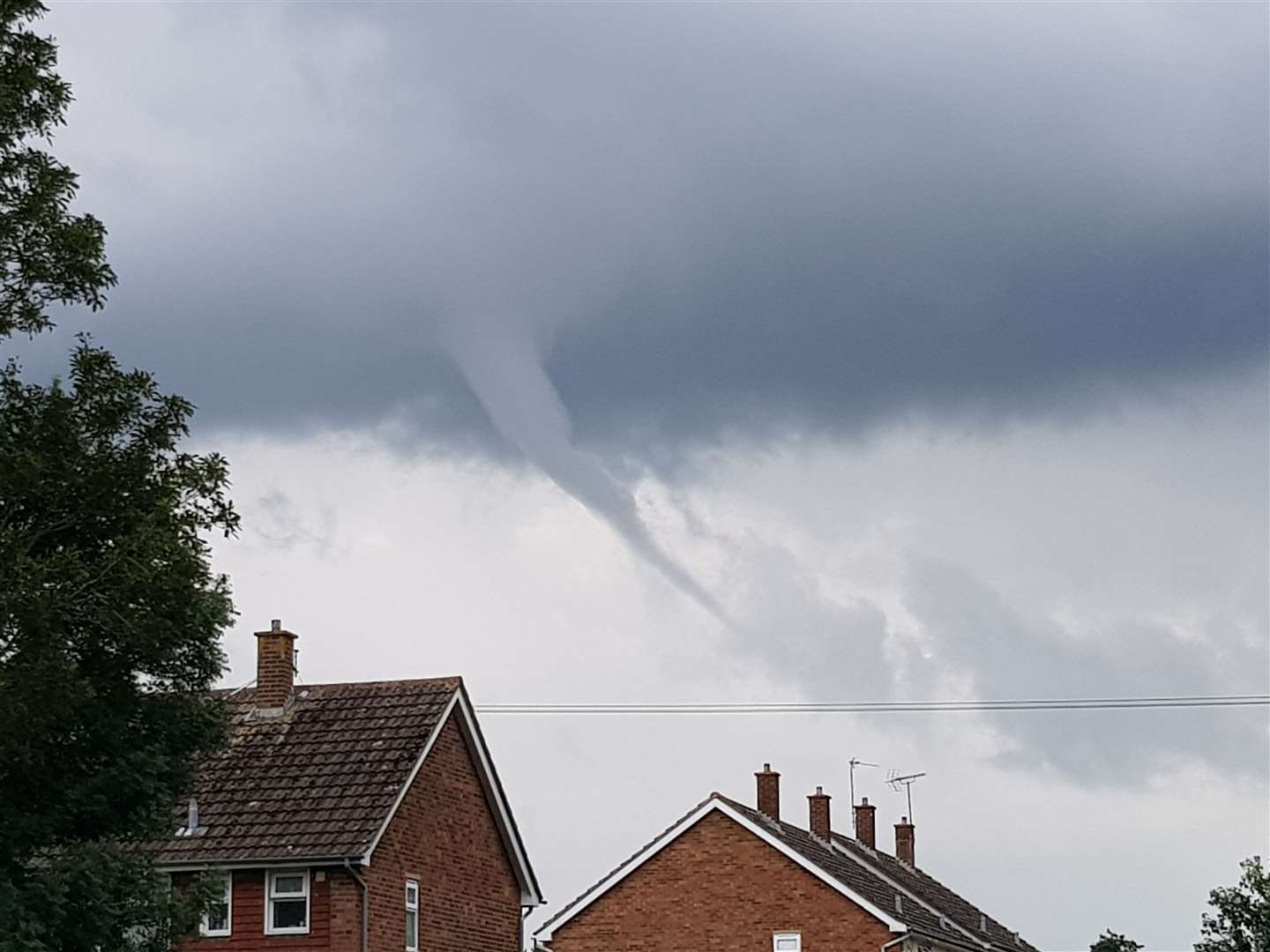
They are often associated with creating thunderstorm clouds, and produce tornadoes when reaching the ground with often very high winds in the centre.
On average, the Met Office says there are about 30-35 tornadoes in the UK every year but are rarely strong enough to cause major damage.
Jeremy Proctor, who runs an amateur weather monitoring station from his home in Sittingbourne, said: "They are the result of an unstable atmosphere usually associated with a deep depression or a very active cold front."
For all the forecasts, warnings and weather related news, click here.