GO AD-FREE. Get 2 Months Digital Subscription for ONLY £1! Use code 2FOR1
GET STARTEDMore on KentOnline
GO AD-FREE. Get 2 Months Digital Subscription for ONLY £1! Use code 2FOR1
GET STARTEDMore on KentOnline
Home Canterbury News Article
A historic map of Kent claimed to be the most beautiful ever produced is set to go on sale with limited-edition copies available for a whopping £2,500.
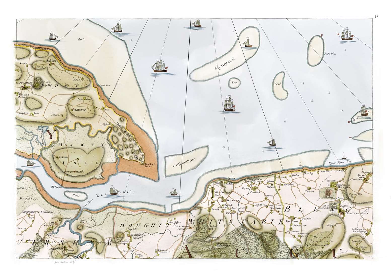
A Map of Kent 1769 is a meticulous recreation of one of the finest 18th century productions showing the county and also contains the most detailed depiction of what is now south east London before its urbanisation.
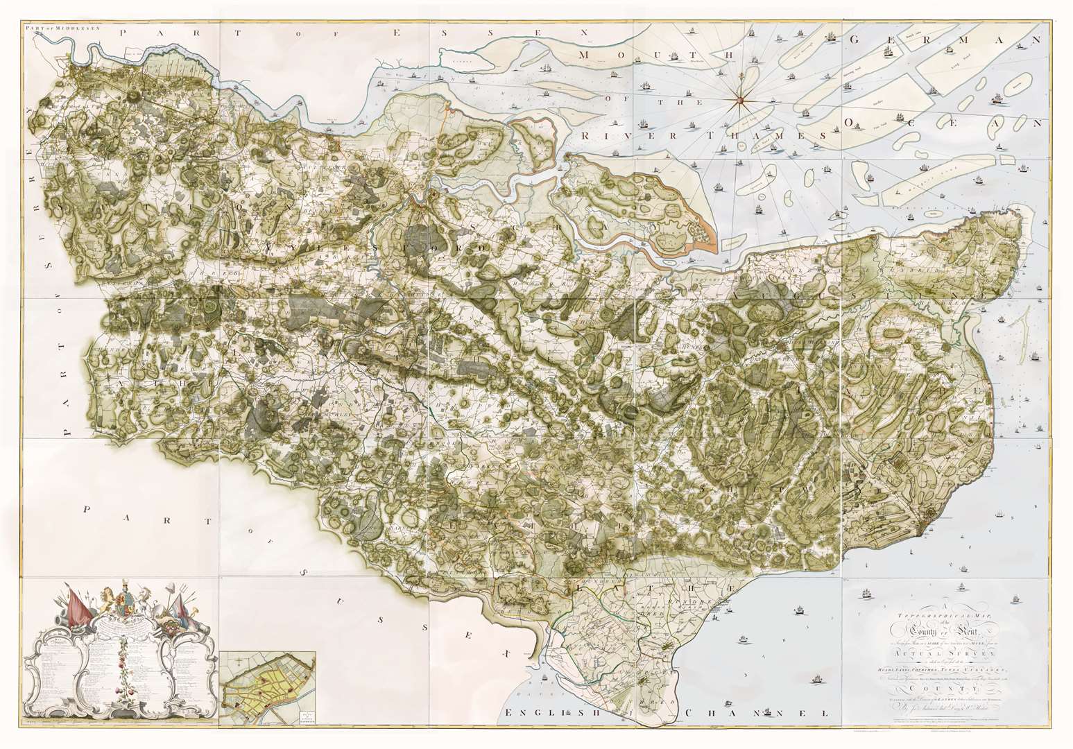
With glorious hand-colouring and calf skin binding, the 25-page volume is said to shine a light on Kent society in the 1700s.
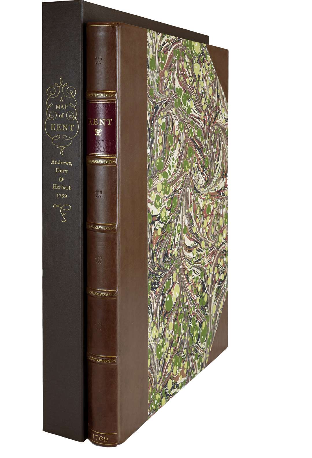
Limited to just 500 individually numbered copies, the recreation of the original map revives traditional book-making skills to create “a treasure worthy of the finest library”, says publisher Addison Publications.
Each volume is half-bound in polished calf skin leather with individually hand-marbled paper sides.
The sheets of the map are printed individually and attached to 'guards' sewn into the spine of the book so they open flat.
The clarity of the engravings, the delicacy of the inscriptions and notable properties included within the maps, such as the home of senior branches of Jane Austen’s family, combine to create what is arguably the “most beautiful map of Kent ever published”, says Addison.
“Readers who immerse themselves in A Map of Kent 1769 may imagine they have been transported back to the 18th century, as they explore southern England’s coastlines, great houses (with owners’ names appearing on the larger properties), farms, churches, gardens, streams, and more”, adds the publisher.
In addition to its illustrations of the area, it is said to offer an insight into the cultural and economic significance of Kent as a region throughout Britain’s history to the present day.
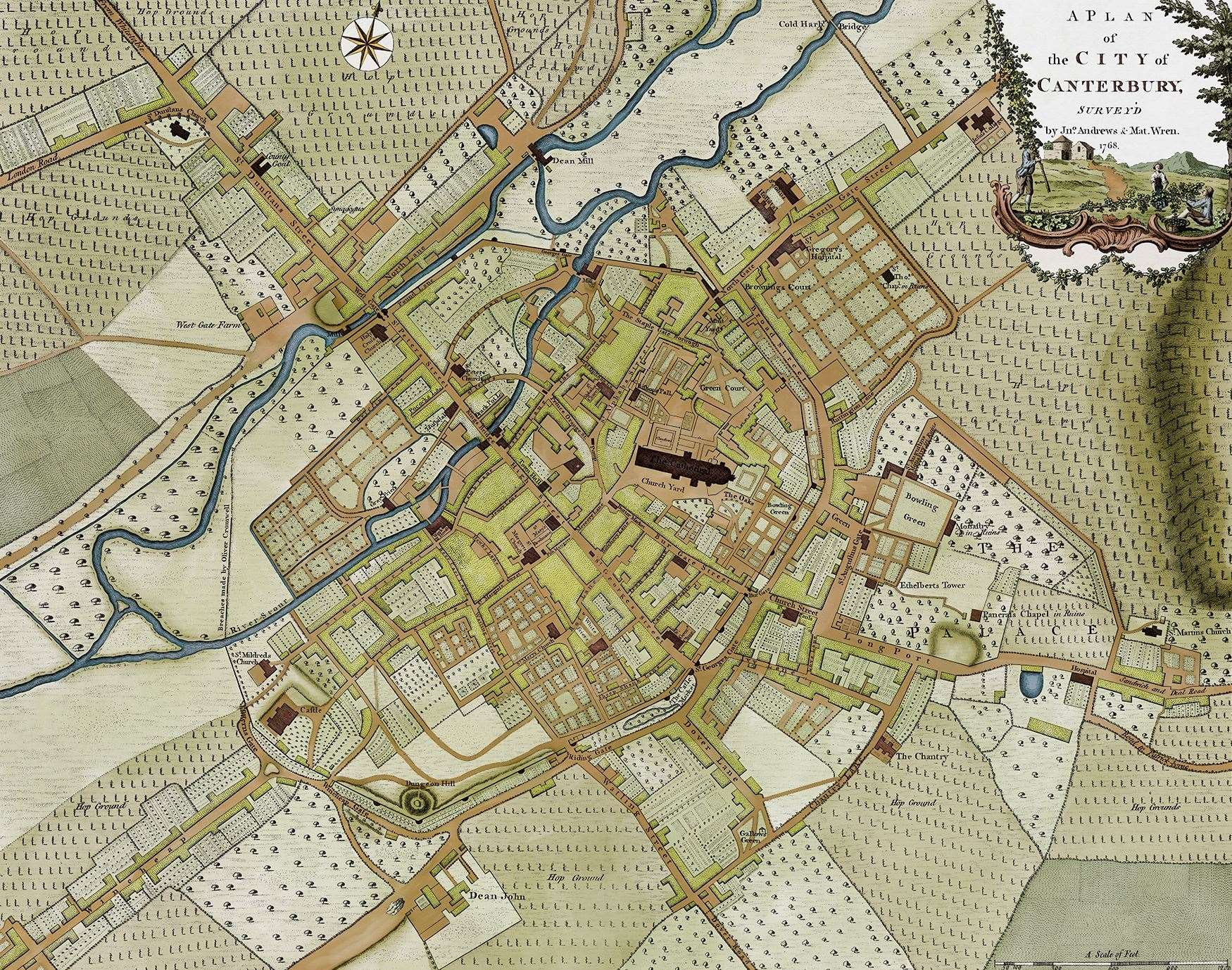
It also includes an additional 18th century street plan of Canterbury mapped at 1 inch to 170 yards.
The highly detailed map was created by London bookseller Andrew Dury and the engraver John Andrews, who worked meticulously for four years to create the intricate and elegant volume.
It is contained in 25 sheets and mapped at two inches to the mile.
Former head of maps and topography at the British Museum, Peter Barber has produced an additional commentary volume that gives an account of the mapping of Kent from Roman times until 1800, and of English county mapmaking and the map trade.
The volume includes a detailed analysis and evaluation of the markers, content, production, patrons and longer-term significance of A Map of Kent 1769.
“A Map of Kent 1769 can lay claim to being the most skilfully engraved and beautiful of all the historic maps of Kent and it contains the most detailed depiction of what is now south east London before urbanisation in the later 19th century, says Mr Barber.
“But perhaps the most striking feature of the map,” he adds, ”is that it is an inevitably subjective image of Kent society at the time.
“It shows the social as well as the physical geography of the county – and at a similar level of detail – and, in particular, it throws light on the spatial aspect of social and political networks.”
A Map of Kent 1769 goes on sale through Addison Publications on November 16.