Unlimited Digital Access / Get £25 off your Annual Digital Subscription! Use code 25OFF
GET STARTEDMore on KentOnline
Unlimited Digital Access / Get £25 off your Annual Digital Subscription! Use code 25OFF
GET STARTEDMore on KentOnline
Several flood warnings have been issued across the county ahead of high tides this evening.
Those living near the coast and the Thames and Medway Estuaries are being warned to stay vigilant tonight.
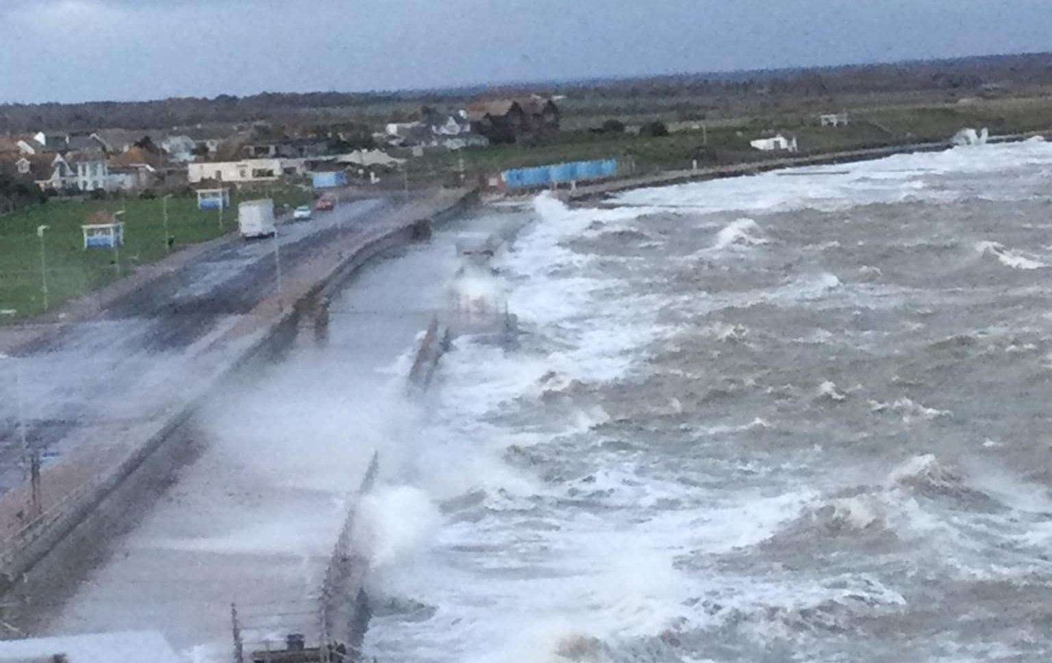
The Environment Agency has confirmed its incident response staff are closing floodgates and checking defences in areas at risk of tidal flooding.
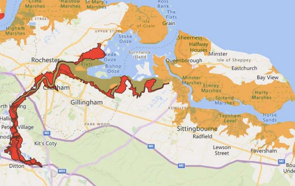
A flood warning is in force for the River Medway and the Medway estuary.
Flooding is expected for parts of Hoo, Rochester, Strood, Chatham, Cuxton, Halling, Aylesford, Larkfield, Wouldham, Upnor, Hoo and Lower Halstow.
The flood warning has been issued from 8pm with high tide due at 10pm.
Residents are strongly urged to remain safe and be aware of their surroundings.
After this tide‚ the weather is expected to be more settled and no further impact is expected.
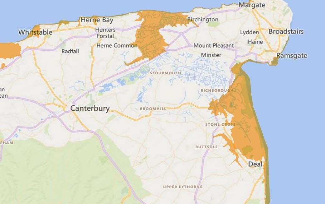
A flood alert is in force across the following Kent towns:
- St Margaret's at Cliffe to Sandgate, including Dover and Folkestone
- Ramsgate to Kingsdown, including Sandwich and Deal
- Whitstable to Margate, including Herne Bay, Reculver, Marshside, Saint Nicholas at Wade, Birchington and Westgate-on-Sea
- Dartford to Allhallows, including Crayford, Greenhithe, Northfleet, Gravesend and the North Kent Marshes
- The tidal River Stour area from Fordwich to Stonar Cut, including the Tidal River Stour area from Fordwich to Stonar Cut including Stodmarsh, Grove Ferry, Plucks Gutter, Ash Level and Minster Marsh.
In coastal areas, a flood alert has been issued, with high tide forecast there at 9pm.
Areas most at risk include particularly low-lying land and roads nearest the sea, however, no property flooding is expected.
This alert will remain in force until after high tide on Saturday morning.
The forecast is for north-westerly force 6 winds throughout the evening and after this tide‚ the weather is likely to be more settled and no further impacts are expected.
Yesterday, floodgates were shut by Canterbury City Council following concerns strong winds could push seawater towards the coast.
The wind was expected to swing north-westerly and cause a wind-driven surge, so the authority took the decision to close some floodgates along the coast.
The gates are adjustable and used to control water flow on seafronts in the Canterbury district, which help prevent flooding during high tide.
The forecast over the next few days is for much colder weather.
Temperatures are expected to plummet to -5°C in rural parts of southern England this weekend with the possibility of snow to come next week.
In the first widespread frost of autumn for much of England and Wales, thermometers are expected to dip below freezing tonight with a further cold spell forecast next week and overnight frosts.

Met Office deputy chief meteorologist Dan Harris said: “Early next week, following a brief more unsettled interlude, we expect to see a return to widely cold but quiet conditions.
“Some rain, or showers, are likely to affect some parts of the east coast, and these could turn increasingly wintry over higher ground areas towards the middle of the week.
“At present, the most likely outcome beyond mid-week is that rain from the west slowly moves east, with snow possible over higher ground, and a continued risk of showers over eastern parts.
“And there is the possibility of snow with colder than average conditions.
“There is a chance that a more active weather system arrives from the southwest, which would bring more widespread rain, stronger winds, and the potential for more significant snowfall should the air over the UK become sufficiently cold ahead of it.”