GO AD FREE | Get your Digital Subscription for only 50p a week! Use code SUMMER
GET STARTEDMore on KentOnline
GO AD FREE | Get your Digital Subscription for only 50p a week! Use code SUMMER
GET STARTEDMore on KentOnline
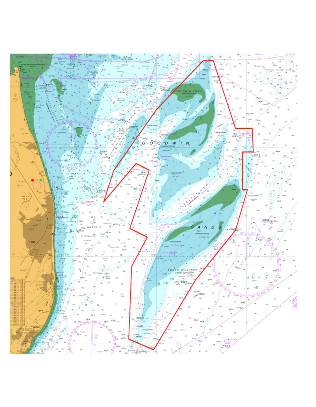
A full survey of the Goodwin Sands has begun.
The notorious shifting sands off Deal are completely charted every 12 years to help save lives by preventing vessels running aground.
Strong currents and tides constantly move them, changing the edges of the sandbank.
The month-long examination is being carried out by contractors A-2-Sea Solutions Ltd from Romsey in Hampshire using their 20-metre survey vessel FPV Morven.
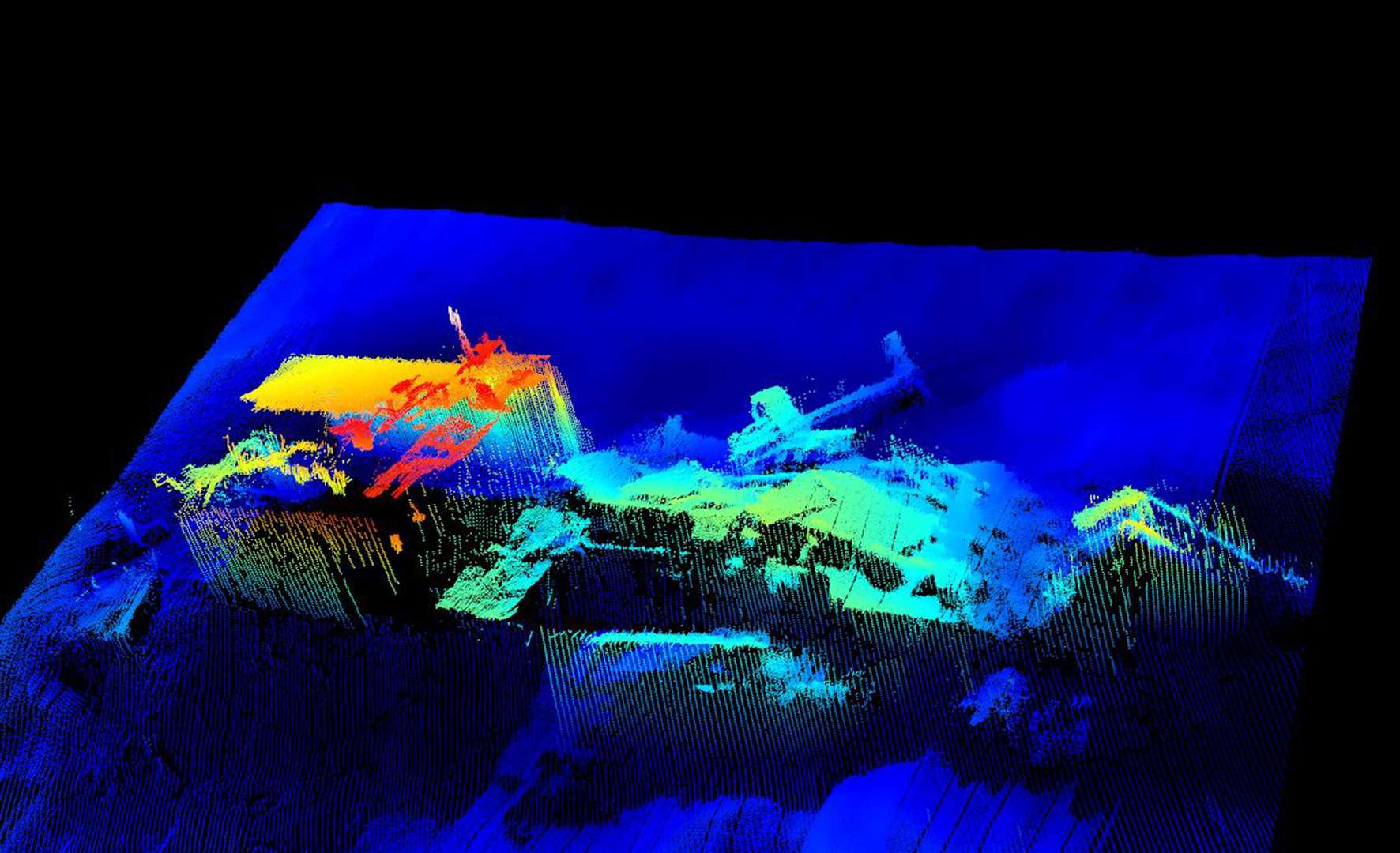
The detailed high resolution multibeam echosounder maps the shifting seabed and identifies potential navigational hazards such as obstacles.
The work is required by the International Convention for the Safety of Life at Sea (SOLAS).
It is because the Goodwin Sands were completely unmarked and uncharted for centuries that they were a constant navigational threat to sailors.
Data collected by the echosounder is processed on board and sent to both the Maritime & Coastguard Agency and the UK Hydrographic Office.
Following completion of validating and analysis, the data will then be incorporated into a new edition of the Admiralty chart, probably published early next year.
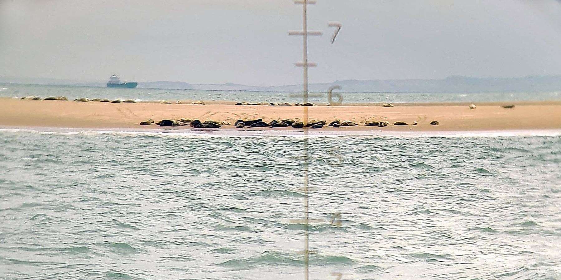
The survey team also recorded seal sightings noting locations and numbers.
One of the shipwrecks they came across was the SS Luray victory. This was an American cargo ship that had to been abandoned after it ran aground on the Goodwin Sands in January 1946.
It had first been launched just 20 months before.
"The lives of mariners depend on this survey."
As well as updating the Admiralty chart, the data collected will be used to produce a report comparing the changes in water depths since the last full study in 2009.
Significant discoveries are sent straight to the Hydrographic Office who will in turn issue a Notice to Mariners with immediate effect.
Paula English, the MCA’s hydrography programme lead, said: “The areas of highest navigational safety risk within UK waters have to be and are surveyed systematically.”
“The lives of mariners can and do depend on it.”
"This work is to make sure our nation’s nautical charts and publications are current, accurate and fit for purpose.
" It means that mariners can make informed and safe decisions about their choice of vessel route to make sure they avoid potential hazards, protecting themselves, their crew, shipping and marine environment.”


