GO AD FREE | Get your Digital Subscription for only 50p a week! Use code SUMMER
GET STARTEDMore on KentOnline
GO AD FREE | Get your Digital Subscription for only 50p a week! Use code SUMMER
GET STARTEDMore on KentOnline
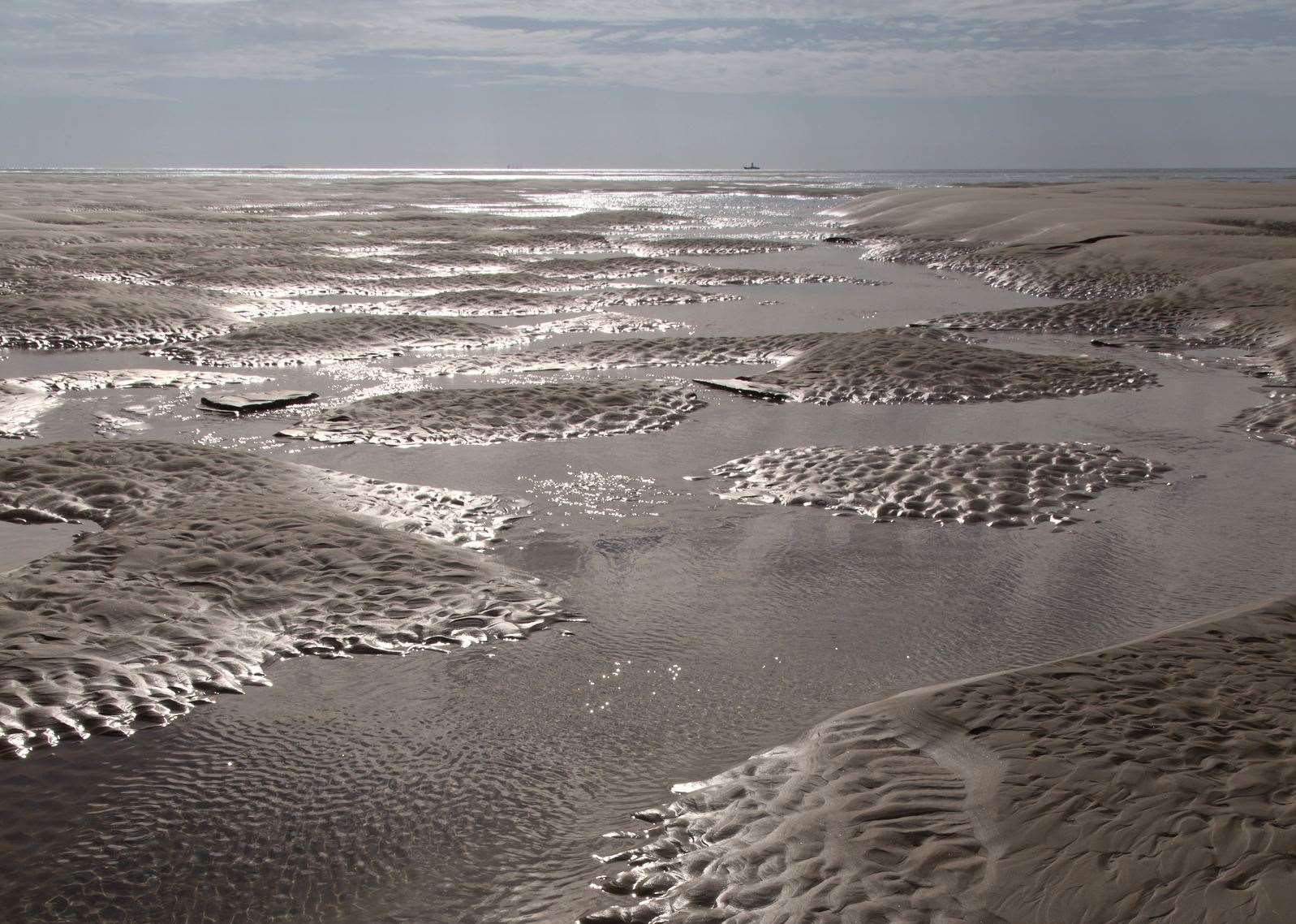
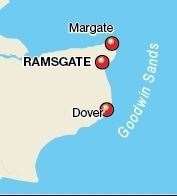
Lying four miles off the east coast of Kent are two mysterious sandbanks hiding some 2,000 shipwrecks.
Together, they are the notorious Goodwin Sands, stretching for 10 miles from Ramsgate to St Margaret’s Bay and varying in width from one to two miles.
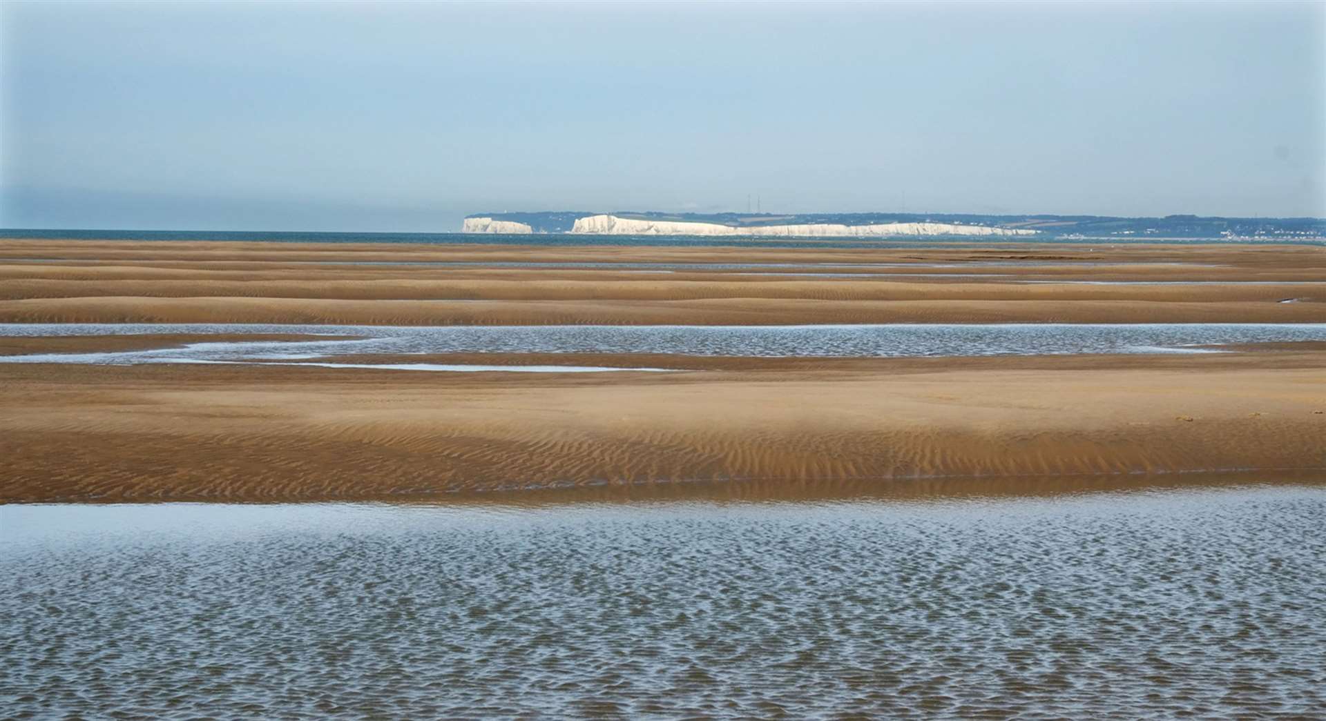
The mystery surrounding the claw-like shaped banks known as North and South Calliper begins with their origin.
No one knows for sure how the Goodwins were created.
Some say they are the result of a silt build up from the River Stour as it exits into the English Channel at Pegwell Bay.
The most popular theory, adopted by Goodwin Sands Conservation Trust (GSCT), is that they were once an island called ‘Lomea’ or ‘Low Island’.
Julius Caesar mentions passing Lomea when invading England, an act commemorated by a stone plaque on the seafront at Walmer, right opposite the Goodwin Sands.
Lomea was thought to be one of three islands recorded during Roman times, the other two being Richborough and Thanet - both of which are now joined to the mainland.
Historians think that Lomea was flooded in 1099 leaving only a couple of long narrow sandbanks, which were subsequently named after Godwyn or Godwin Earl of Wessex.
Godwin was the father of King Harold II who was famously defeated by William the Conqueror at the Battle of Hastings.
For centuries since then, encounters with the hidden banks have resulted in tales of tragedy.
Around 2,000 are known but many incidents are believed to have gone unrecorded.

Joanna Thompson from GSCT explains why the area is scattered with so many wreckages.
She said: "Historically the Goodwins were such a hazard to mariners because they were completely unmarked.
"There were no warning beacons in place until the end of the 16th century/mid 17th century.
"No charts showed them until 1583 and the first lightship was installed in 1795.
"Today the Sands are marked by the East Goodwin light vessel, 18 marker buoys, an Admiralty chart and, of course, GPS."
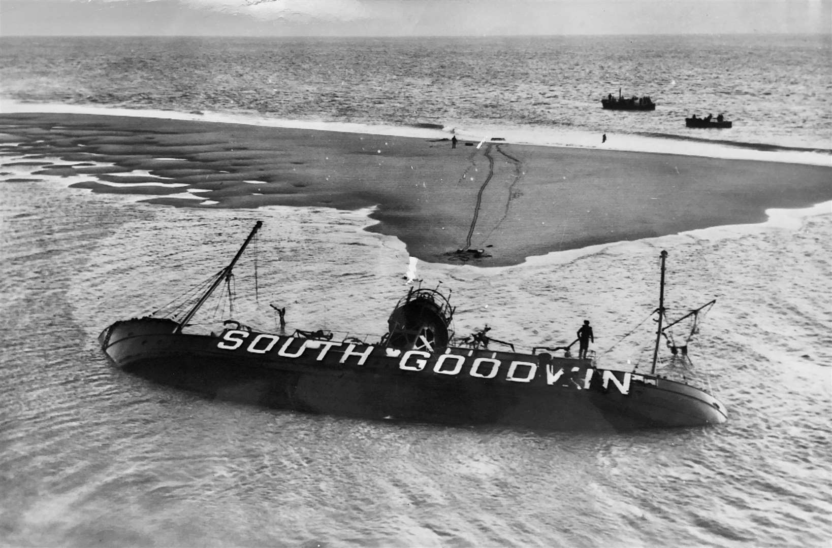
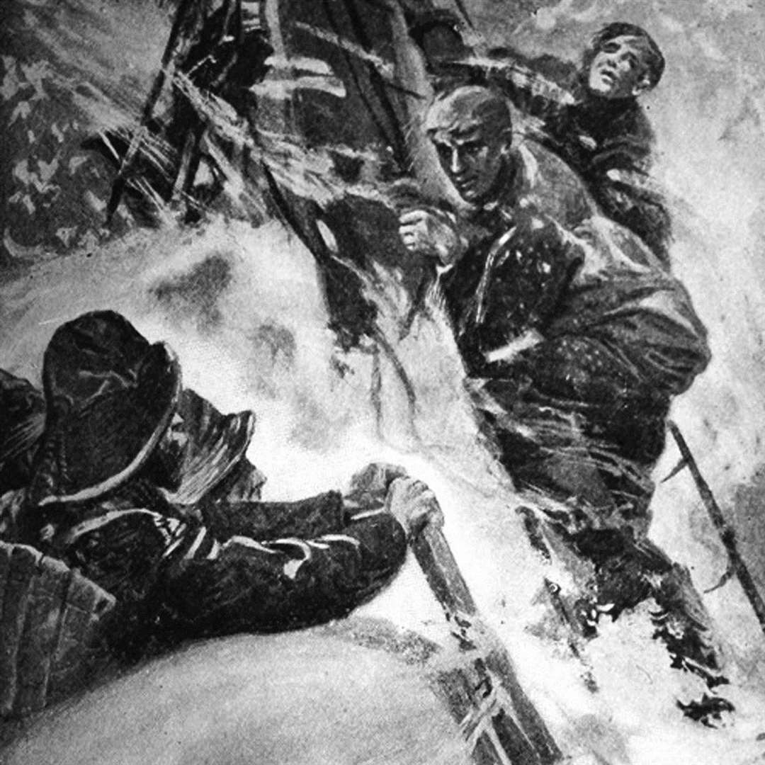
The most recent tragedy was the loss of the South Goodwins light vessel during a violent storm in 1954.
During the night of November 27, one of the heaviest storms in two centuries blew up and the South Goodwin light vessel lost her anchors.
She was driven nearly six miles north where she eventually came to rest near the North Goodwin sandbank.
Her seven crew members all died and their bodies have never been found.
Only one survivor was rescued by a US Navy helicopter; Ronald Murton, a 22 year old employee of the British Ministry of Agriculture who was on board monitoring bird migration, was rescued after eight hours of clinging to the rigging.
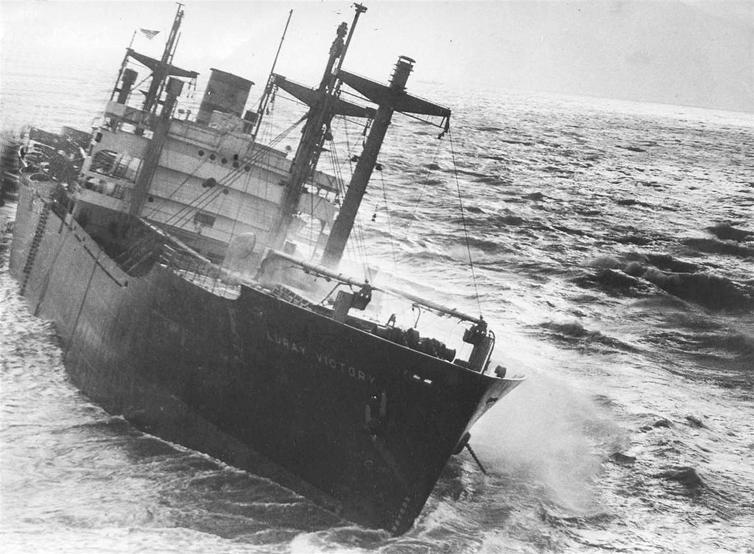
SS Luray Victory sank in 1946. She was one of several American Liberty ships sending much needed supplies to the allies in Europe just after the Second World War.
The US Government frowned on the use of pilots around the English Channel and because the Goodwins weren't marked on many of their maps, the ships subsequently ran aground.
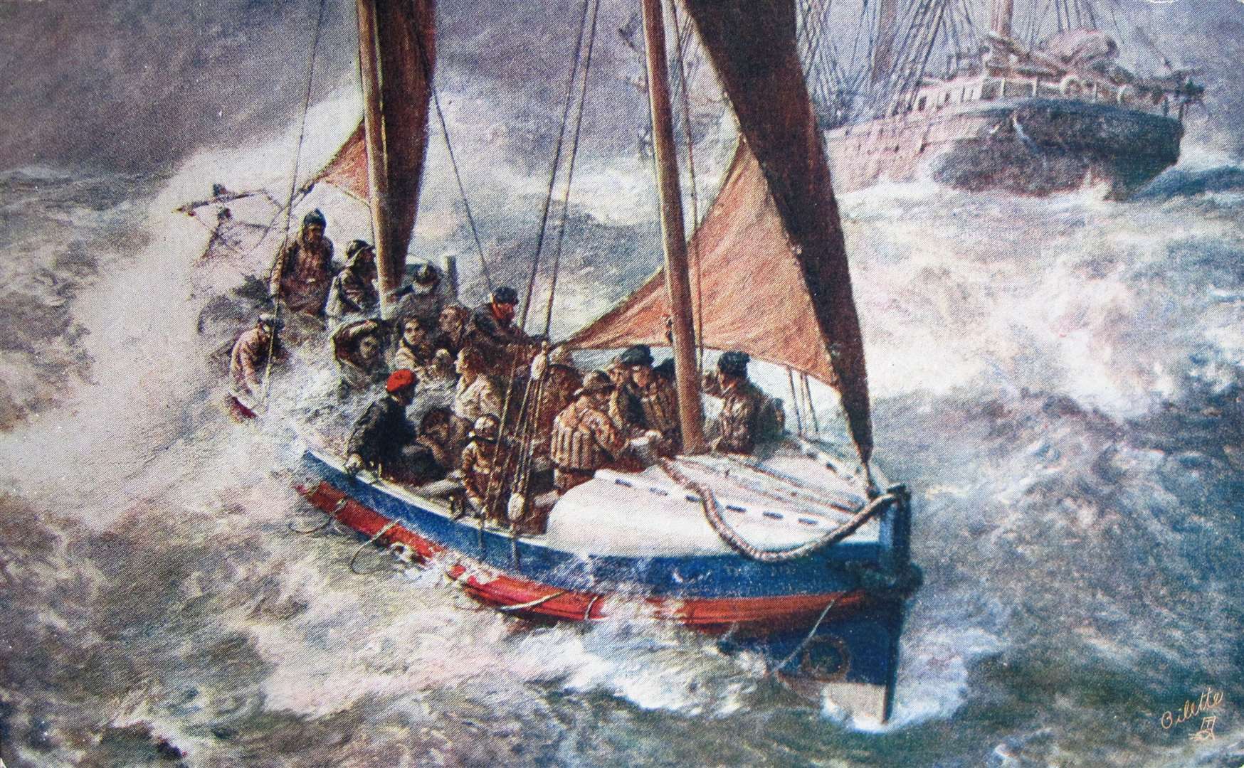
In 1919, the crews from two ships had to be rescued after stormy weather forced them onto Goodwin Sands.
Ketch barge Corinthian, and the smaller ketch Glenavon, had both left the port of Antwerp on October 31 and were sailing together for London despite the high winds.
But as the weather worsened, Corinthian captain, Ernest Leek, decided to make a run for it, to shelter at Dover.
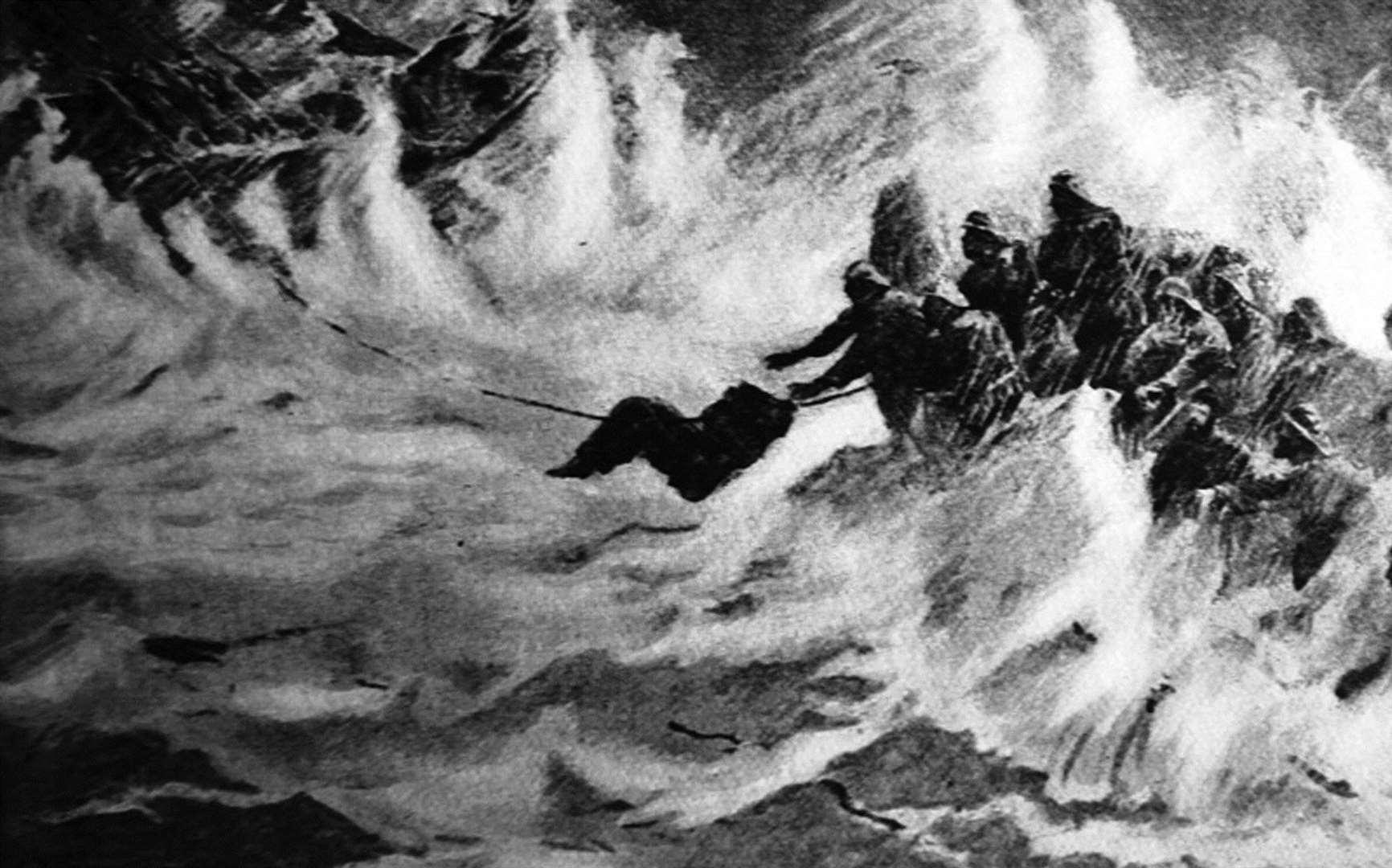
Trouble with the mainsail however, saw the vessel drift onto the Goodwin Sands, where eventually she started to take on water.
Efforts were made by the captain who set light to blankets to signal their distress.
But various delays meant the lifeboat didn't reach them until 17 hours later, by which time the many men of both vessels had perished.
Due to the nature of the shifting sands, wrecks disappear and re-appear as the sands change shape.
The form of one wreckage, Lady Lovibund, is said to appear every 50 years as a 'ghost ship'.
The schooner encountered the Sands in February 1748.
Accounts suggest she was bound for Oporto in Portugal with caption Simon Reed on board who was celebrating his marriage.
Despite the longstanding sailors' superstition that it was bad luck to bring a woman on board, Reed had brought his bride Annetta with him on the ship.
According to legend, the first mate, John Rivers, a rival for the hand of the captain's young wife, was pacing the decks in jealous anger.
While the captain, his wife and their guests were celebrating the marriage below deck, the first mate was seized with a fit of jealous rage.
Casually drawing a heavy, club-like belaying pin from the rail, the mate walked softly up behind the crew member at the wheel and felled him to the deck with one crushing blow.
Rivers then seized the wheel and steered the ship onto the treacherous Goodwin Sands, killing everyone aboard.
A subsequent inquiry into the disaster recorded a verdict of misadventure.
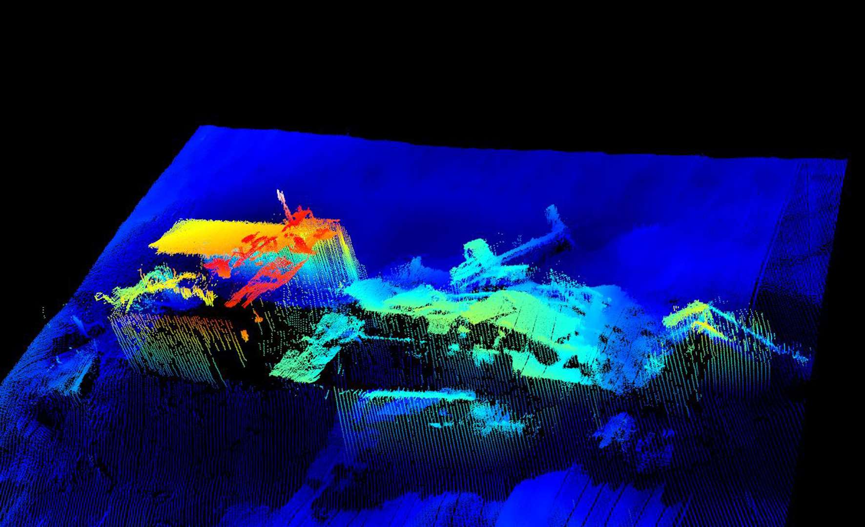
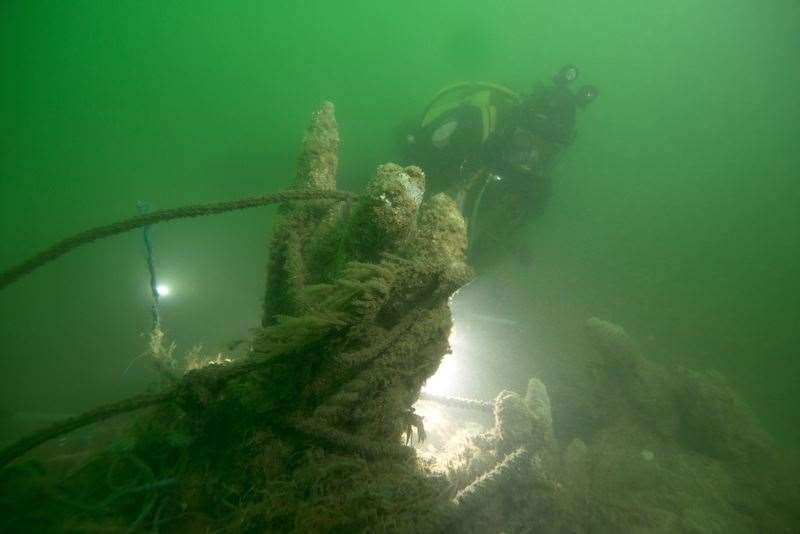
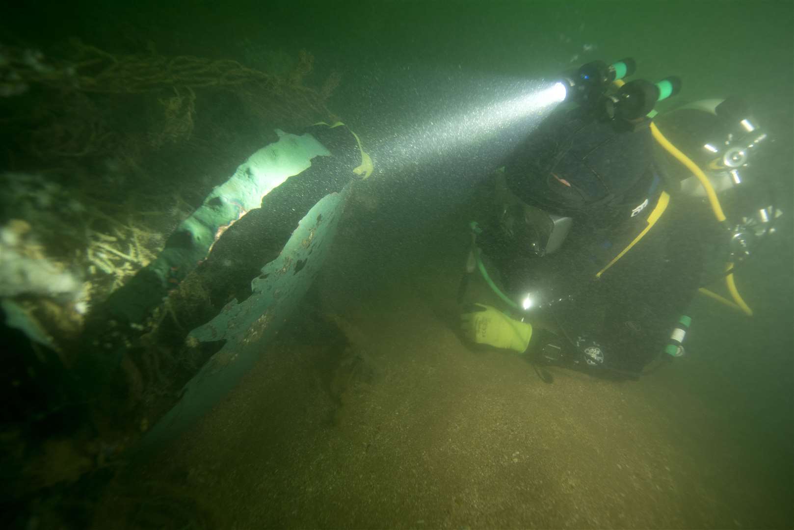
Rooswijk, Northumberland and Restoration are three shipwrecks listed as 'at risk' by Historic England.
The VOC (Dutch East Company) ship Rooswijk was built in Amsterdam in 1737 but stranded on the Goodwin Sands in 1739 while en route from the Texel to the East Indies.

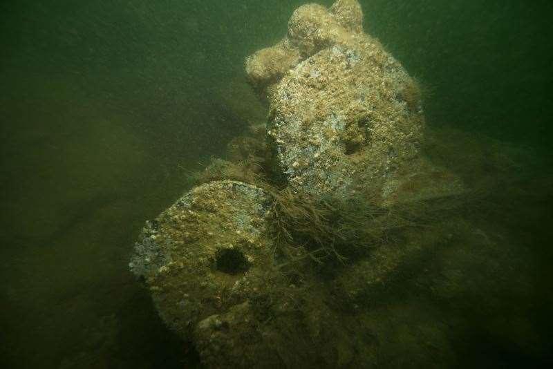
The site represents archaeological evidence for the practice of large-scale overseas commerce between the Netherlands and Asia during the 18th century.
A large scale excavation was undertaken in 2017 and 2018, in a joint project with the Dutch Cultural Heritage Agency and other stakeholders.
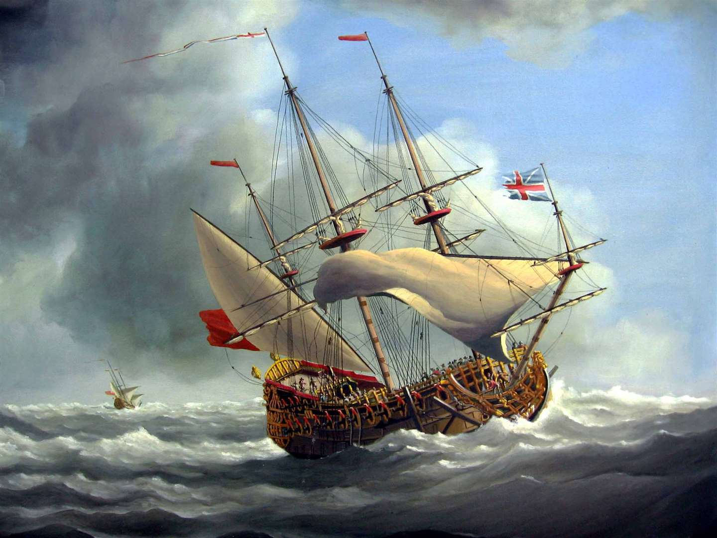
Northumberland was a third rate 70-gun warship built in 1678 as part of Samuel Pepys' regeneration of the English navy.
It was the first third rate ship to be built under contract, after it was realised that the naval dockyards could not cope with the construction of the number of ships requested.
The warship foundered on Goodwin Sands during the 'Great Storm' of 1703.
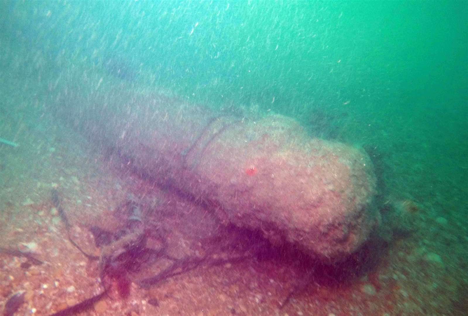
HMS Restoration was the most recent vessel to be added to the list.
The 1,055-ton British warship was built in 1678 and sank in the Great Storm that struck central and southern England in 1703.
Restoration has been added to the Register this year because a recent geophysical survey revealed that the highly mobile sandbank had almost completely migrated off the wreck.
That exposed the surviving archaeology to an extent not previously seen in years.
The surviving artefacts, including the wooden remains of the hull and several iron cannons, are now exposed.
The history surrounding the Sands is one reason campaigners fought so fiercely against Dover Harbour Board's application to dredge the area.
It was for aggregate to help in the build of it Dover Western Docks Revival project.
The application was opposed by the Goodwin Sands SOS group but lost after a High Court appeal.
The SOS groups main argument was based on damage to the environment and the disturbance of war graves.
Mrs Thompson from GSCT said: "During the Great Storm that swept through the southern part of England in November 1703, four Royal Navy warships that were anchoring in The Downs anchorage were swept on to the Goodwin Sands where they foundered and sank with the loss of 1,200 lives.
"They lay covered by sand until reports of fishermen' nets snagging on underwater objects led to their discovery between 1979 and 1984 - just a few years after dredging of the Goodwins started in 1976.
"Three of these ships, the Northumberland, Restoration and Stirling Castle are now on Historic England's Heritage at Risk register; the wreck of the Mary has not been located but is thought to be at the same location as the Northumberland.
"Despite this protective designation, there has been no research undertaken to understand the relationship between removing great quantities of sand via aggregate extraction and the subsequent uncovering of these, or any other, historic shipwrecks."


