Unlimited Digital Access / Get £25 off your Annual Digital Subscription! Use code 25OFF
GET STARTEDMore on KentOnline
Unlimited Digital Access / Get £25 off your Annual Digital Subscription! Use code 25OFF
GET STARTEDMore on KentOnline
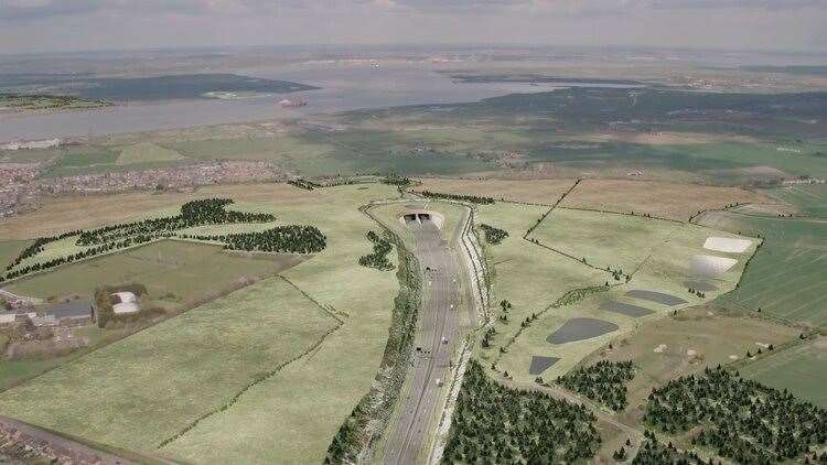
A new 'fly-through' video has been released to show changes to the planned £8.2 billion Lower Thames Crossing.
National Highways has published the video today, as the government's Planning Inspectorate opens a new stage of public consultation on the revised plans for the crossing between Kent, near Gravesend, and Essex.
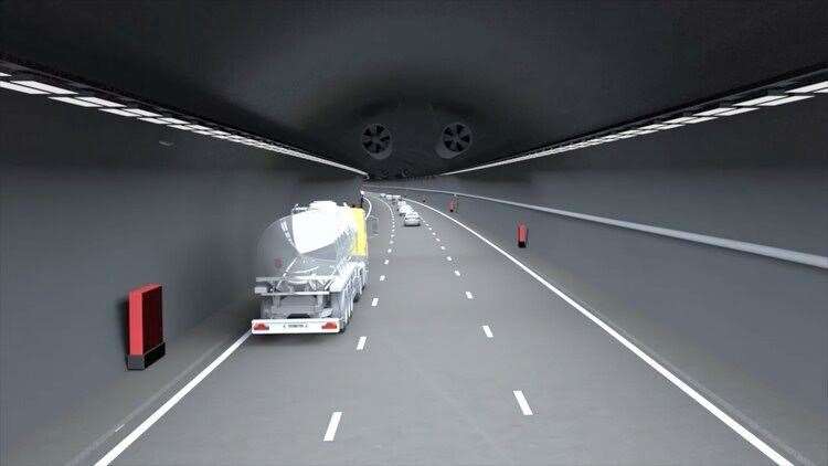
The video shows a bird’s eye view of the scheme – including two 2.6-mile road tunnels under the Thames – which if approved would provide a new connection between the A2 in Kent to the M25 in Essex.
National Highways says the design has been shaped by the "most comprehensive programme of consultation and engagement ever undertaken for a UK road scheme".
The fly-through uses a 3D computer model of the new road blended with real video footage to show how the planned route sits in the landscape, with 80% of the road below ground level through the use of cuttings, embankments and the tunnel.
It also shows the scale of proposed planting and public open space, including two new public parks, seven green bridges and over 1 million extra trees.
Changes made to the design in Thurrock and presented in the project’s last consultation are also included in the fly-through, such as changes on the north bank of the Thames to make space for the Thames Freeport, and changes to the connection between the Orsett Cock roundabout to the A1089 to reduce traffic impacts on some local roads.
National Highways submitted its revised plan in October following an earlier withdrawal, which will be examined by an expert panel later this year.
Members of the public and stakeholders must register on the Planning Inspectorate website before February 24 to make representations.
Matt Palmer, executive director of the Lower Thames Crossing, said: “Our plans have been shaped by a comprehensive programme of consultation and will now be examined in detail by the government’s independent planning authority.
"I’d like to thank members of the public and stakeholders for taking the time to give their views, both in the past and during this planning process.”
National Highways says the proposed crossing will almost double road capacity between Kent and Essex through the UK’s longest road tunnels, and will ease congestion on the Dartford Crossing.
Seven 'green bridges' are planned to provide safer crossing points for people and wildlife, and viaducts are planned to protect a nearby flood plain.
It also says over 60km of new or improved pathways would also be made available for walkers, cyclists and horse riders.
However, the project has come under fire over its eco-credentials and whether it solves traffic issues and provides taxpayers with value for money.
National Highways says the Lower Thames Crossing has been designed to be "the greenest road ever built in the UK", and that a tunnel was chosen rather than a bridge to avoid protected wetlands and marshes.
The planning process is likely to take around 18 months including six months of examination, some taking place at public hearings.