GO AD-FREE. Get 2 Months Digital Subscription for ONLY £1! Use code 2FOR1
GET STARTEDMore on KentOnline
GO AD-FREE. Get 2 Months Digital Subscription for ONLY £1! Use code 2FOR1
GET STARTEDMore on KentOnline
Home Whitstable News Article
Plans for 220 new homes are being backed by council officers as the authority concedes it has failed to meet its housing target.
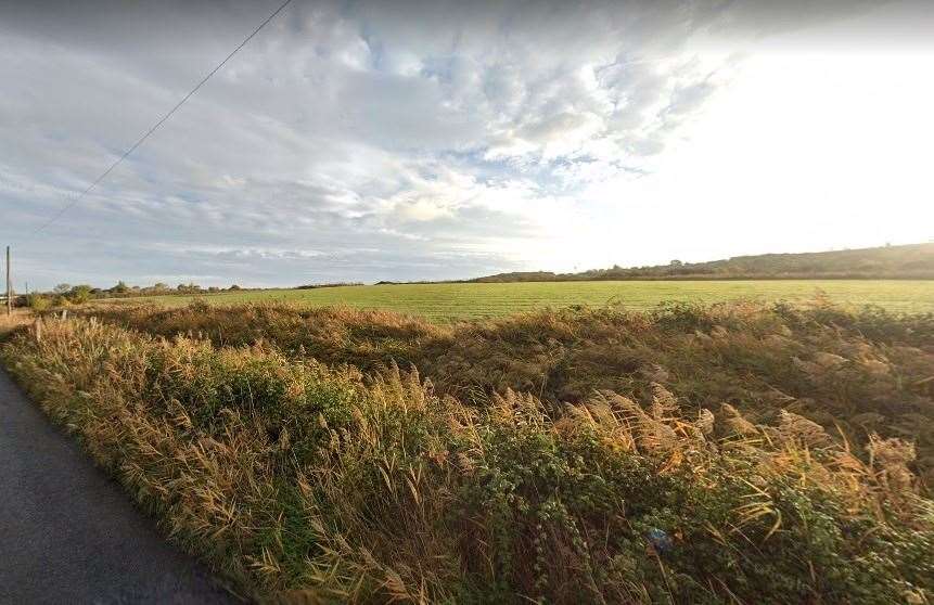
Developers unveiled a proposal for a housing estate covering 40 acres next to the slip-road taking motorists off the Thanet Way and into Whitstable.
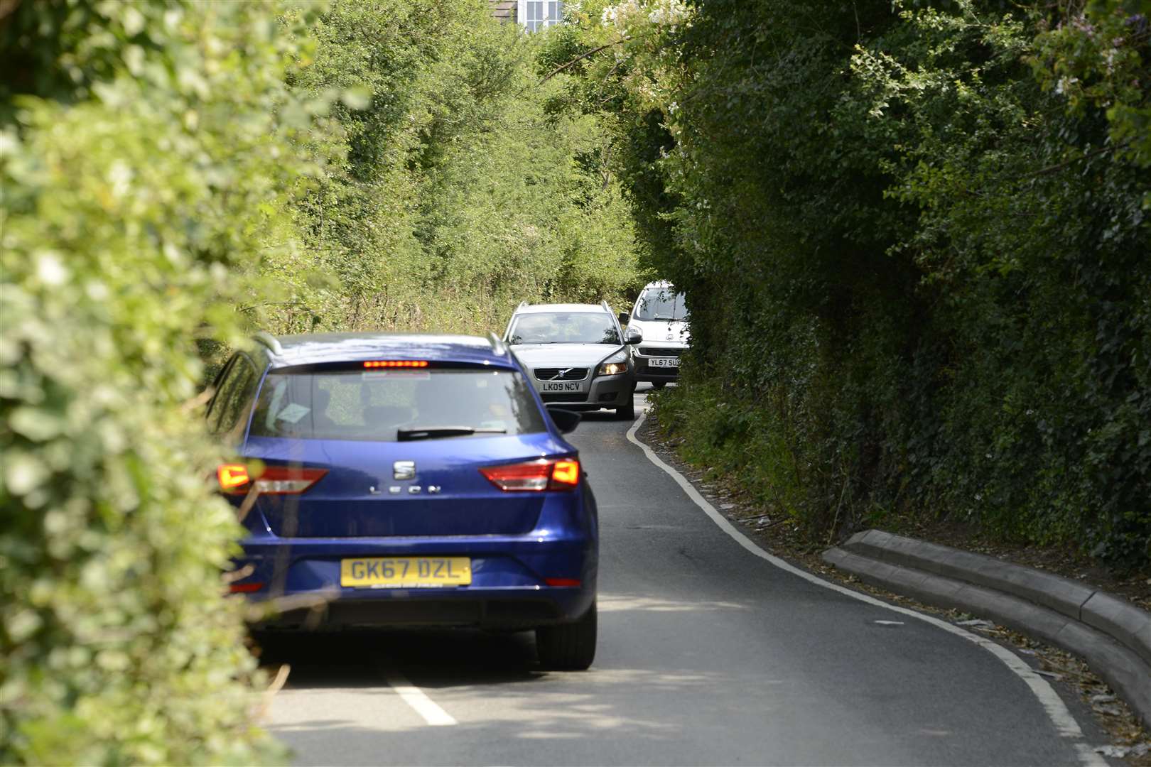
It is anticipated the new homes could help solve “nightmare” issues along notorious rat-run Church Lane in Seasalter.
And the plans have now been recommended for approval by Canterbury City Council planning officers ahead of a committee meeting next week.
The local authority’s report sets out how it has “failed the government’s Housing Delivery Test” by delivering less than 75% of its target.
But it states this does not lead to an “automatic assumption” developments which conflict with planning policy should be green-lit.
However, where the council has failed to “secure a sufficient supply of deliverable housing sites”, the government’s planning policy seeks to ensure the “presumption in favour of sustainable development” is applied.
“Whilst it is clear the location of housing on a greenfield site, outside of the urban area and Local Plan, would result in a degree of visual harm, the site would be read in the context of adjacent highway infrastructure and built form to the north,” the report said.
“The extensive wildlife area and on-site planting would soften the urbanising impacts of the development such that the overall extent of visual harm would be lessened as time passes.
“Turning to the benefits of the proposal, it would provide 220 residential units, making a significant contribution towards the council’s housing and affordable housing need.
“It would include highways improvements in the form of an alternative, safer route to Church Lane, alongside pedestrian and cycle improvements along that route and contributions towards public rights of way improvements in the residential estate to the north.”
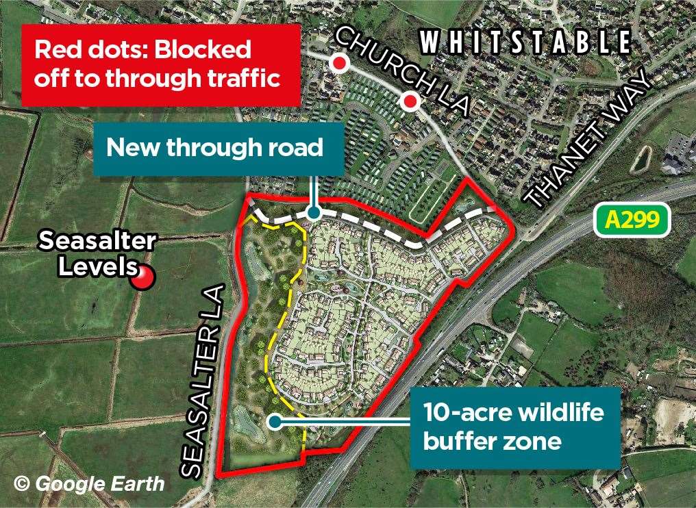
A through road would be built as part of the development, replacing the narrow Church Lane as the new link between the Old Thanet Way and Seasalter.

The new route, which would join the rat-run and Seasalter Lane, would have two lanes and be wide enough for buses.
Church Lane, which also has a junction with Faversham Road in Seasalter, would be blocked to through traffic at its central point.
The land earmarked for the development sits next to the nationally important marshland of the Seasalter Levels.
The Site of Special Scientific Interest (SSSI), which is a haven for birds, recently underwent a major upgrade and is set to be opened up to the public in the future.
To mitigate any impact on the Levels, developers propose building a 10-acre “dedicated wildlife area”, acting as a buffer zone between the houses and the marshes.
Seasalter councillor Ashley Clark told last year how he believes the substantial plot’s proposed transformation could be positive.
“I want harmony for Seasalter, and with this plan there seems to be quite a lot of benefits – not only for the people who will live there but also existing residents,” the Conservative said.
“There will be a road running along the edge of the estate which will effectively create a bypass that will solve the nightmare problems at Church Lane. It has long been a narrow canyon prone to road rage and accidents.
“Drivers speed up as they try to dash through before they encounter something. But all of that will be ended with this.
“People will be able to walk or cycle along there in total safety, which they can’t do now.
"People are intimidated to use it at the moment and I’m pleased the issues can be addressed at long last.”
The application, which is for outline planning permission, will be decided at a planning committee meeting on Tuesday.