More on KentOnline
More on KentOnline
A yellow weather warning for wind has been issued as gales of up to 50 mph are set to hit the county.
The strong weather is set to come into force from 6am tomorrow (Wednesday) and last until 8pm.
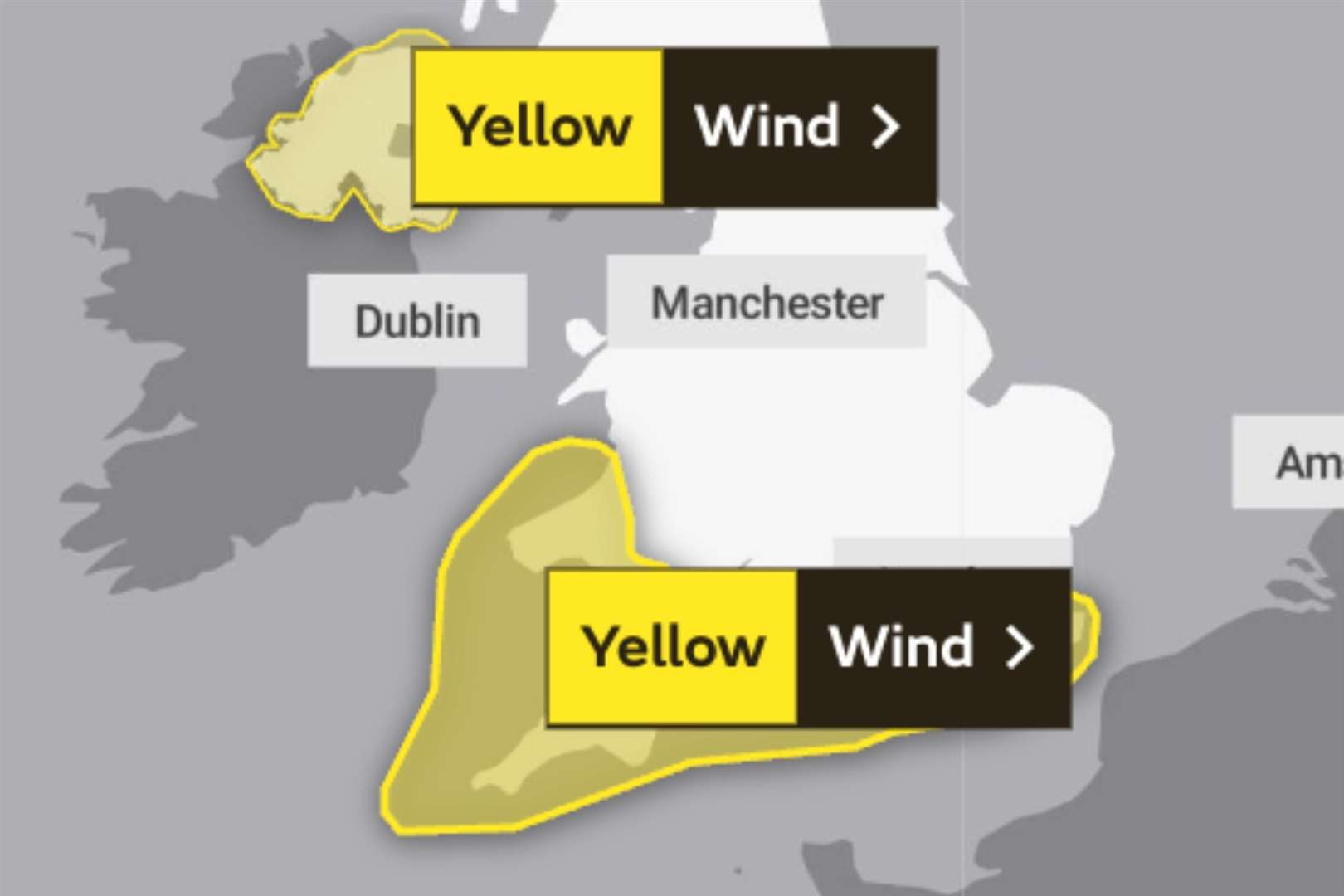
The Met Office says delays to travel can be expected with journeys likely to take longer than normal.
It also says coastal routes, seafronts and coastal communities could be affected by spray and/or large waves.
The high winds are set to hit as high pressure moves away to the east and is replaced by a westerly Atlantic regime.
Met Office deputy chief meteorologist Steven Keates said winds in excess of 60mph could happen in coastal regions in other parts of the country.
"The focus for the medium-range forecast is a low-pressure system that’s likely to develop just to the southwest of the UK, potentially bringing a period of high winds and heavy rain late on Tuesday and into Wednesday," he said.

"There’s a distinct possibility of some disruptive wind for parts of the UK, especially in southern and western areas, as well as potential for heavy rainfall and even some snow, though the latter probably confined to high ground in the north.
"Although subject to a large degree of uncertainty, gusts of wind could be in excess of 60 mph in some exposed upland or coastal regions, with around 35-50 mm of rain possible for some areas."
Advice for how to stay safe in strong winds has been published on the Met Office's website, which says all lose items such as bins, plant pots and garden furniture should be secured.


