More on KentOnline
More on KentOnline
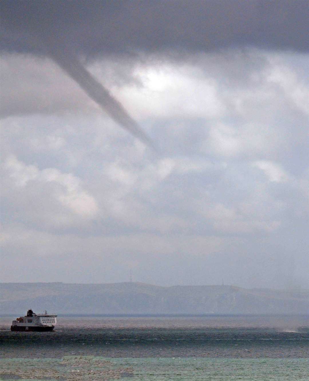
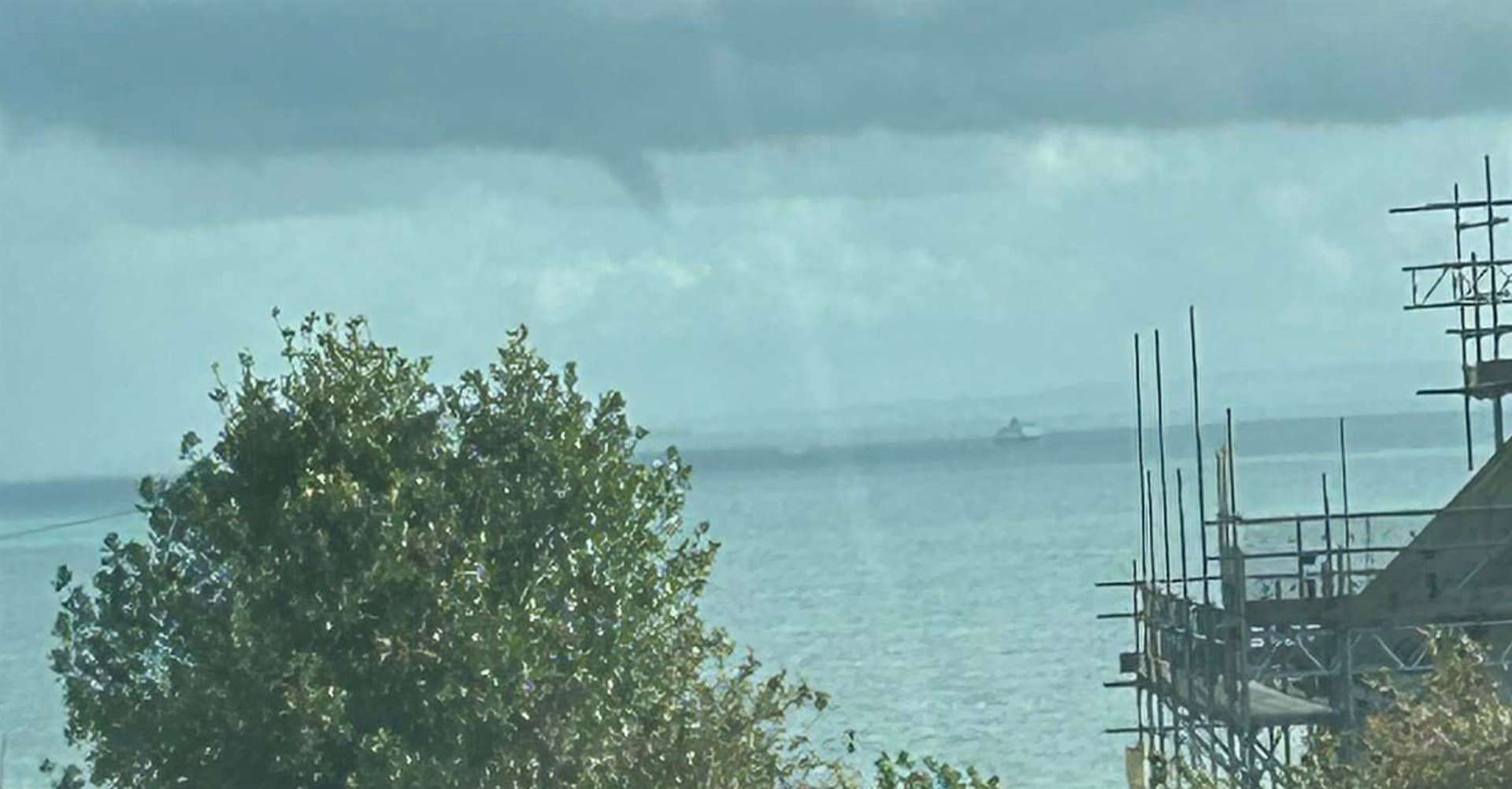
A water spout has been spotted on the English Channel as Kent braces for the arrival of Storm Ciaran.
High winds are expected to wreak havoc along the coastline in the coming days, with the Met Office raising an amber alert for wind.
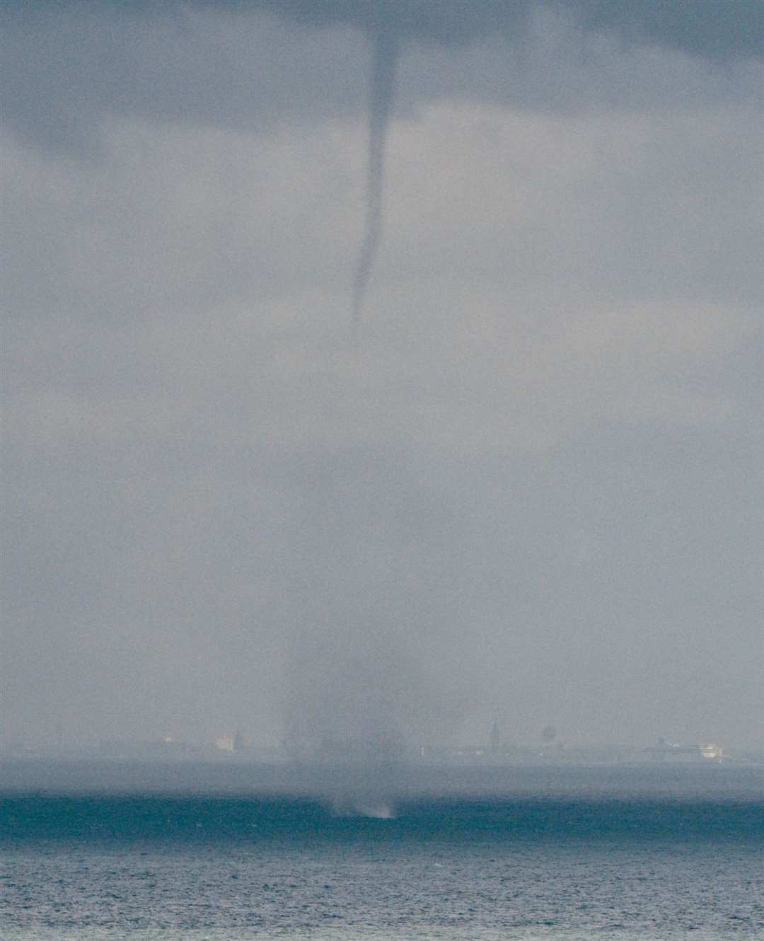
The rare natural phenomenon was spotted over St Margaret’s bay, in Dover, at around 1pm today.
Originating as as a funnel cloud, the cyclone could be spotted briefly touching down on the water, raising spray.
The dramatic scene was spotted by Deal resident John Sheridan, who was fast enough to grab pictures.
“It was still a funnel cloud when I first saw it, but it touched down for around a minute,” he explained.
“It raised quite the spray – which was difficult to capture with just my phone but I just about managed it.”
Also known as tuba, funnel clouds form when a rotating column of wind draws in droplets from the base of storm clouds, according to the Met Office.
It is the same process by which tornadoes form, but funnel clouds only become a tornado if they reach the earth, or a waterspout if they reach a body of water.
While remaining rare phenomenon, this is not the first time this year water spouts have been spotted off the Kent coast – a number were seen in the Thames Estuary near Herne Bay in July.
Meanwhile, further volatile weather is expected in Kent, with an amber wind alert in force from 6am until 8pm on Thursday. Weather experts are warning very large waves could bring additional impacts to coastal areas.
The gales, which could be up to 85mph, come as a result of Storm Ciaran which is already causing flooding across the UK.
Tomorrow, there are yellow weather warnings for both wind and rain covering the whole of Kent which could result in flooding.


