GO AD-FREE. Get 2 Months Digital Subscription for ONLY £1! Use code 2FOR1
GET STARTEDMore on KentOnline
GO AD-FREE. Get 2 Months Digital Subscription for ONLY £1! Use code 2FOR1
GET STARTEDMore on KentOnline
People in Kent have been warned to expect travel disruption and potential flooding as a yellow weather warning remains in place for heavy rain this afternoon and evening.
The Met Office warning says heavy showers in the county and elsewhere may lead to localised flooding, with the warning in place from noon until midnight.
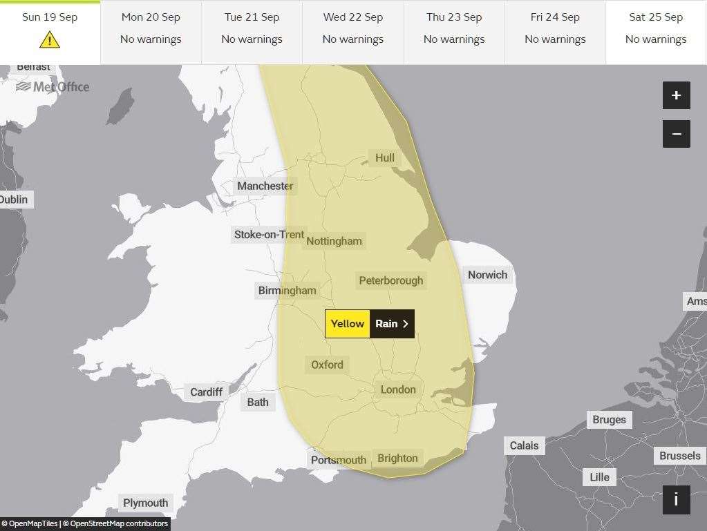
There is a small chance that homes and businesses could be affected by floodwater, leading to damage to some buildings
Sunday is starting dry but the Met Office says a band of rain and heavy, thundery showers will slowly drift east.
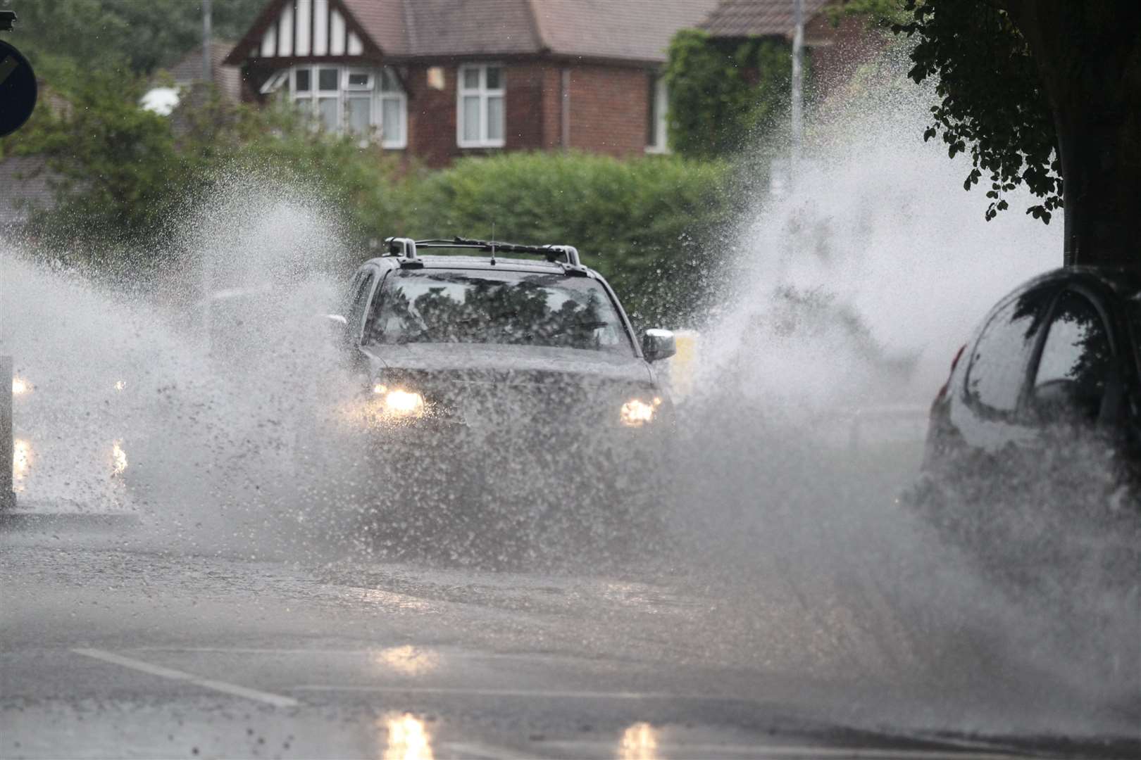
Where these showers become slow moving, 30 to 40mm of rain could fall in a relatively short time leading to surface water flooding and transport disruption.
Motorists are warned that spray and flooding could lead to difficult driving conditions and some road closures.
There is also slight chance of power cuts and loss of other services to some homes and businesses.
The Environment Agency said: "We are preparing for the possibility of heavy, isolated rainfall on Sunday.
"This high intensity rain may cause localised surface water flooding as drainage systems may not be able to cope, particularly in more built-up areas.
"There is also the potential for flooding from fast responding rivers, however we are currently unable to predict the specific locations that may be impacted.
"Not all areas will be affected. We are actively monitoring the weather forecast and our operational staff will continue to proactively clear debris screens in order to help keep the rivers flowing freely."
For all the forecasts, warnings and weather related news, click here