GO AD FREE | Get your Digital Subscription for only 50p a week! Use code SUMMER
GET STARTEDMore on KentOnline
GO AD FREE | Get your Digital Subscription for only 50p a week! Use code SUMMER
GET STARTEDMore on KentOnline
Having previously examined Kent from the skies in the 1990s, we take a step back in time and explore the county as it was in the two decades prior.
With scores of big developments, drastic town centre shake-ups and an abundance of wild weather, parts of the area were changed forever.
We've dug into the photo archives to compile an array of aerial images showcasing the county - so scroll down and take a trip down memory lane to see how various towns have altered in the past 50 years.
Black and white photographs make up most of the collection but there is also a scattering of colour images from the 80s.
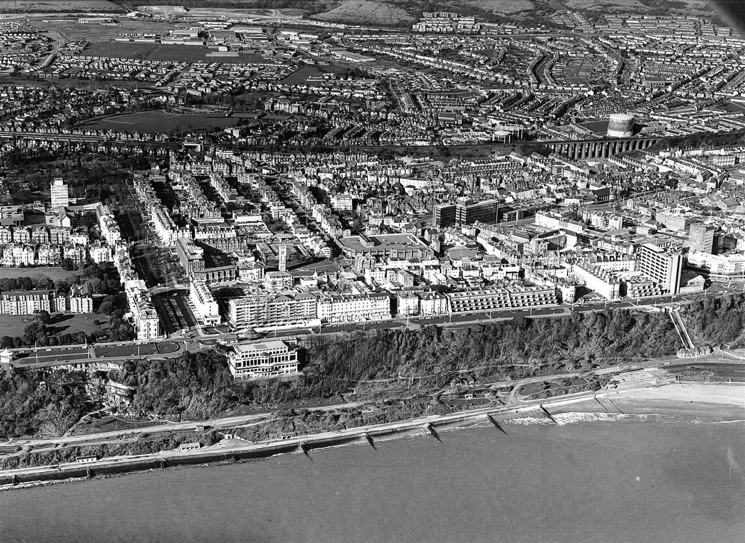
Margate & Ramsgate
A once impressive Victorian pier, Margate Jetty was lost to the sea in the late 70s.
It was closed to the public on safety grounds in 1976 and was severely damaged when it was overwhelmed by storms two years later.
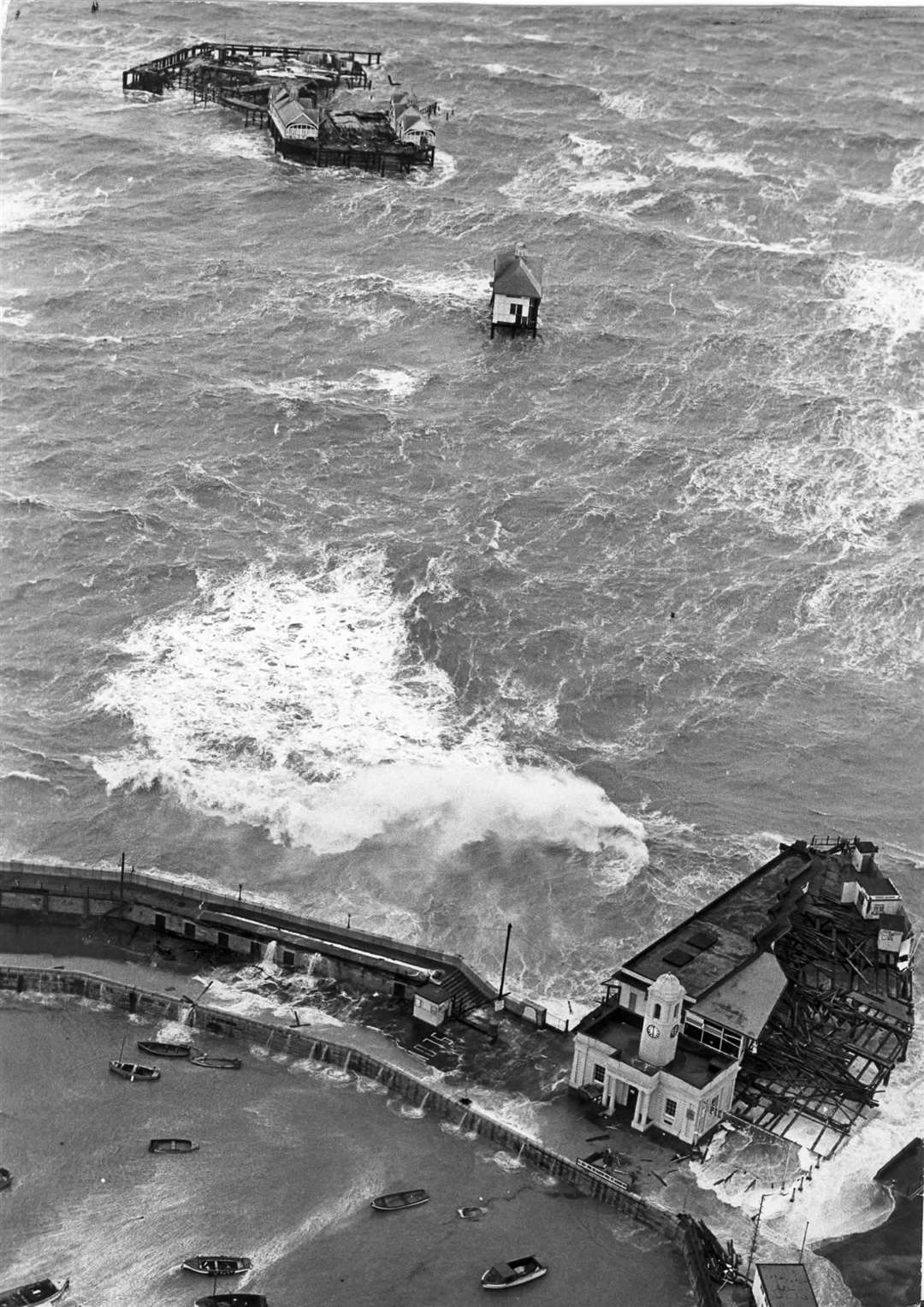
Waves crashed through the structure - leaving the lifeboat station isolated in the water - as the wooden remnants of the pier washed up on Margate beach.
More than a dozen attempts were made to blow up its remains before it was completely erased from the seafront in 1998.
In Ramsgate, the town's allure as a summer holiday destination faded during the 70s due to the onset of cheap package getaways.
At its peak, the Marina Pool - down on the seafront below East Cliff - could attract as many as 5,000 people each weekend.
It survived five decades, but in the early 1980s succumbed to the same threats as many lidos at the time and closed forever.
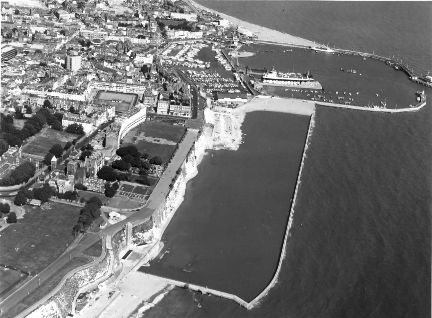
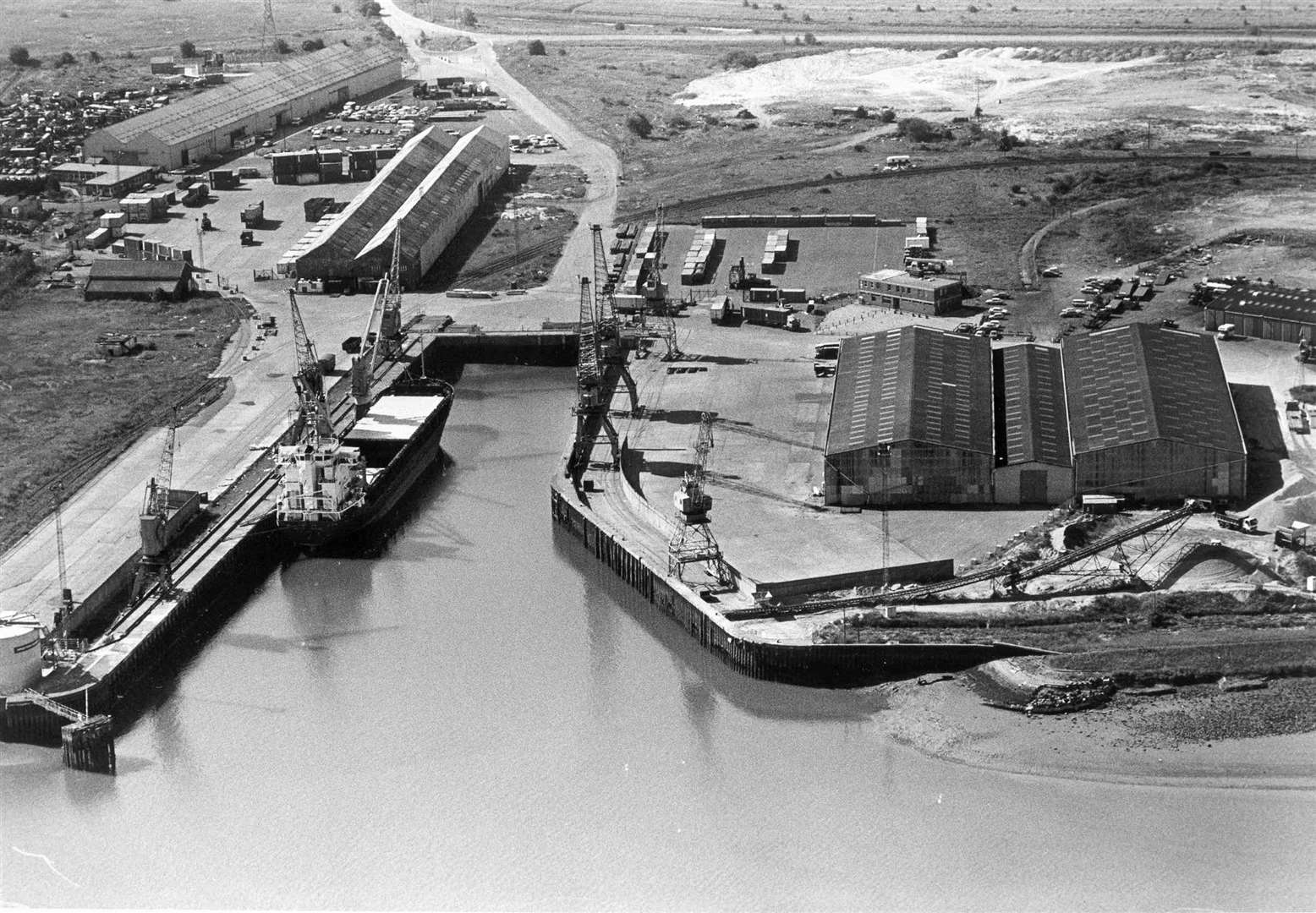
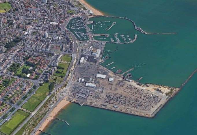
In order to handle the demands of modern shipping, the existing port was constructed in the 80s.
Now derelict, West Cliff Hall became a motor museum in the 1980s, while the Royal Victoria Pavilion - now the country's largest Wetherspoon - was turned into a nightclub and then a casino.
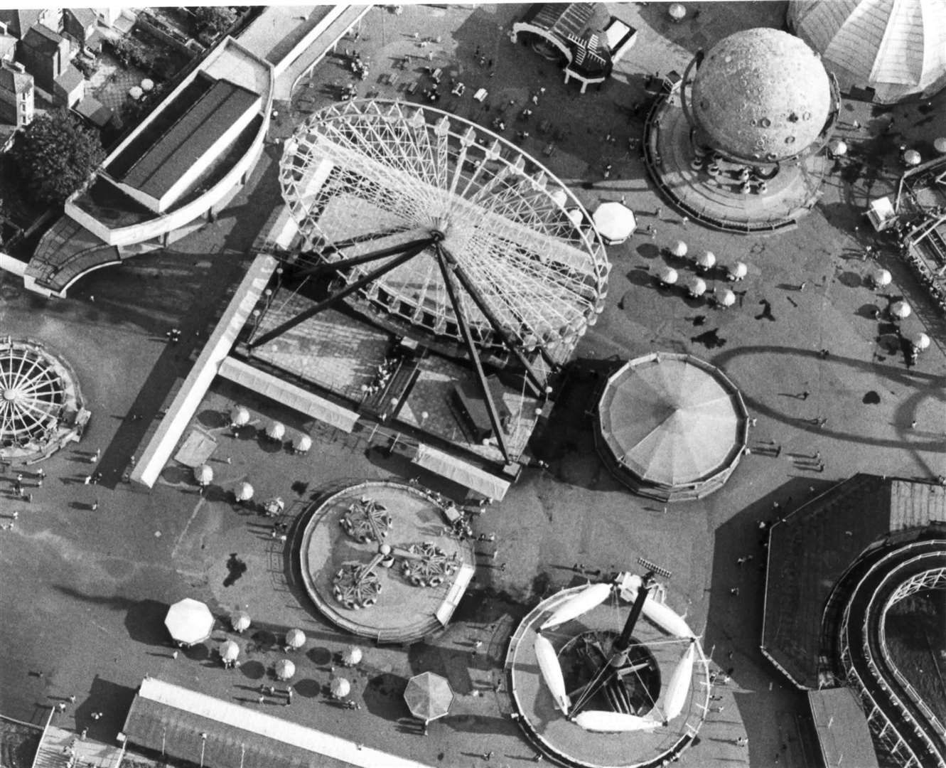
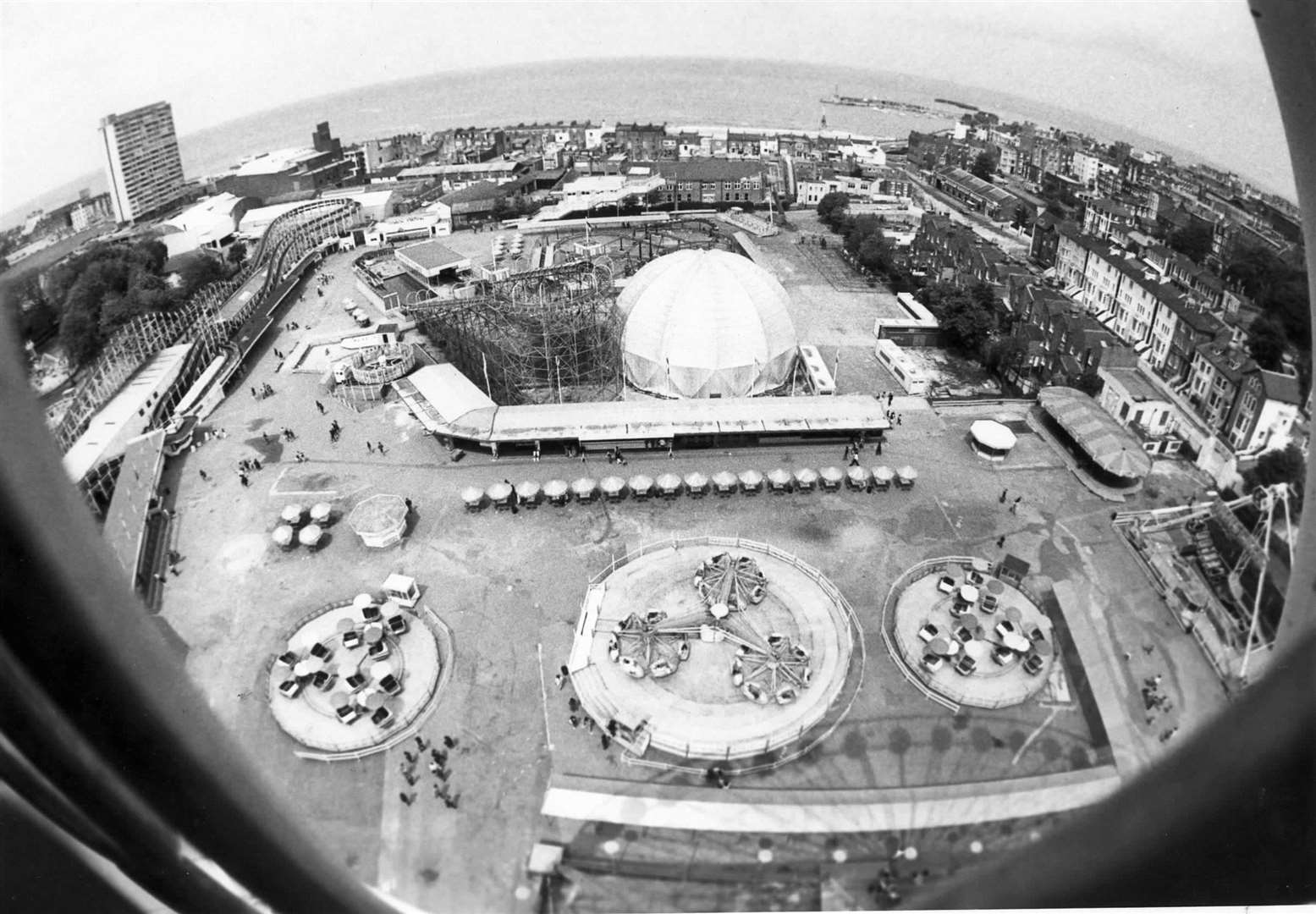
Dreamland
Associated Leisure Entertainments Ltd was running the park in the 70s, with the giant Astroglide slide and water chute making their first appearances.
In 1980, the big ferris wheel arrived and a year later the site was taken on by Dutch operators and renamed the Bembom Brothers Theme Park.
An admission charge was introduced for the first time and in 1989 the park played a starring role in the Only Fools and Horses special, The Jolly Boys' Outing.
The Bembom Brothers name was ditched at the turn of the decade in the 90s, as it returned to the traditional Dreamland title.
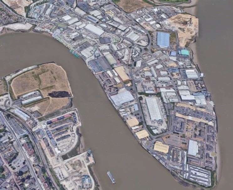
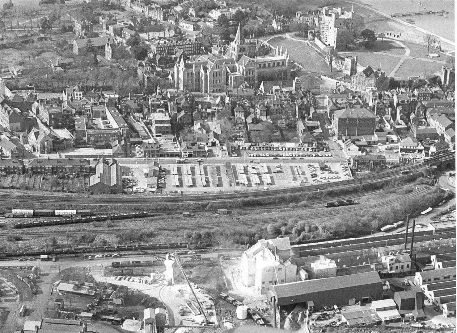
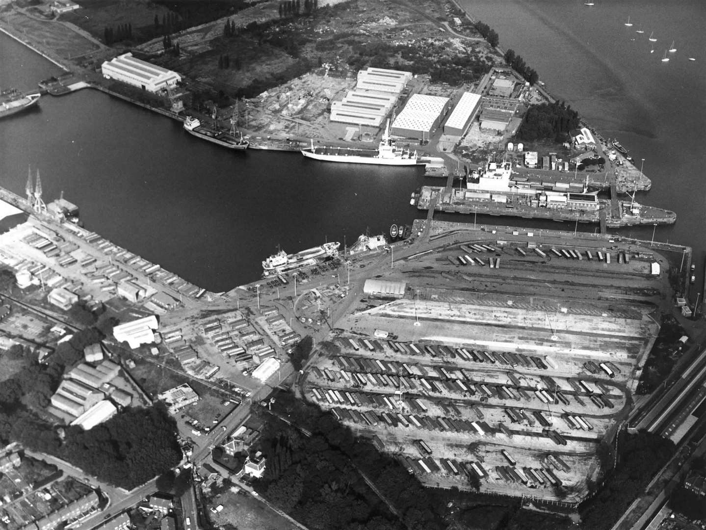
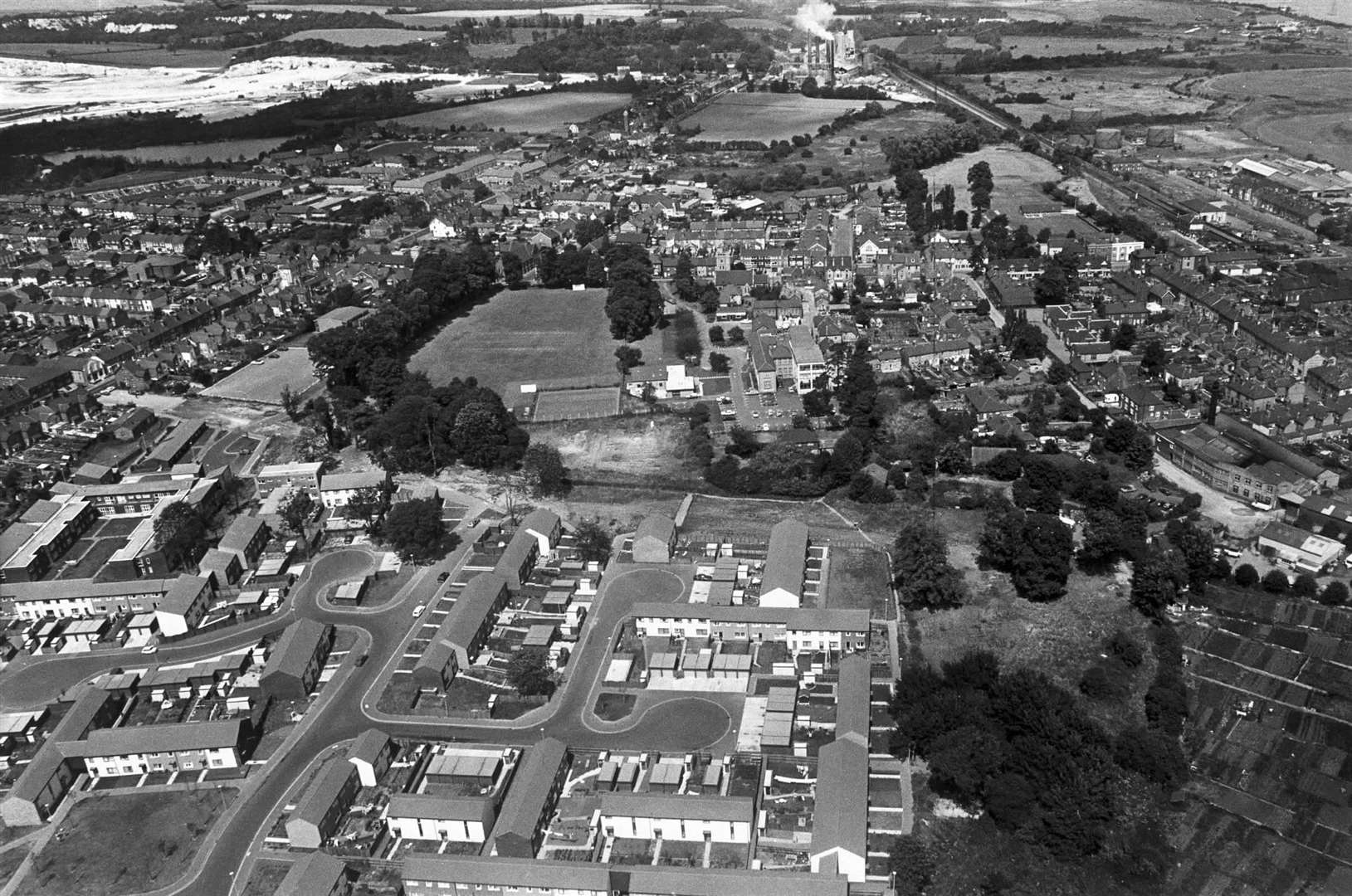
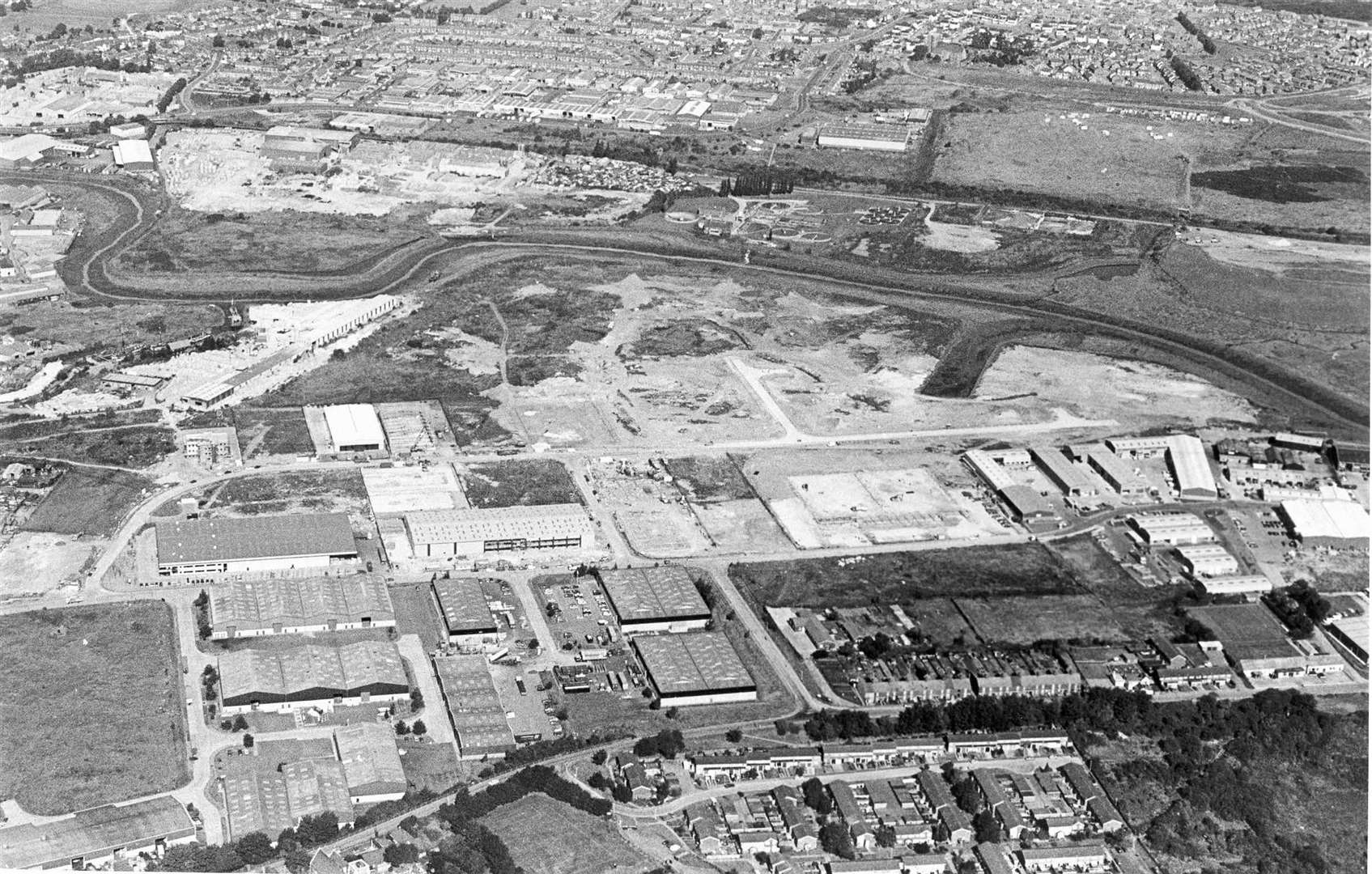
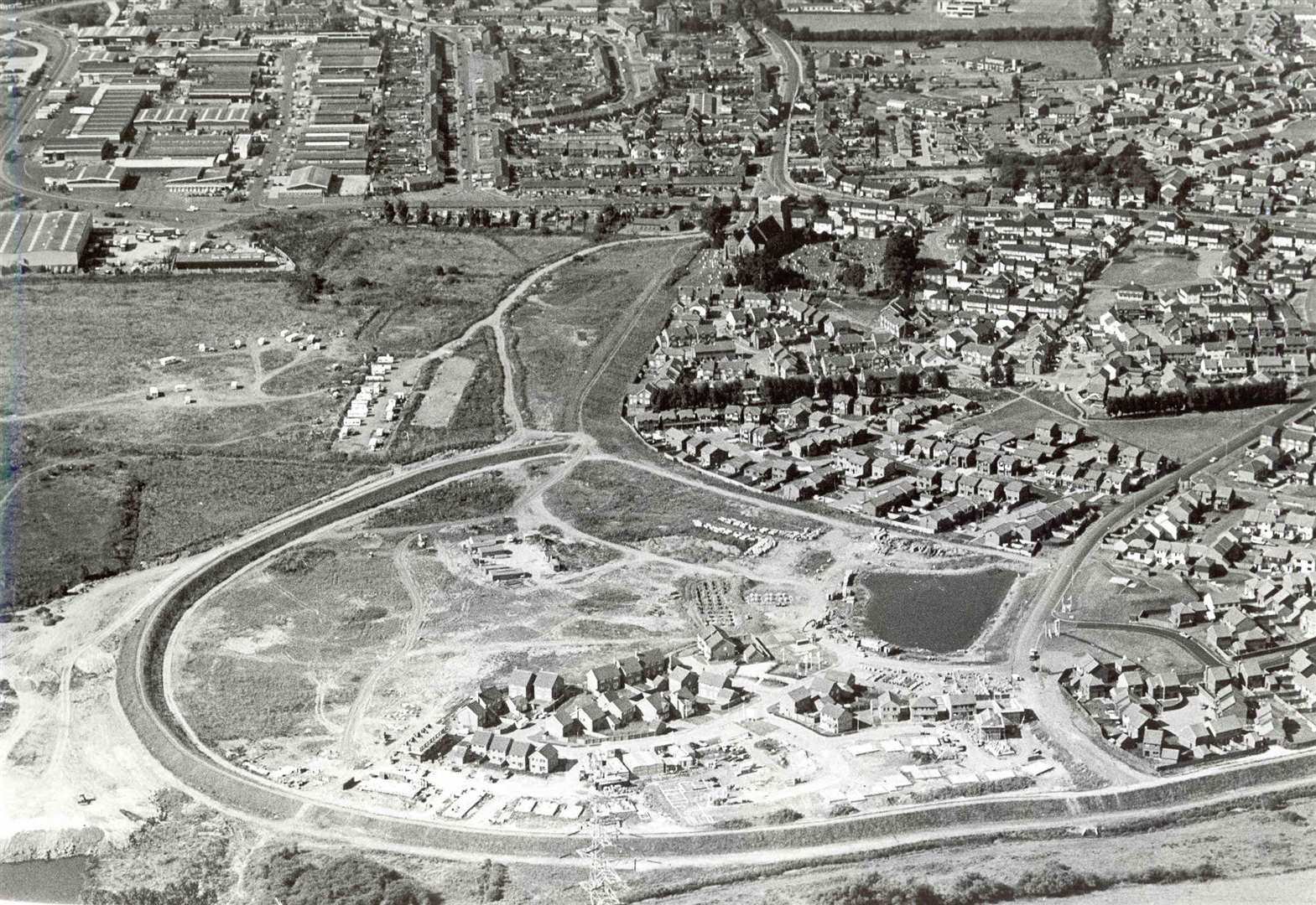
Medway
Cliffe Contractors Ltd is the grandfather of the Medway City Estate, having built the first office on the business park in 1985, after managing director David Fry bought some land on the peninsula in 1979.
The estate has expanded massively since, as have the notorious rush-hour queues to get off it.
The City of Rochester, the Borough of Chatham, and Strood Rural District Council joined forces to create Medway District Council in 1974. Gillingham chose to remain separate.
Eight years later, the borough was renamed as Rochester-upon-Medway - transferring the city status to the entire borough.
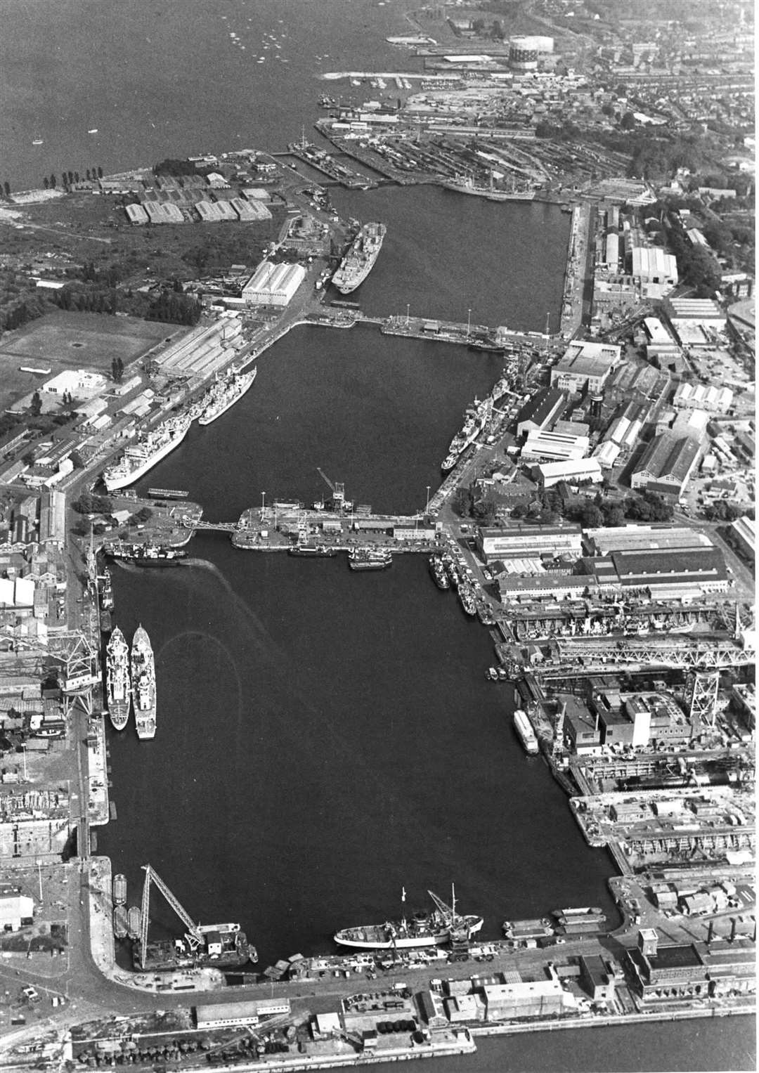
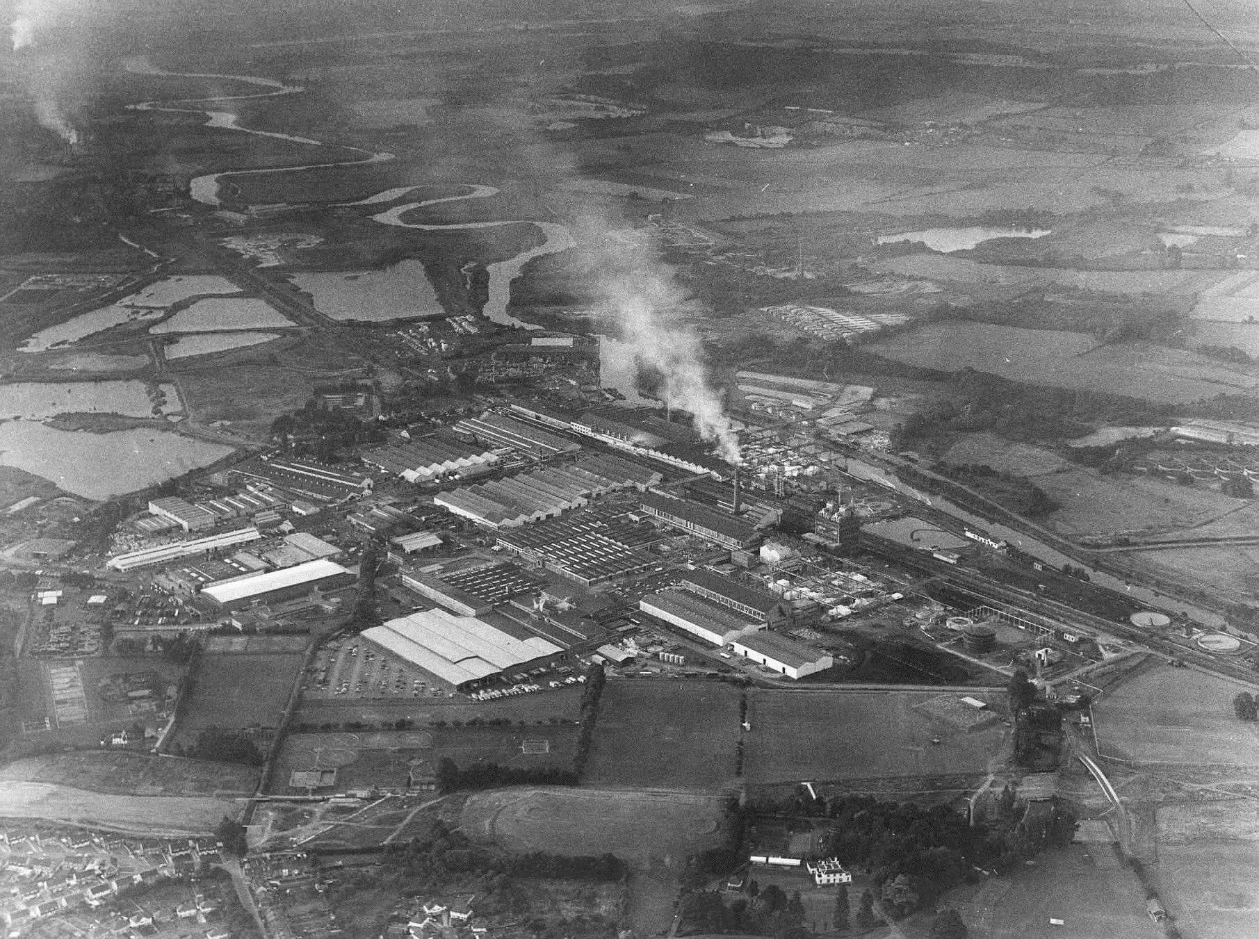
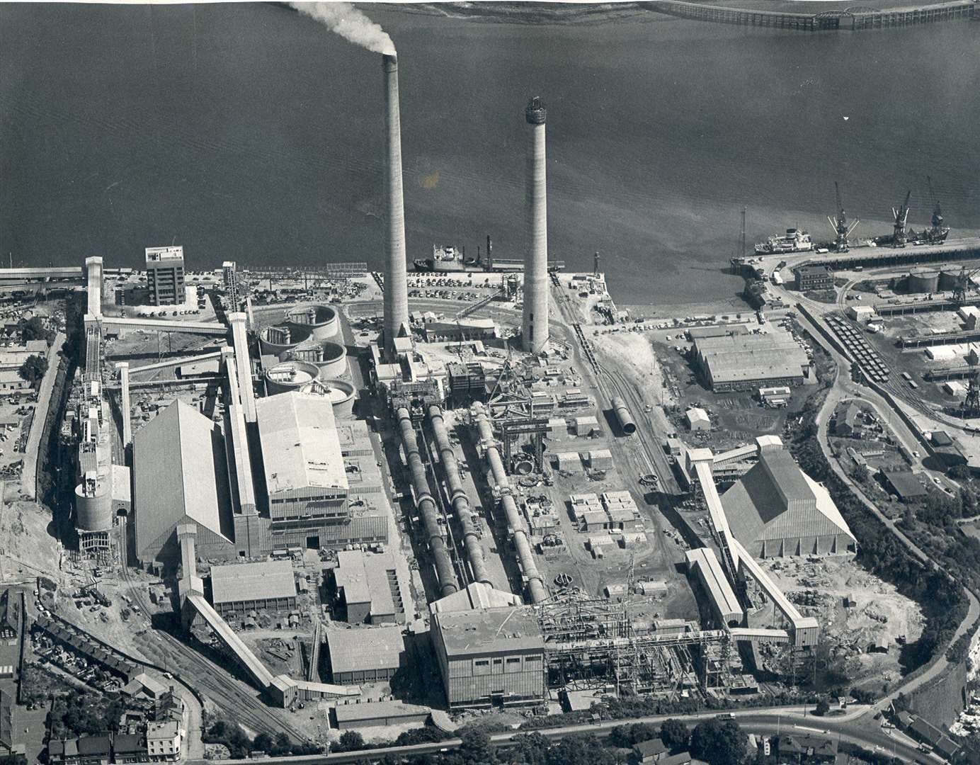
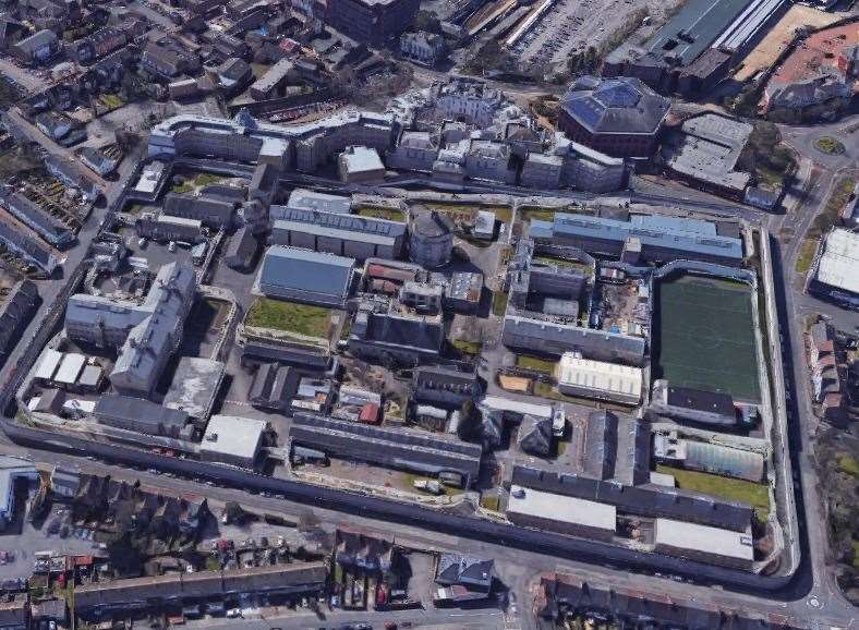
The mid-80s spelled the end of Chatham Dockyard as well as the neighbouring naval barracks.
The closure - brought about due to a decline in naval power and in shipbuilding - sparked a massive surge in unemployment figures in north Kent. Before the final workers left in 1984, the dockyard was heavily involved in manufacturing and repairing ships for the Falklands War.
The unprecedented surge in unemployment left 16% of people in the area jobless as Medway tried to painfully adjust to a post-industrial economy.
Following its closure, it has been split up into what we know today, including the Historic Dockyard Chatham attraction, the universities at Medway, Chatham Maritime and the St Mary's Island development.
In January 1987, Kent and Medway was covered in half a metre of snow as the worst wintry conditions for two decades hit the county.
It was a staggering 52cm deep in East Malling - the worst-hit part of the south east.
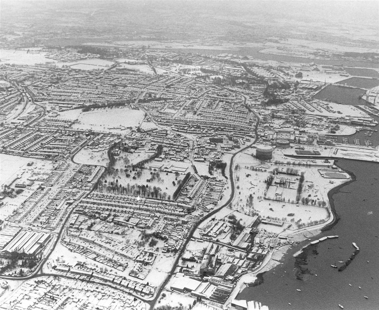
The Isle of Grain was cut off for 12 days, meaning doctors and midwives could not get to expectant mums.
Snow fell heavily for four days - leaving people stranded in their homes and cars buried under white blankets. Schools were shut for days, with Herne Bay Juniors shutting for three weeks because the toilets were frozen.
Later that month, Faversham became one of three places in Britain to have 15 consecutive days without seeing any sunshine, from January 13 to 28, which was a new record.

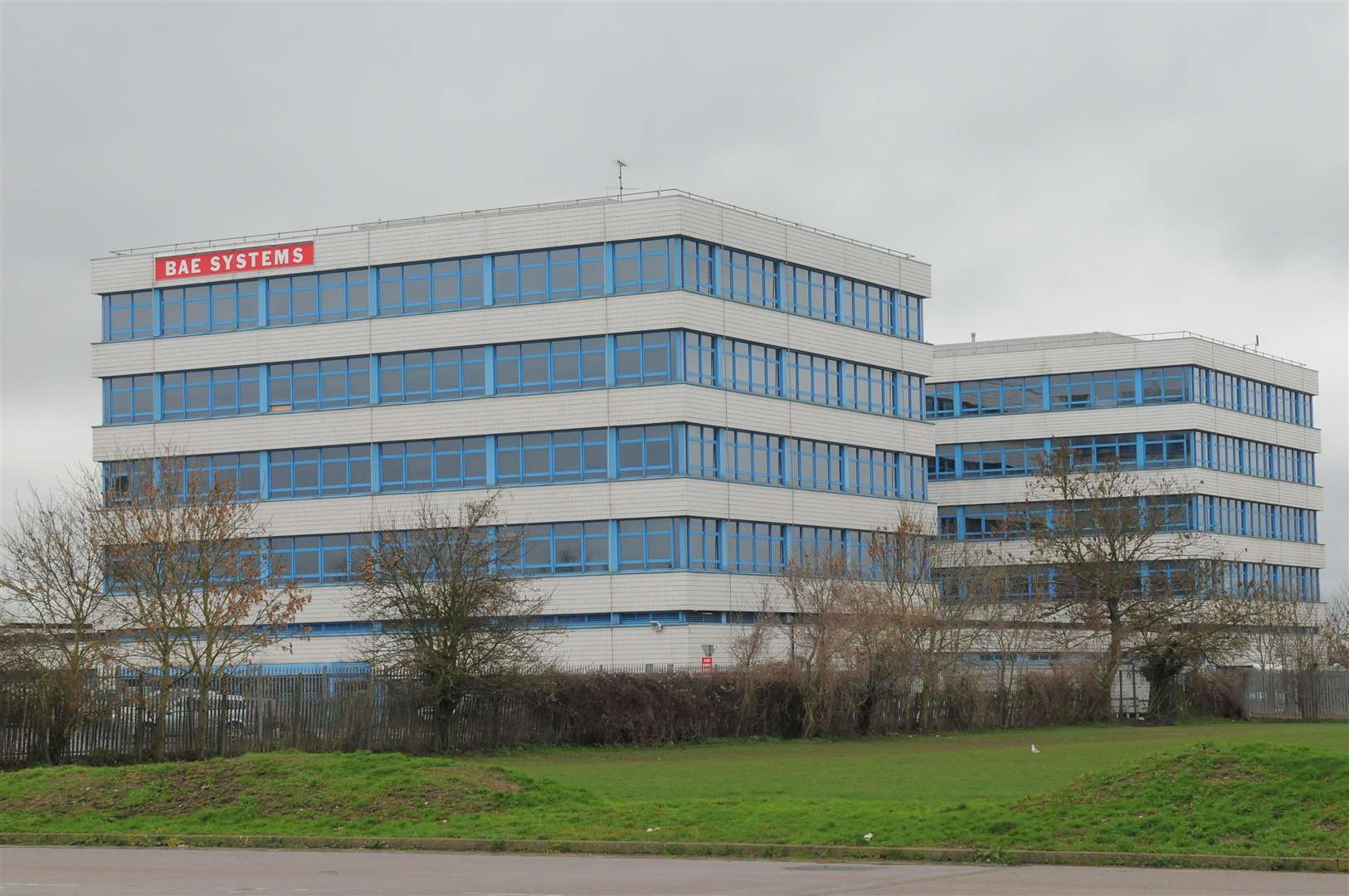
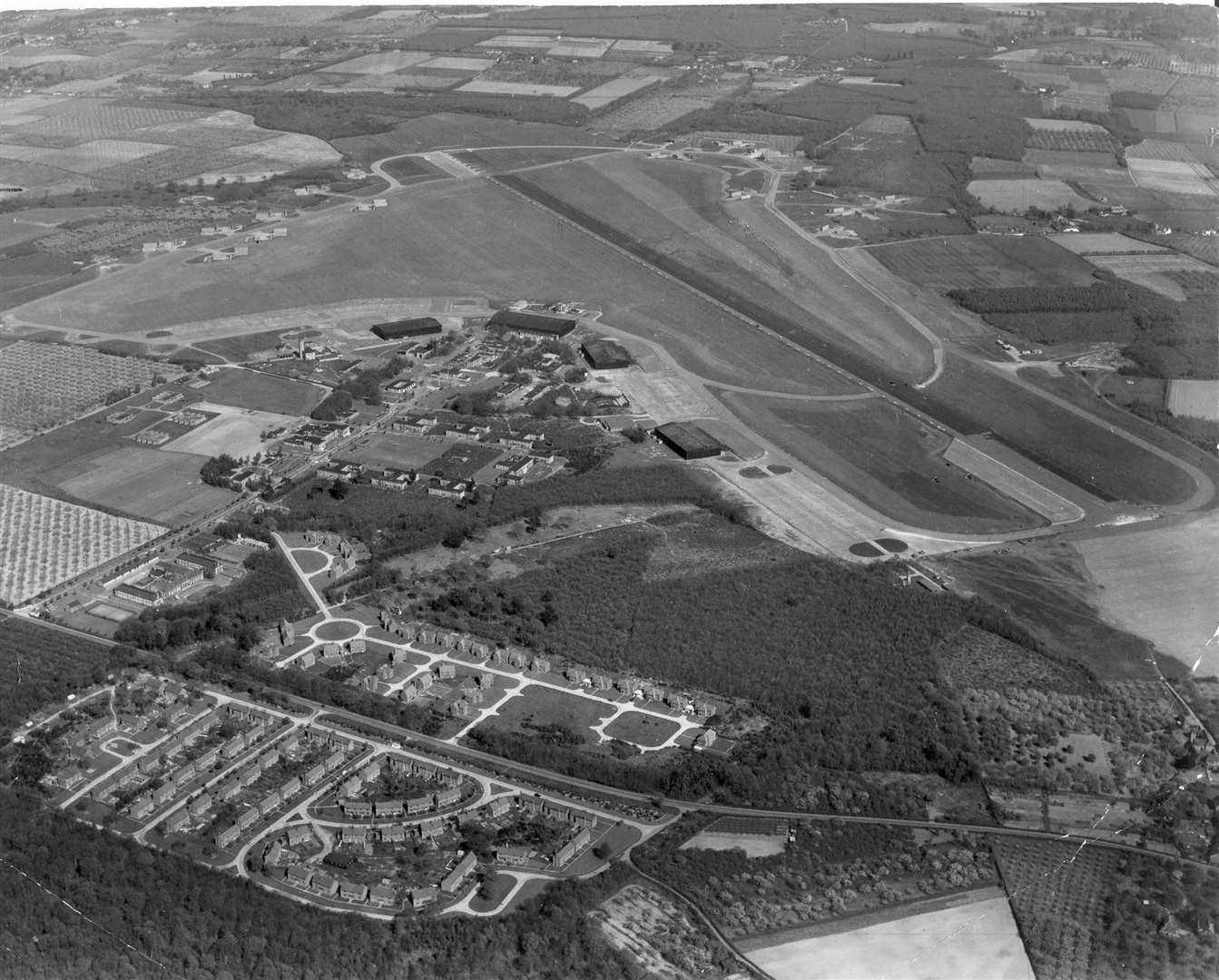
In 1962, Elliott Flight Automation was established with its large headquarters next to Rochester Airport - employing hundreds of people.
Italian firm Marconi - acquired by English Electric - bought Elliott Brothers in 1967. This was then acquired by GEC in 1968, which used the Marconi brand to market its defence businesses.
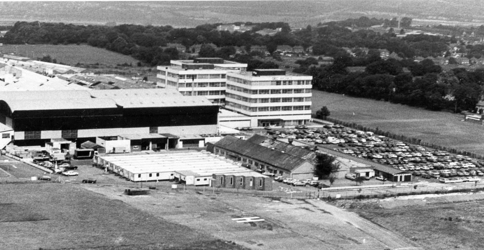
The name Marconi Avionics came into being in 1978 and changed to GEC Avionics in 1984.
In 1999, Marconi Electronic Systems - the defence arm of GEC - formed BAE Systems in a £7.7 billion merger with British Aerospace. Today, it employs about 1,400 people at the site in Rochester Airport.
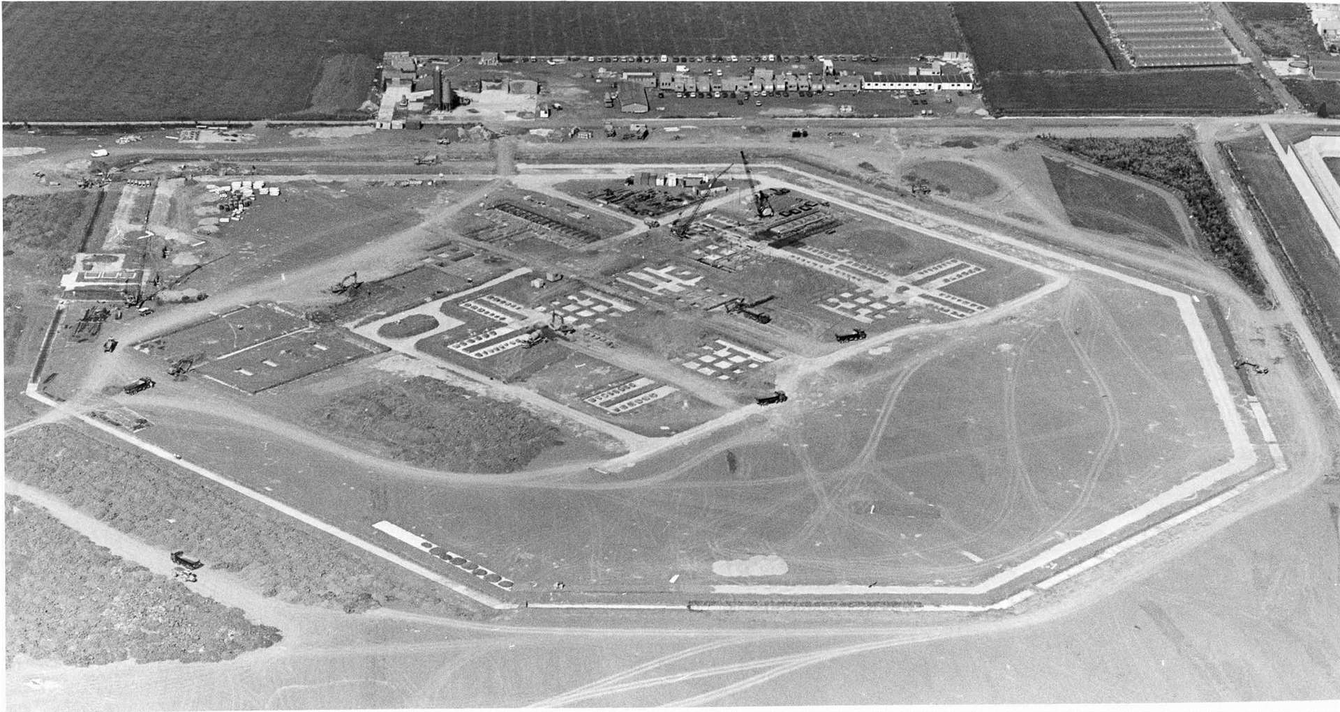
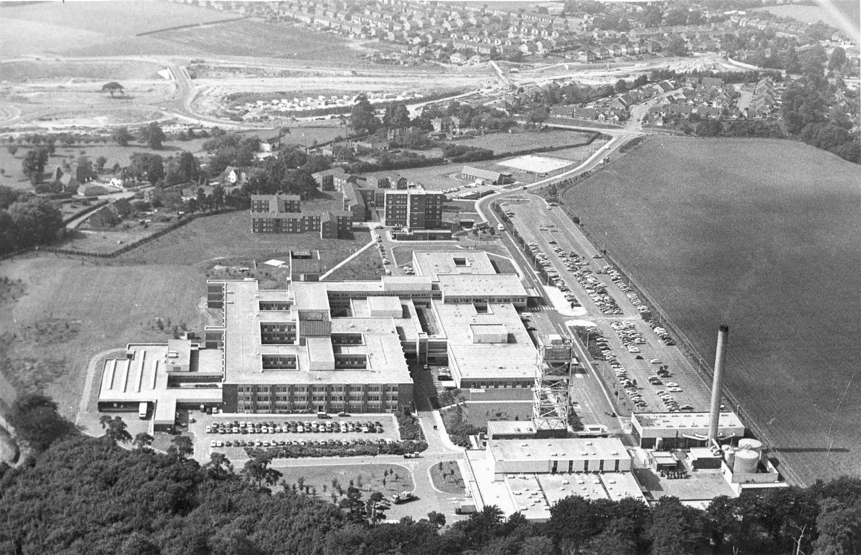
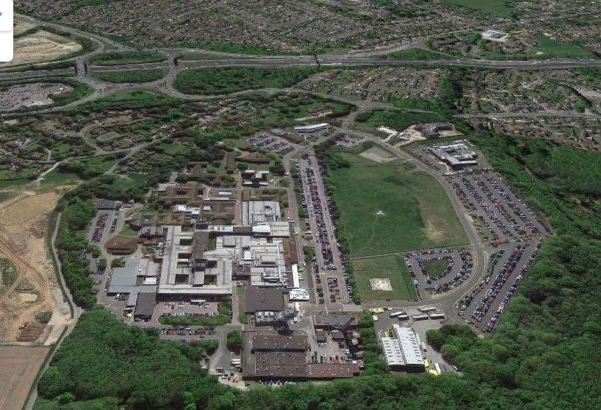
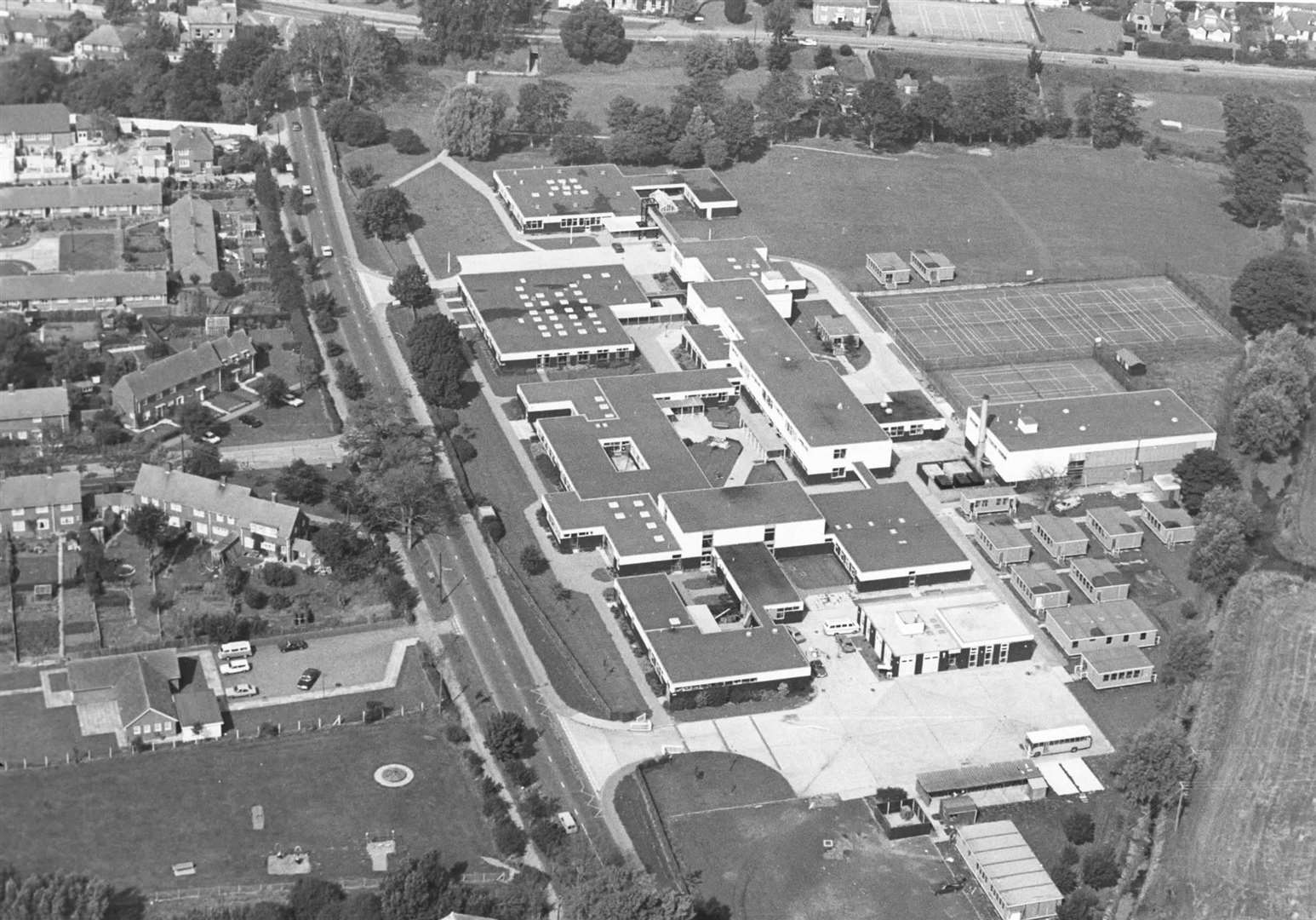
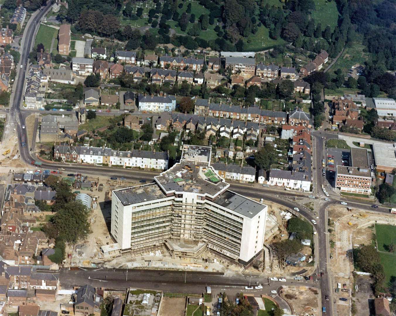
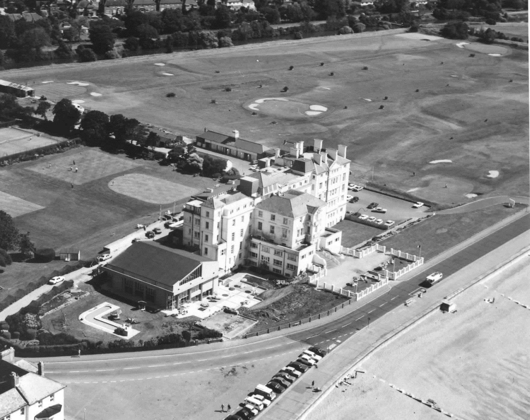
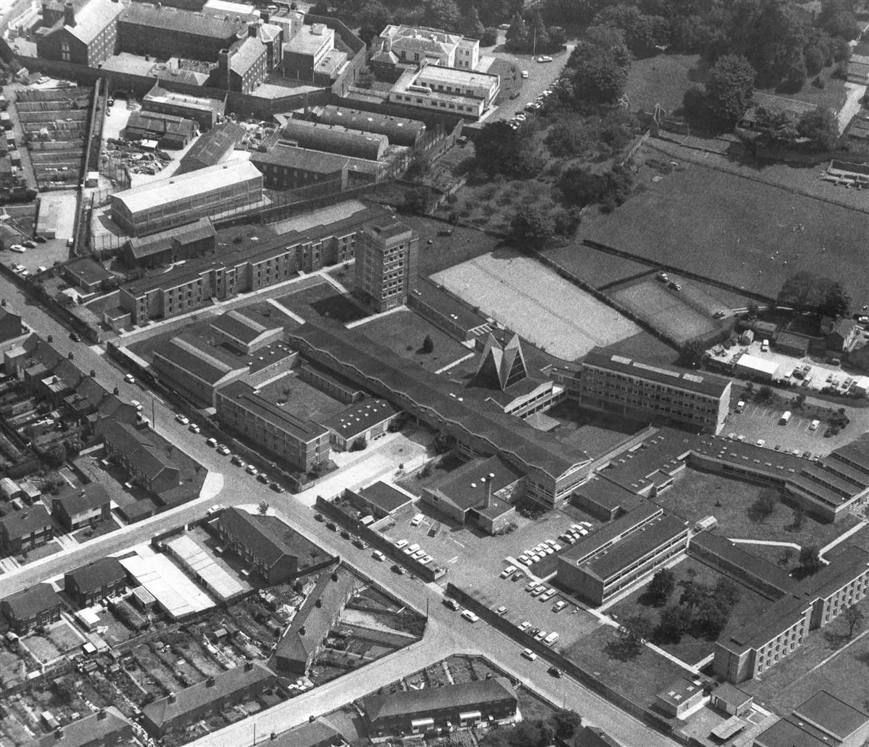
William Harvey Hospital, Ashford
In 1970, the South East Metropolitan Regional Hospital Board covering east Kent put the long-standing medical facilities in the area under intense scrutiny with a view to replacing them.
A 30-acre site at Lacton Green beside the A20 road was chosen, where sections of the network were being adapted for the new M20.
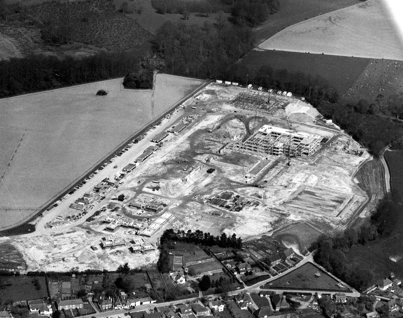
With a budget of £7-8 million, work started in 1973 and it opened in stages in 1979.
The first outpatients used the hospital from April 1979 with midwifery open for business by May 1 that year.
Although there wasn’t an ‘official opening’, the wards opened gradually every week until September 1979 when 95% of the hospital was open.
The 80s marked a visit from Princess Diana as patron of the National Rubella Council.
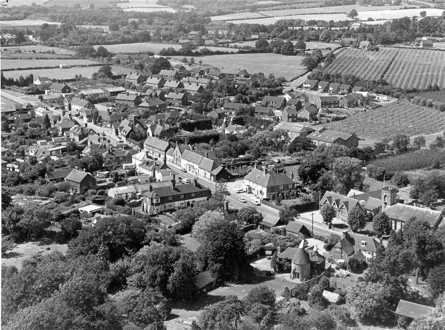
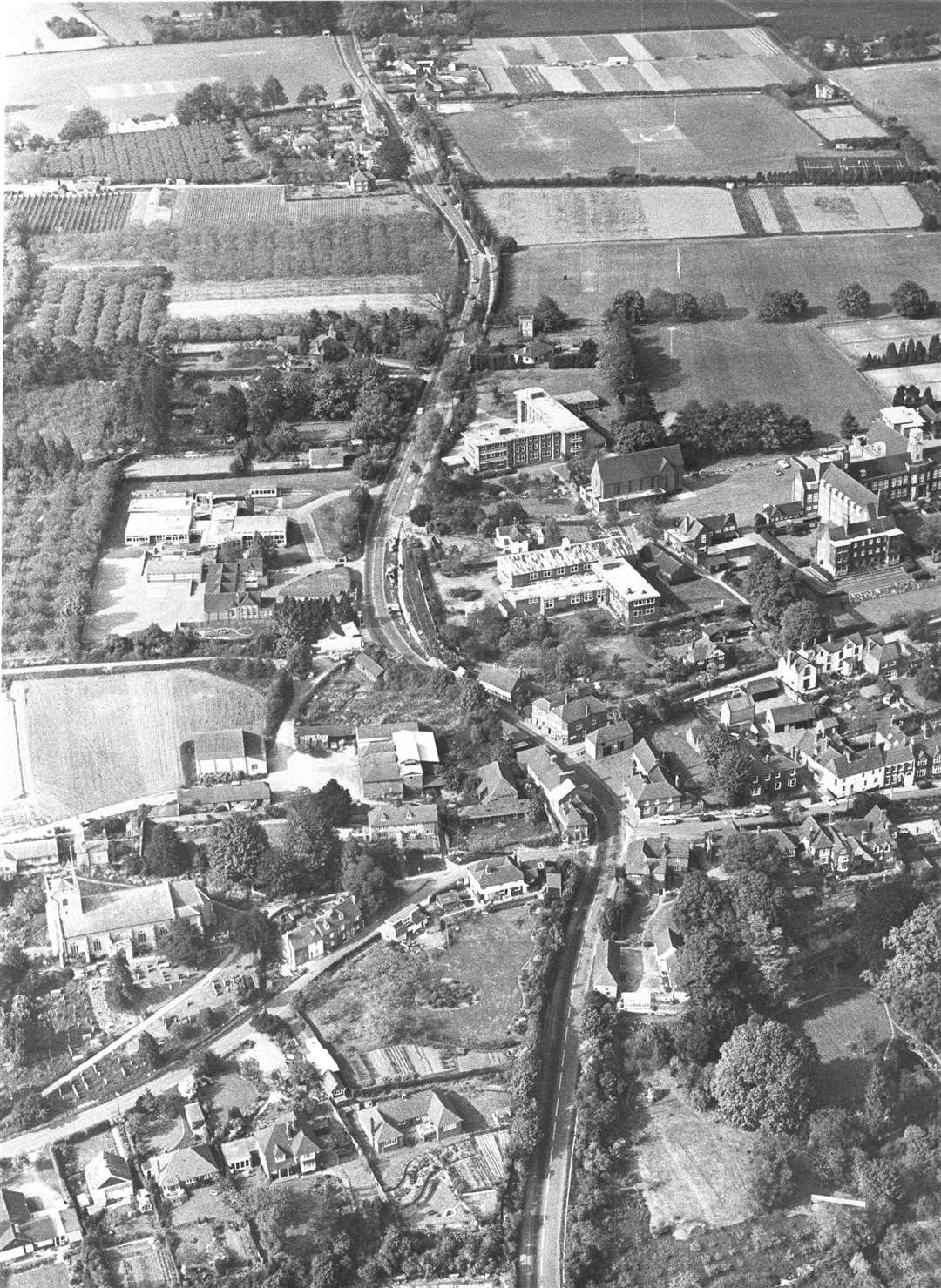
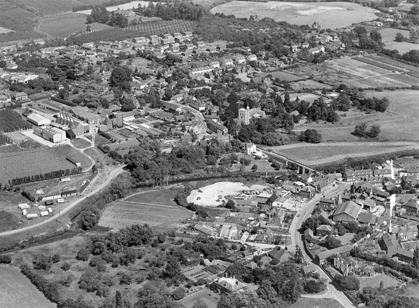
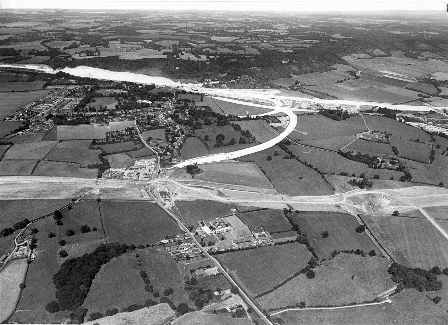
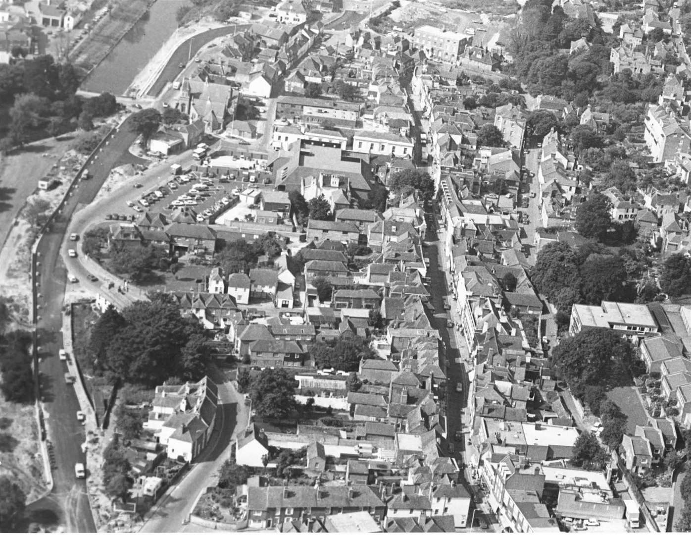
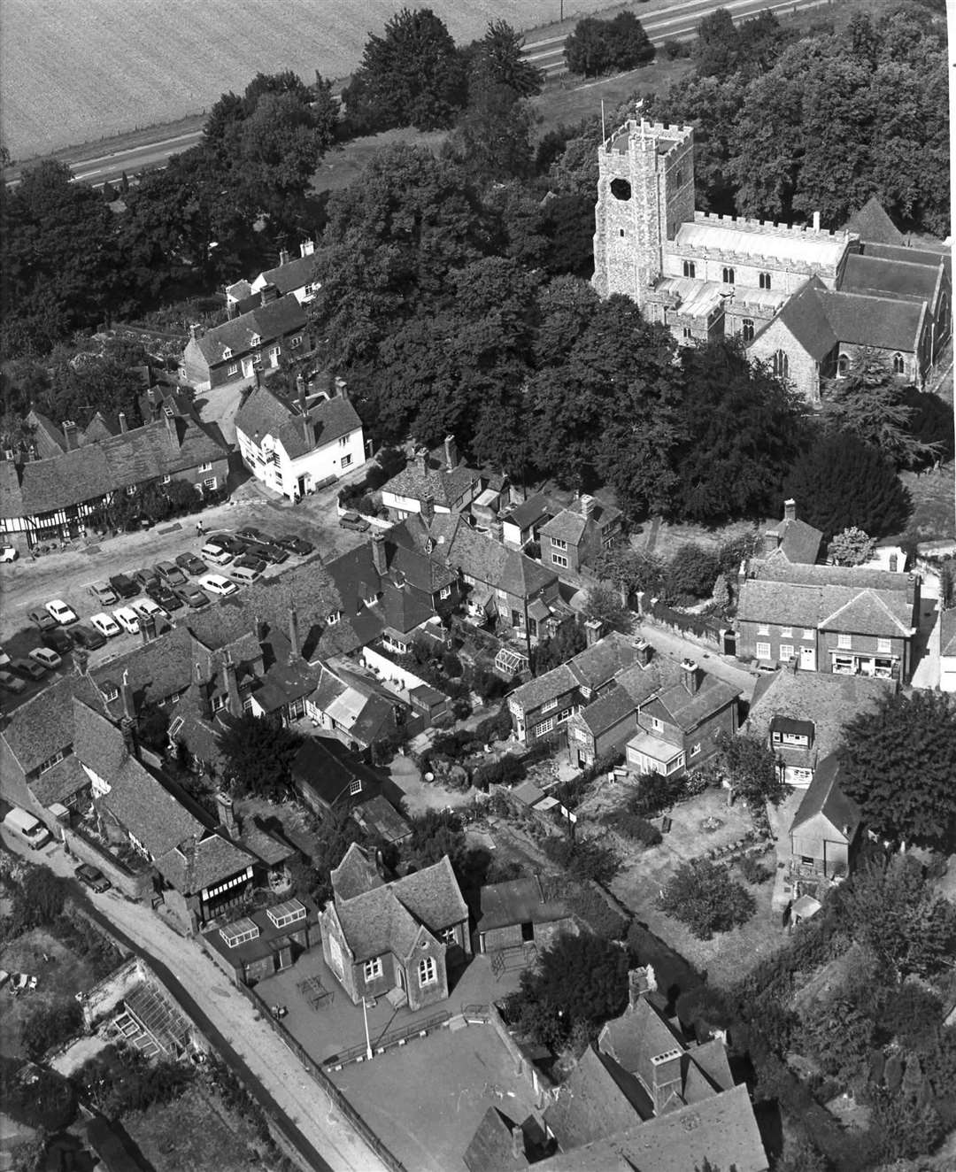
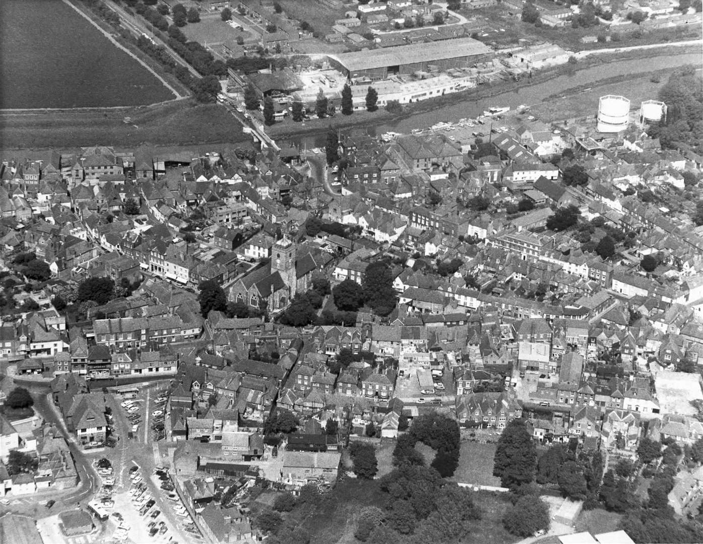
Aylesford &West Malling

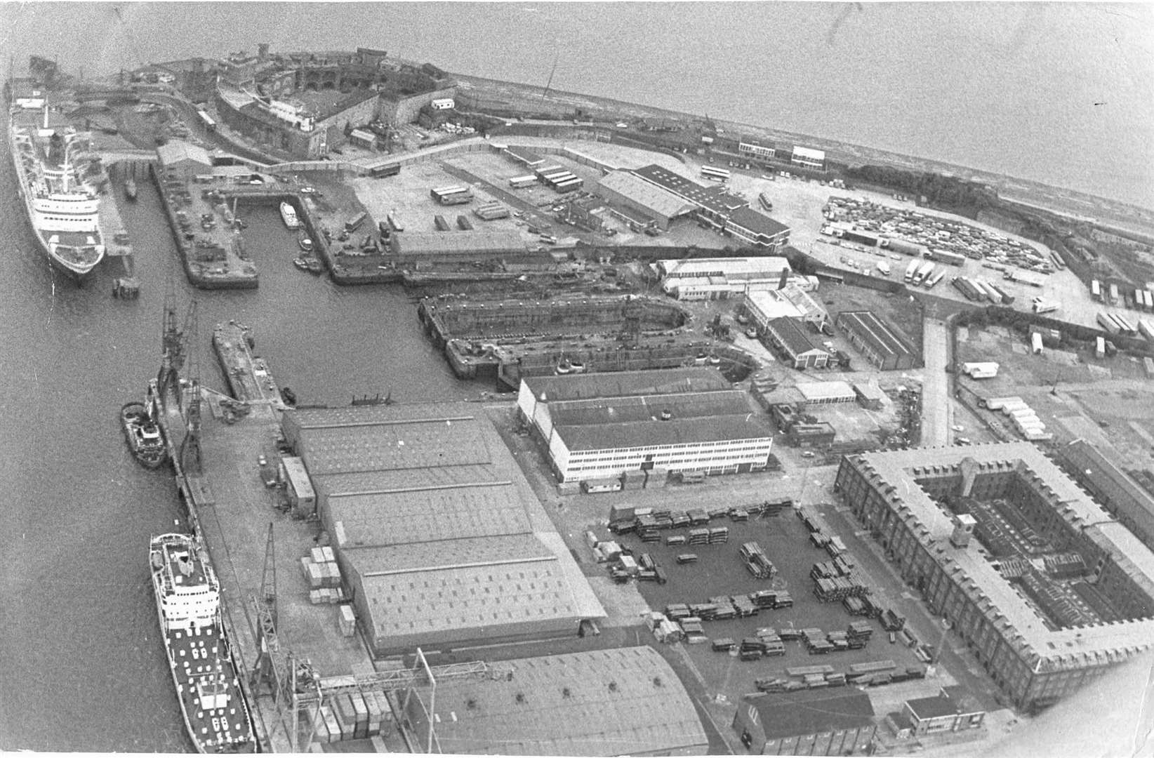
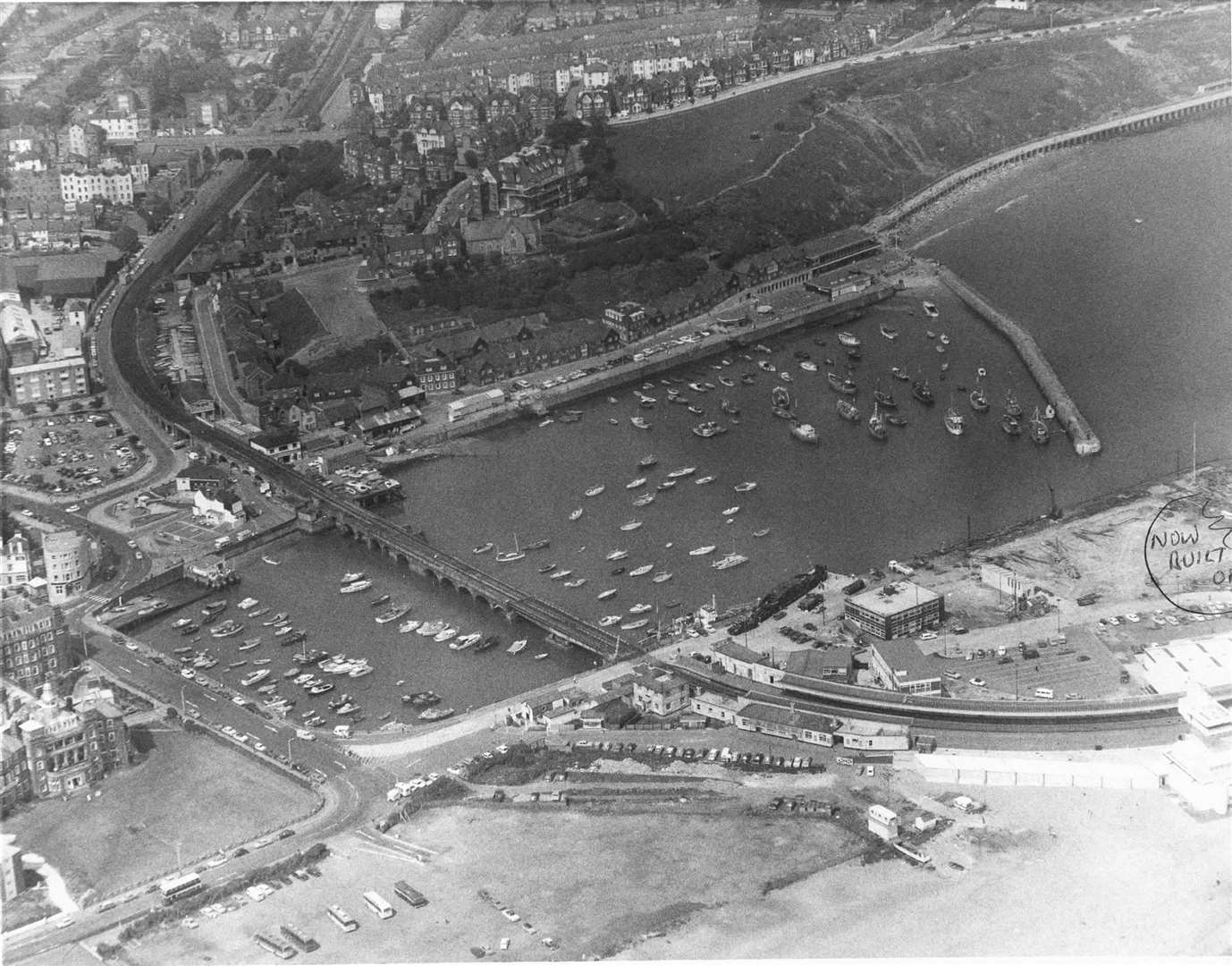
Dover
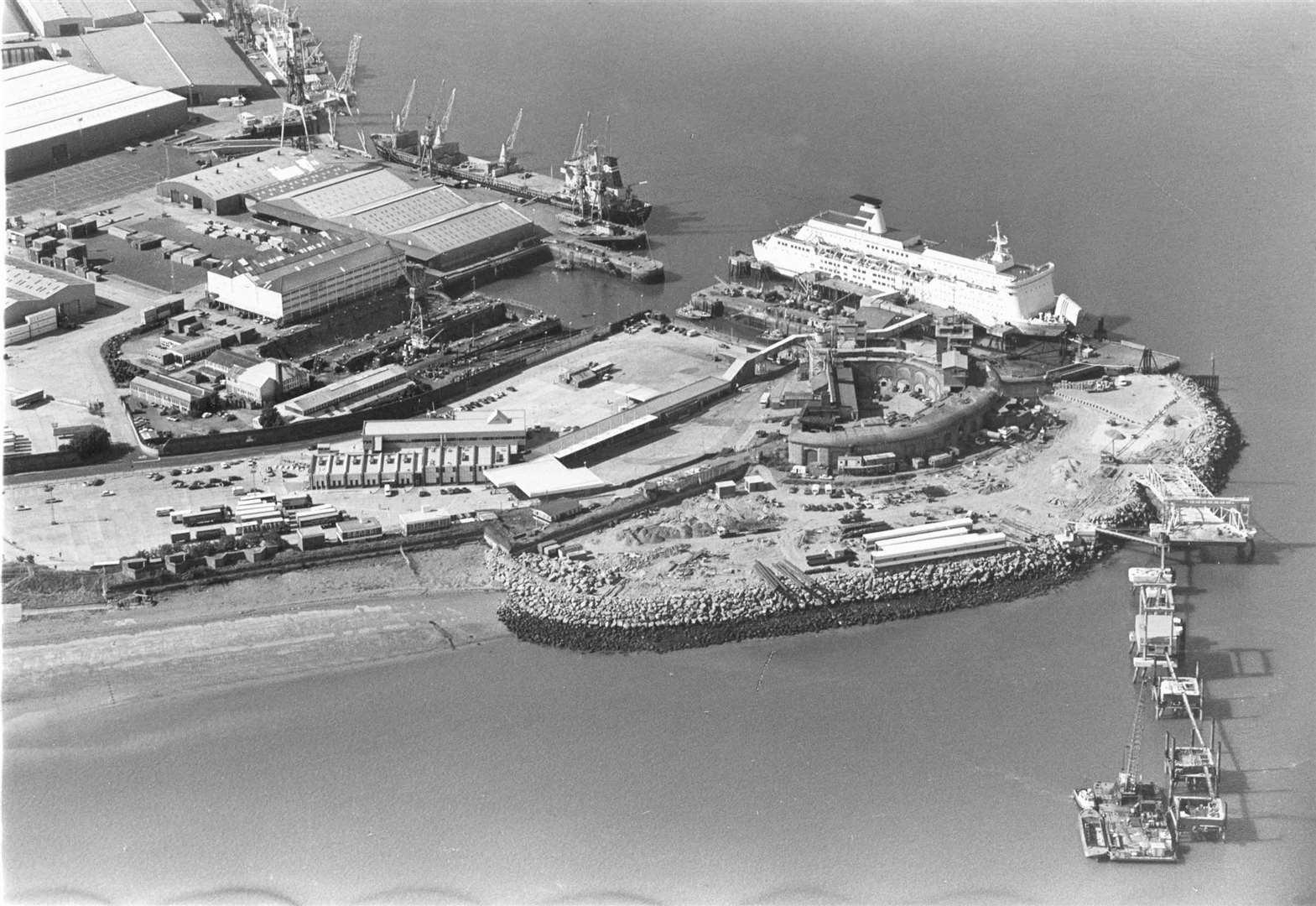
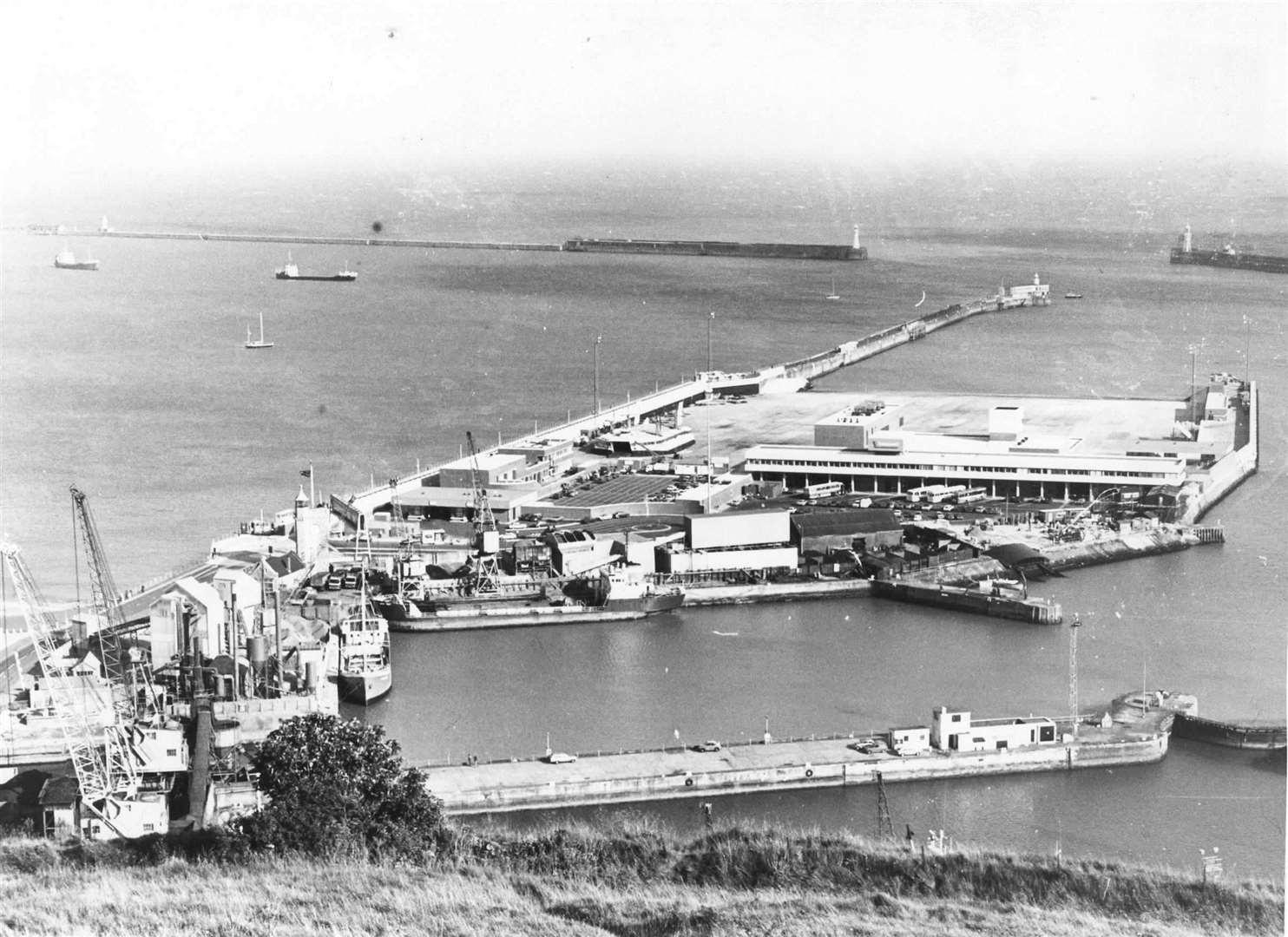
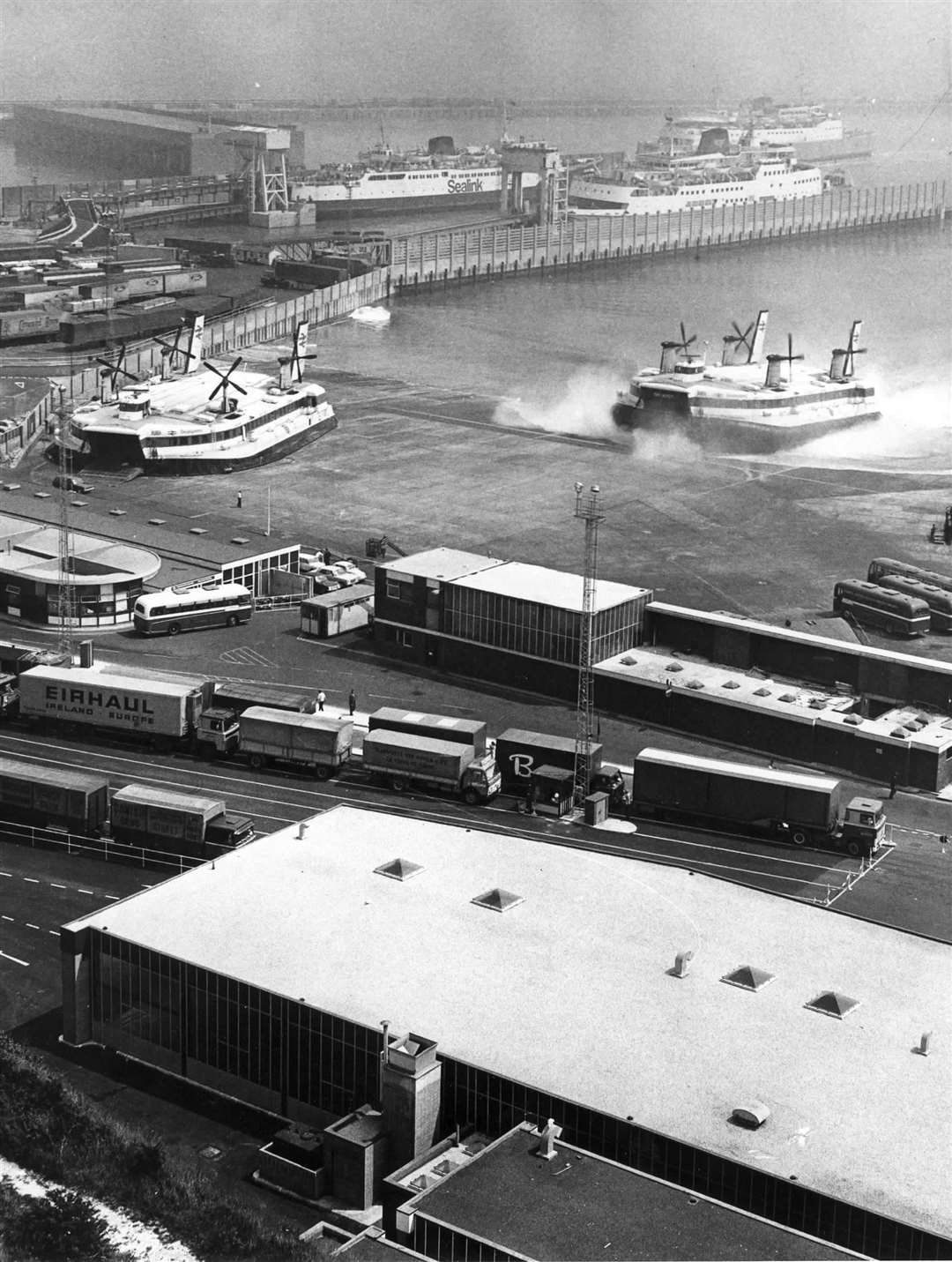
Skimming across the water from Dover to France in just 30 minutes, noisy hovercrafts were once a popular method of transport for those leaving Kent.
The original Seaspeed Dover hoverport was opened in 1968 and a larger £14m base at the town's Western Docks launched in the 1978.
Seaspeed and Hoverlloyd merged three years later to form Hoverspeed and services ran until 2000. The two hover vessels, the Princess Anne and the Princess Margaret, could carry 52 cars.
SeaCats ran until 2005 when the comfort of ferries, the success of the Channel Tunnel, rising fuel costs and the loss of duty free spelled the end of the road for Hoverspeed.
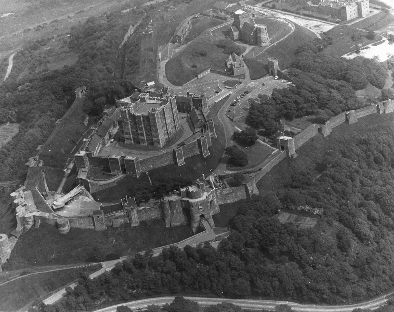
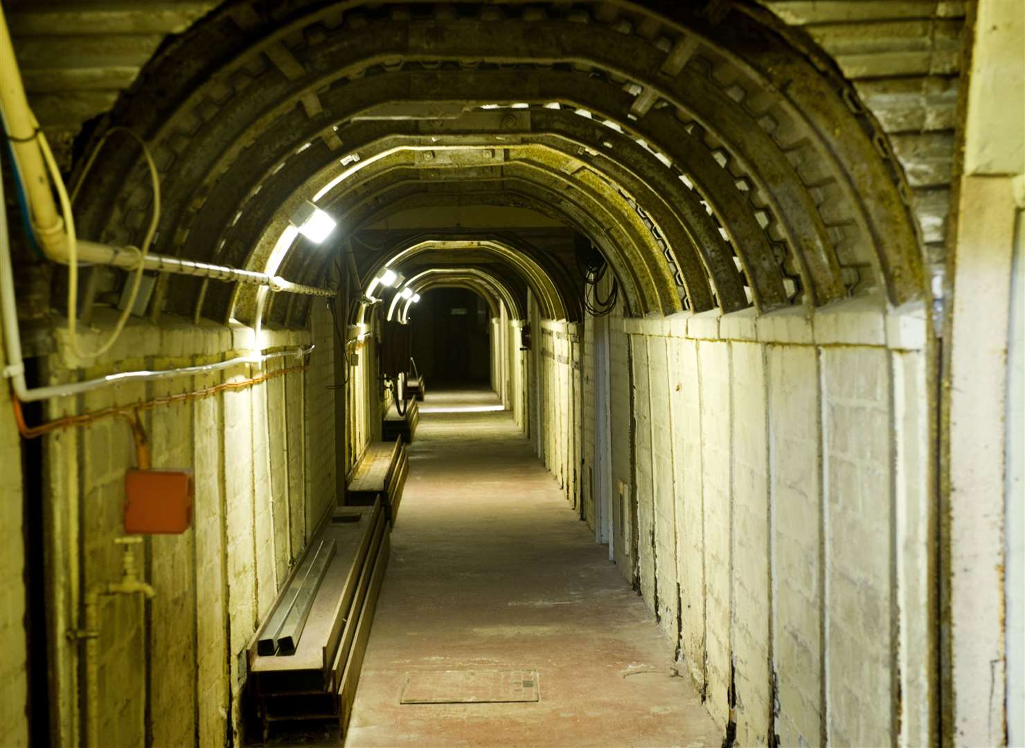
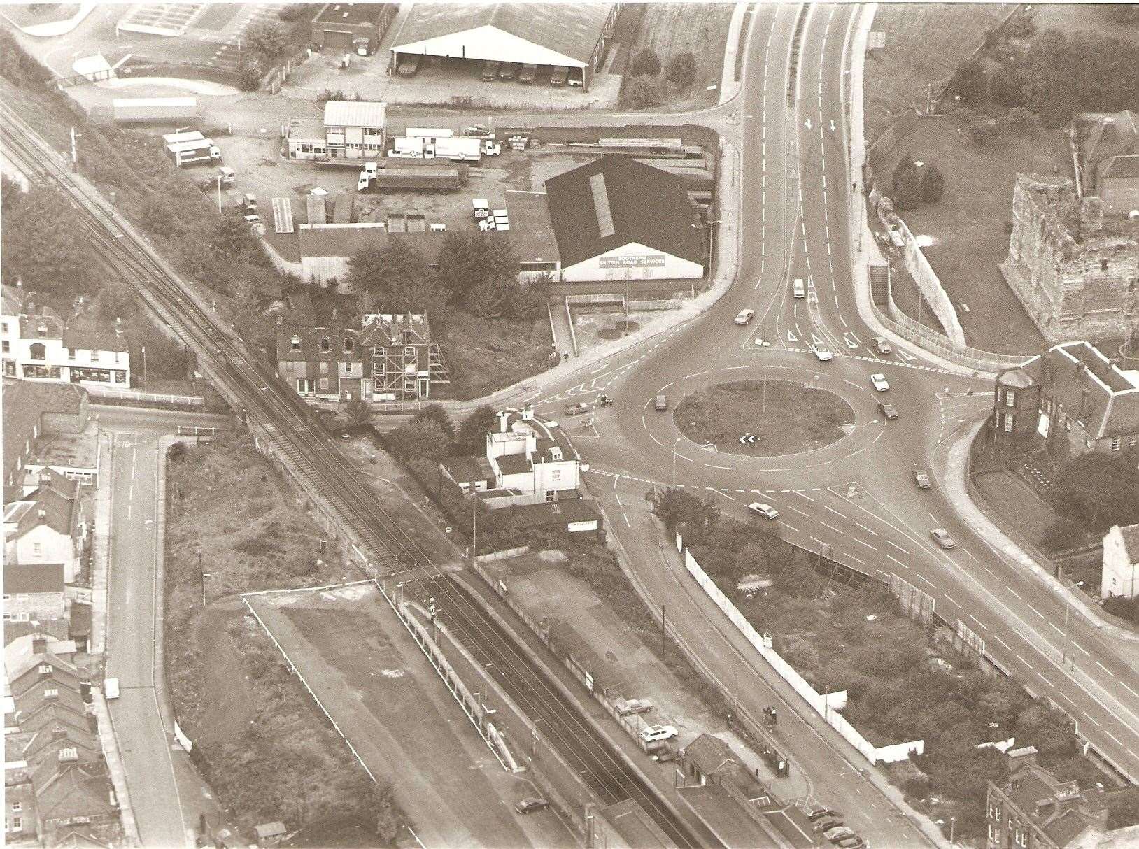
Up on the hill overlooking the town, Dover Castle was used during the Cold War.
The Cuban Missile Crisis saw the country's leaders select the castle and its network of underground tunnels as one of 12 Regional Seats of Government to be occupied in the event of nuclear war.
The 'Dumpy' level, constructed during the Second World War, became the heart of the operation. Had it been required, it would have housed 300 government and military chiefs.
The complex was sealed against contamination and given air filtration and communications equipment including a TV broadcasting studio. It was eventually decommissioned in 1984 and handed over to English Heritage.
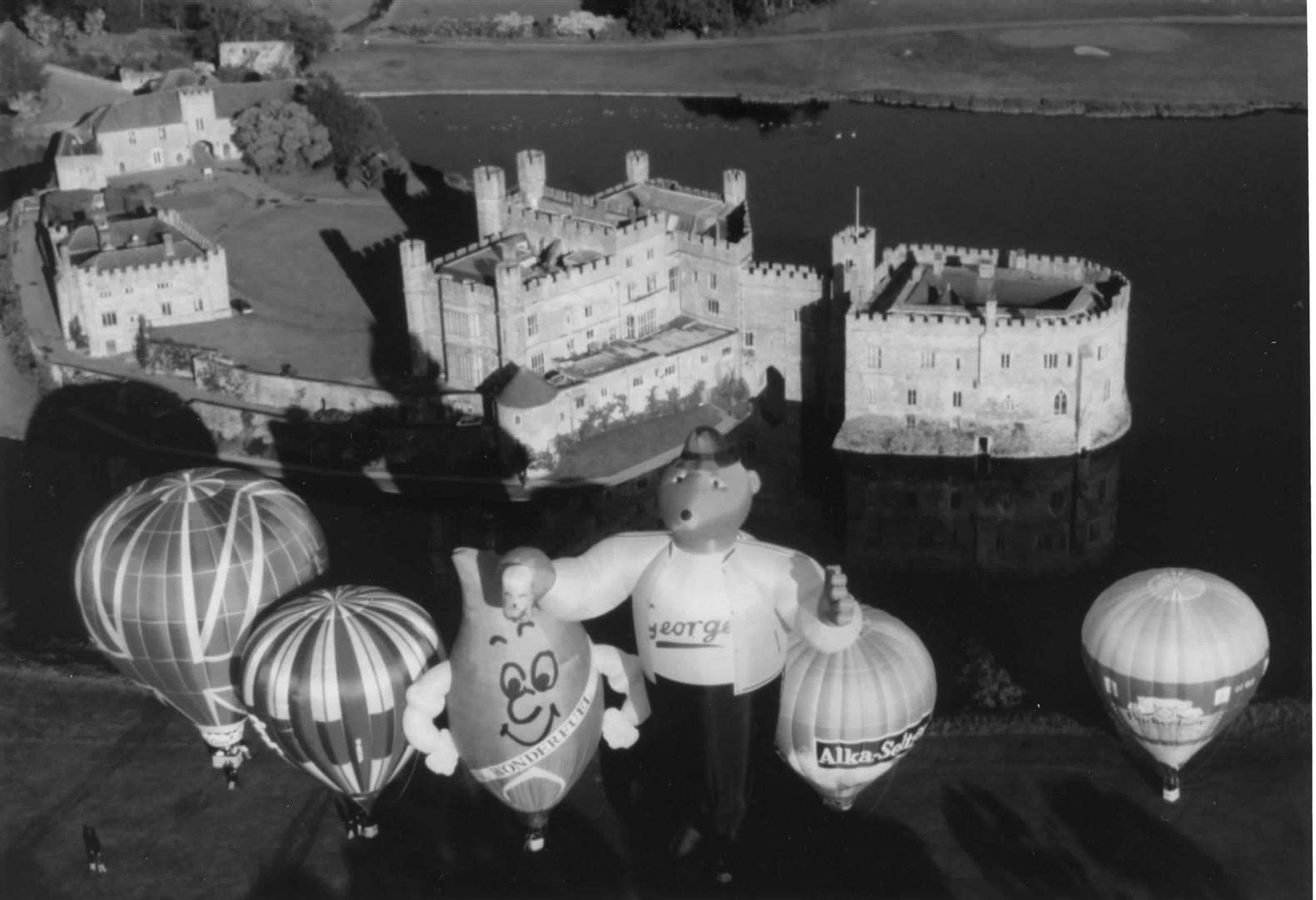
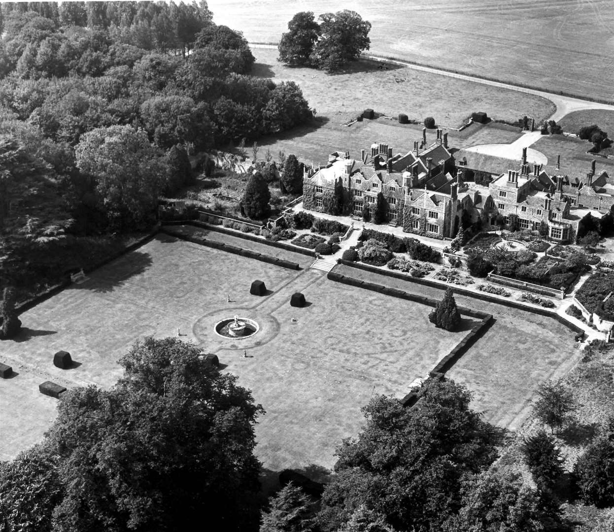
Scotney Castle
Winds reaching 110mph caused devastation across Kent in the early hours of Friday, October 16, 1987.
Four people lost their lives in the county to the Great Storm, with 15 million trees being toppled across southern England and northern France.
Every corner of Kent felt the full force of the biblical weather as hundreds of homes were damaged.
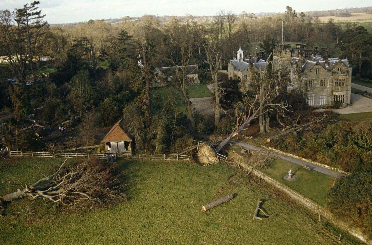
Scotney Castle, pictured above, lost 400- to 500-year-old sweet chestnuts, some of which narrowly missed the house in its grounds.
Six out of the seven trees at The Vine, Sevenoaks, said by many to have given the town its name, were brought down by the storm.
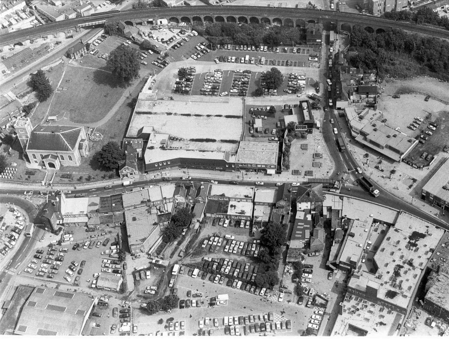
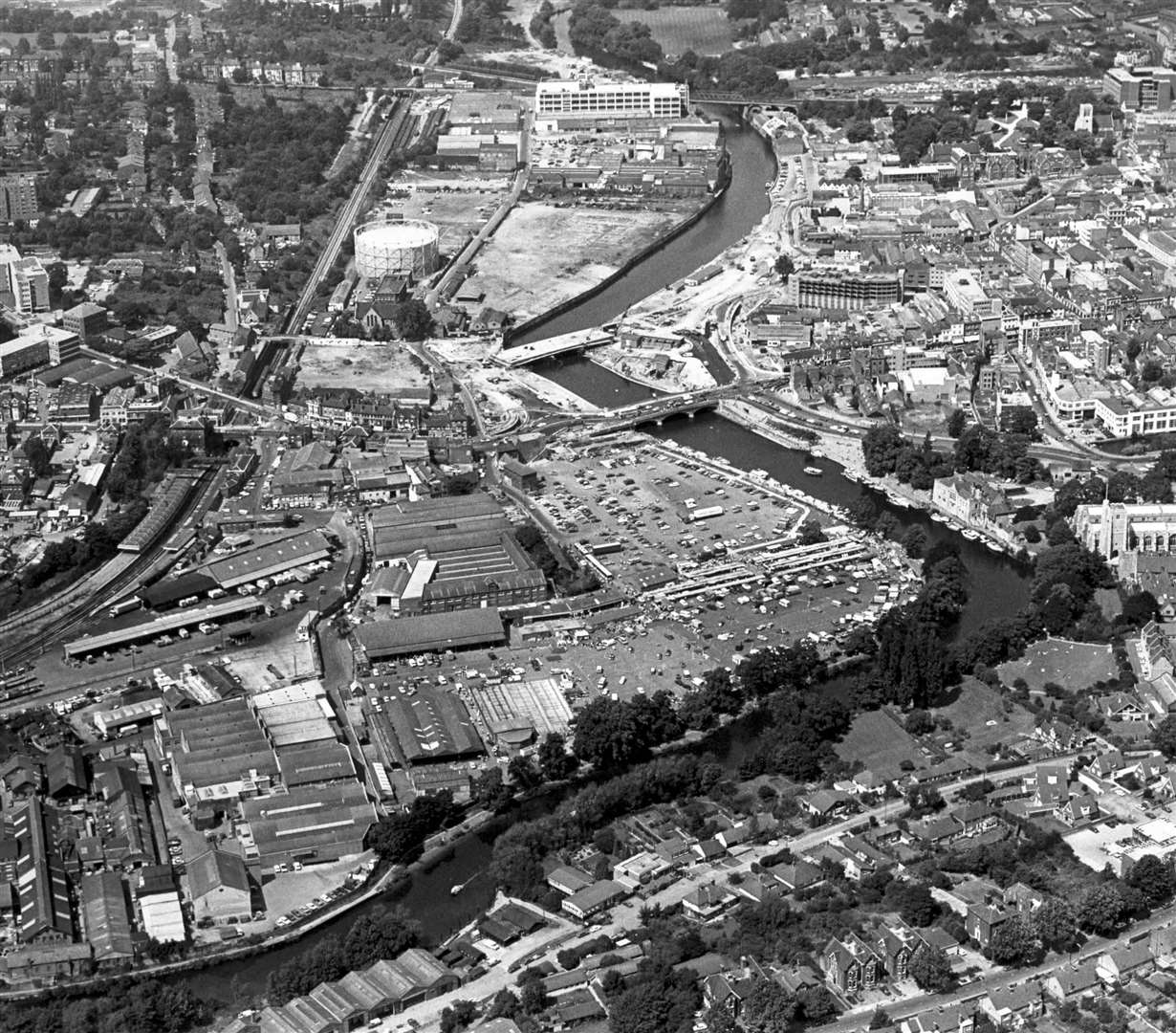
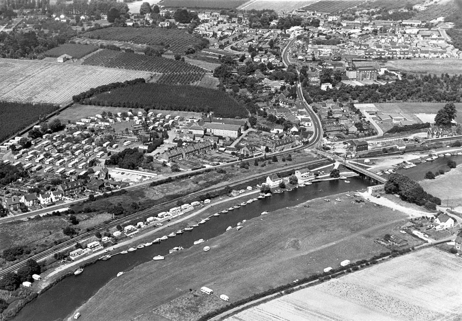
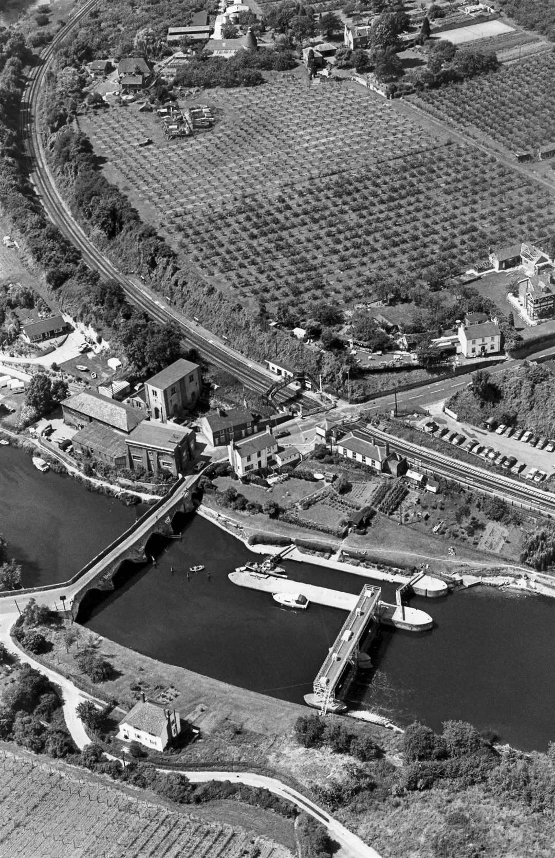
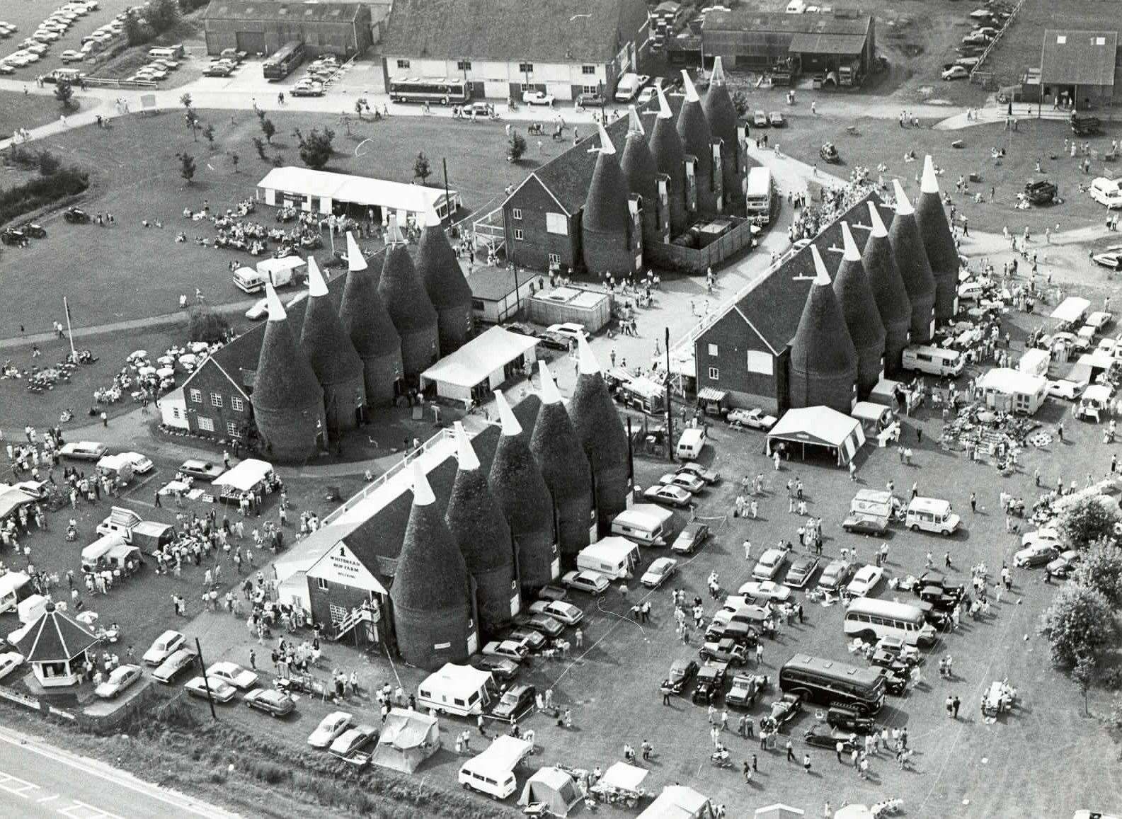
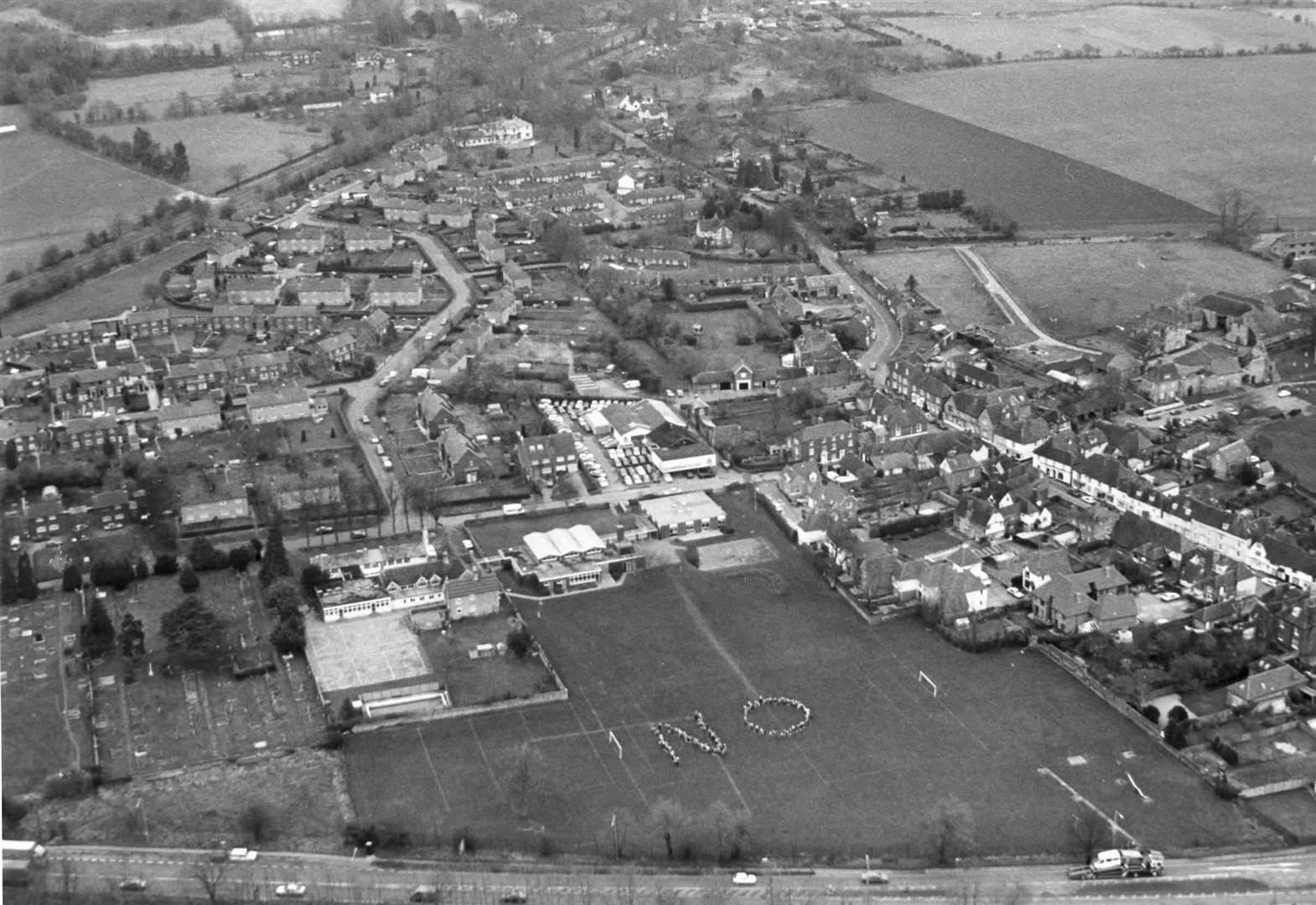
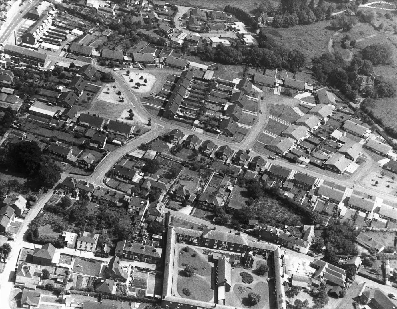
Sittingbourne
North Kent
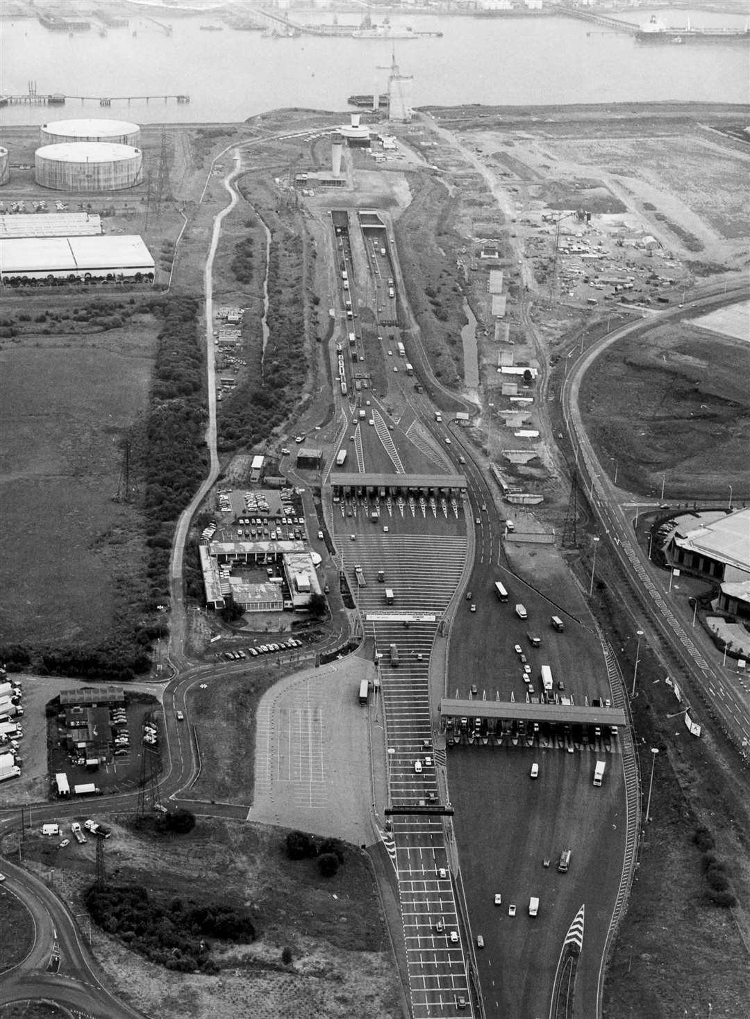
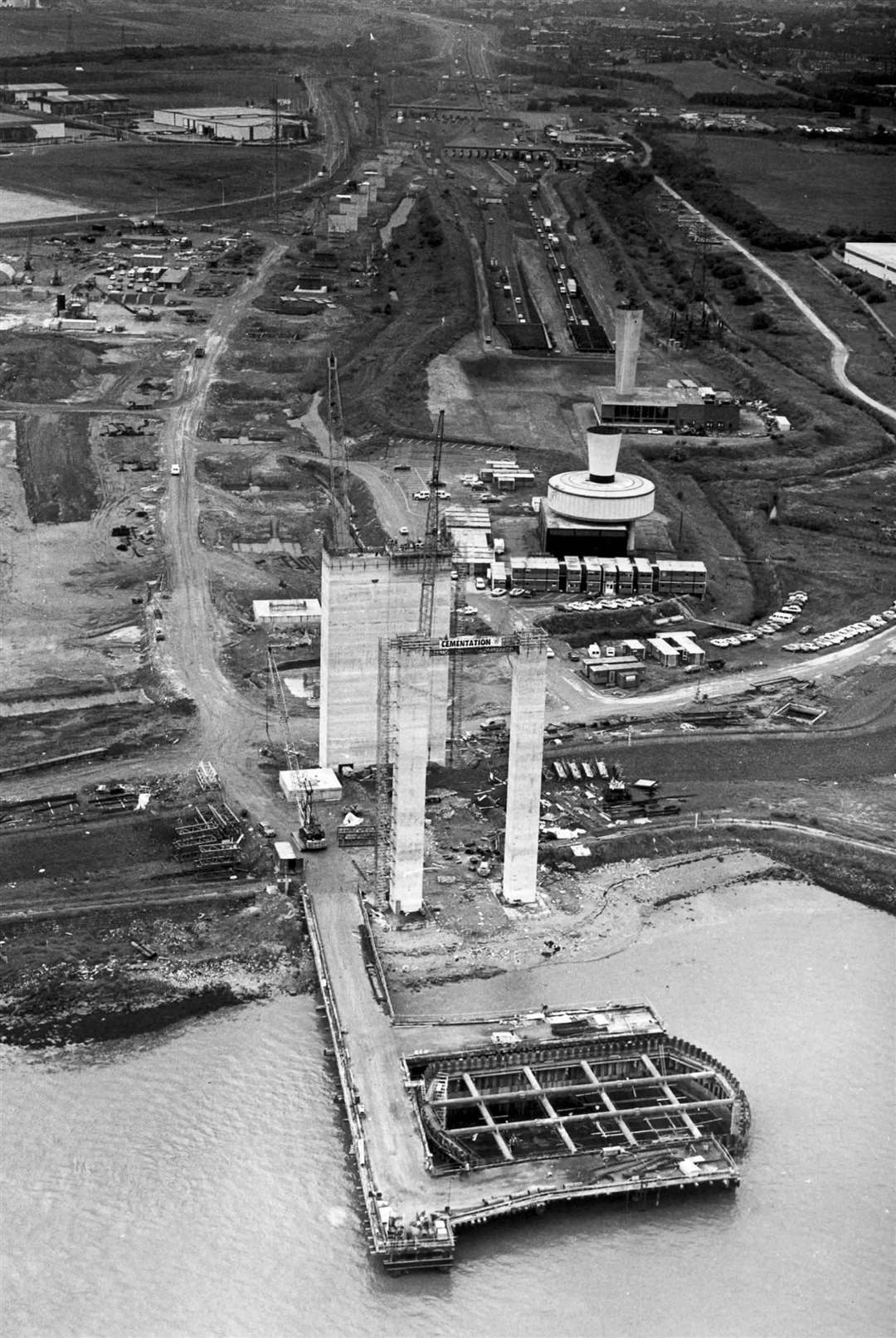
With the first Dartford Tunnel under the Thames opening in the 60s, the second was completed in May 1980.
Its opening allowed each tunnel to handle one direction of traffic, significantly boosting the amount of vehicles which could use the crossing each day.
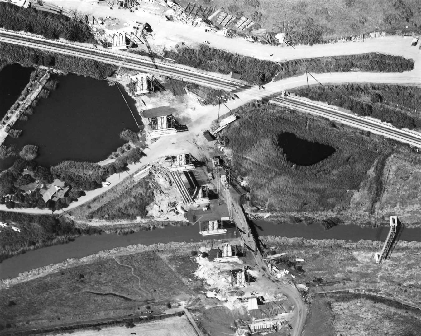
Construction of the QEII Bridge began in 1988 before it opened three years later.
Bewl Water
Work constructing Kent's biggest reservoir began in 1973 - almost 40 years after the idea to increase the county's water supply was first conceived.
The £11m project was completed in 1975.
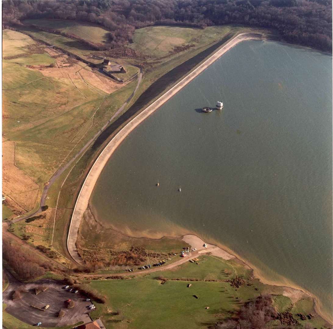
With a surface area of 760 acres and a depth of 30 metres, the huge body of water, near Tunbridge Wells, can store more than 31 million litres.
That equates to the equivalent of almost one gallon of water for every person in the world.
Maidstone & Weald
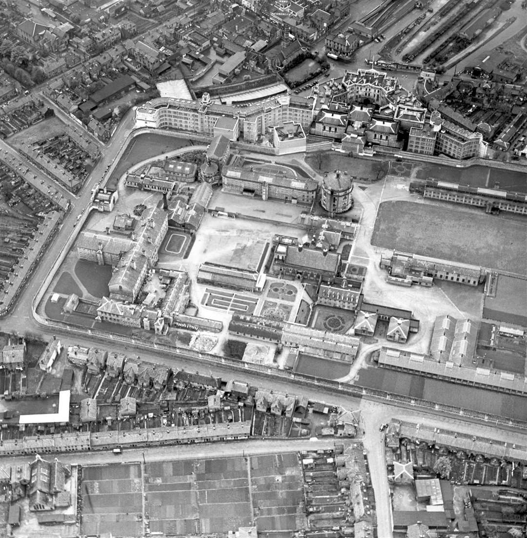
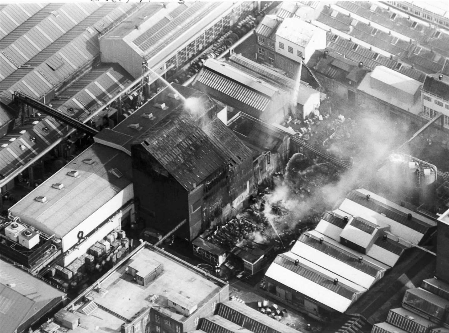
In 1975, an IRA bomb ripped through The Hare and Hounds pub and injured two police officers.
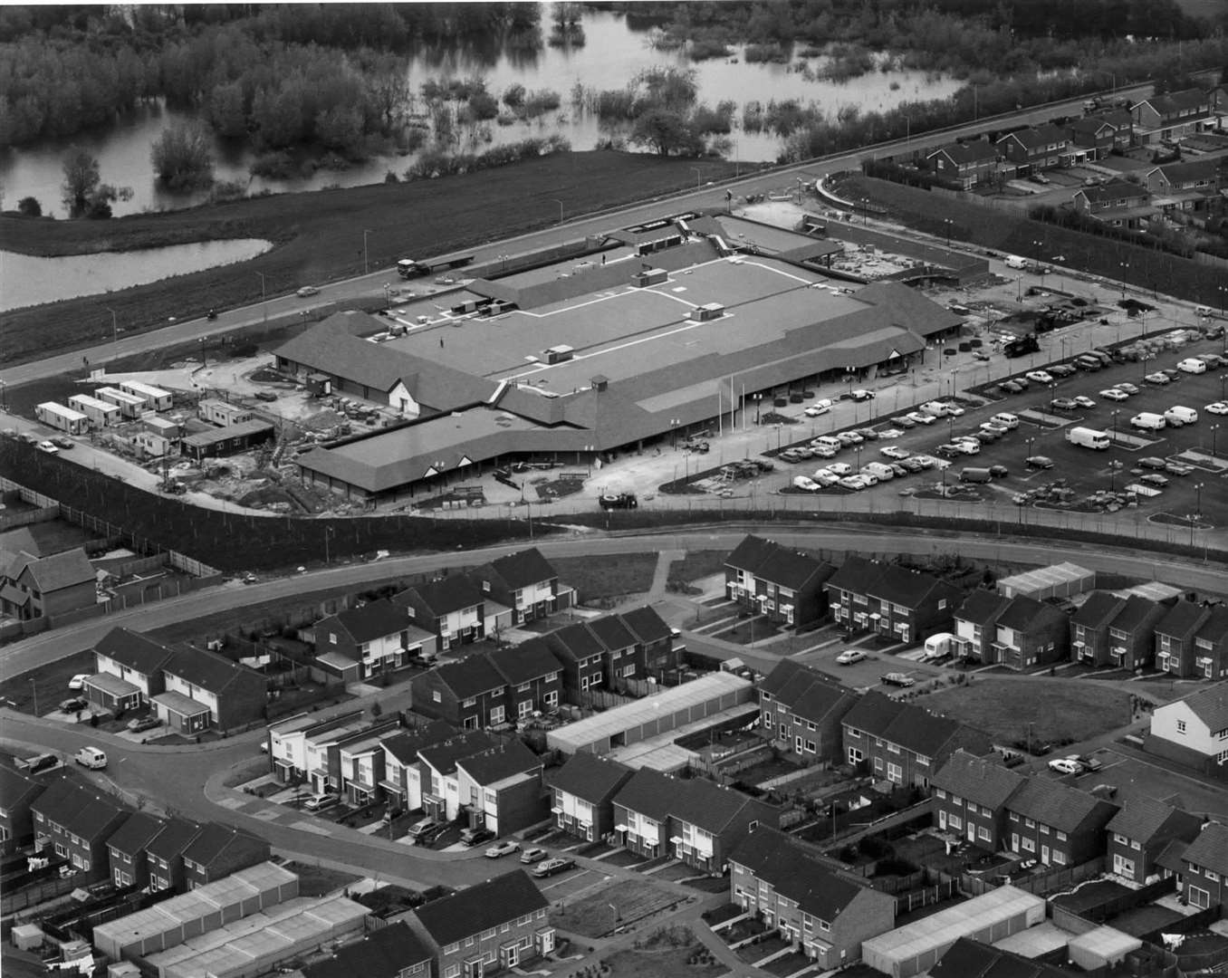
Maidstone General Hospital opened on the outskirts of the town in 1983, replacing the 150-year-old West Kent General Hospital, while the Stoneborough Centre - subsequently named Chequers and then The Mall shopping centre - opened in the town seven years prior.
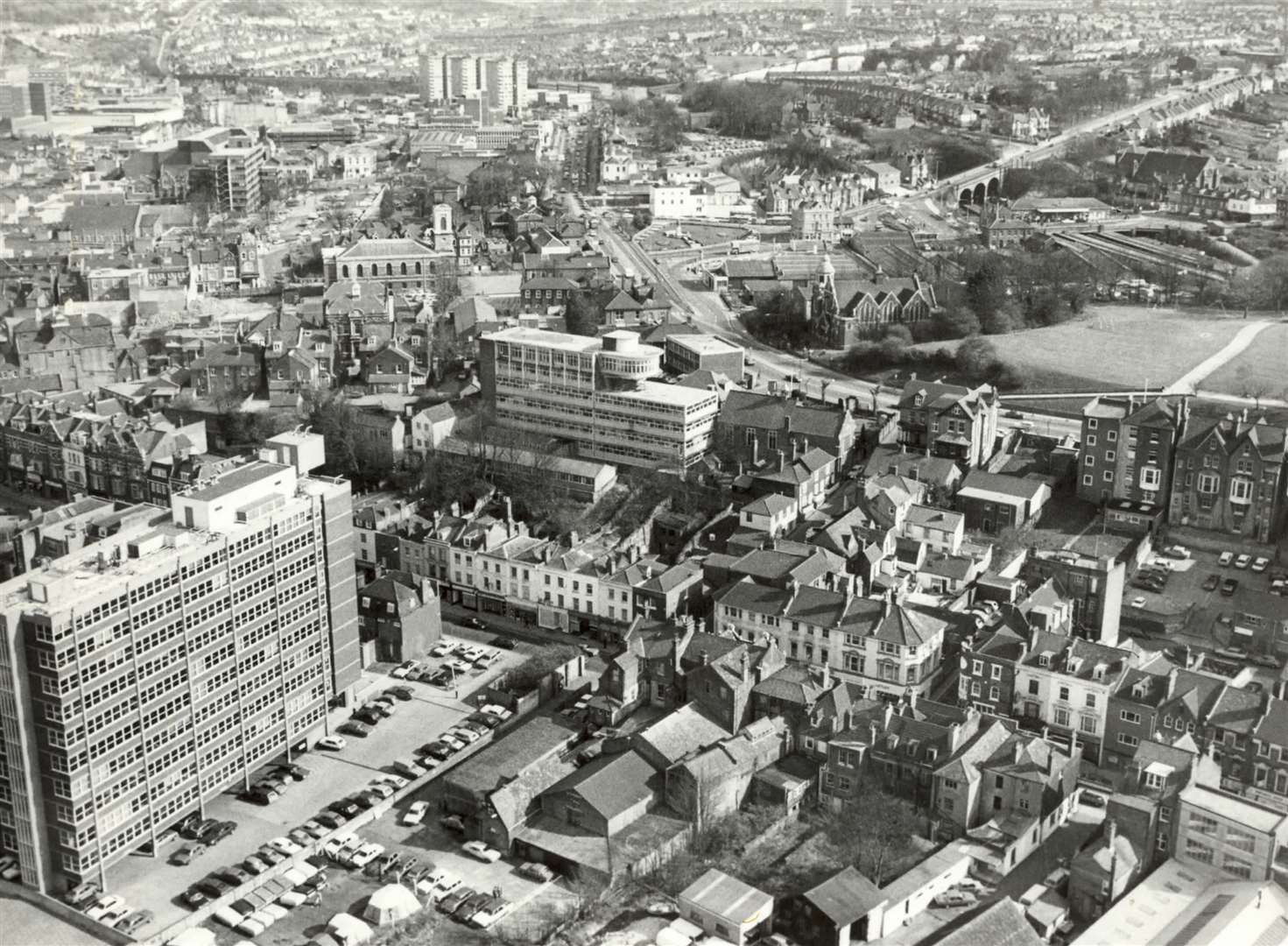
To accommodate increasing traffic, a second bridge opened over the River Medway at St Peter's in November 1978.
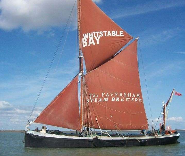
Whitstable
During the 70s and 80s, the town was yet to stray towards its more bohemian-like style which has seen it become a trendy holiday destination.
In the early 1970s, the present Gorrell Tank was built underground, with the Gorrell car park - the town's largest - being in service above ground since.
A vessel reflecting Whitstable's rich maritime history, the Thames sailing barge contributed significantly to the town's economy.
While their peak came at the turn of the 20th century, they still served as the workhorses ferrying goods to and from Whitstable until about 1970.
Motorways
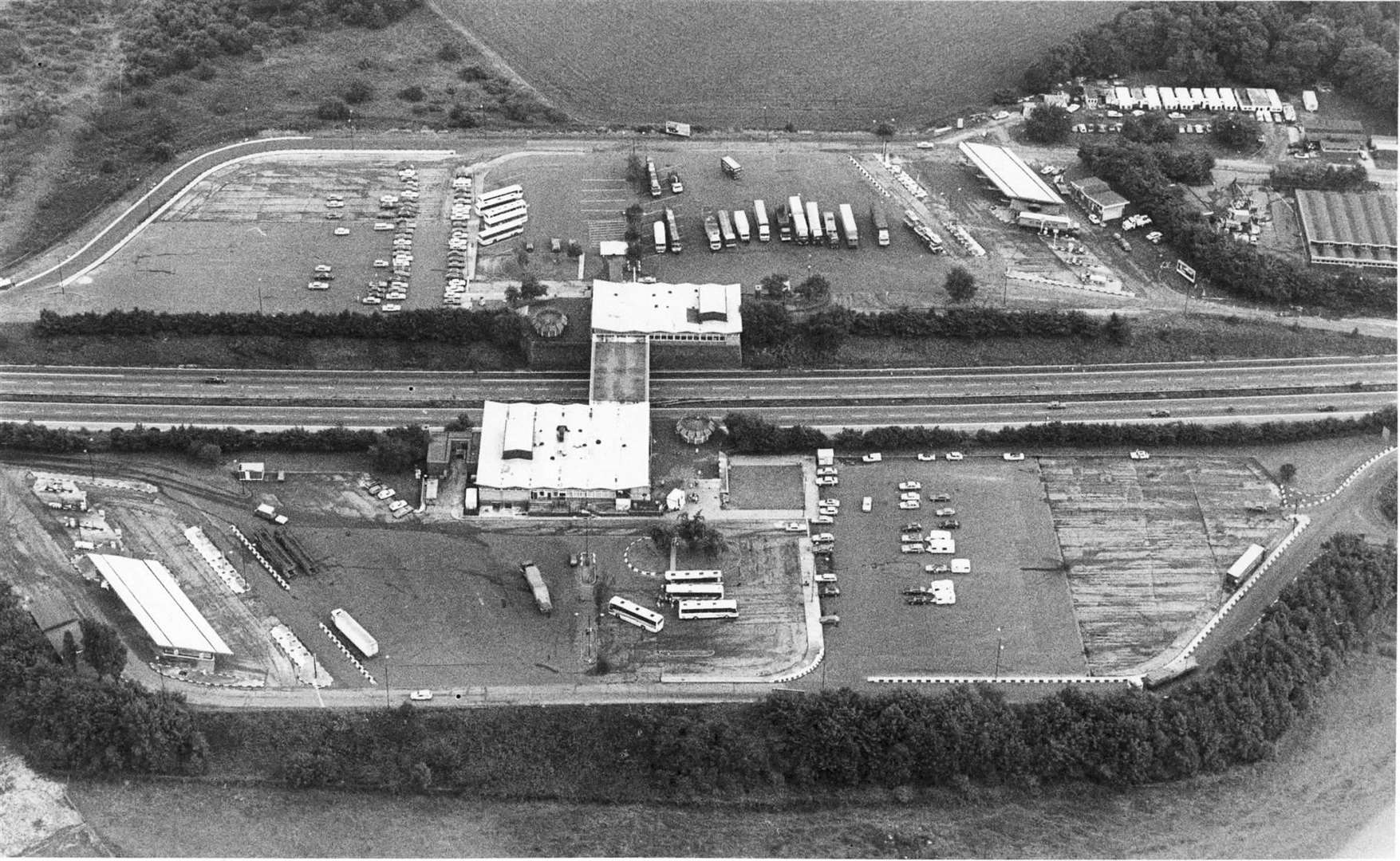
Having opened in 1963 as the Farthing Corner services (named after the nearby village), the M2 Medway Services - now operated by Moto - was given a big refurbishment in 1979.
The Top Rank Motor Lodge hotel was built in 1987 - it later became Granada Lodge, and is now a Travelodge.
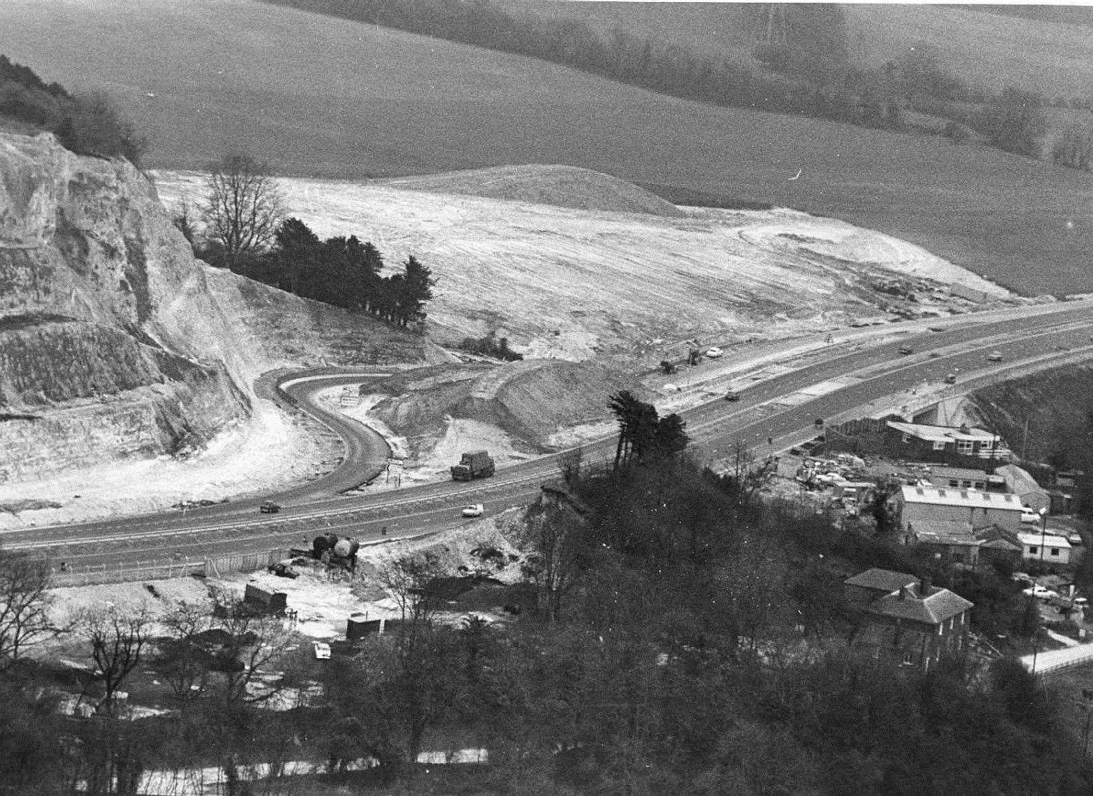
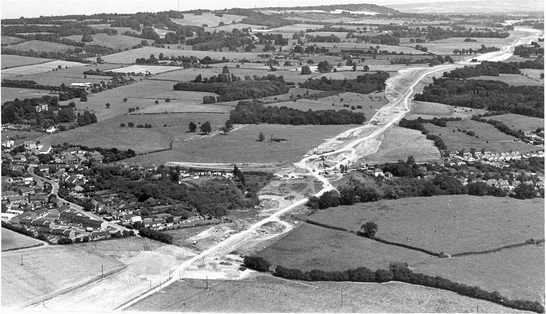
With the first stages of the M20 opening in the 1960s, the stretch between Junctions 3 to 5 opened in 1971, followed by Junctions 1 to 2 in 1977.
In 1981, Junction 11, where the M20 crosses the A20 at Sellindge, to Junction 13 for Folkestone were built.
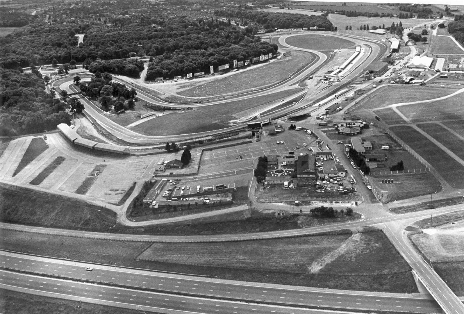
Brands Hatch
One of the world's best-known race circuits, Brands Hatch hosted 14 Grands Prix - 12 British and two European - between 1964 and 1986.
In a championship battle made famous again by Ron Howard's Hollywood film ‘Rush’, the 2.4-mile track played a key part in the 1976 title race between Niki Lauda and James Hunt.
Lauda inherited that year's British GP after Hunt, who took the flag first, was disqualified for failing to return to the pits as per race procedure following a first-lap crash.
In 1980, South African Desiré Wilson became the only woman to win an F1 race of any kind by triumphing in a British Aurora F1 series round at the circuit.
Six years later, the West Kingsdown track hosted its final Grand Prix when Nigel Mansell took a famous win in his Williams-Honda.
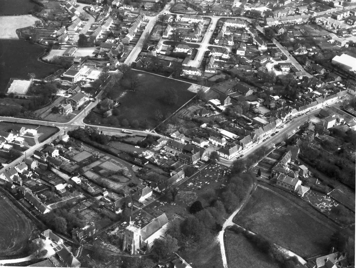
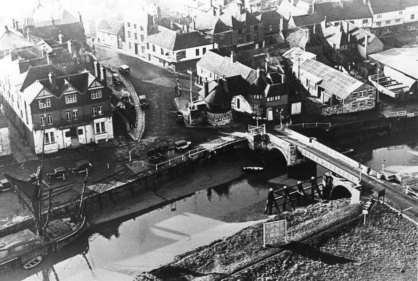
New Romney & Lydd
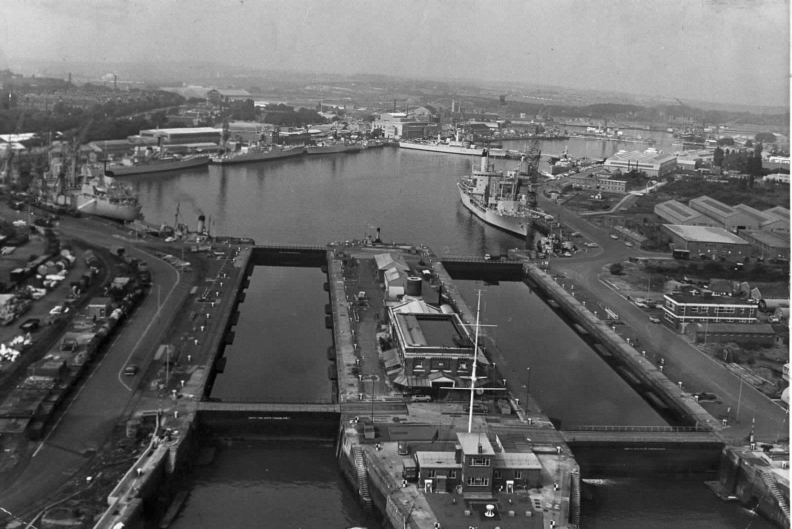
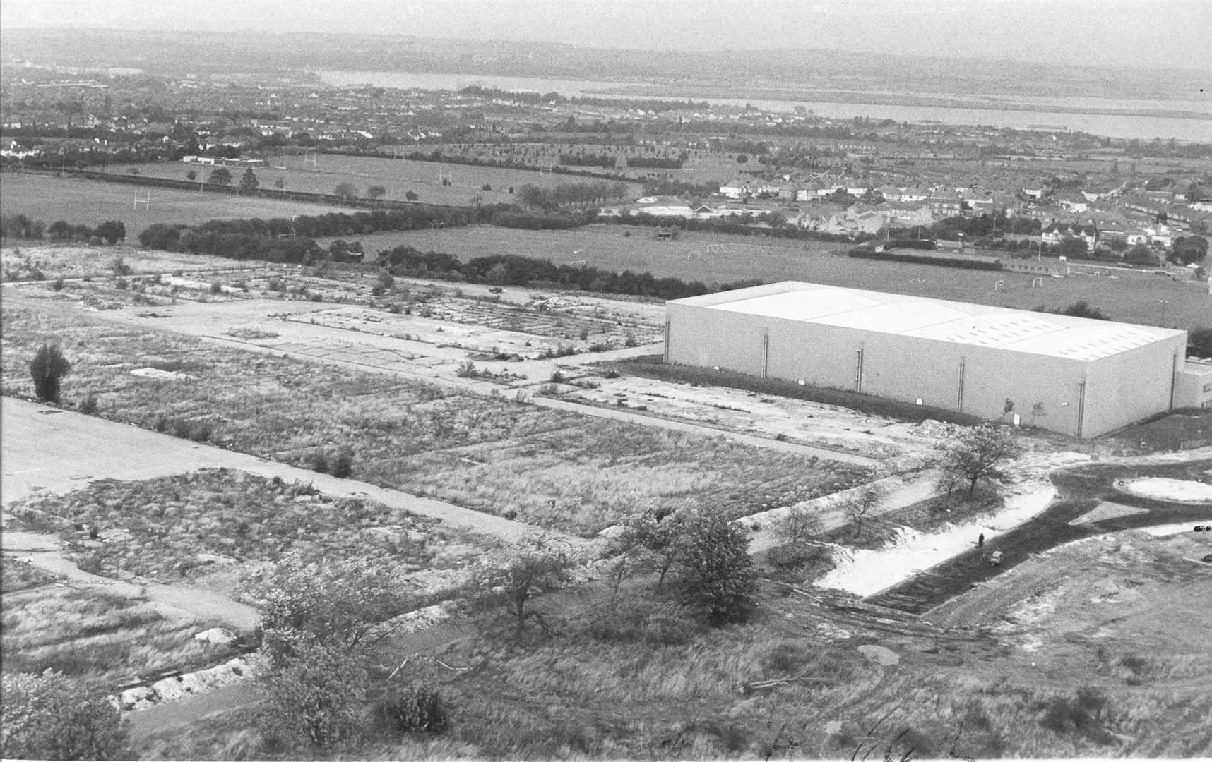
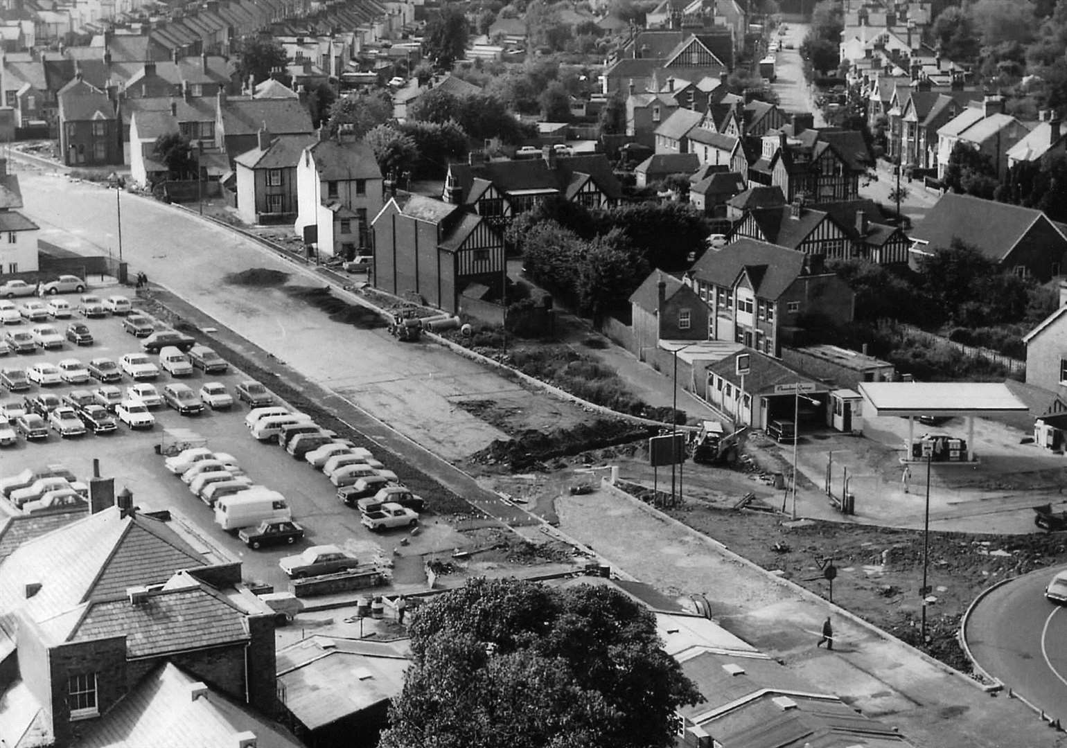
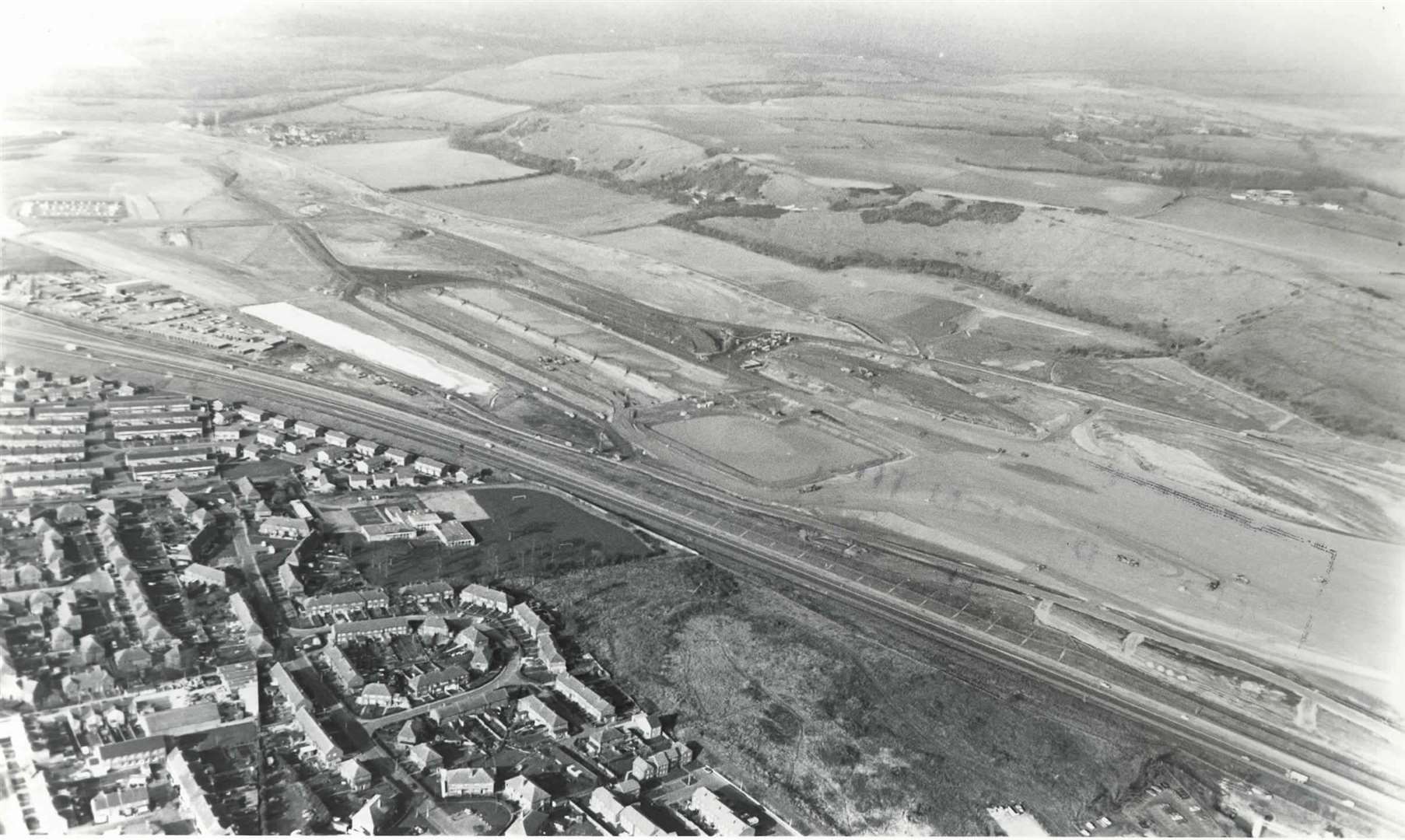
Ashford
Towering over Ashford for decades, The Panorama – previously known as Charter House – opened as an office block in 1975 following the start of construction two years prior.
Converted into flats in the mid-2010s, it was the headquarters for Charter Consolidated, a large British corporation with global mining interests.
Over the decades it housed various commercial occupiers including Stena Line and Santander, before being converted to residential accommodation in 2013 rebranded as The Panorama.
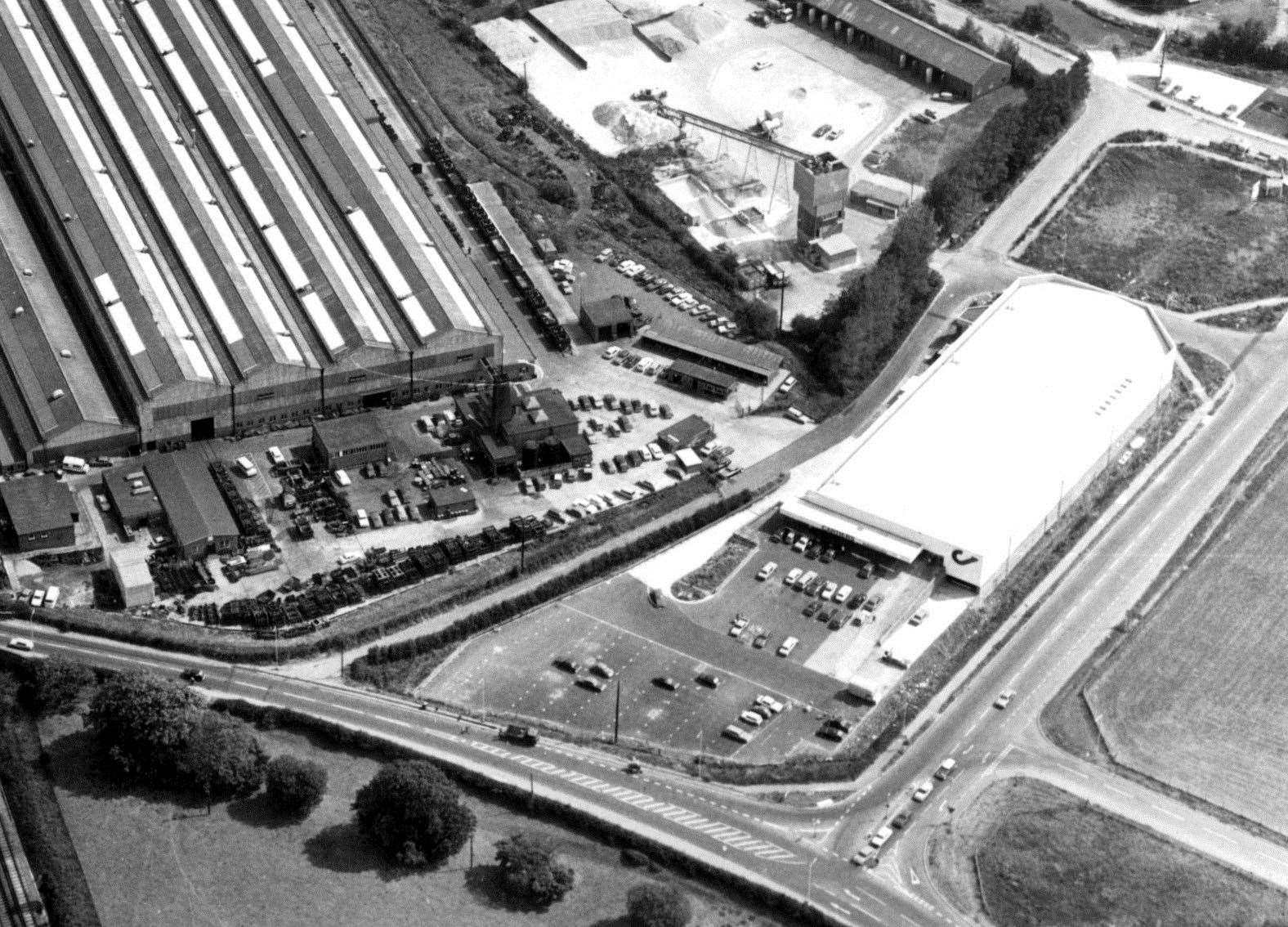
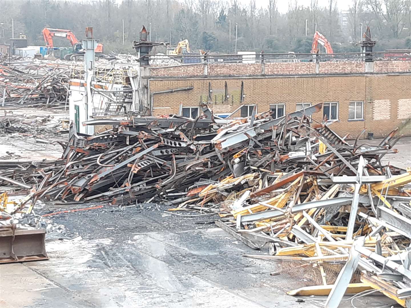
Almost everyone in Ashford has a connection to the expansive former Chart Leacon rail works in the southern part of town.
Neighbouring the former Cartier's Superfoods frozen food store - which then became a Tesco and is now a Matalan - the site opened in 1961 as a rail depot.
Refurbishing and maintaining rolling stock for decades, the once bustling workplace sadly closed in 2014 when owned by Bombardier.
The Beaver Lane site is now in a sorry state, with the old workshops recently being reduced to a pile of rubble.
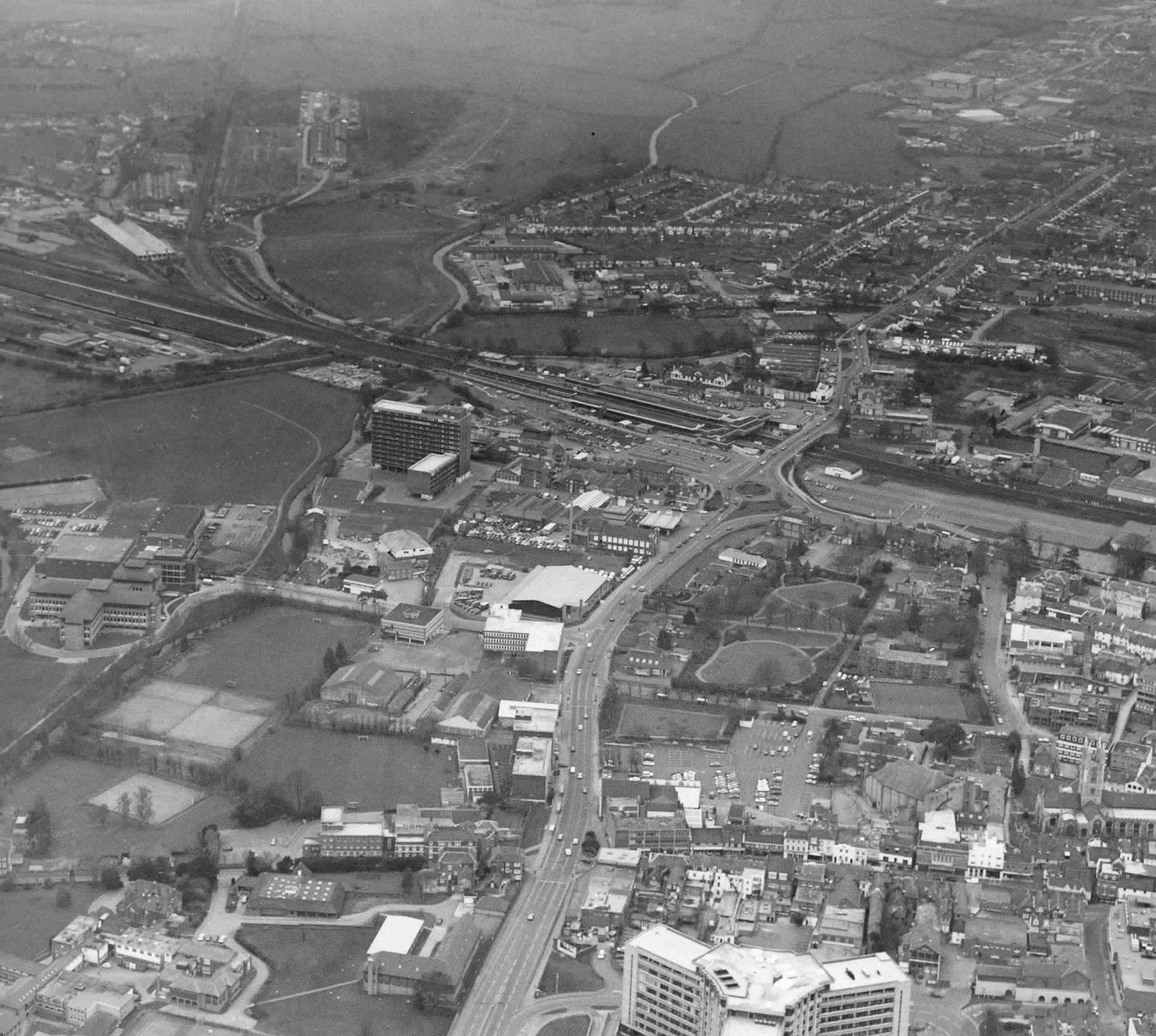
Throughout the 1970s, Ashford underwent a substantial alteration to its road system. The ring-road scheme was completed in several stages - starting in '71 and ending in '78.
Its construction involved land and properties being compulsorily purchased as the new road effectively encircled its way around the town’s heart.
The system was substantially altered in 2008, which involved making some sections two-way, reversing the traffic flow, creating the controversial shared space zone and introducing many more traffic lights.
As for the actual town centre, it was massively redeveloped in the 70s with the opening of the Tufton Centre.
By 1989, the shopping complex was deemed too old-fashioned and became the fully covered County Square.
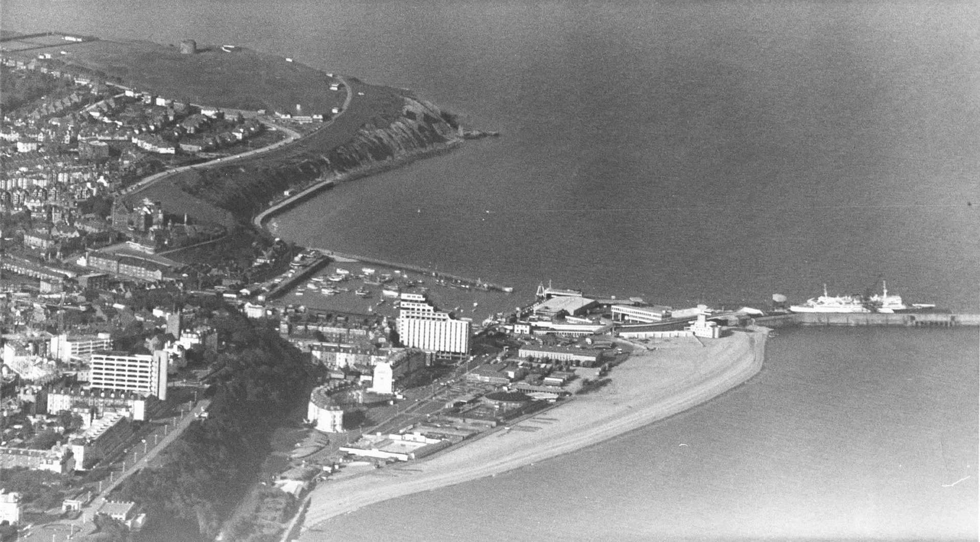
Folkestone & Hythe
Cross-Channel passenger ferries operated from Folkestone to Boulogne, Calais and Ostend during the 70s and 80s.
The introduction of a roll-on/roll-off ramp for two new ships in 1972 saw more than 1.2 million passengers depart from the town annually.
But the emergence of larger vessels began to expose the limitations of shallower water depth at Folkestone. The harbour was sold in the 1980s, along with the ferry company Sealink, as part of the government’s privatisation programme.
Different firms took over the running of the ferries until SeaCats were introduced but later withdrawn at the turn of the millennium.
The remnants of the concrete ‘dolphins’ which carried the linkable ramp can be seen today by visitors to the renovated harbour arm.
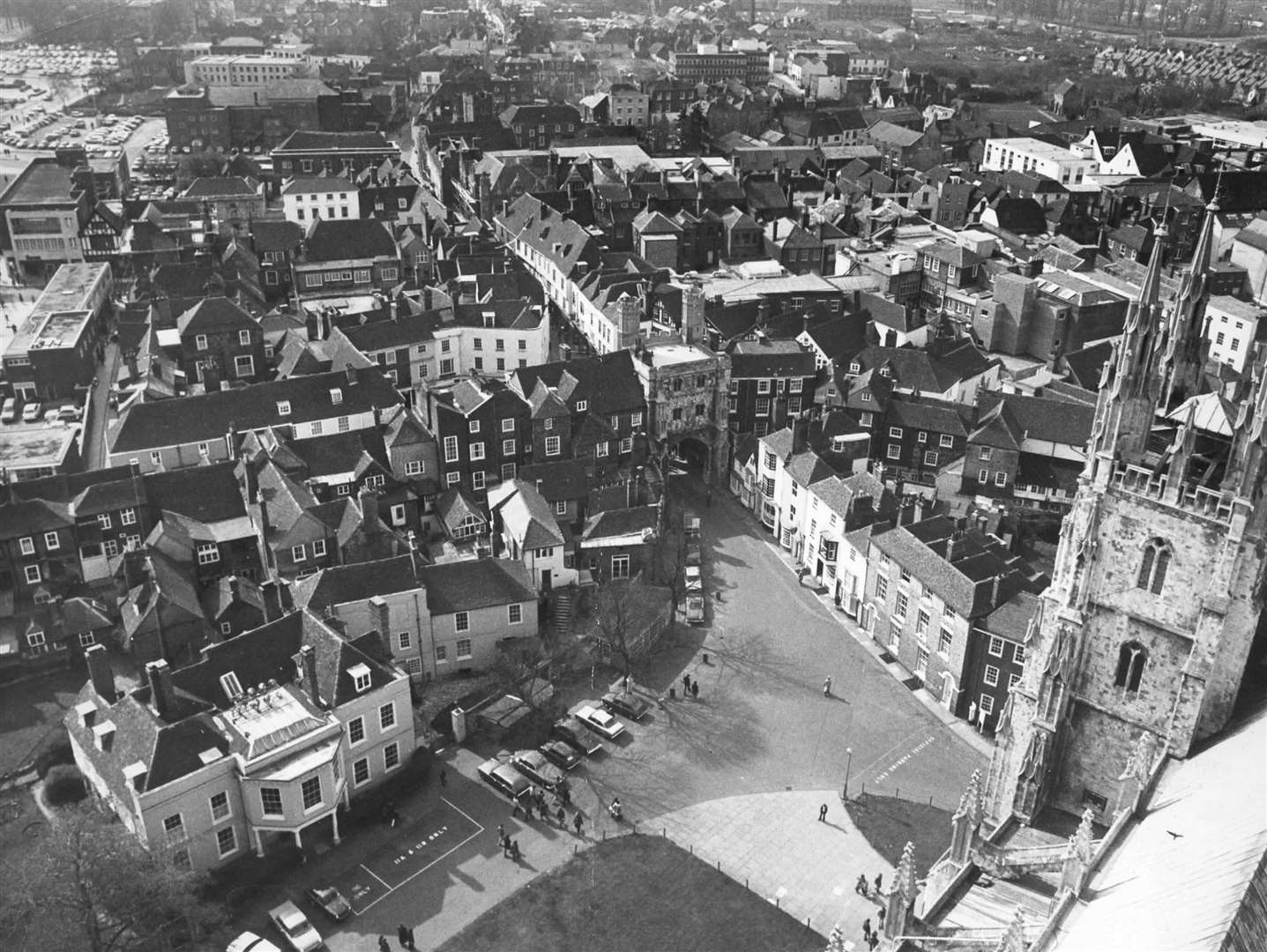
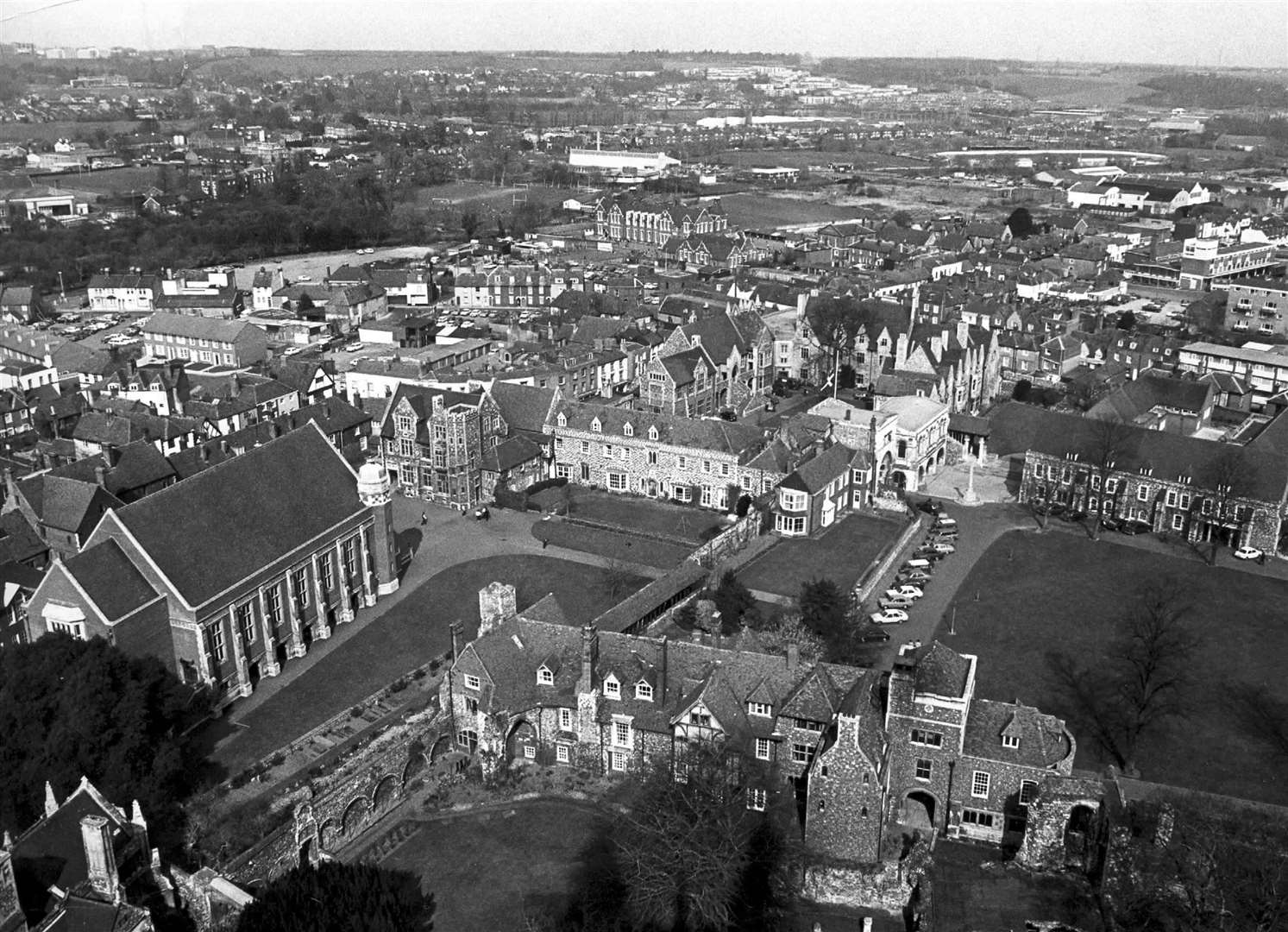
Canterbury
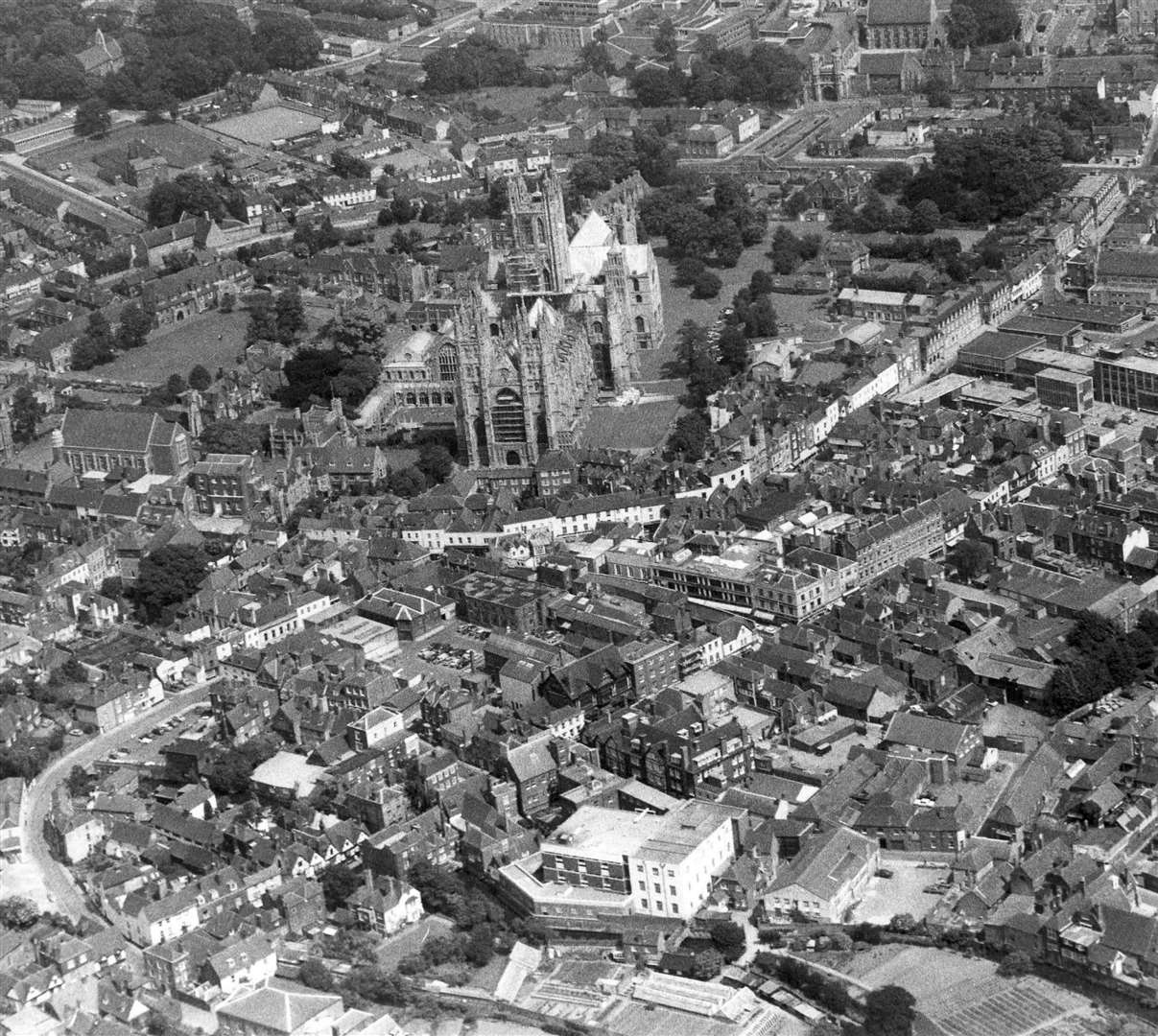
The mid-70s heralded a huge change for Canterbury as the city centre became pedestrianised, with cars bypassing the old route through the city.
The 1980s saw visits from Pope John Paul II and the Queen Elizabeth, as well as the beginning of the annual Canterbury Festival.
Christ Church College originally opened its doors with just 70 students and nine teachers in 1962.
It was set up as a teacher training college in response to a national shortage of teachers and a first degree programme - Bachelor of Education - was introduced in 1970.
The first non-teacher training degrees were launched six years later. It has since grown and grown and went on to gain full university status in 2005.
Deal & Sandwich
Deal changed forever in September 1989 when 11 bandsman were killed in an explosion set off by the IRA.
The Royal Marines School of Music blast, which also resulted in another 21 people being injured, could be heard from miles away, shaking windows in the centre of Deal and creating a large pall of smoke over the town.
The 6.8kg device went off in a sofa in the Coffee Boat recreation room, destroying all three floors of the building and damaging dozens of neighbouring houses.
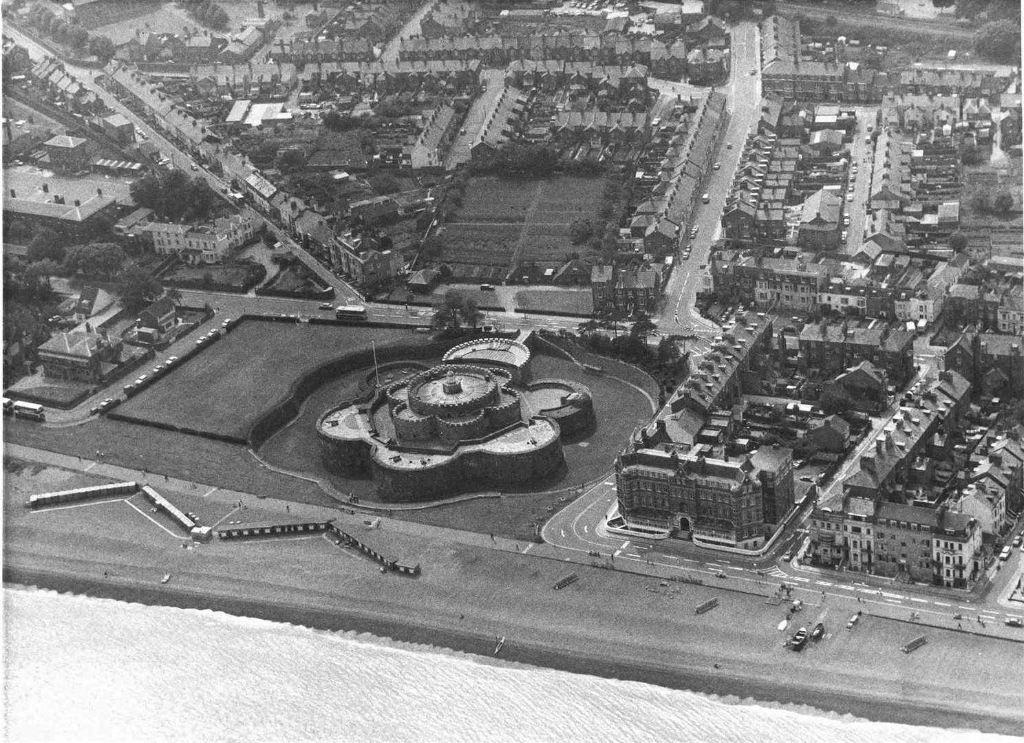
Many victims were trapped in the rubble for hours and heavy lifting equipment was needed to clear it.
The IRA claimed responsibility afterwards, having rented a property in Campbell Road to plot the cold-blooded attack, which instantly attracted world media interest.
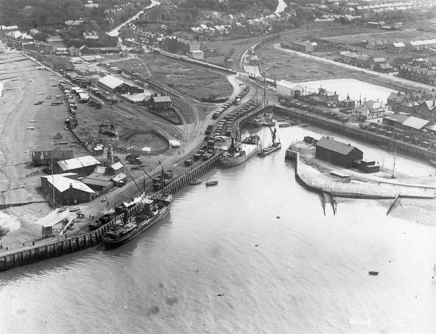
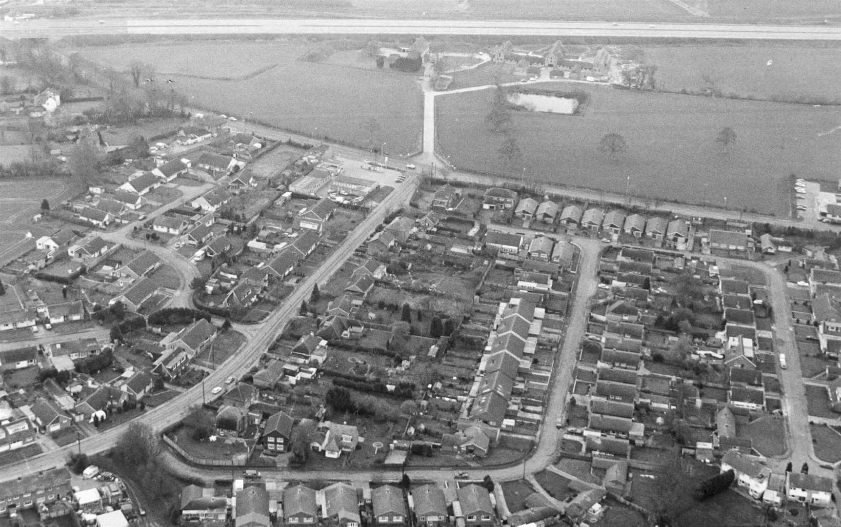
Sheppey