GO AD-FREE. Get 2 Months Digital Subscription for ONLY £1! Use code 2FOR1
GET STARTEDMore on KentOnline
GO AD-FREE. Get 2 Months Digital Subscription for ONLY £1! Use code 2FOR1
GET STARTEDMore on KentOnline
It's been one of the hottest days of the year so far and it is likely to get even hotter tomorrow.
But then the storm clouds are expected to roll in across the county.
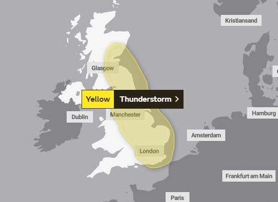
The Met Office has issued a yellow warning of thunderstorms for the south-east tomorrow from 3pm. The storms are likely to continue until the early hours of Friday.
A Met Office spokesman said: "Following a hot day, scattered thunderstorms are likely to break out from late afternoon onwards.
"While some areas, particularly in the south of the warning area, may avoid the storms, where they do occur they could produce 20-30 mm of rain in less than an hour along with frequent lightning, hail and gusty winds."
He added: "Perhaps the main focus will be later in the evening and into the first part of the night."
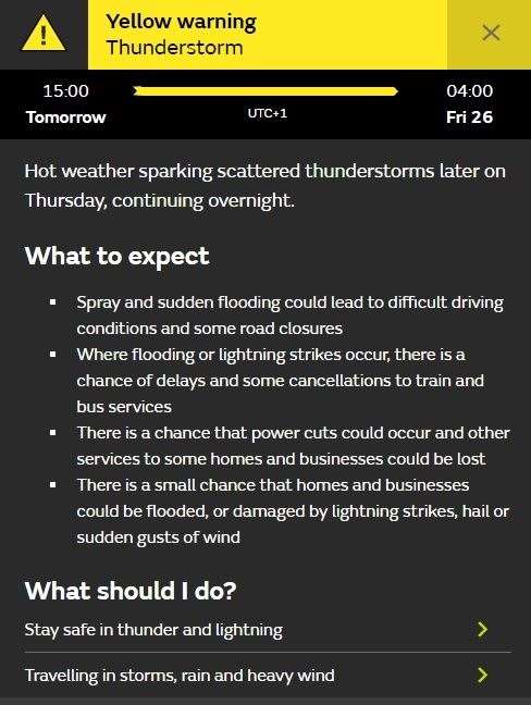
We can expect:
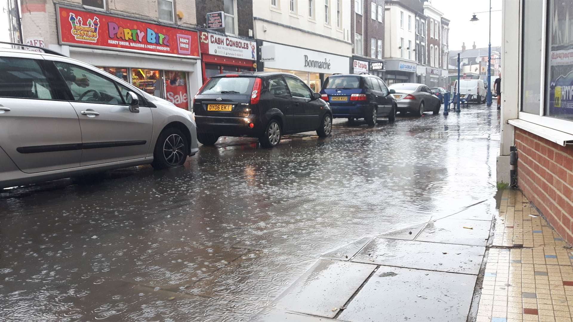
* Spray and sudden flooding leading to difficult driving conditions and some road closures
* Delays and cancellations to train and bus services where flooding or lightning strikes happen
* Possible power cuts to homes and businesses
There is a small chance homes and businesses could be flooded or damaged by lightning strikes, hail or sudden gusts of wind.
For all the forecasts, warnings and weather related news, click here.