GO AD-FREE. Get 2 Months Digital Subscription for ONLY £1! Use code 2FOR1
GET STARTEDMore on KentOnline
GO AD-FREE. Get 2 Months Digital Subscription for ONLY £1! Use code 2FOR1
GET STARTEDMore on KentOnline
With the big day out of the way, and the strange interlude between Christmas and the New Year festivities upon us, what better time to rally the whole family for an invigorating walk in the Kent countryside? And if a welcoming pub is part of the plan, all the better.
Here, Rhys Griffiths picks out a selection of great walks in the county that will definitely be worth the effort of rising from the sofa and wrapping up against the cold in the coming days…

Writing about my occasional strolls in the glorious Kent countryside – and occasionally our towns as well – has given me a renewed appreciation for the wonderful landscapes we are blessed with here in the Garden of England.
Although it’s fair to say many of these routes would be at their finest in the summer sunshine, there’s no reason they cannot be enjoyed all year round. Provided you dress for the weather, and be sure to select appropriate footwear.
I have picked out four of my favourites from 2023. We would love to hear your recommendations in the comments below too.
Through the Medway valley
When it comes to judging a countryside walk, there are a few factors I usually take into consideration. Is the route well served by public transport, can I expect some glorious scenery, and will my path lead me past the door of a welcoming inn or two?

Based on this checklist, I have to say that a stroll along and around the Medway valley to the west of Maidstone is pretty much close to perfection.
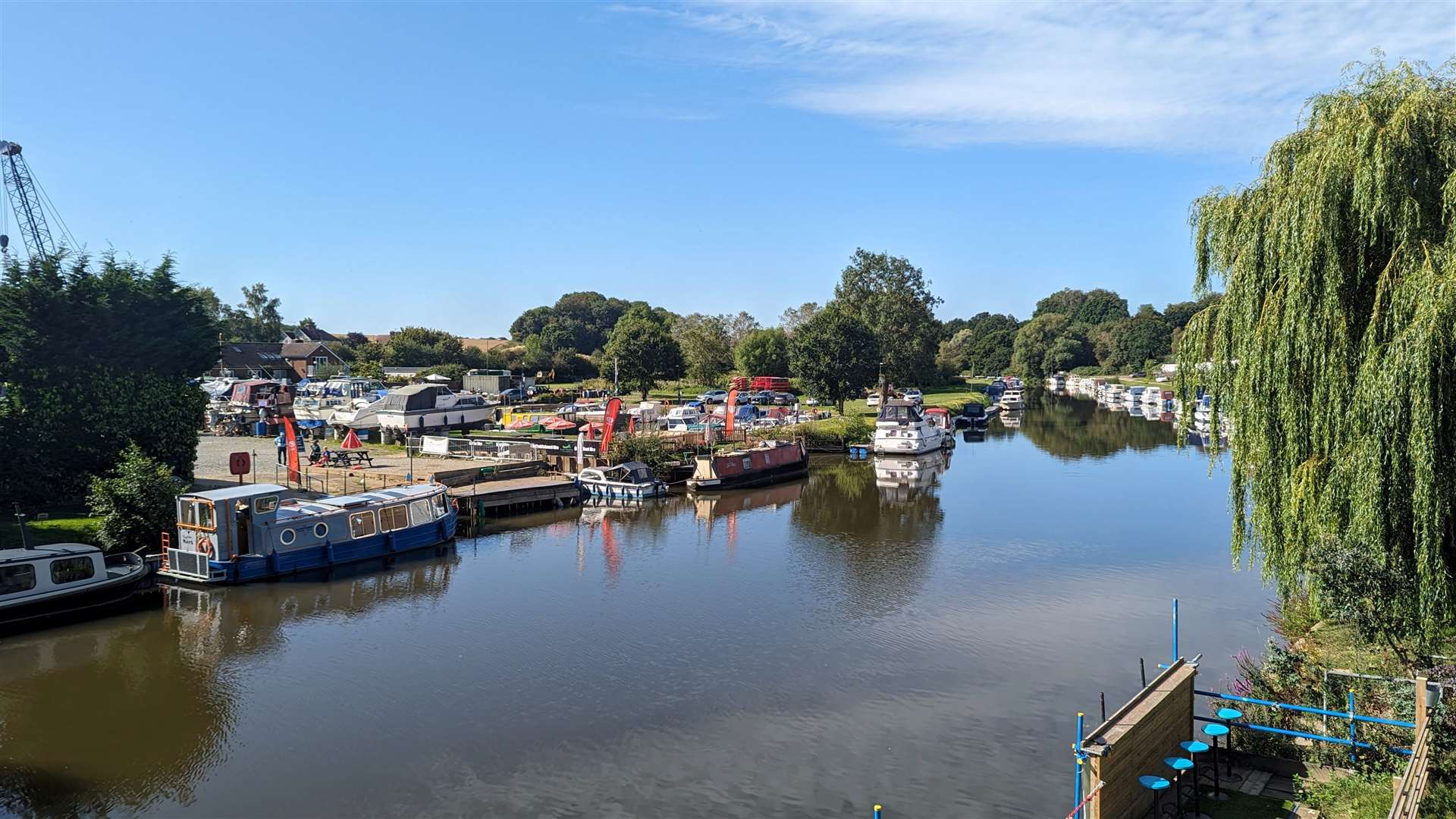
The walk I took earlier this year began in Wateringbury, which is served by trains on the Medway Valley line, passing through East Farleigh, before turning south and west towards Yalding, a route which would afford some fine views of the valley.
This stretch of the Medway is extremely popular with owners of pleasure cruisers and houseboats, which give the stretches alongside the water plenty of interest for the nosy to admire the vessels and their occasionally elaborate moorings.
Not long into the walk, and you’ll soon come to the rather lovely Teston Bridge Country Park, which takes its name – you’ll be shocked to hear – from the impressive Teston Bridge which crosses the Medway here.
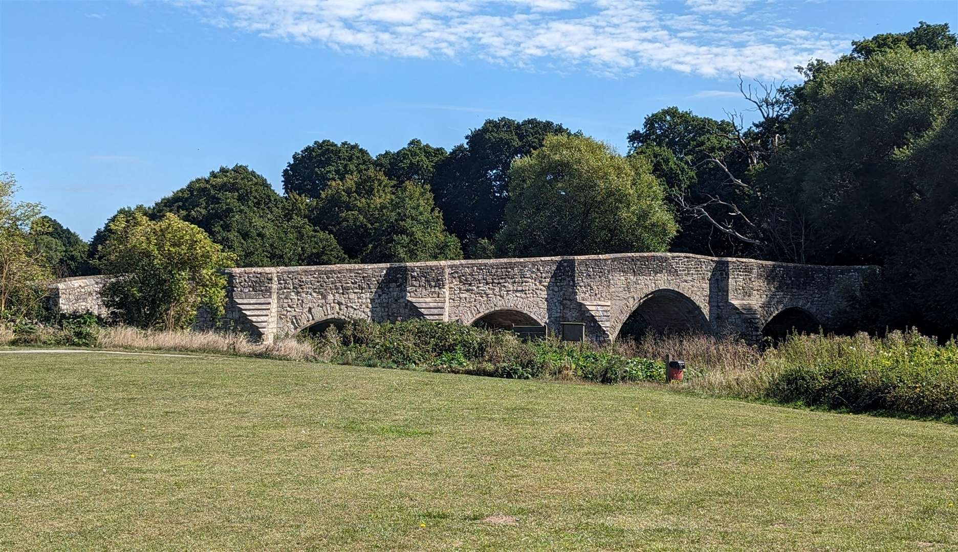
East Farleigh lies not far beyond Teston and is itself centred around another fine example of medieval engineering. The ragstone bridge here is narrow, allowing traffic to pass only in one direction at a time, so for pedestrians there is care to be taken when crossing.
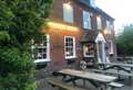
My pub pick on this walk was the Walnut Tree in Yalding, where I encountered a decent lunchtime crowd of drinkers and couples having a bite to eat. I opted for a very agreeable session ale and a classic pub-grub dish of ham, egg and chips.
The proximity of the Medway Valley Line means walkers are well served with opportunities to pick up the train on this walk, and I could have brought my day to a close earlier if I’d decided to head to Yalding station. But I was determined to complete the loop starting and finishing in Wateringbury.
I’d say this walk is hard to beat. Particularly if you are not a seasoned hiker and don’t like the idea of yomping over huge distances in the middle of nowhere.
Let the train take the strain, walk from one village to the next, and then decide if you want to go further or simply want to call it a day and head home. Or stop off at one of the numerous pubs which dot this corner of the county.
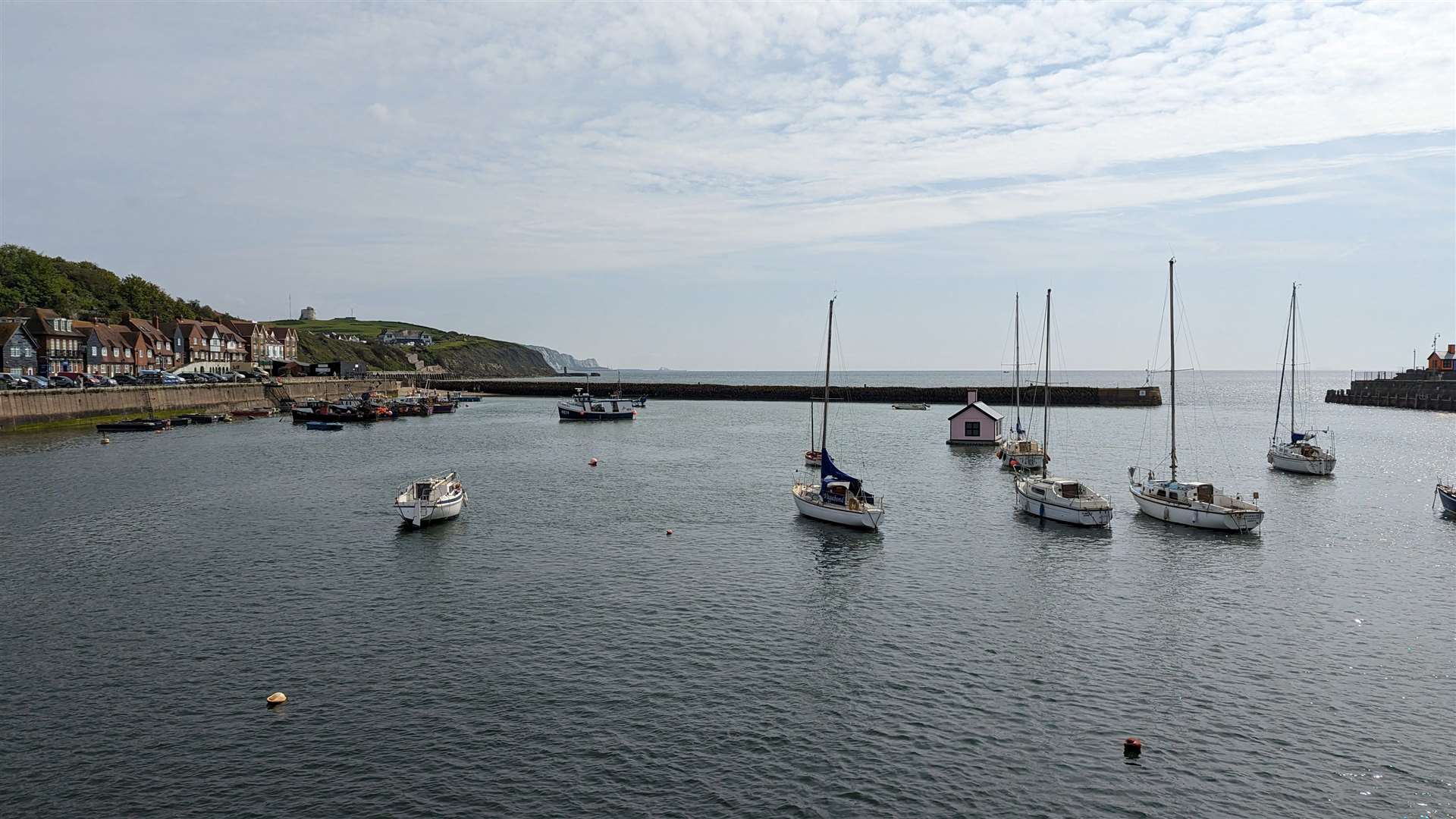
Folkestone to Dover (or vice versa) along the Kent Heritage Coast
This walk takes in a stretch of coast Lonely Planet describes as “a unique combination of history, heritage, stunning and iconic natural landscapes”.

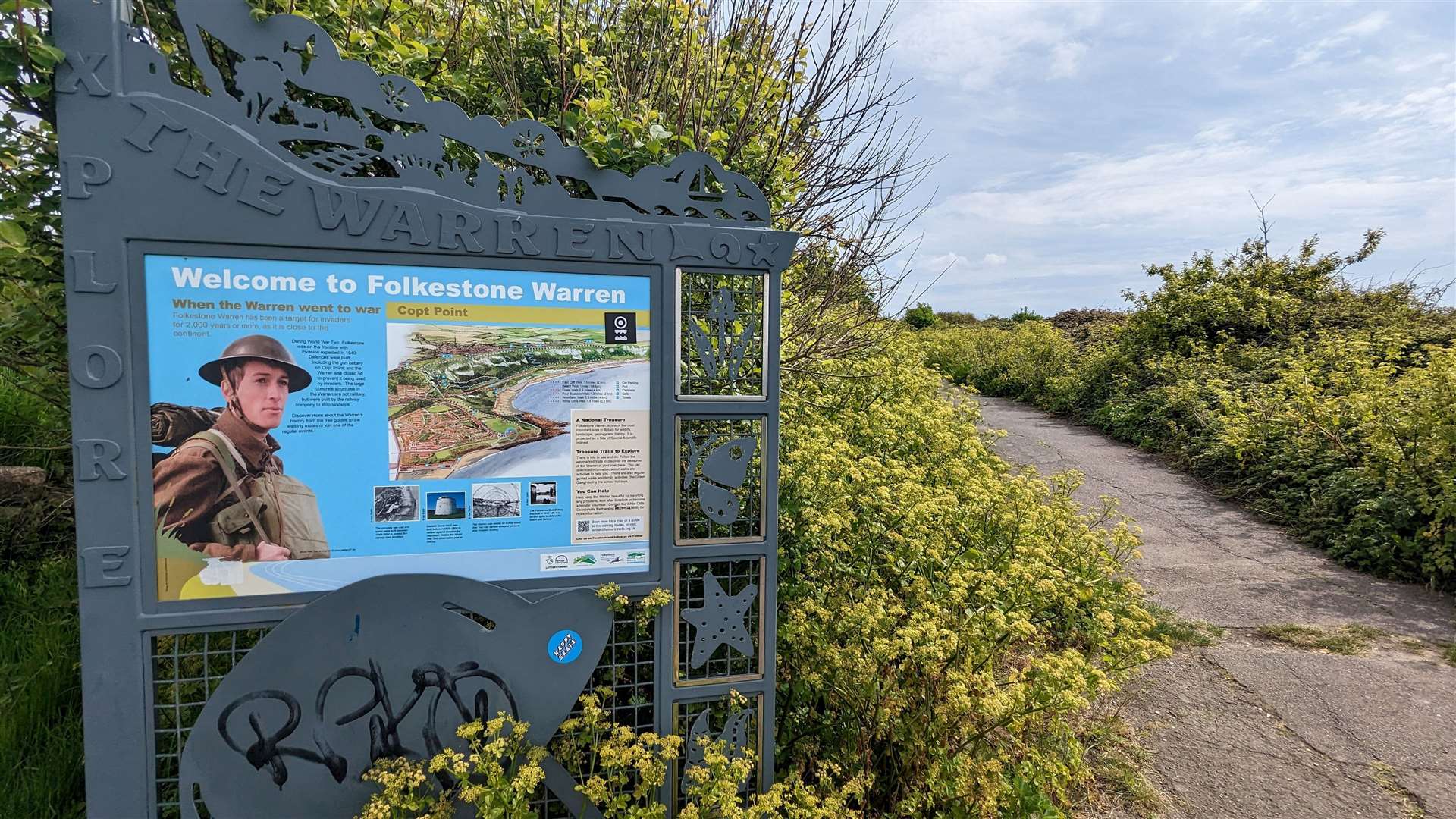
The initial part of the route from the harbour in Folkestone to the clifftop eastward is quite testing. After walking the promenade at Sunny Sands it is a climb of the East Cliff, with its Martello Tower, pitch-and-putt golf course and quirky Triennial artwork. There then follows a sudden, steep climb of the footpath above the Warren to Capel.
From here its a short walk to the Battle of Britain Memorial, with its poignant statue of a fighter pilot keeping eternal watch out over the Channel.
Beyond the Cliff Top Cafe, the path winds vertiginously above a steep drop. I was extremely grateful for a sturdy barrier between me and the clear air beyond. Heights are not my favourite thing, especially when the path is uneven in places and I’m having to watch my every step.
Before reaching Samphire Hoe, I am glad when the footpath runs close to the national cycle route between Folkestone and Dover. I opted to switch to the surer footing of the cycle path, giving up views for a more comfortable walking surface slightly more in-land.
A detour down to Samphire Hoe will see you walking on part of the Kent coast which did not exist half a century previous.
During the preparation for the building of the Channel Tunnel, there was plenty of discussion about what to do with the vast amount of spoil which would be excavated by boring the tunnels linking Britain to France. Eventually it was decided the best option was to reclaim land from the sea at the base of Shakespeare Cliff.
The last leg of the walk is perhaps the least enjoyable, as much of it runs alongside the busy A20, with lorries and cars racing by on their way to catch the ferries from the Eastern Docks. But the White Horse pub, famous for its links to Channel swimming, makes a fine destination.
The Wye Crown and some of Kent’s best views
This circular walk begins and ends at Wye railway station, just a few minutes up the line from the junction at Ashford. Crossing the River Stour, you will pass by the Tickled Trout pub, which makes the ideal place to conclude the walk with a drink and a bite to eat. The riverside garden, which is a haven in summer, might be off the cards, however, depending on the weather.

Walking through and out of the village, strike out roughly south-east, walking broadly parallel to the hills to the left before making the climb to the ridge and heading back towards Wye.
The route is well-marked and relatively easy-going, with a splendid view of the 180ft Wye Crown, carved into the chalk of the hills, which is something of a local landmark. It was created in 1902 by students from the Wye Agricultural College to mark the coronation of Edward VII, and the Kentish Express of that year observed that it was “one of the most suitable commemorations in the county”.
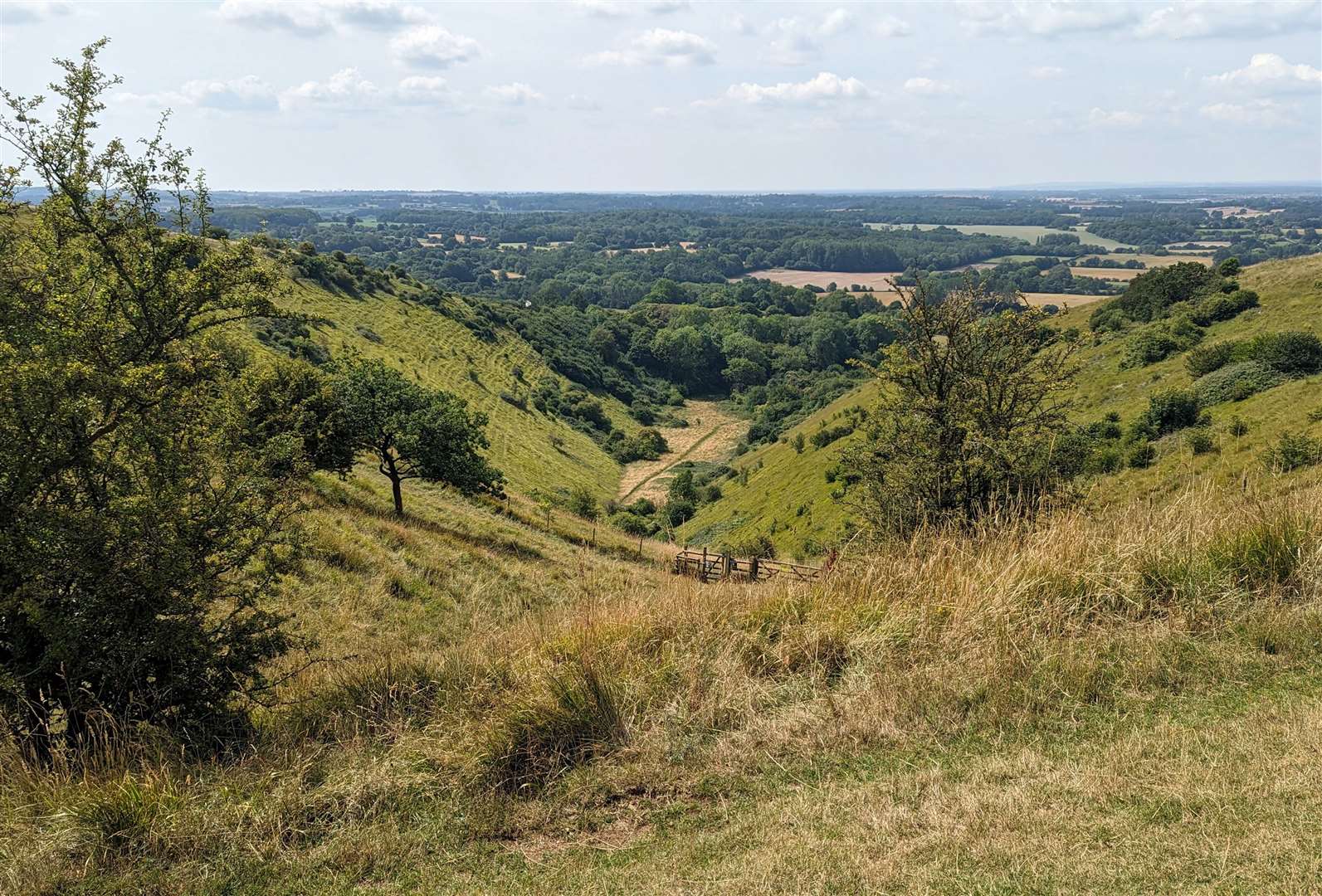
One of the natural highlights of this walk is the Devil’s Kneading Trough. One of the largest and most famous steep-sided dry valleys that characterise the Kent Downs, it is a truly spectacular natural feature from where, on a perfectly clear day, you can see as far as the English Channel. Kent’s topography may be relatively low-key, but it’s a great reminder that there are still spots of wonder in the landscape.
From here to the top of the Wye Crown the path is well marked and maintained. Stop to take in the views before following the way back down to Wye itself and a well-earned stop at the Tickled Trout or one of the village’s other watering holes.
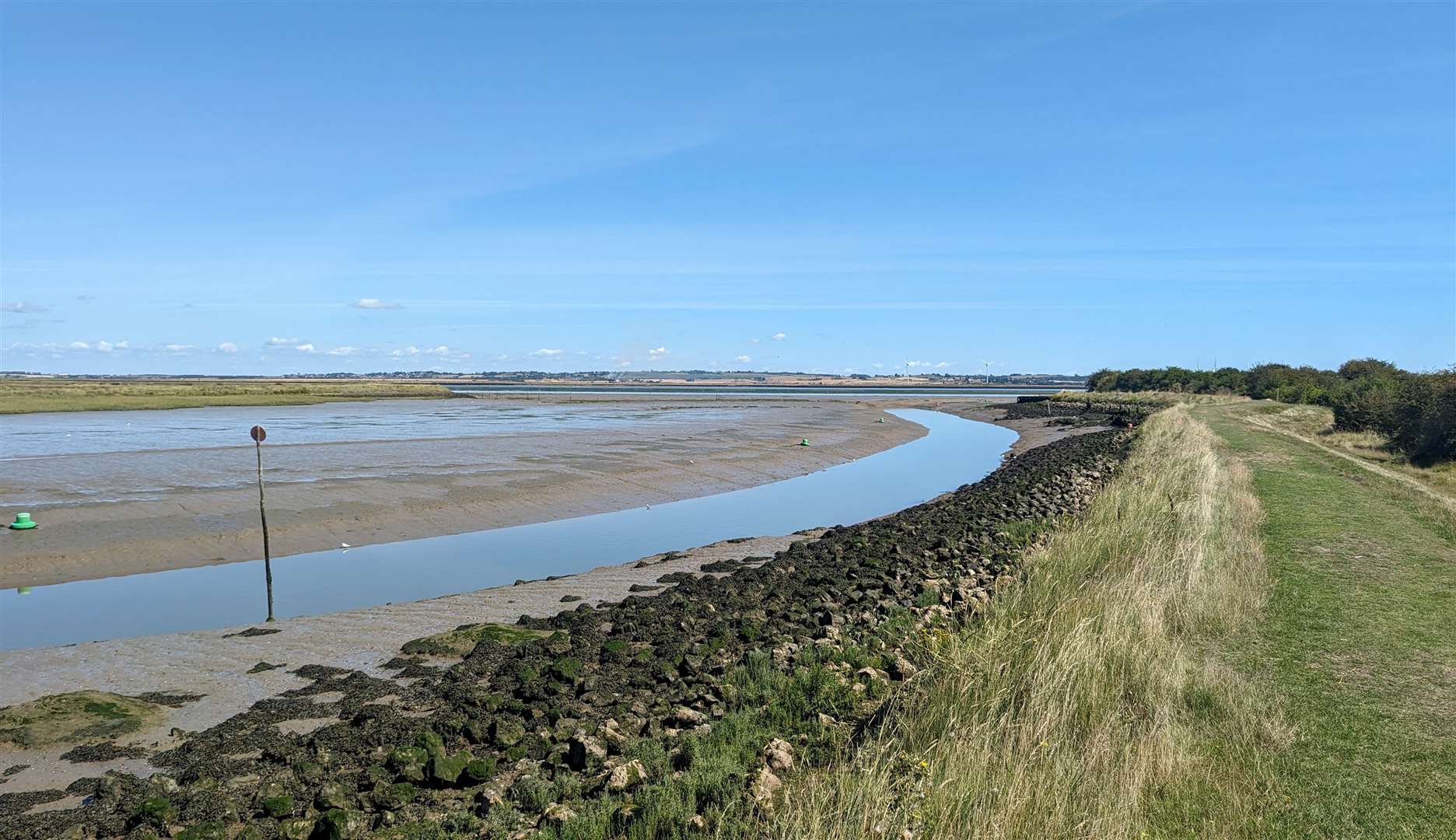
The Saxon Shore Way and Oare Marshes Nature Reserve
This walk starts at Teynham railway station, heads through the charming creekside hamlet of Conyer, before following the Saxon Shore Way along the southern edge of the Swale tidal channel towards the Oare Marshes Nature Reserve at the mouth of Faversham Creek.

The skies here are absolutely huge. To my right when I took this walk earlier in the year were the low-lying marshes, with sheep and cattle grazing in the middle distance, to my left the occasional boat picking its way along the narrow navigable route left passable by the low tide.
The coastal path bisects the two, running along the crest of the earthworks built to hold back the waters of the Swale and protect the farmland below.
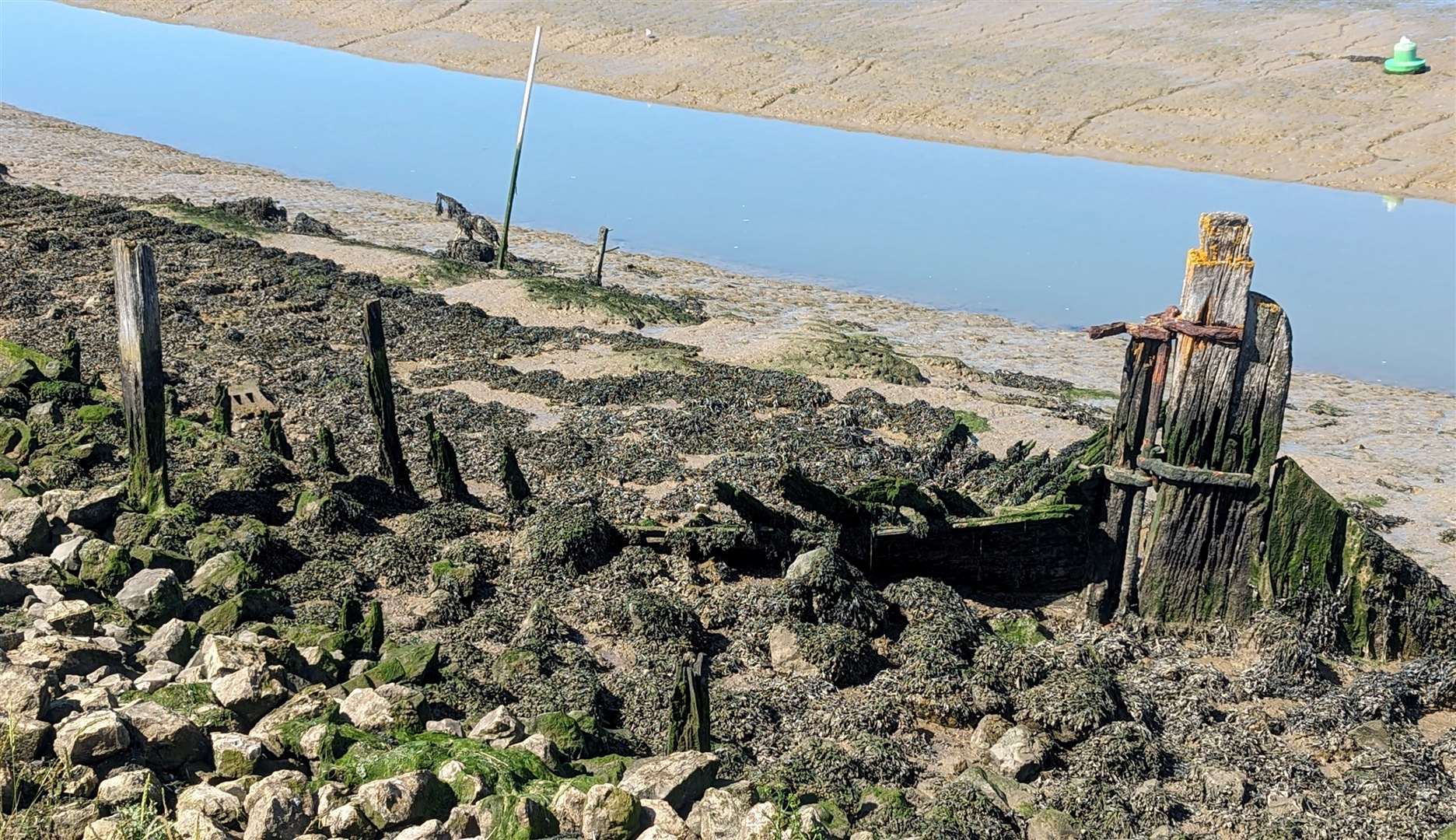
Reaching the creek, the route swings south past boatyards and slowly decaying wrecks of old vessels, before reaching the village of Oare and the promise of a well-deserved pit stop. The Three Mariners had the kerb appeal to lure me in, but there are other well-recommended options in the area too.
The last leg of the circular route back to Teynham, up and down country lanes and along the occasional footpath across fields, is rather less dramatic than the earlier hours spent skirting the Swale. But the walk as a whole – about 19km or so, all told – is an absolute delight.