GO AD FREE | Get your Digital Subscription for only 50p a week! Use code SUMMER
GET STARTEDMore on KentOnline
GO AD FREE | Get your Digital Subscription for only 50p a week! Use code SUMMER
GET STARTEDMore on KentOnline
Once at the forefront of Britain's defences, warding off everyone from the Romans to the Nazis many of Kent's fearsome forts now sit decaying, some swallowed by the land they once protected.
Lynn Cox explores their hidden history from Henry VIII to nuclear threats... and even a fort which kept sinking.

Fort Bridgewoods, Rochester
Built on land purchased by the War Office in about 1860 and forming part of a protective ring around the then Royal Dockyard at Chatham work on this Victorian fort in Maidstone Road began in 1879 but came to a stop five years later when the money dried up.
Construction was hurriedly resumed in 1892 when a new invasion threat came from France.
It was envisaged that a line of forts would stretch from the River Medway to the Thames, but lack of cash meant only five of the original large forts and two small ones were built.
Work was done by prisoners but by the time Bridgewoods was completed France was an ally and the new enemy was Imperial Germany.
Money problems saw certain parts finished with dirt.
A large prison was built on the hill above it near Borstal to house the workforce. This later became a young offenders institute which gave birth to the blanket term 'Borstal', used across the country to describe youth incarceration.
Bridgewoods was one of four forts – Horsted, Luton and Borstal were the others – which were linked by a small railway, hauled by prisoners, to move building materials between the sites. The railway remained in use until about 1905.
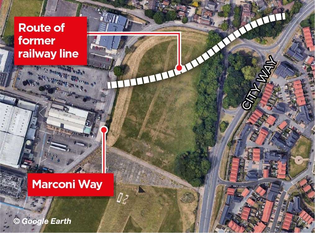
The line of a section of the track between Bridgewoods and Horsted can still be seen from the air, as it curves away in a south westerly direction from the junction of City Way and Marconi Way in Rochester.
Until the outbreak of the First World War, the fort was only sporadically garrisoned.
In the early part of the 20th century Royal Engineers mined and blew up one corner of the fort during a field exercise.
With repairs undertaken the fort slipped into obscurity but would go on to be used for radar trials, anti-aircraft efforts and even a Home Office control centre for south east London for the event of a nuclear strike.
A large fire ripped through the building in 1982 and in 1988, despite being listed as of historic interest, the fort was demolished and nothing of it can now been seen.
However, it is rumoured some of the forts underground portions may have survived.
The site is now a small industrial estate, which kept the fort's name and houses a Royal Mail depot, a fruit distribution business and several other firms.

Shornemead Fort, Higham
Built in the 1860s as an artillery fort it was designed to guard the entrance to the Thames from attacks from France.
It is situated on the south bank of the river where the Thames curves sharply north and west and gives the fort long views of the river in both directions.
Its third and final iteration was built between 1861 and 1870 for £211,063 (£25 million in today's money) and despite the long-running use of the site it's location on marshland led to major problems with subsidence.
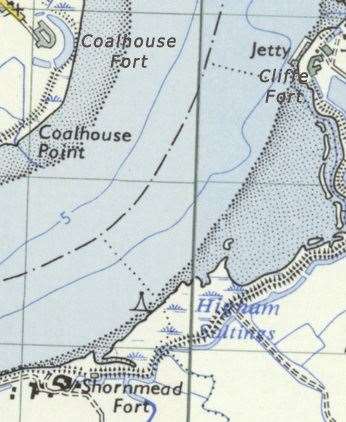
The fort and its counterparts at Coalhouse Point and Cliffe were designed by Captain Siborne of the Royal Engineers.
Originally the river was guarded by a number of forts built around Gravesend and Tilbury in the 16th and 17th centuries but these were no match for new technology.
At this point the first artillery battery was established at Shornemead in 1795-96, during the Napoleonic Wars, along with two others at Lower Hope Point on the Kent side and Coalhouse Point on the Essex side.
The first Shornemead Fort had a barracks, magazine and even walnut trees, which were planted nearby to supplement the food supply and provide wood for the stocks of soldier's muskets.
After the defeat of Napoleon the battery was abandoned, but rebuilt in the mid-1840s, along with Coalhouse Fort.
A government report in 1860 into emerging threats recommended a triangle of forts in the area so Coalhouse and Shornemead were replaced and a new fort was built at Cliffe.
Originally it was intended that they would form part of a line running all the way to Chatham, but the rest of the chain was never built.
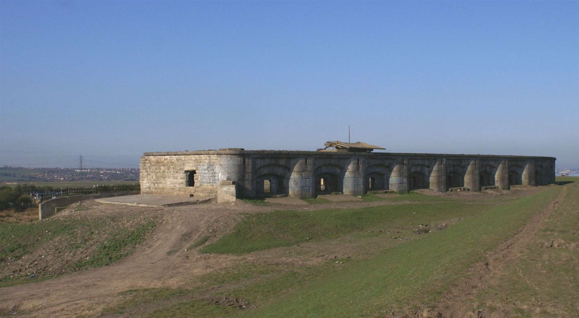
While strategically in a great spot the extent of the subsidence at Shornemead meant it became unsafe for the guns to be fired and it was disarmed by the early 20th century, temporarily coming back into use as a training facility and during D-Day.
The fort is now in a mostly destroyed condition with only a few ruins above ground which are vulnerable to vandalism.

The magazines still exist below ground but they are flooded and were apparently sealed off in 2008.
The site can be visited by the public, as it is now part of the Royal Society for the Protection of Birds' Shorne Marshes Nature Reserve.
And over the years, people have regularly explored what's left of it including it's flooded underground tunnels (not as sealed off as they are meant to be) and four years ago Charley Croker even sent a drone up to capture footage of what the fort looks like now.
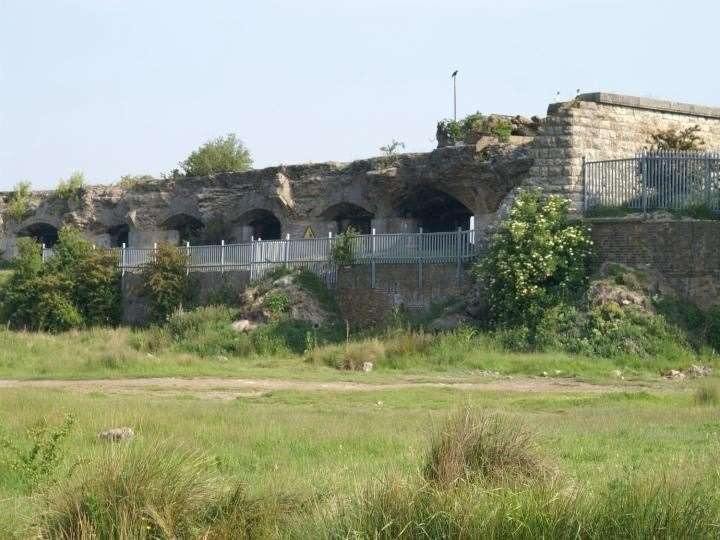
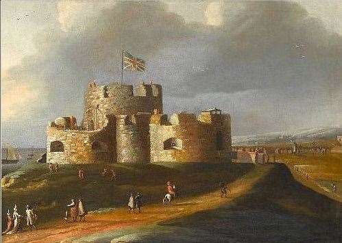
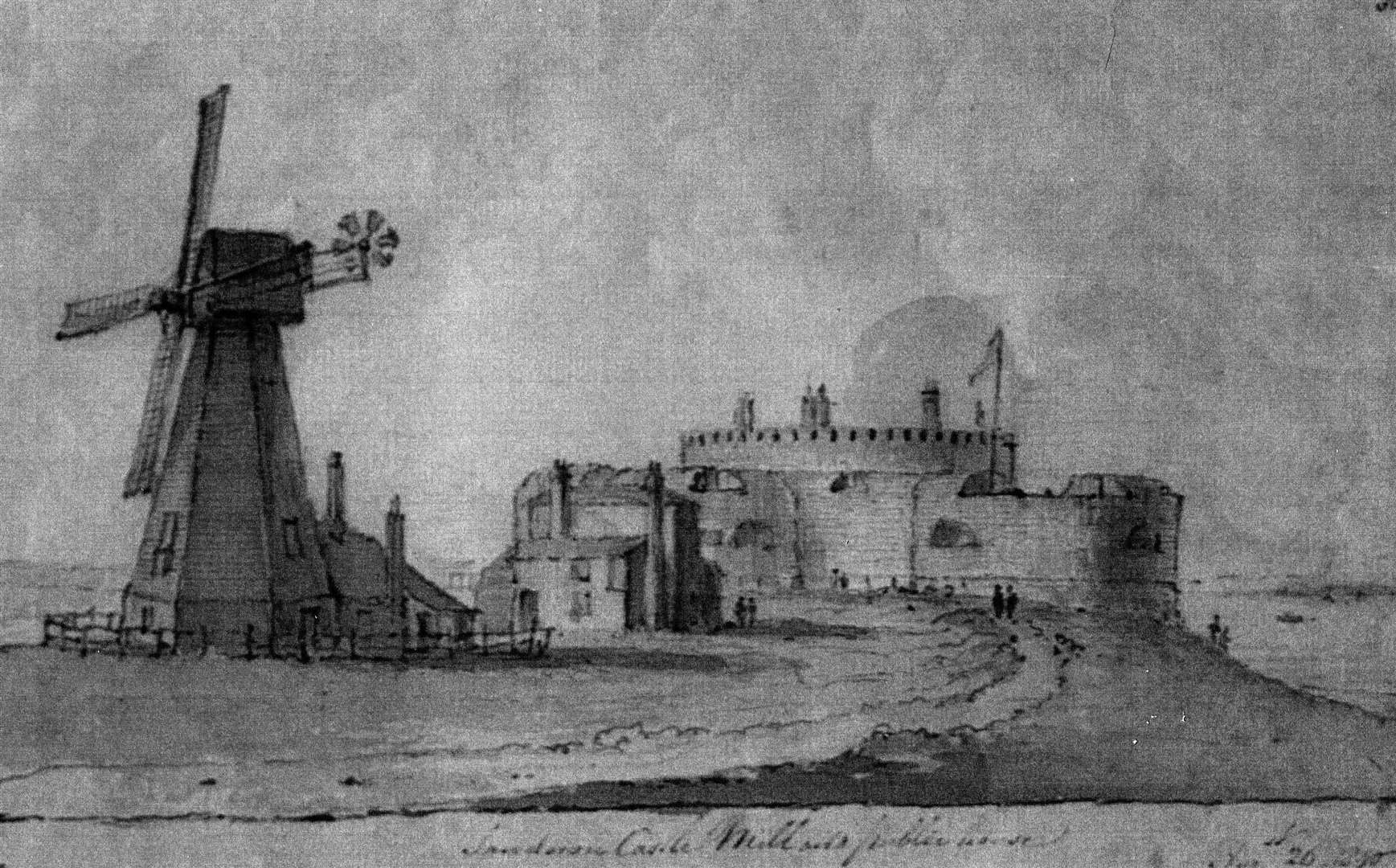
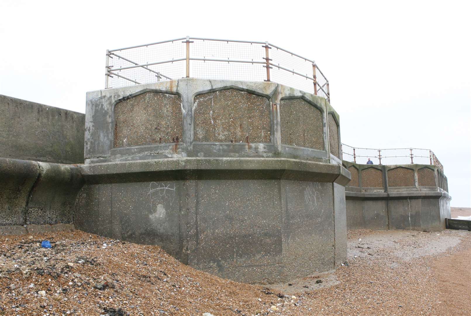
Sandown Castle, Deal
A nephew enraged by his aunt's divorce saw Sandown Castle come into being.
Henry VIII constructed the defence between 1539 and 1540 as part of the King's Device programme to protect against invasion from France and the Roman Empire.
It defended the strategically important Downs anchorage, formed by the Goodwin Sands off the coast.
The fort was built because of a conflict between England, France and Pope Paull III after King Henry VIII broke from the Catholic church to annul his marriage with Catherine of Aragon.
Catherine was the aunt of Charles V, the Holy Roman Emperor, and Charles took the annulment as a personal insult.
This resulted in France and the Empire declaring an alliance against the King in 1538, and the Pope encouraging the two countries to attack England.

Henry then issued an order, called a 'device', in 1539, giving instructions for the "defence of the realm in time of invasion" and the construction of forts along the English coastline.
It cost the Crown a total of £27,092 (more than £11 million in today's money) to build the three castles of Sandown, Walmer and Deal, which were connected by earthwork defences and were collectively known as the Castles of the Downs.
The original invasion threat passed, but during the Second English Civil War of 1648-49, Sandown was seized by pro-Royalist insurgents and was only retaken by Parliamentary forces after several months' fighting.
By the 19th century, the castle was suffering badly from the effects of coastal erosion but remained in use until 1863.
The War Office then demolished the upper levels and carried out a second wave of demolition work in 1882, destroying most of the surviving stonework in 1893.
The remains of Sandown were purchased by the town of Deal for £35 to form part of the local sea defences, some was encased in concrete in the late 1980s to form a sea wall but remains vulnerable to further erosion.
The remains are protected under UK law as a scheduled monument and the area has been turned into a community garden for people to use as part of a coastal park.
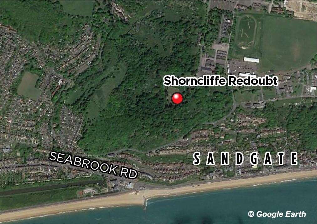
The Shorncliffe Redoubt, Sandgate
This large earthwork fortification was constructed during the early stages of the Napoleonic Wars.
One of the last earthwork forts built it can be attributed to being the original home of the modern British Army as in 1802, Sir John Moore founded a camp there for light infantry.

It was a world first and is seen by many today as a World Heritage site.
In the early 1790s, with France having declared war on Britain, our land-based defences were inadequate and Britain had always relied upon the Royal Navy for its defences.
So to get ready for invasion in 1794, parliament acquired a large piece of land at Shorncliffe, as it was only 20 miles away from the coast of France. People living in the area could actually see smoke from camp fires of Napoleon's waiting army.
A few years later, more defences were added along the coast including the 28-mile-long Royal Military Canal and Martello Towers.
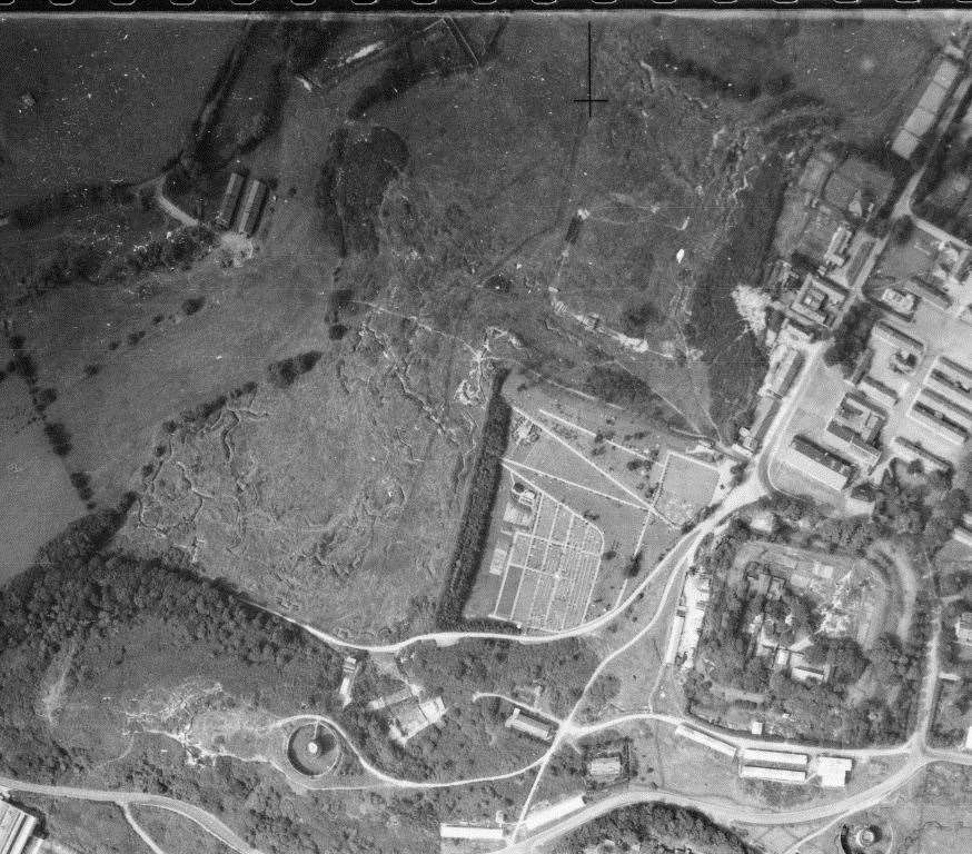
Extra strong walls, blast-proof foundations and a five-metre deep ditch made the fort stand out.
While some maps of it show fortified magazines, archaeological digs have failed to find them and it has turned out the maps were more guidelines for the construction of a much larger fort which was never built.
Shorncliffe Army Camp remains nearby and is still in use. The fort is no longer and has fallen into a state of disrepair.

Channel 4's Time Team featured a dig conducted on the site in 2007.
Reenactment events have been held over the years and the Shorncliffe Trust is working towards creating a Heritage and Education Centre dedicated to the history and legacy of the modern British Army.
However, most of the MoD land is now owned by Taylor Wimpy which has built a large new housing estate around it and more homes are being built near the site still today.
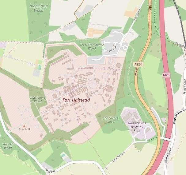
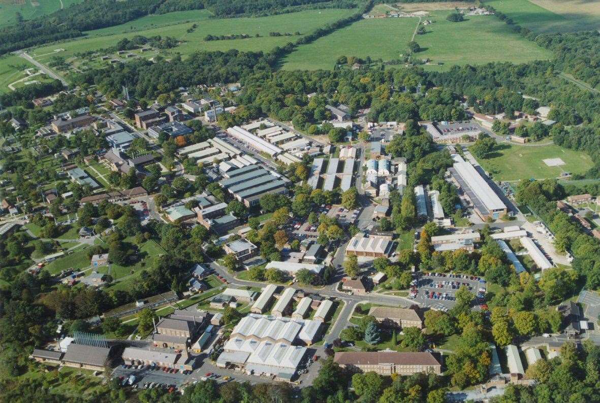
Fort Halstead, Sevenoaks
Sat on the crest of the Kentish North Downs, overlooking Sevenoaks, and originally constructed in the late 1890s as part of a ring of fortresses around London, Fort Halstead was to be manned by volunteers in the event of any crisis.
It formed part of the London Defence Positions, a scheme implemented by the Secretary of State for War, Edward Stanhope, in 1889.
The idea at the time was to dig a line of entrenchments in the event of any conflict to protect the southern and eastern approaches to the capital.
To support this, it was intended 13 simple forts, known as Mobilisation Centres, would house the tools, ammunition, stores and men of the volunteer force, who would be tasked with digging the trenches and manning them.
But eventually the Royal Navy's superiority saw the threat of invasion decrease to such an extent the scheme was abandoned during the early part of 1906.
Some of the Mobilisation Centres were sold off, but Fort Halstead was kept.
At the outbreak of the First World War it was decided the London defence scheme would be revived and many of the planned trenches were actually dug.
It was about this time the fort reverted to its original role and in 1915 a lab was built inside it so ammunition could be inspected.
In 1921 it was sold to a retired colonel who lived in the laboratory and let out the cottages to others. The rest of the site was used for camping and to house refugees.

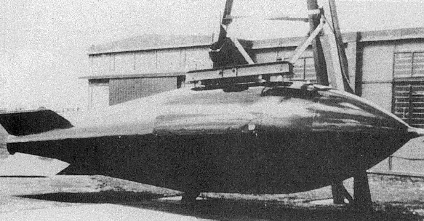
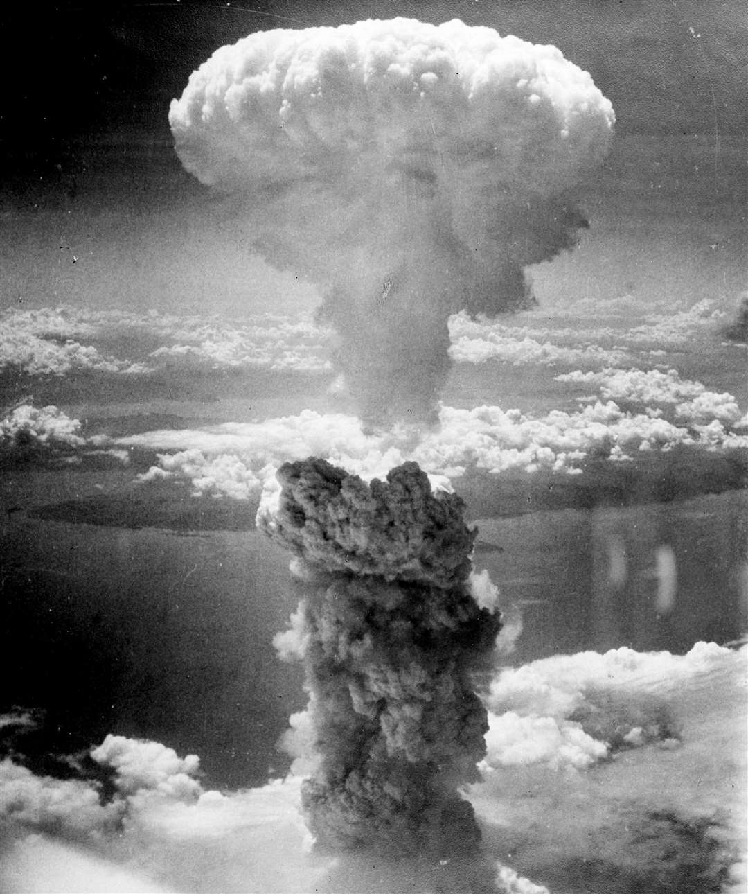
In 1939 the Ministry of Defence decided to buy it again and use it for work on anti-aircraft rockets and for research.
It is understood the development of Britain's atomic bomb, hidden under the name High Explosive Research (HER), was initially based at the fort. The bomb was taken to Australia and exploded in the Montebello Islands.
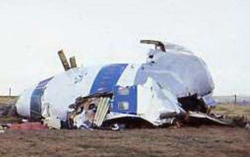
Since then the Royal Armament Research and Development Establishment (RARDE) was based at the fort and, among many projects, conducted examinations of crash debris from the December 1988 Lockerbie bombing and developed a video game to train troops ahead of the Gulf War.
The site's explosives lab was again used in the probe following the attempted London bombings on July 21, 2005.
Once one of the largest employers in Sevenoaks, at one time providing 1,300 jobs, the site has now been sold off and is set to become a housing development. To find out more, click here.


