More on KentOnline
More on KentOnline
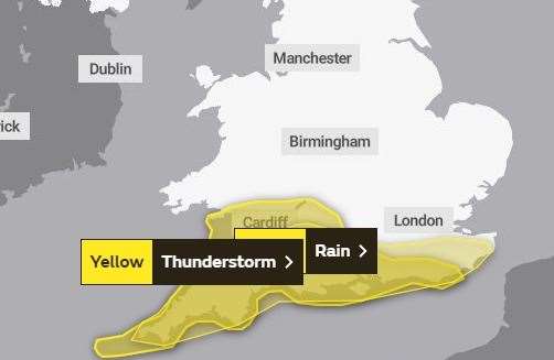
A warning has been issued about potentially heavy thunderstorms sweeping across Kent and most of southern England.
Forecasters at the Met Office are predicting heavy rainfall tomorrow afternoon.

The yellow warning is in place from midday until 10pm with some areas possibly experiencing up to 60mm of rain.
While many place will "miss the worst", said the Met Office, there will be "scattered torrential thundery downpours".
These may cause flooding to roads with spray and sudden flooding leading to difficult driving conditions and some road closures, the Met Office said.
A warning has also been issued for a chance of homes and businesses becoming flooded quickly in the downpours with damage possible from floodwater, lightning strikes, hail or strong winds.
The Met Office said: "Following clearance of overnight heavy rain, there is the potential for thundery downpours to develop across parts of southern England on Monday afternoon, lasting well into the evening.
"Where these form, they could prove to be slow-moving and produce large amounts of rainfall, with 20 to 30 mm falling within an hour and perhaps a few places seeing 50 to 60 mm in 2-3 hours.
"Lightning, hail and gusty winds may prove additional hazards in a few locations."
The warning is in place from Cornwall in the west, as far north as Bristol and east into Kent across the south coast in Dorset, Hampshire and Sussex.
For all the forecasts, warnings and weather related news, click here.


