GO AD-FREE. Get 2 Months Digital Subscription for ONLY £1! Use code 2FOR1
GET STARTEDMore on KentOnline
GO AD-FREE. Get 2 Months Digital Subscription for ONLY £1! Use code 2FOR1
GET STARTEDMore on KentOnline
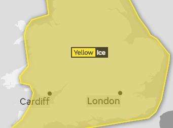
Forecasters have issued a yellow weather warning for ice across the county this evening.
The warning was issued earlier for the whole of the county and ice is expected to form on surfaces from now until at least 11am tomorrow.
Further wintery showers have also been forecast for overnight and Kent's gritters will be out this evening treating the county's main routes and motorists are advised watch out for icy patches.

Further hail, sleet and snow showers are also likely at times and there be a small amount of settling snow about 1cm or less could fall overnight.
Winds will be light and variable and temperatures are likely to fall to -2C.
Roads which have not been treated will be icy as will pavements and cycle paths so people should take care.
Tomorrow will see a frosty start across the county but sunny spells are likely with many places staying dry but some wintry showers are possible in parts of the county.
A sharp frost will return overnight tomorrow and temperatures will not reach over 4C.
From Thursday there will be sunny spells and rain overnight and it will becoming less cold and cloudier on Friday with occasional drizzle, mist and stronger winds.

Rain is expected through Saturday and it will be colder with showers.