GO AD-FREE. Get 2 Months Digital Subscription for ONLY £1! Use code 2FOR1
GET STARTEDMore on KentOnline
GO AD-FREE. Get 2 Months Digital Subscription for ONLY £1! Use code 2FOR1
GET STARTEDMore on KentOnline
The heating has been turned on and the winter wardrobe has emerged from storage - it can only be a British summer.
And while the next few days are expected to stay dry, the wet weather will return in time for the weekend.

According to the Met Office, the rain and cloud will move south this afternoon leaving drier and clear skies overnight
The dry spells will continue through Wednesday and into the start of Thursday. Temperatures will be a warm 20C.
But it will start to take a turn on Thursday as the clouds start to move in from the north.
Showers will return on Friday and are expected to remain across the south of the UK throughout the weekend.
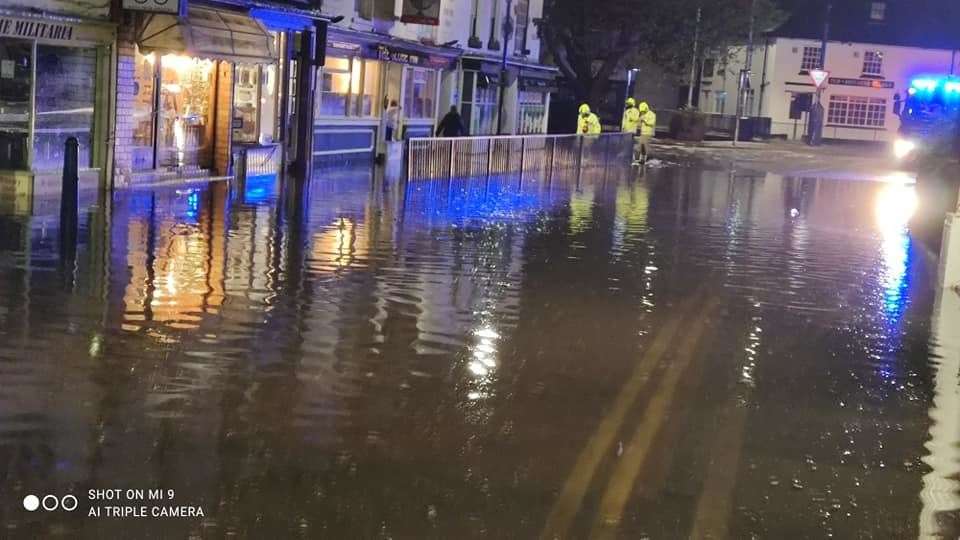
Last week a weather warning was issued for the county of intense thunderstorms.
The council were prepared with sandbags and tankers after warnings that there could be up 30mm of rainfall in an hour.
People in Hythe suffered the most with several buildings flooded and the fire service were called out on two occasions.
Flood warnings were issued on Friday and the bad weather has continued ever since.