GO AD FREE | Get your Digital Subscription for only 50p a week! Use code SUMMER
GET STARTEDMore on KentOnline
GO AD FREE | Get your Digital Subscription for only 50p a week! Use code SUMMER
GET STARTEDMore on KentOnline
In another chapter of our archive series showcasing Kent from the skies, we take a step further back in time and take an aerial look at the county in the 1950s and 60s.
Rebuilding after the destruction left behind from the Second World War was the main focus in some towns, while others were earmarked for huge expansion.
Scroll down to see how Kent's towns looked from above decades ago. Not every part of the county is included as for some areas we sadly don't have archive photos dating back that far.
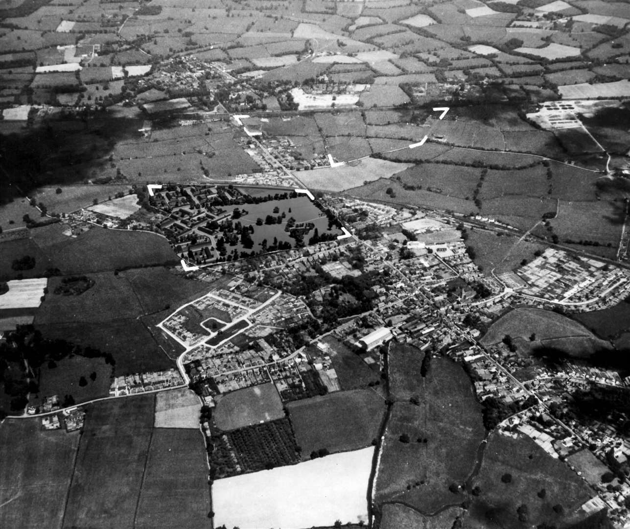
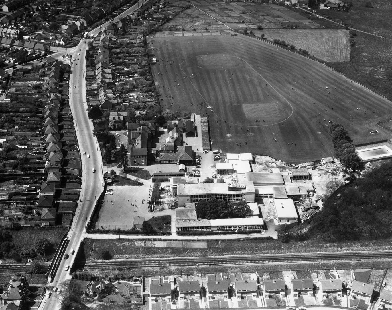
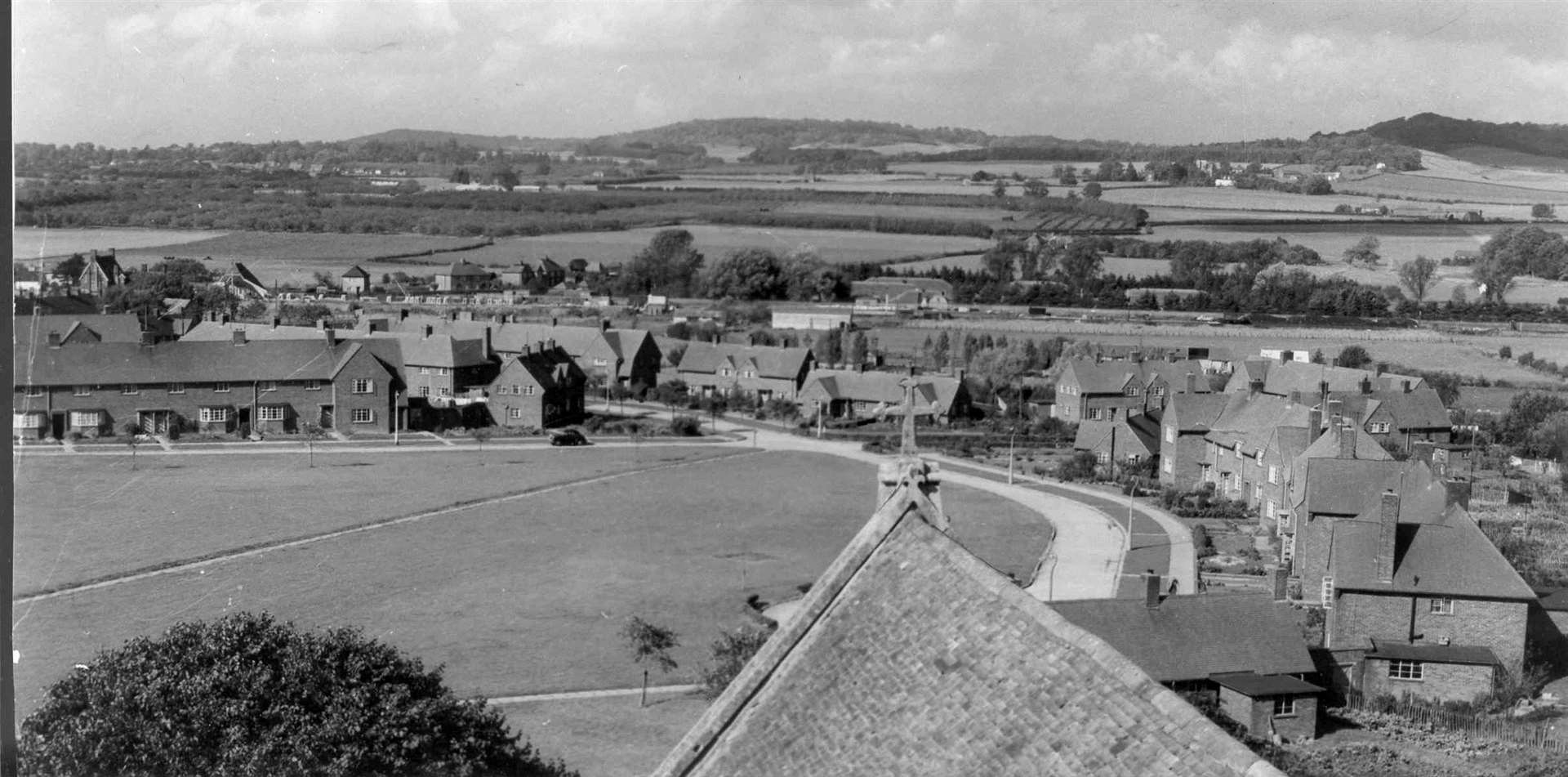
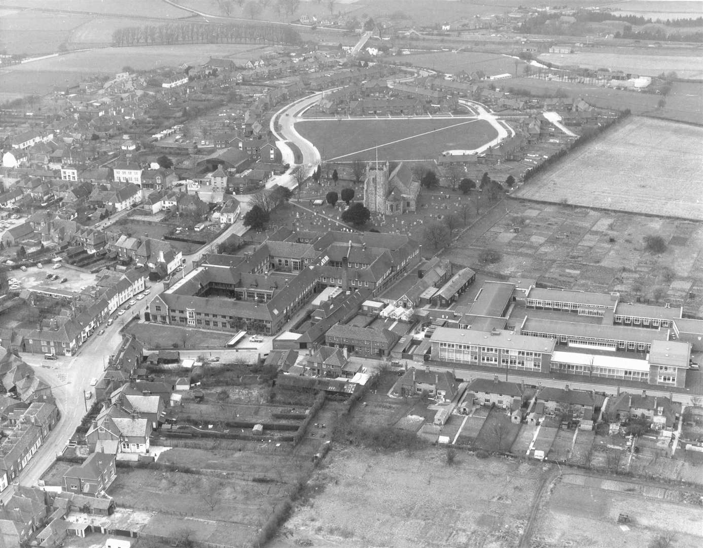
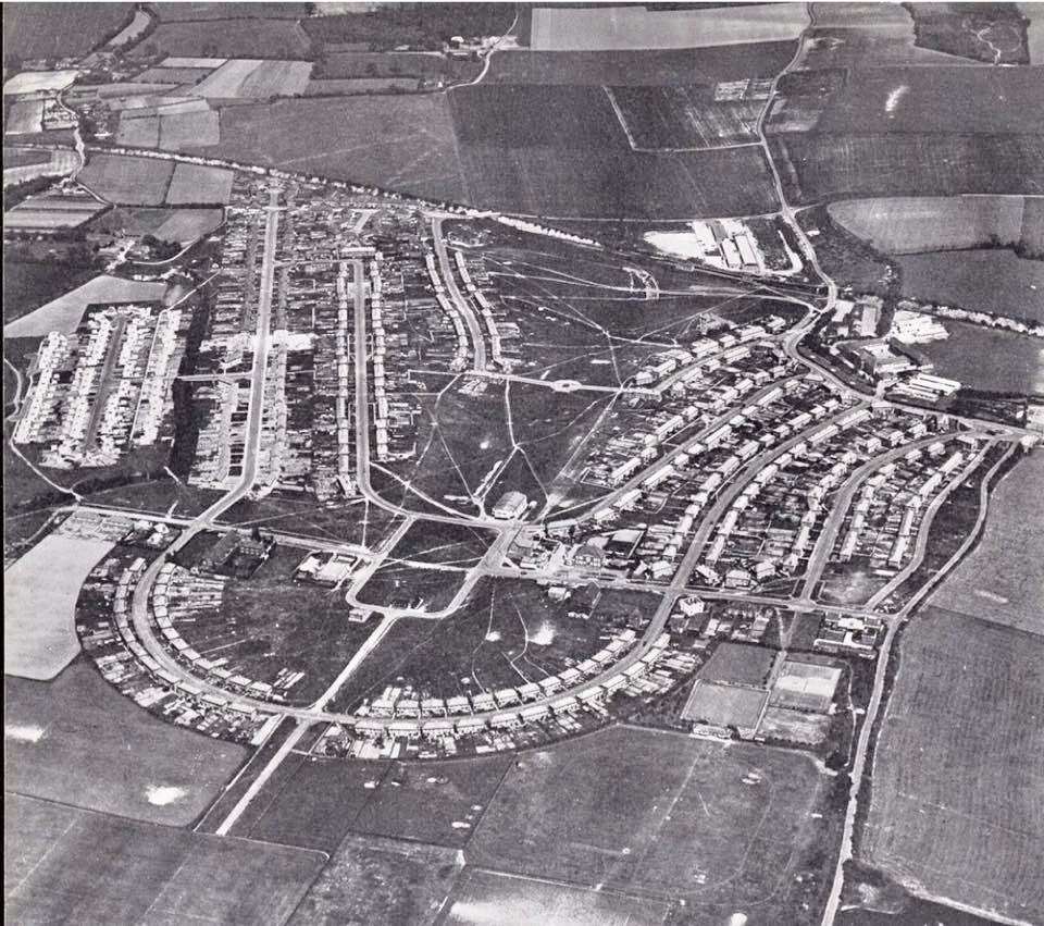
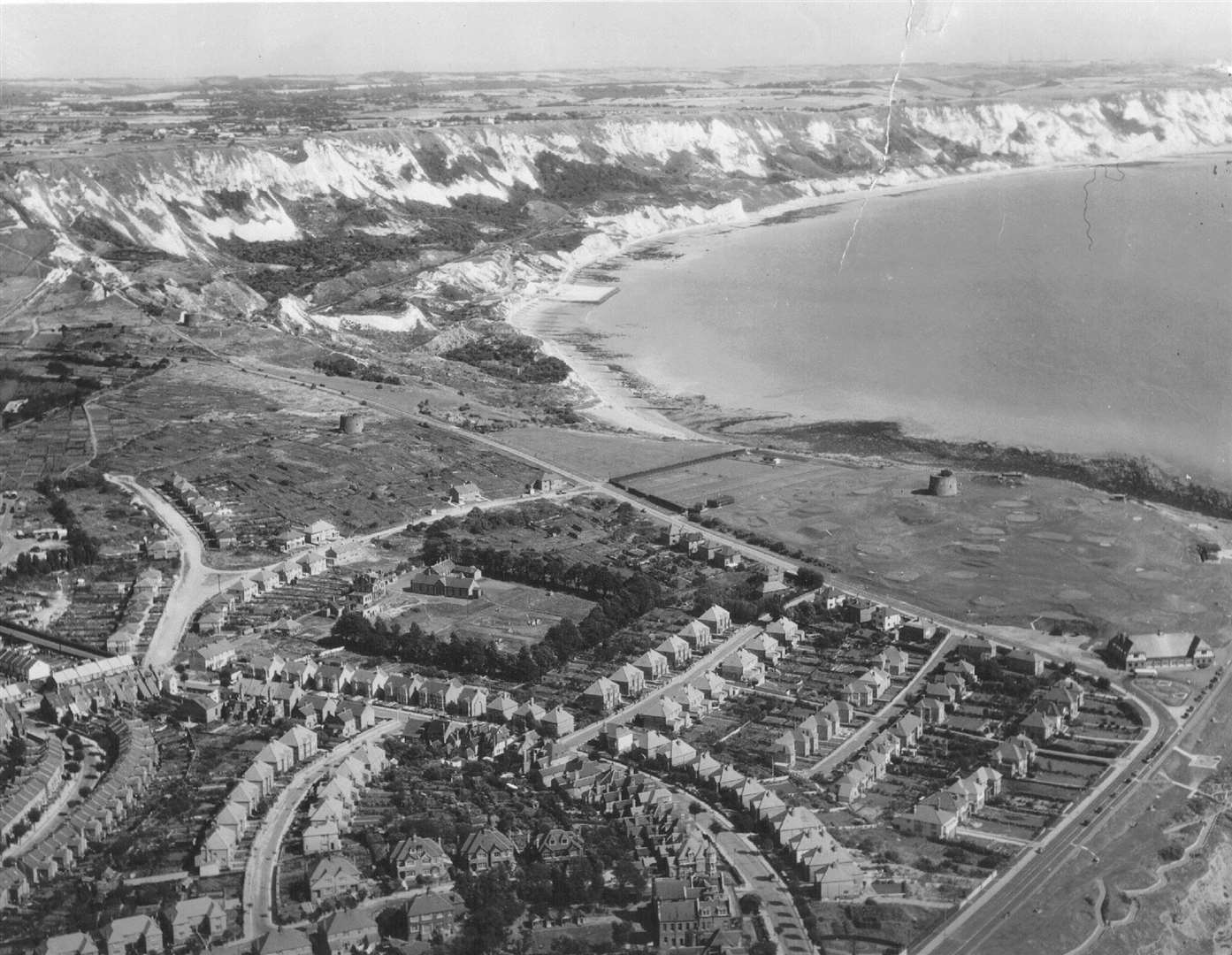
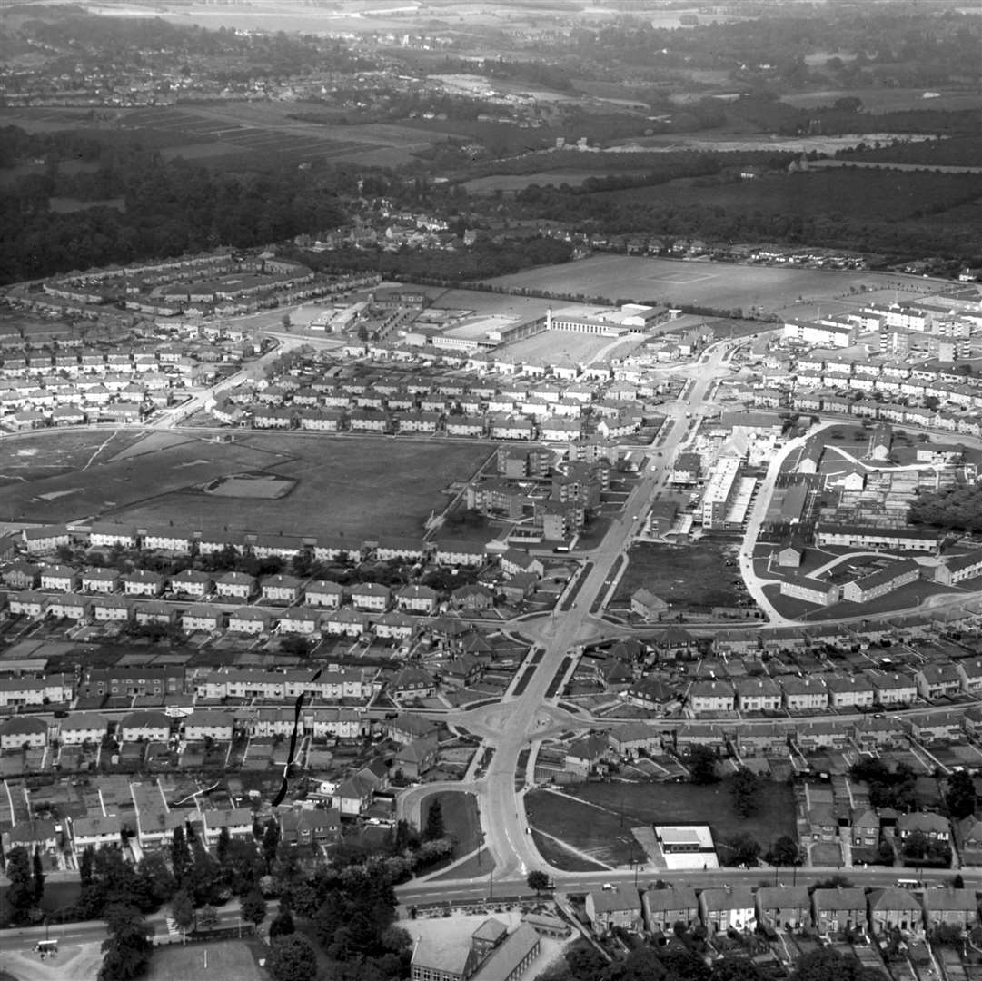
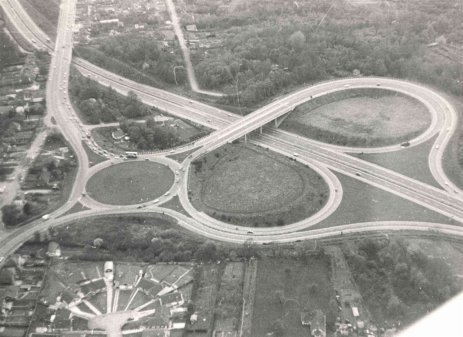
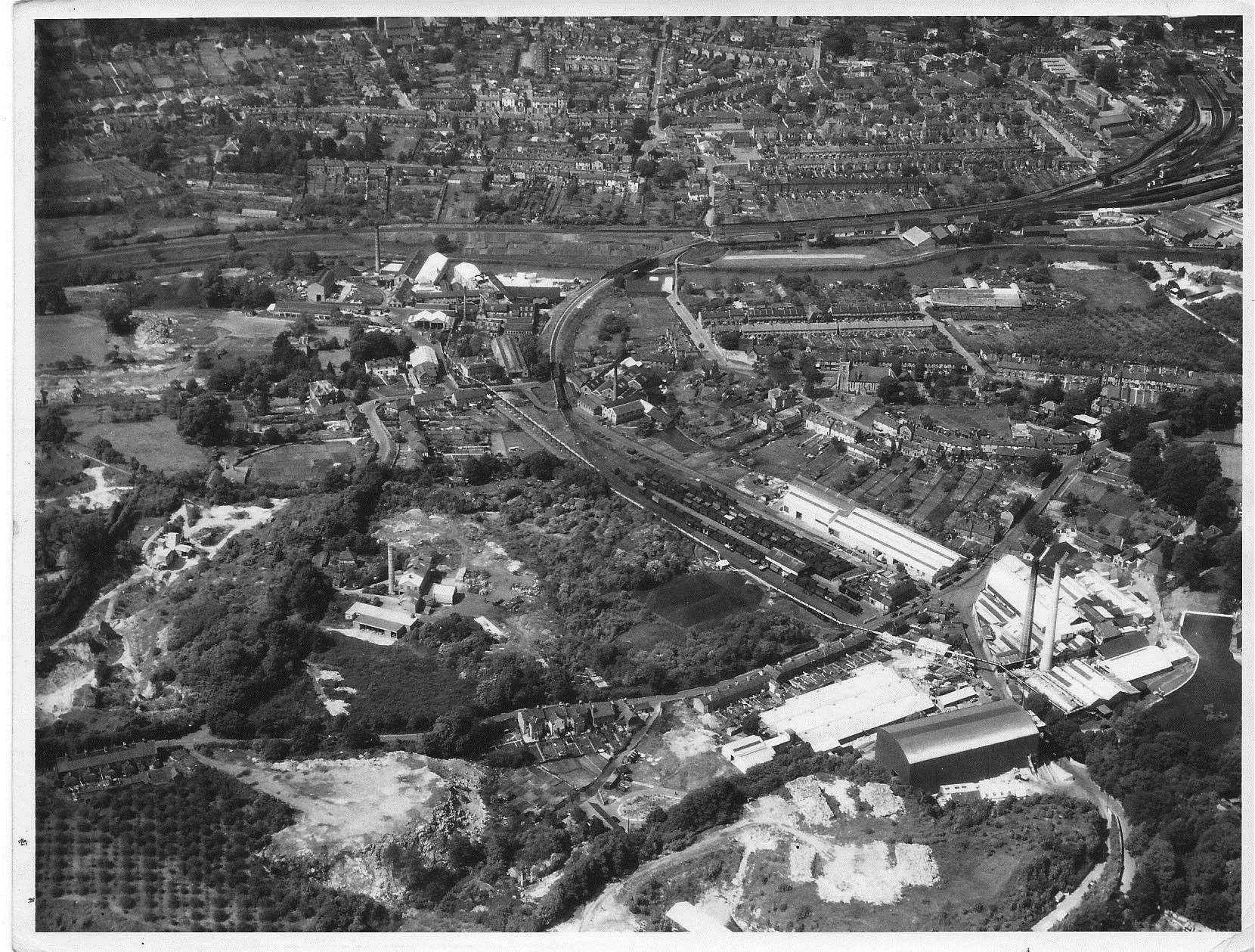
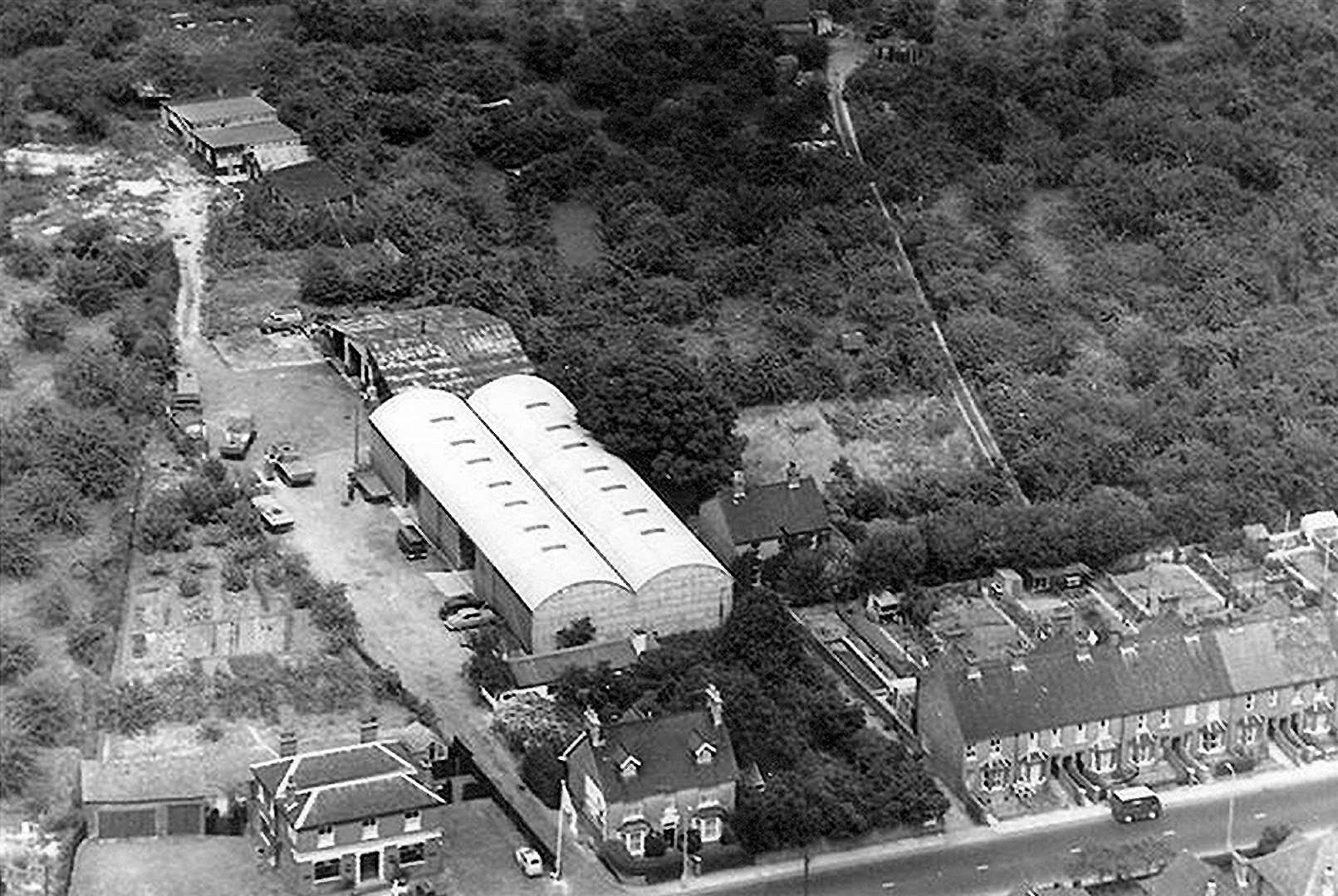
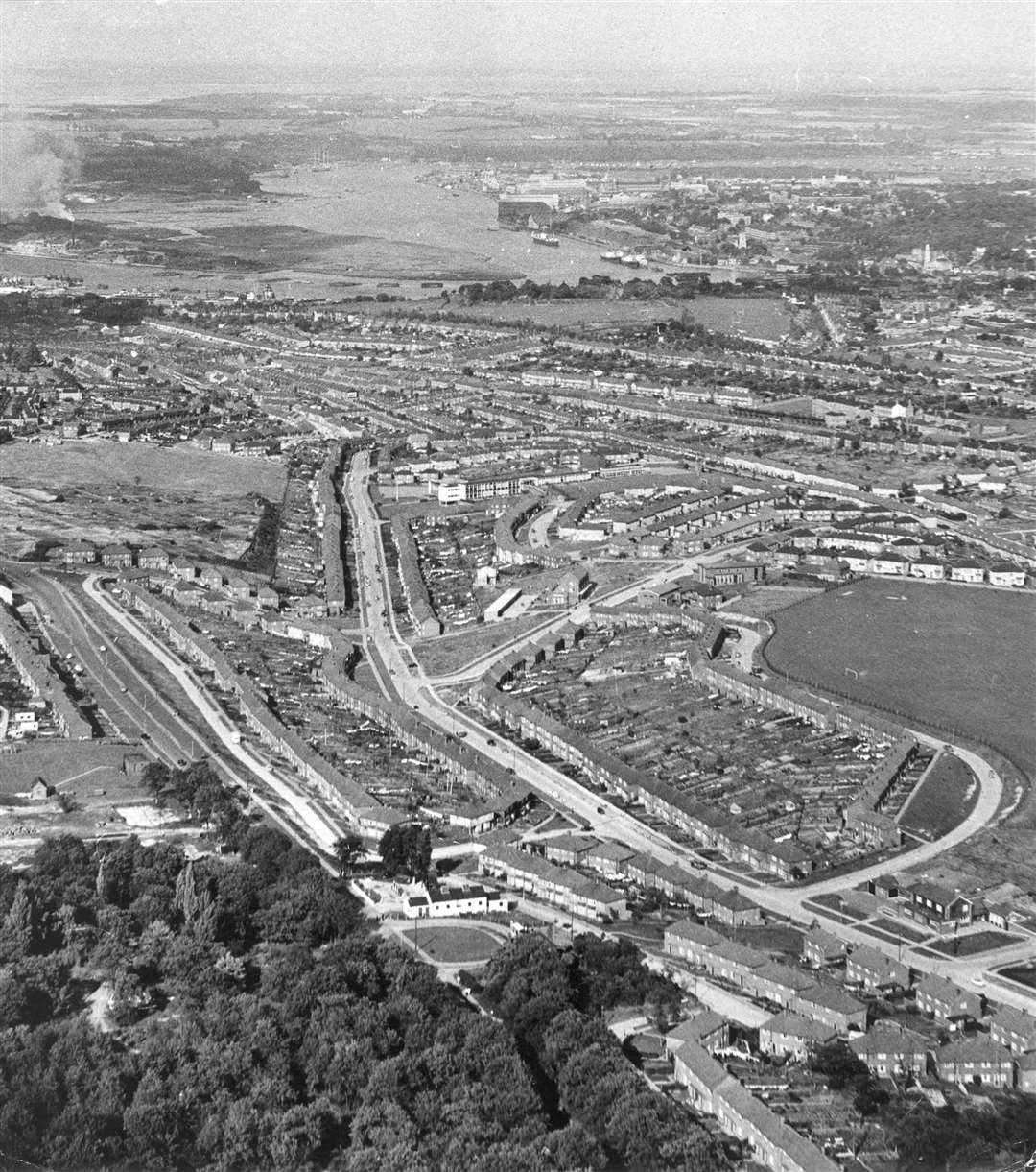
Ashford
Midway through the 20th century, Ashford was perceived as an ideal location to cater for great expansion.
It was decided that 5,000 new homes were to be built as overspill from London - creating most of what is now South Ashford and part of Kennington.
Long-running firm Headley Brothers was printing and exporting more than two million books by the mid-50s, while the Letraset company set up an arts material factory in the town in the 60s.
In 1957, soup manufacturer Batchelors opened up its £2.5 million factory, which is now owned by Premier Foods. And neighbouring that, Proprietary Perfumes Ltd opened a sprawling fragrance, flavour and research facility - now run by Givaudan - in 1962.
The Corn Exchange, on the junction of Bank Street and Elwick Road, was demolished in 1963.
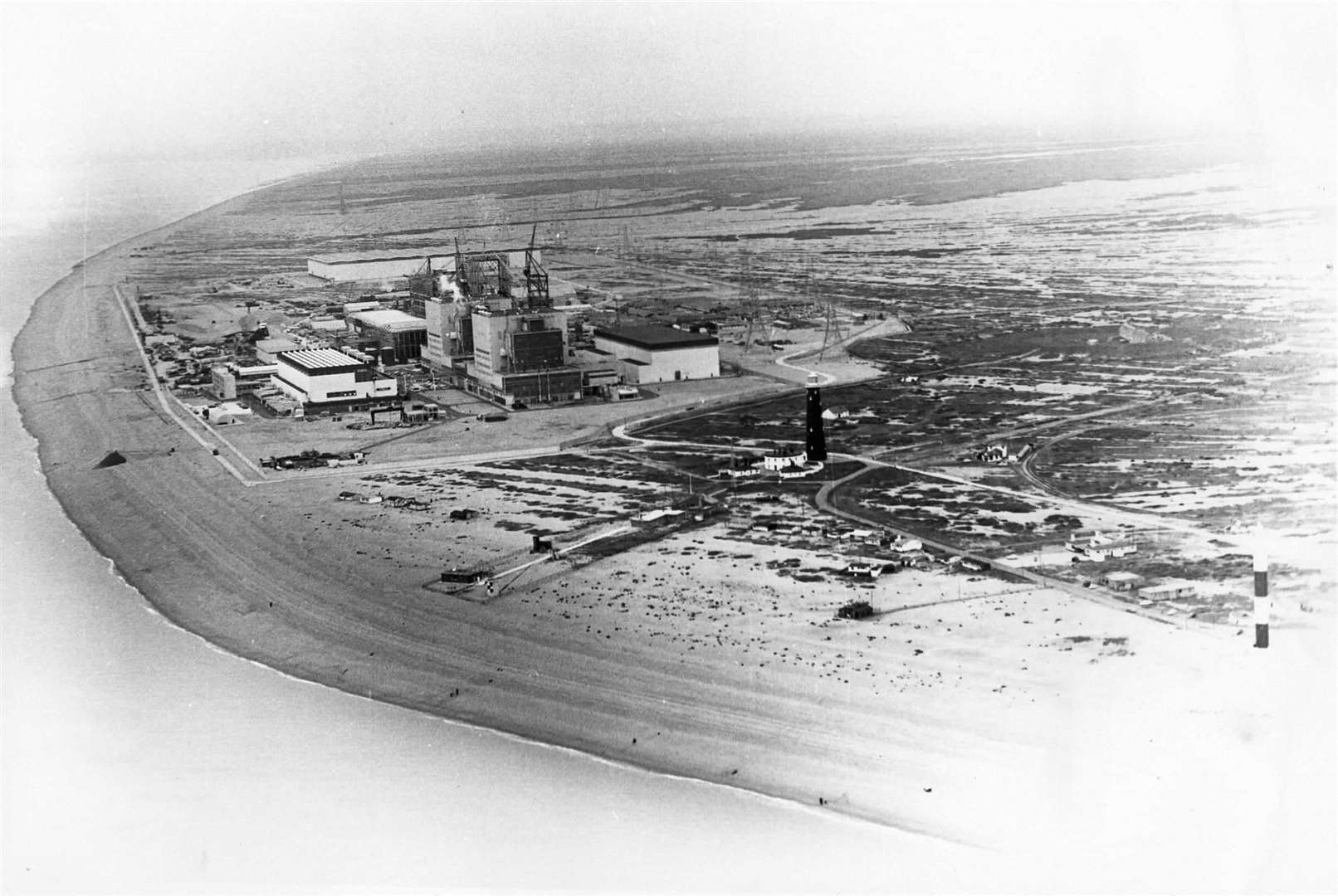
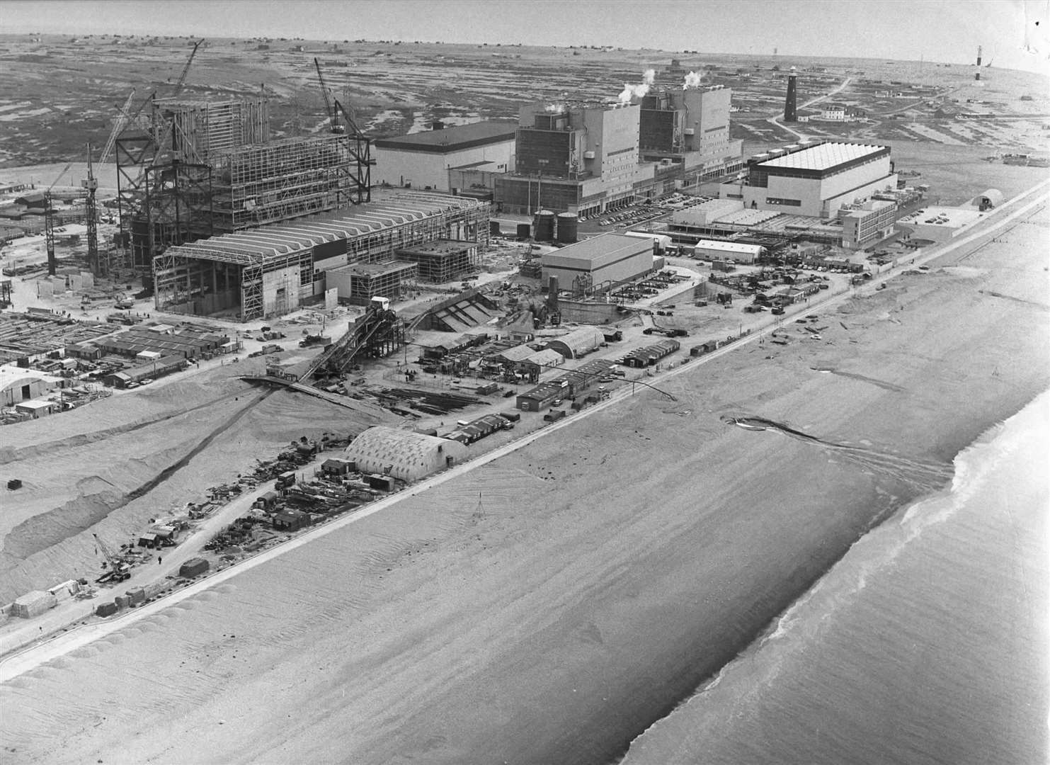
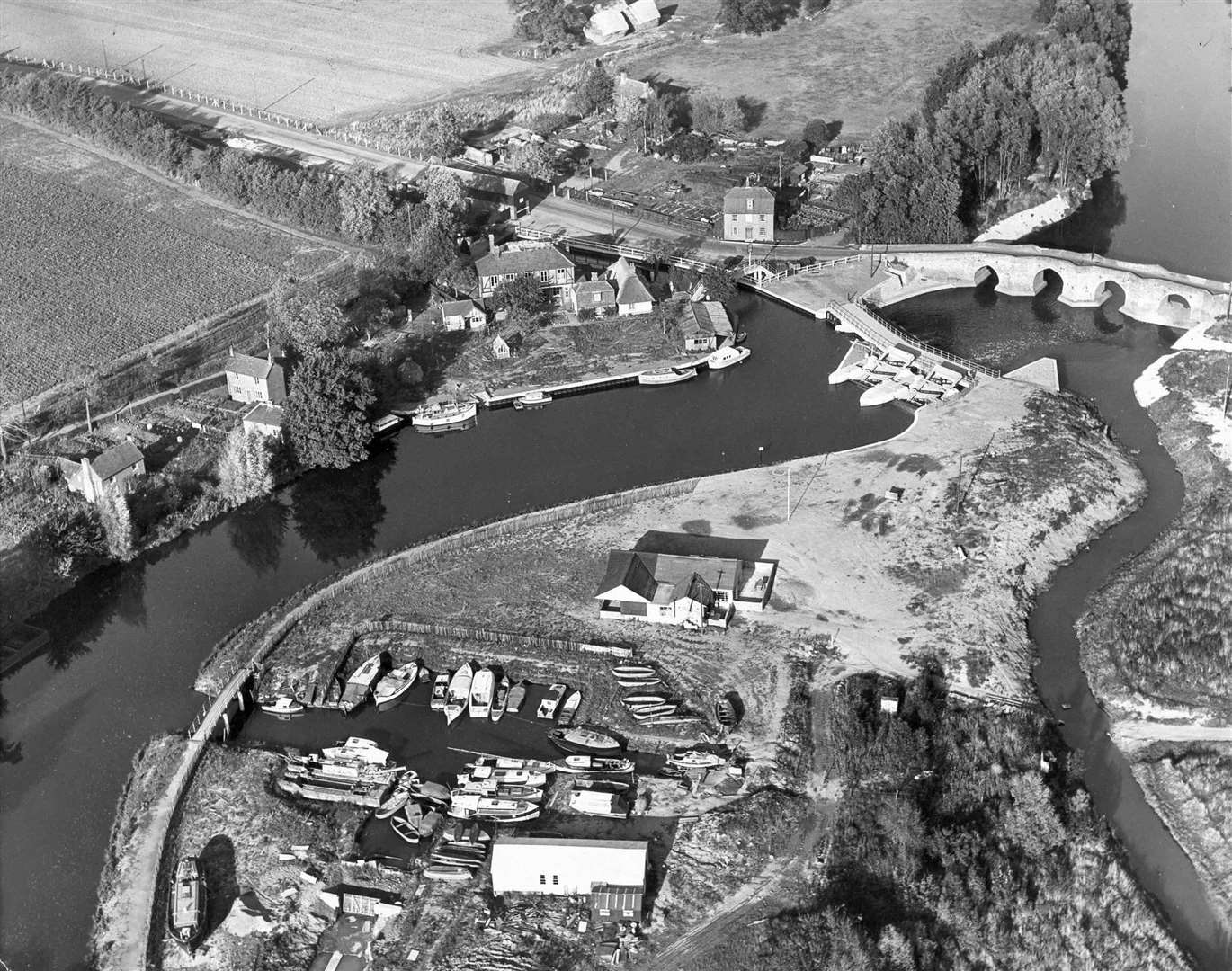
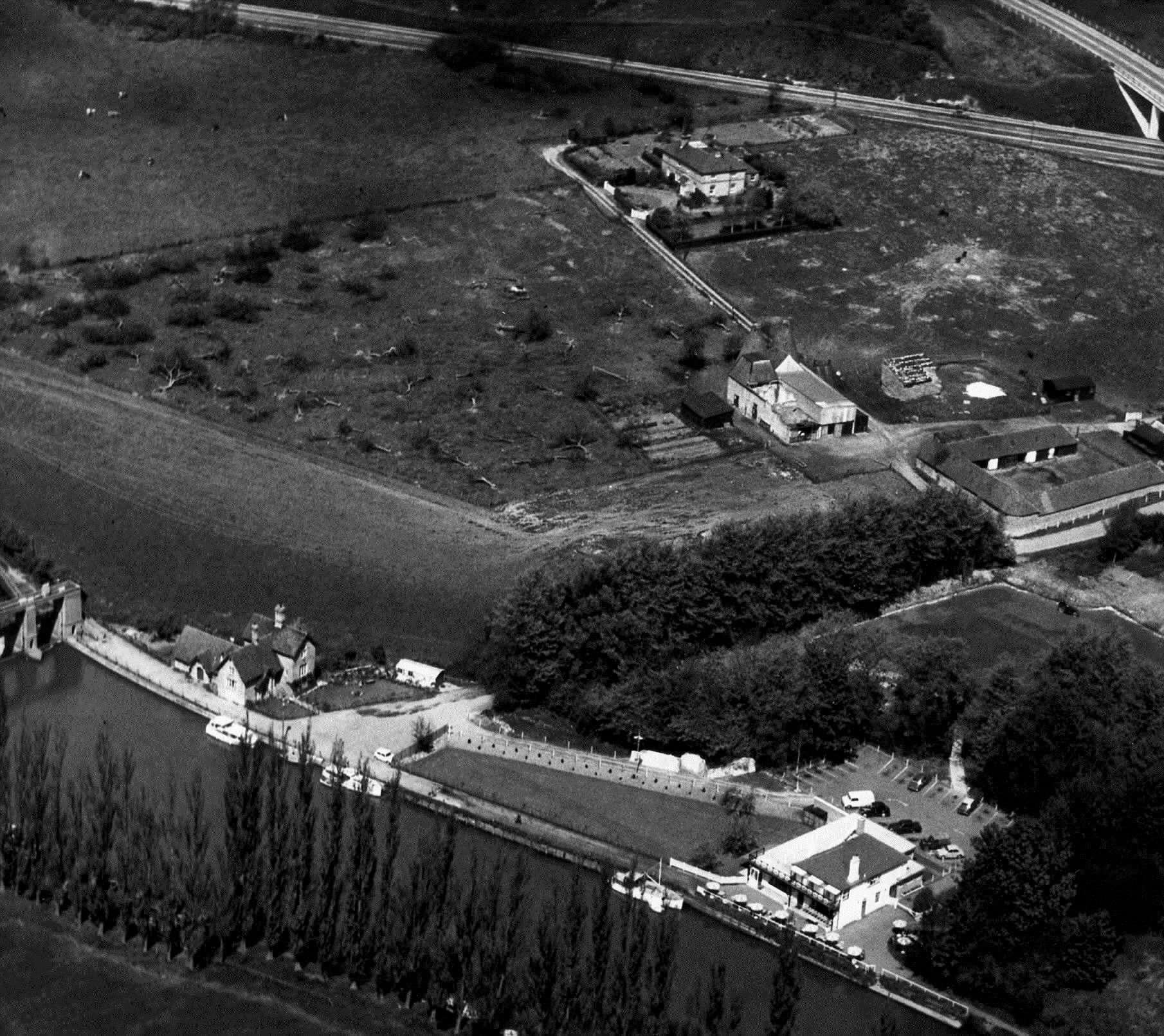
Romney Marsh
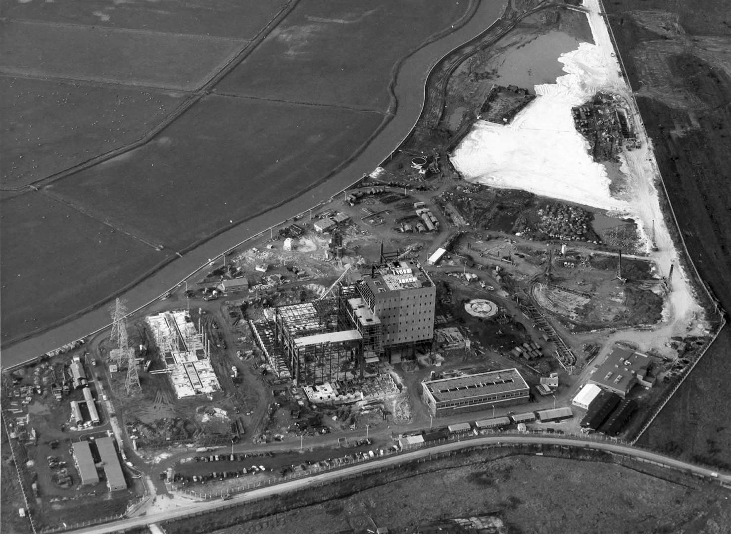
On the tip of Kent's most southerly point, Dungeness nuclear power station opened in 1965.
The power plant is actually a pair of stations, A and B.
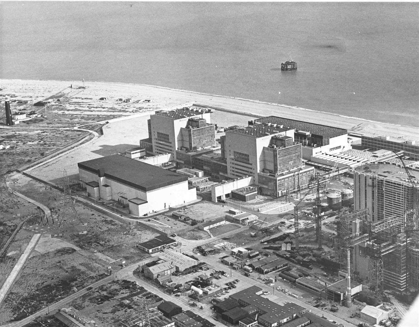
Dungeness A, with its Magnox reactor, became operational in the 60s and finally stopped generating power in 2006 - at that point it was the oldest nuclear power station in operation in the world.
Dungeness B was built in 1966 but didn't start generating energy until 1983.
It has two reactors, which were part of the second wave of nuclear technology known as advanced gas-cooled reactors.
The power station was taken off the grid in September 2018 after cracks and erosion were found on pipes. The site is set to be decommissioned in 2028.
Lydd Airport - under the name Ferryfield - opened for the first time in 1954 after six months of construction work costing £400,000.
Flights to Southampton and across the Channel to Le Touquet, Calais, Ostend and Cherbourg proved very popular and the airport was one of the busiest in the UK by the end of the decade.
It was Britain's first airport constructed after the war and the first privately owned.
Etched into Romney Marsh folklore is the character of Dyn Syn - a fictional smuggler.
The 1960s saw the release of two rival films based on the exploits of the Marsh anti-hero.
Starring Patrick McGoohan, Disney released the much-loved and critically acclaimed Scarecrow of Romney Marsh.
While two years prior, a Hammer Film Productions starring Whitstable legend Peter Cushing movie hit the big screen - albeit with the title Captain Clegg in an effort to avoid copyright issues.
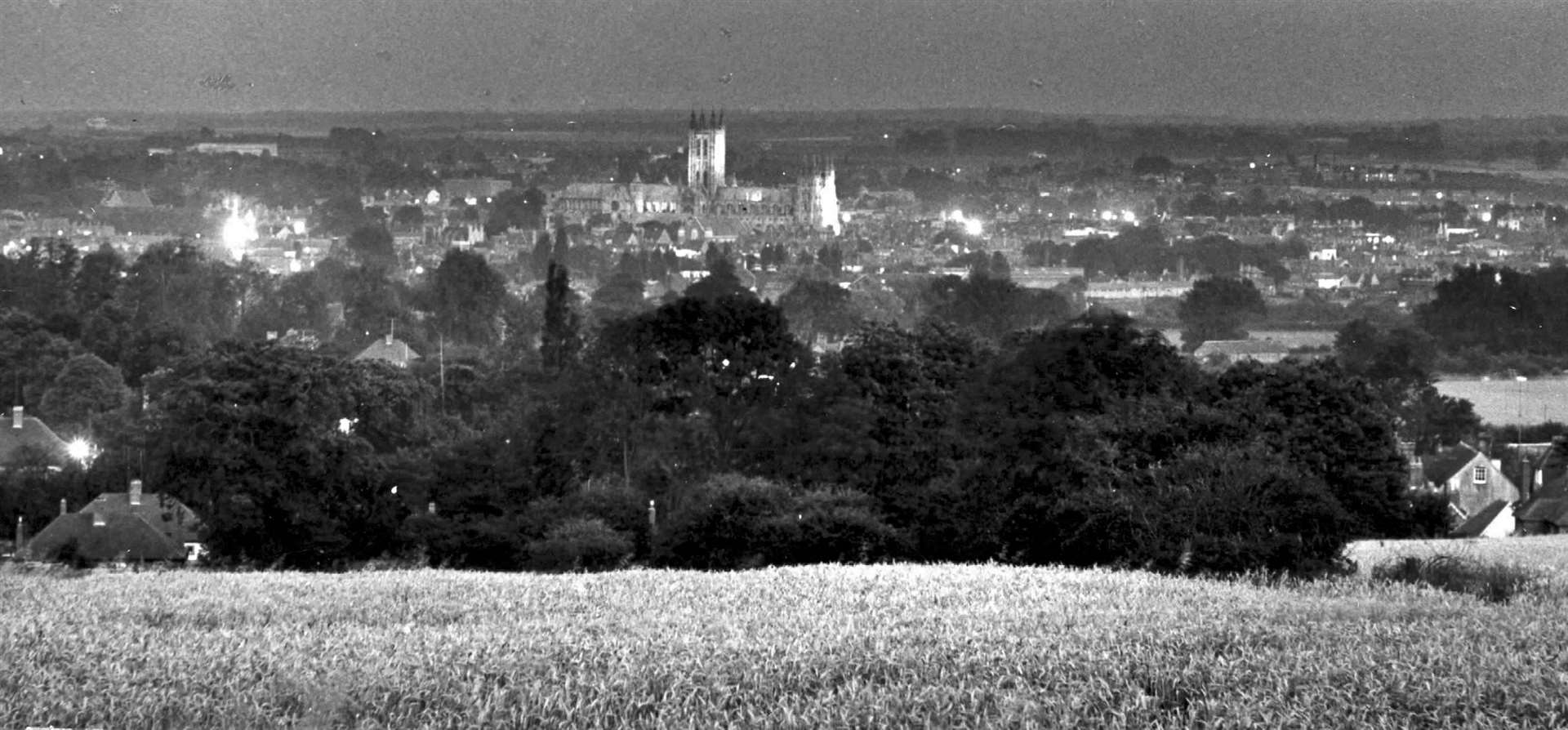
Canterbury & Whitstable
Now a popular walking route, the Crab and Winkle railway line - which linked Canterbury and Whitstable - closed in December 1952.
Known as the "first regular steam passenger railway in the world", the line first opened way back in 1830 with the famous Invicta locomotive.
Passengers were carried until 1931, after which the line was used for goods only. The 50s then spelled the end for the Crab and Winkle.
The following decade also saw the demise of one of Canterbury's great industrial links, when Chislet Colliery closed in 1969.
The once-thriving colliery - where more than 1,000 people worked - became a victim of British Rail's abandonment of steam traction.
Elsewhere in Canterbury, the University of Kent was granted its Royal Charter in January 1965 and the first batch of 500 students arrived in October. It went on to grow at a rapid rate throughout the decade.
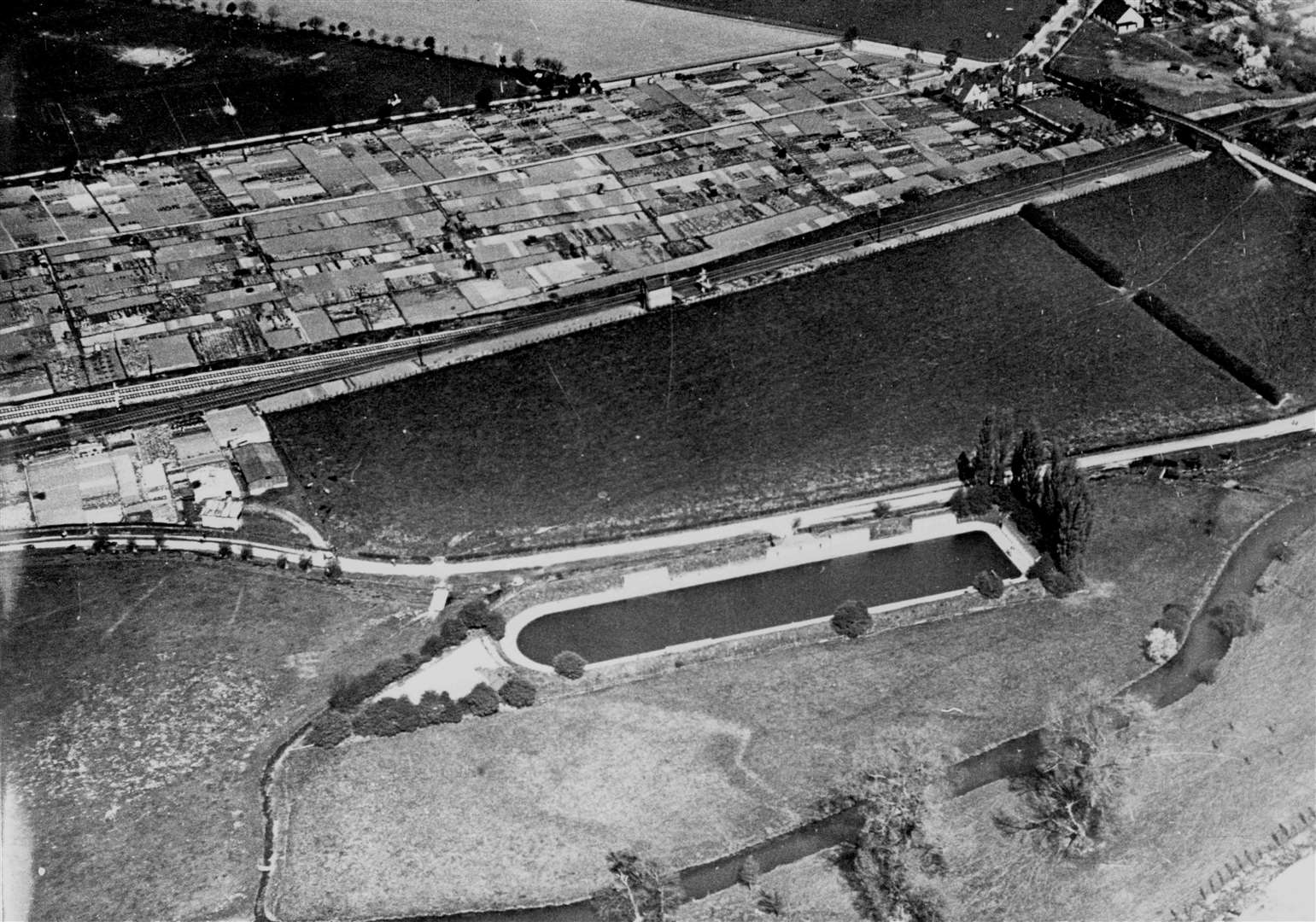
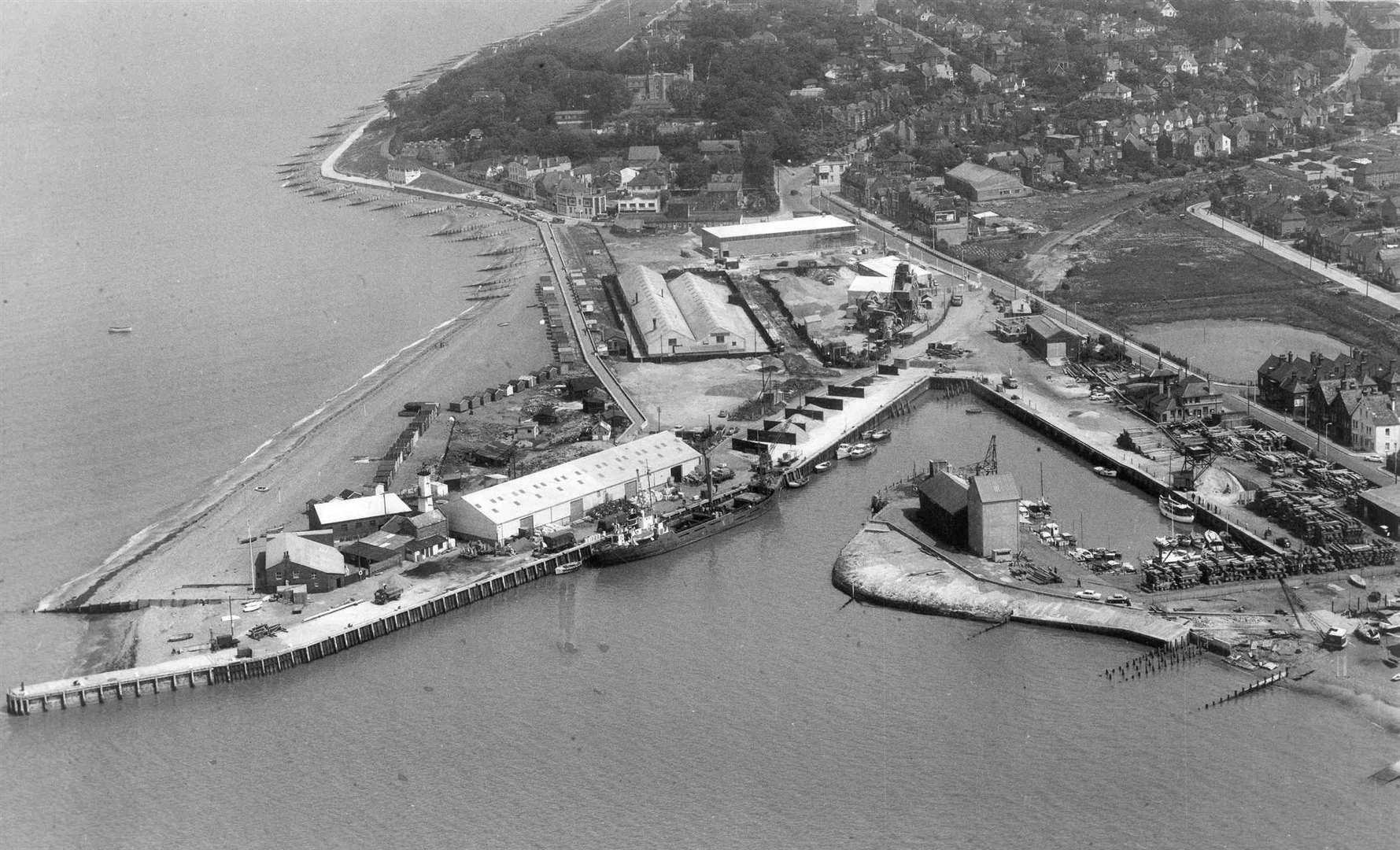
Whitstable Harbour gradually fell into decay after the war, but in 1958 the Whitstable Urban District Council purchased and repaired the site with the intention of rejuvenating the town's economy.
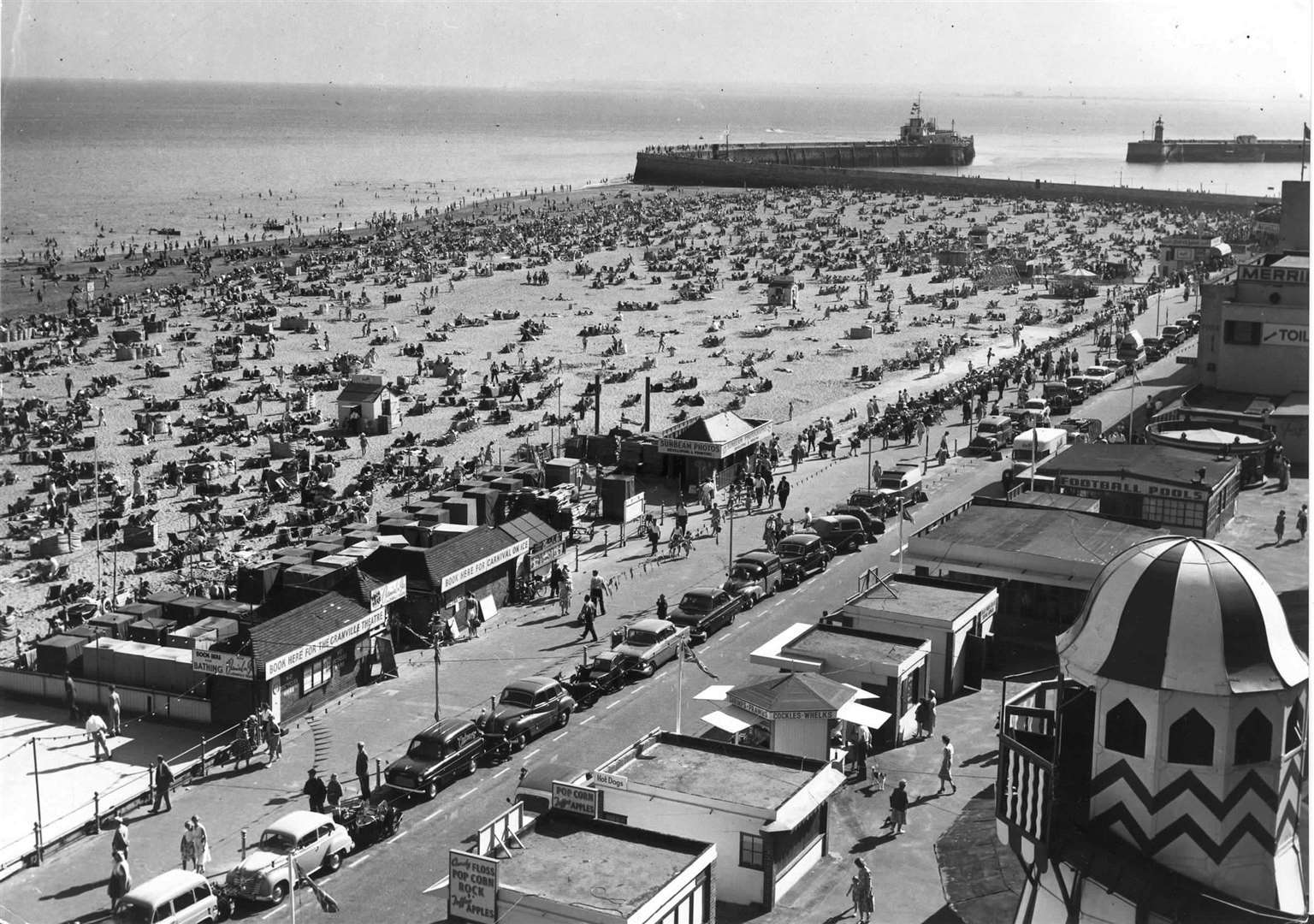
Folkestone
In July 1967, the Folkestone Salvage Company made an attempt to retrieve the cargo of a sunken Polish munitions ship in the Channel.
During the operation, some of the cargo inside the ship - which had been on the seabed since 1946 - blew up.
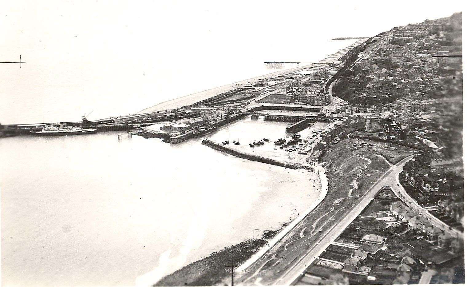
The explosion was so severe it measured 4.5 on the Richter scale and damaged chimneys and ceilings in Folkestone.
It is reported the event "brought panic to Folkestone’s town and chaos to the beaches". A six-metre deep crater was left behind as a result, and thankfully no one was injured.
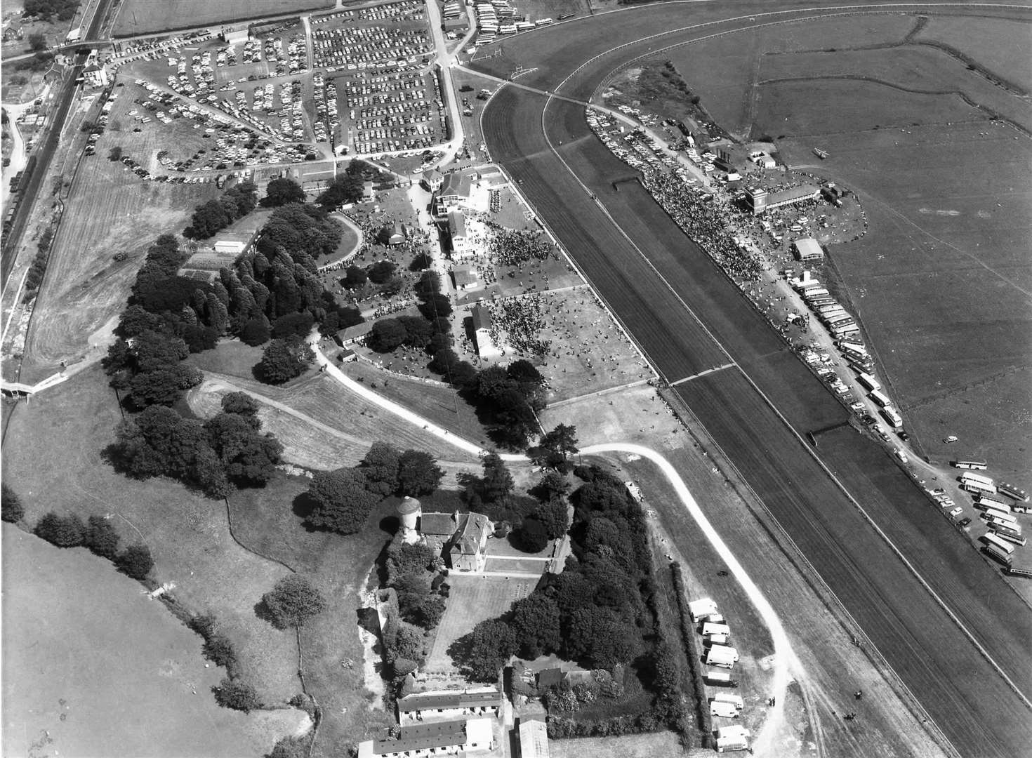
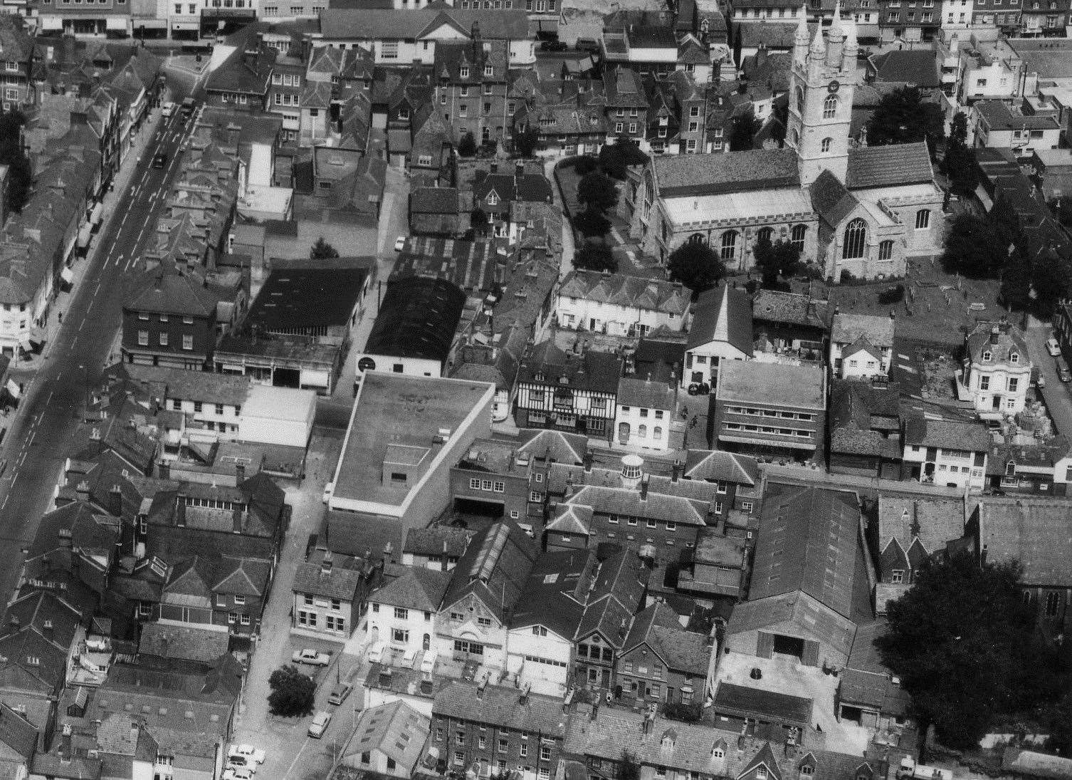
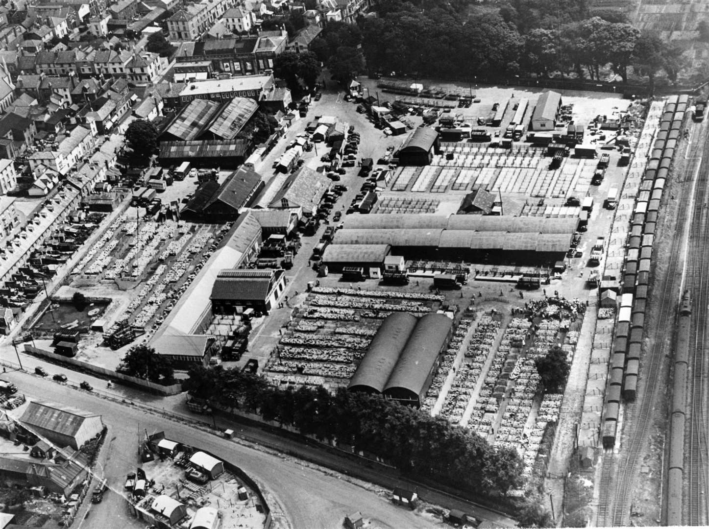
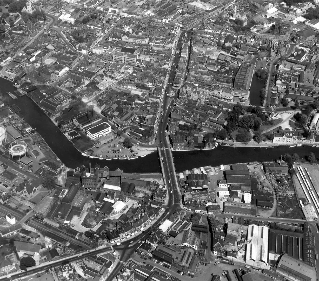
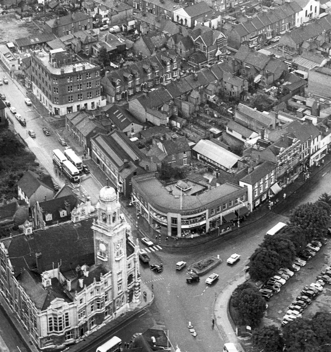
Maidstone
The Hazlitt Theatre opened its doors for the first time in 1955, and four years later the town said goodbye to Maidstone Zoo, which had been a popular attraction for 25 years.
Locals used to hear the lions roaring from their homes and elephants Gert and Daisy became firm favourites.

Fremlin’s Ales & Beers, which had grown to become the biggest brewery in Kent after its establishment in 1861, had amassed 800 licensed premises by 1967.
It was bought by Whitbread - which also owns Costa Coffee and Premier Inn - but was sold off five years later.
Town brewery Style & Winch shut in 1965 and the riverside building was demolished in 1976.
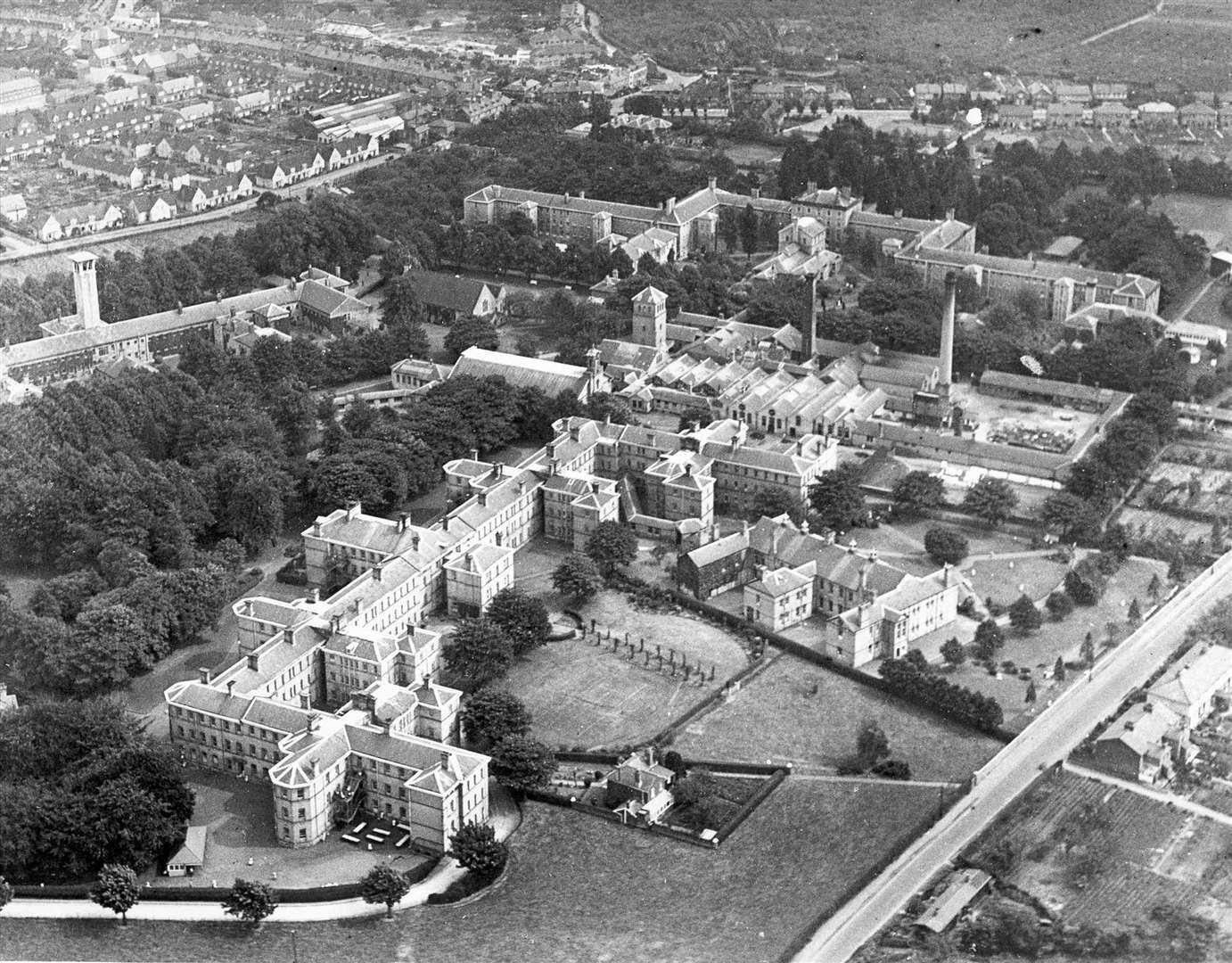
Disaster struck in 1957 when a devastating fire ripped through Oakwood Hospital in Barming Heath - causing the deaths of seven people.
The hospital suffered major damage when the blaze broke out in the tailor's workshop on the first floor.
A 120ft ventilation tower collapsed and claimed the lives of three firefighters, a nurse, the hospital printer and one patient.
Another disaster occurred on a foggy January day in 1969 when two trains collided near Marden.
A passenger train ran into the rear of a parcels train - killing four people and injuring 11.
Sheppey
Sheerness Naval Dockyard closed for the final time in 1960, in what a was a major blow for the island as 2,500 workers lost their jobs.
A decision over the site's future was revealed in parliament two years prior, with the news being described as " like a bomb going off in our house" by family members of those who worked there.
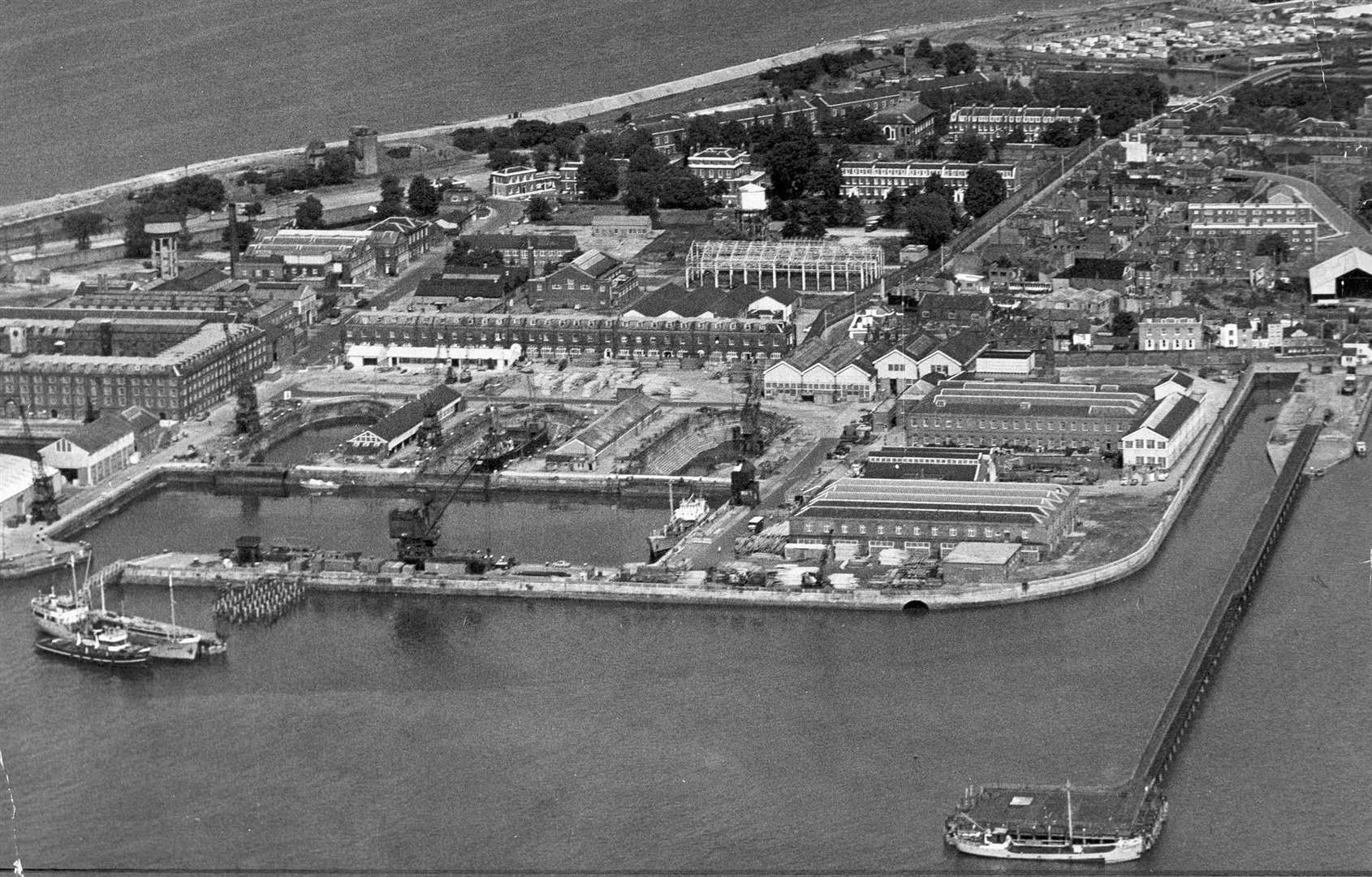
A closing ceremony took place in March 1960 and the Medway Port Authority took over the site for commercial use.
The docks have since gone through many different hands before becoming part of the Peel Ports empire.
Over the years, scores of ships were built for the Royal Navy at Sheerness. In the early 20th century, the Admiralty decided to cease shipbuilding and instead refit torpedo boats and torpedo boat destroyers at the docks.
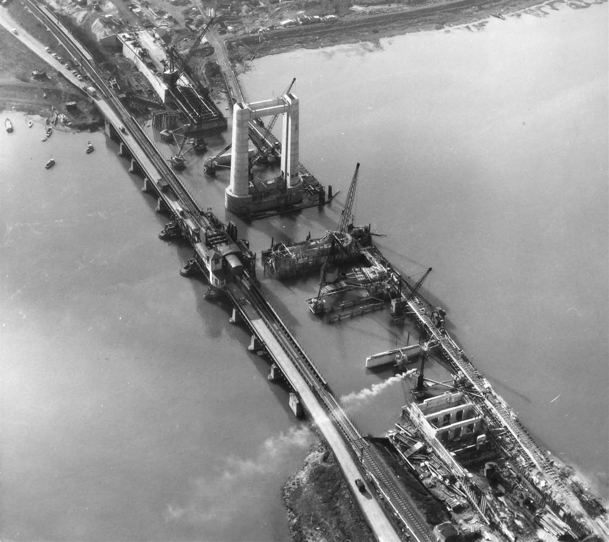
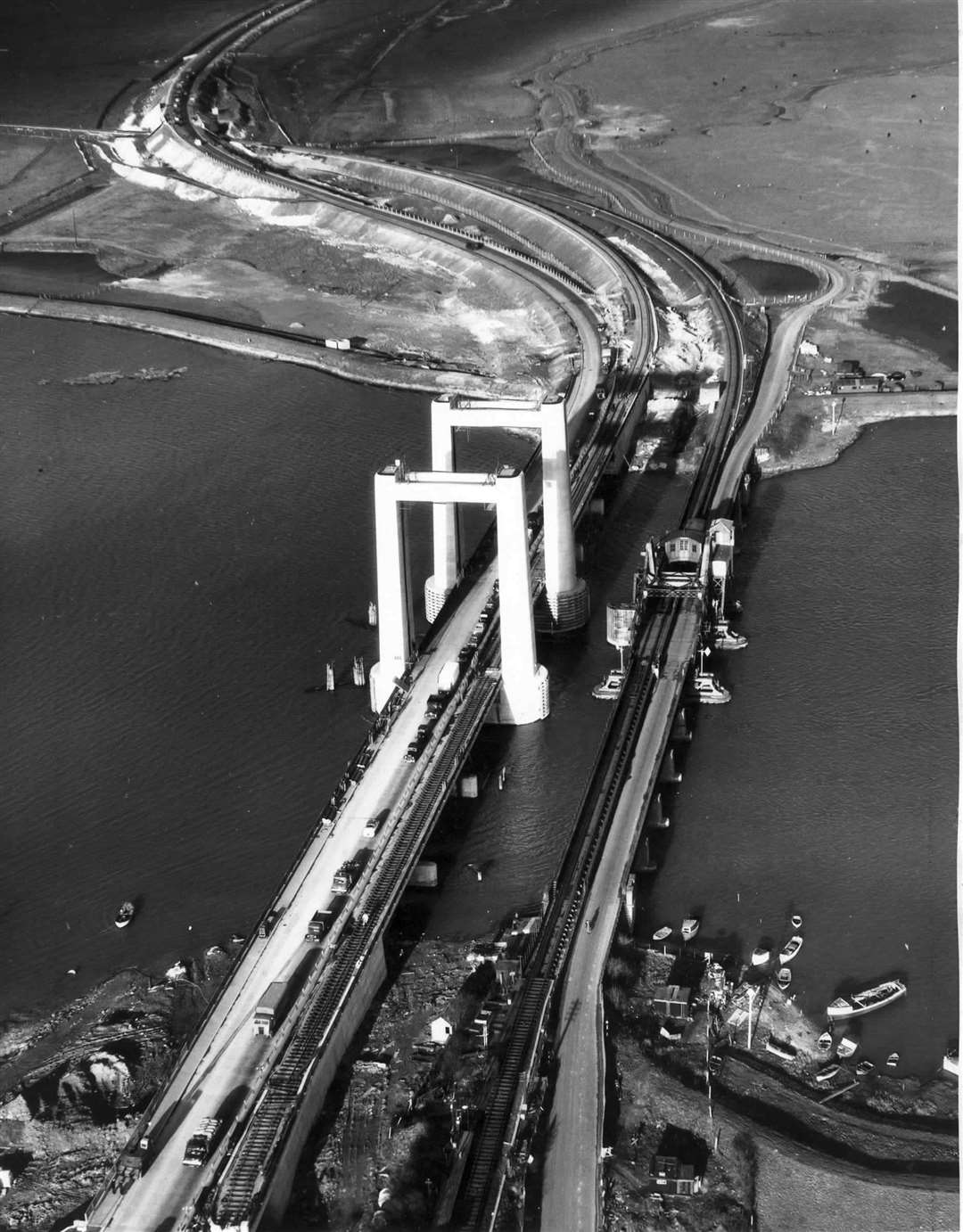
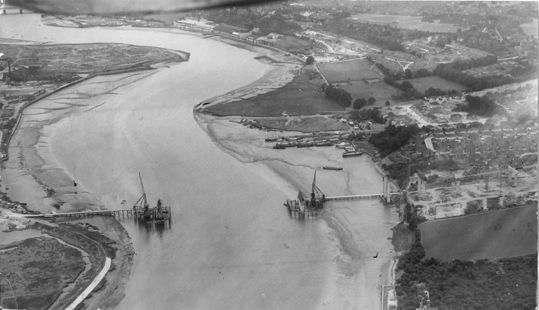
The 50s marked the start of construction for the replacement Kingsferry Bridge.
Principal contractor John Howard & Co started work in 1957, and the new link to the mainland was officially opened by the Duchess of Kent in April 1960.
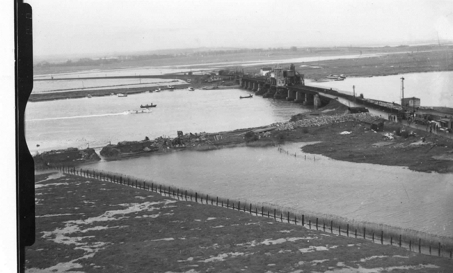
1953 saw more than 300 people lose their lives as a result of immense floods.
The sea level was the highest since records began in 1911, with the freak event being classed as a one-in-1,000 year catastrophe.
The two-day storm surge whipped the sea into such a frenzy that almost all defences across the Kent coast were breached.
On Sheppey, the old Kingsferry Bridge was marooned in an expanse of water four miles wide, while damage at Sheerness Dockyard was estimated at £1.5 million and was described as the “worst peacetime catastrophe”.
In Deal, cows were reported to be standing in water up to their necks. In Herne Bay, asphalt was torn from the Neptune Jetty, concrete slabs ripped from the sea wall and 400 buildings flooded.
A reporter for the Herne Bay Press wrote: "The scene on the seafront is one which almost baffles description.
"Immense waves rolling in, lashed by the north westerly gale, struck the sea wall with the noise of heavy artillery and flung water scores of feet into the air.
"Caught by the wind, the spray dashed almost horizontally across the promenade, carrying with it pebbles which came almost with the force of bullets."
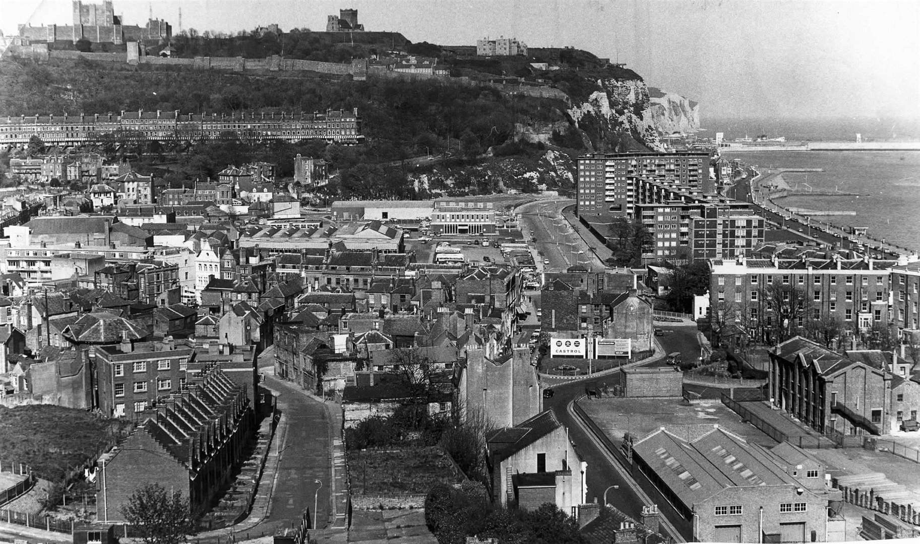
Dover
Skimming across the water from Dover to France in just 30 minutes, noisy hovercrafts were once a popular method of transport for those leaving Kent.
The original Seaspeed Dover hoverport was opened in 1968 - taking passengers across to Boulogne.
Richborough
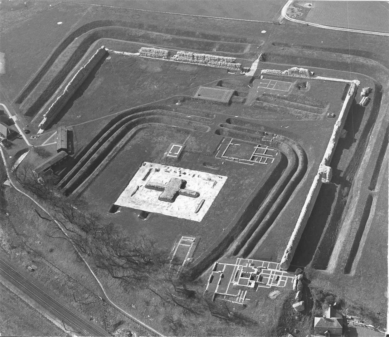
Dominating the east Kent skyline for decades, the mammoth cooling towers of Richborough power station were constructed in 1958.
The station was coal-fired when it opened in 1962, but was eventually converted to oil and then a controversial oil-water emulsion.
It went on to close in 1996, and the iconic towers and chimney were demolished in 2012.
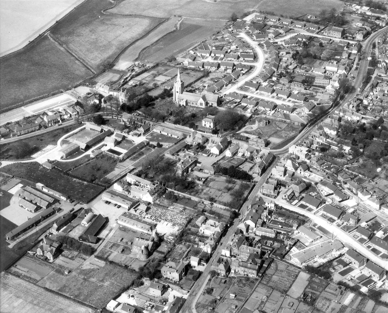
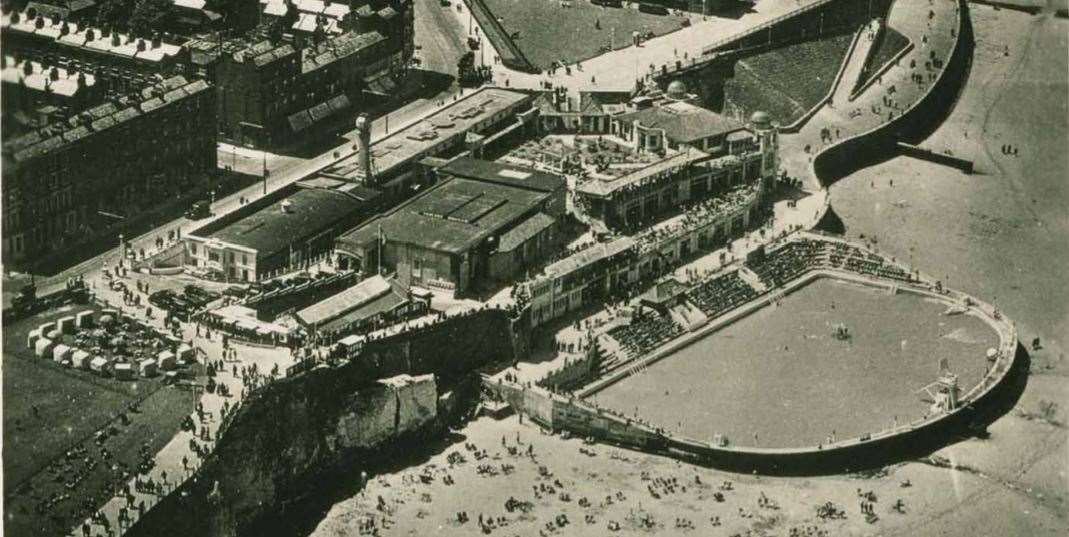
Thanet
Following the war, Thanet struggled to regain its reputation with the clientele that had frequented the large Victorian and Edwardian hotels of Cliftonville.
Butlins snapped up six of them in 1955 and marketed them as The Cliftonville Hotels.
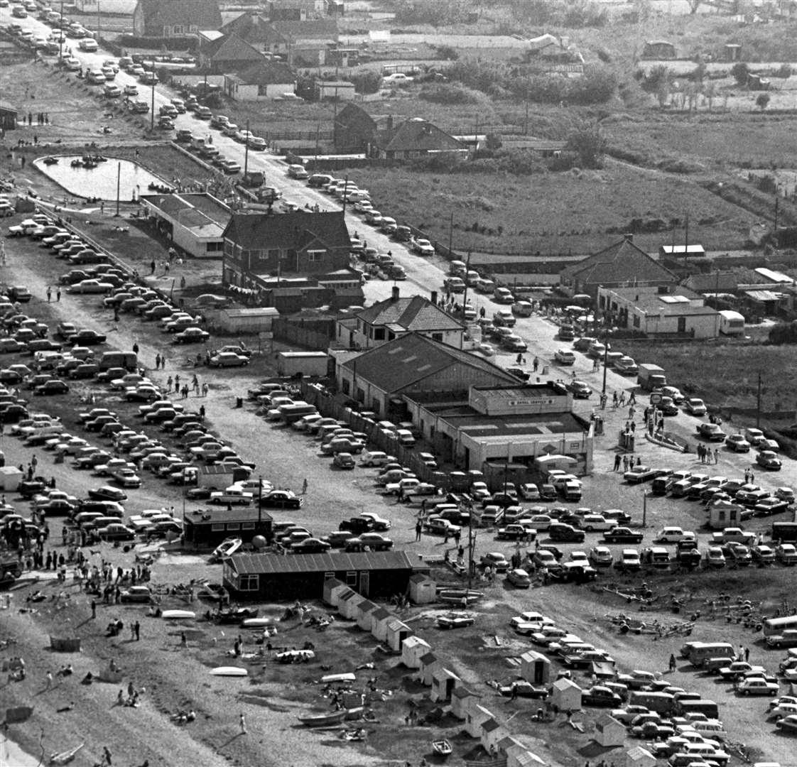
The 60s saw Margate become a pilgrimage-like attraction for mods and rockers, with well-publicised fights on the beach.
The Mayor of Margate is quoted at the time as saying: "We in seaside resorts have a difficult enough job to make a living in the short English summer, and the sort of publicity we get from activities of these morons as glamorised in the national press and on television does us no good at all."
Again, the storm surge of 1953 left its mark. The Westbrook Pavilion, Marine Terrace Bathing Pavilion, the Lido and Margate's jetty were all damaged.
The baths and cafes in the bays of Cliftonville were all completely destroyed.
Arlington House, the multi-storey apartment block which dominates the town's skyline, was opened in 1963.
1967 spelled the end of The Hippodrome cinema, with it being demolished and replaced by the library and local authority offices.
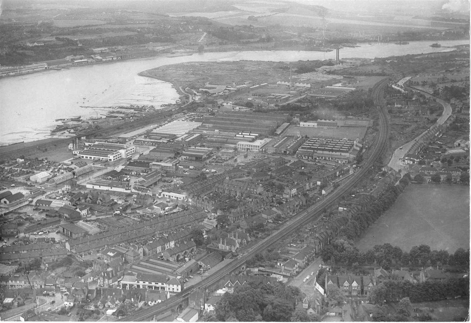
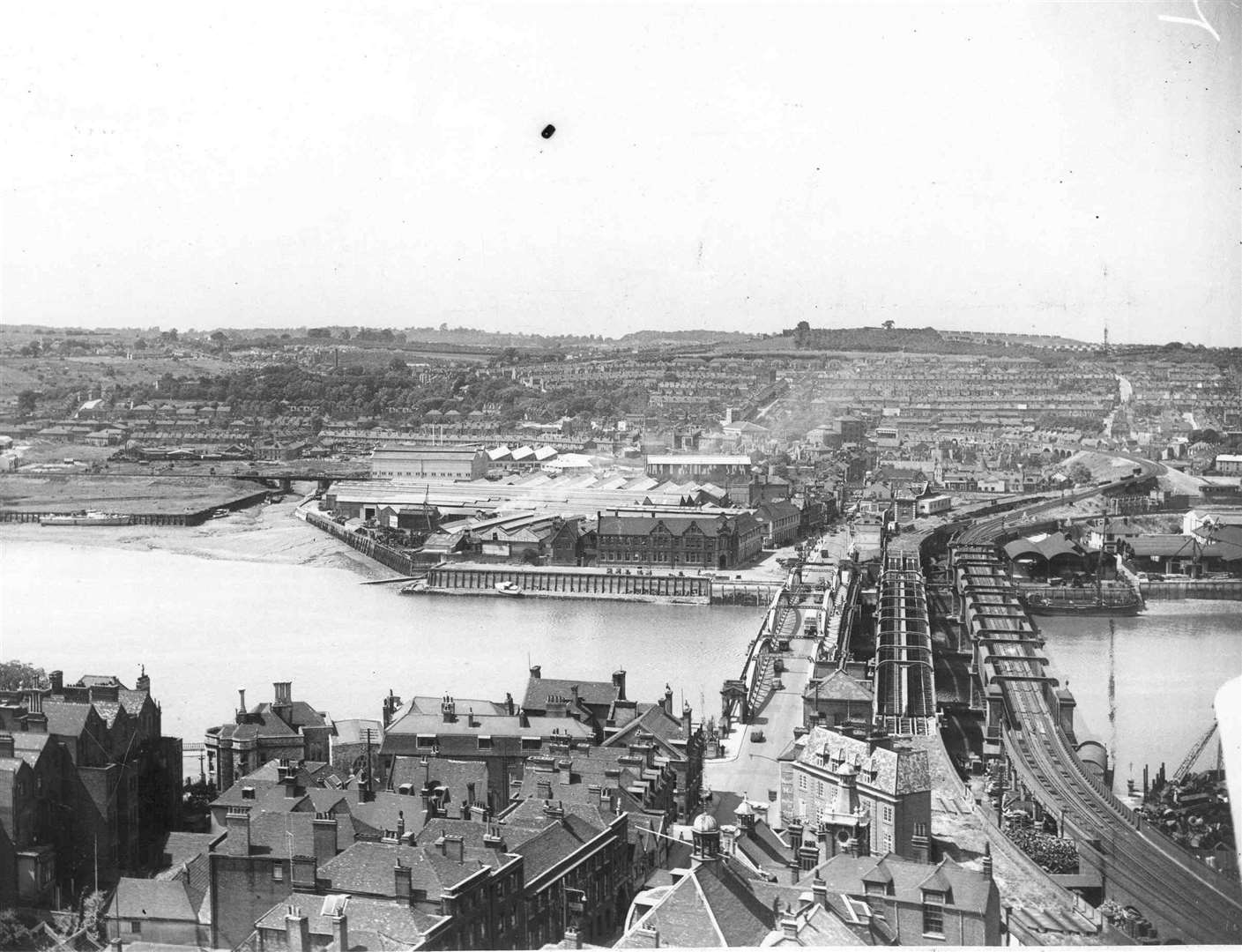
Medway
Originally built as a Royal Naval hospital, what we now know as the Medway Maritime was transferred by the Admiralty to the NHS in 1961.
Prior to that, Royal Marines Police guarded the entrance with visitors having to show a pass in order to gain entry.
After the NHS takeover, the hospital underwent a four-year revamp and reopened as the Medway Hospital in 1965.
Subsequent renovations followed, and in 1999 it was renamed the Maritime in honour of the town's proud links to the Navy.
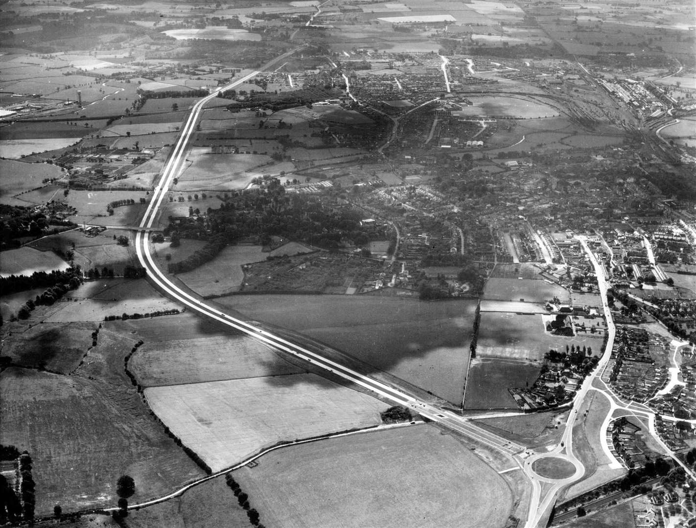
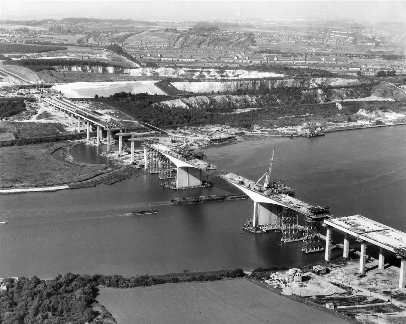
In order to alleviate traffic on the A2, plans for the 26-mile M2 were drawn up and the motorway was completed in the 60s.
1965 saw Rochester Castle switch into the hands of the Ministry of Works, having previously been cared for by the Corporation of Rochester. English Heritage took over guardianship 19 years later.
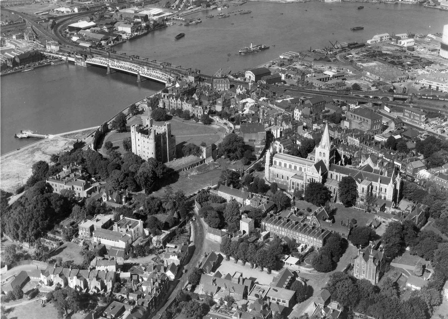
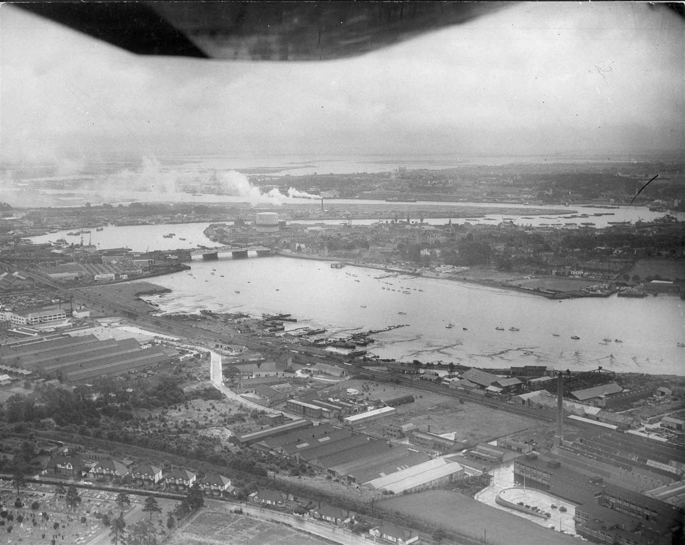
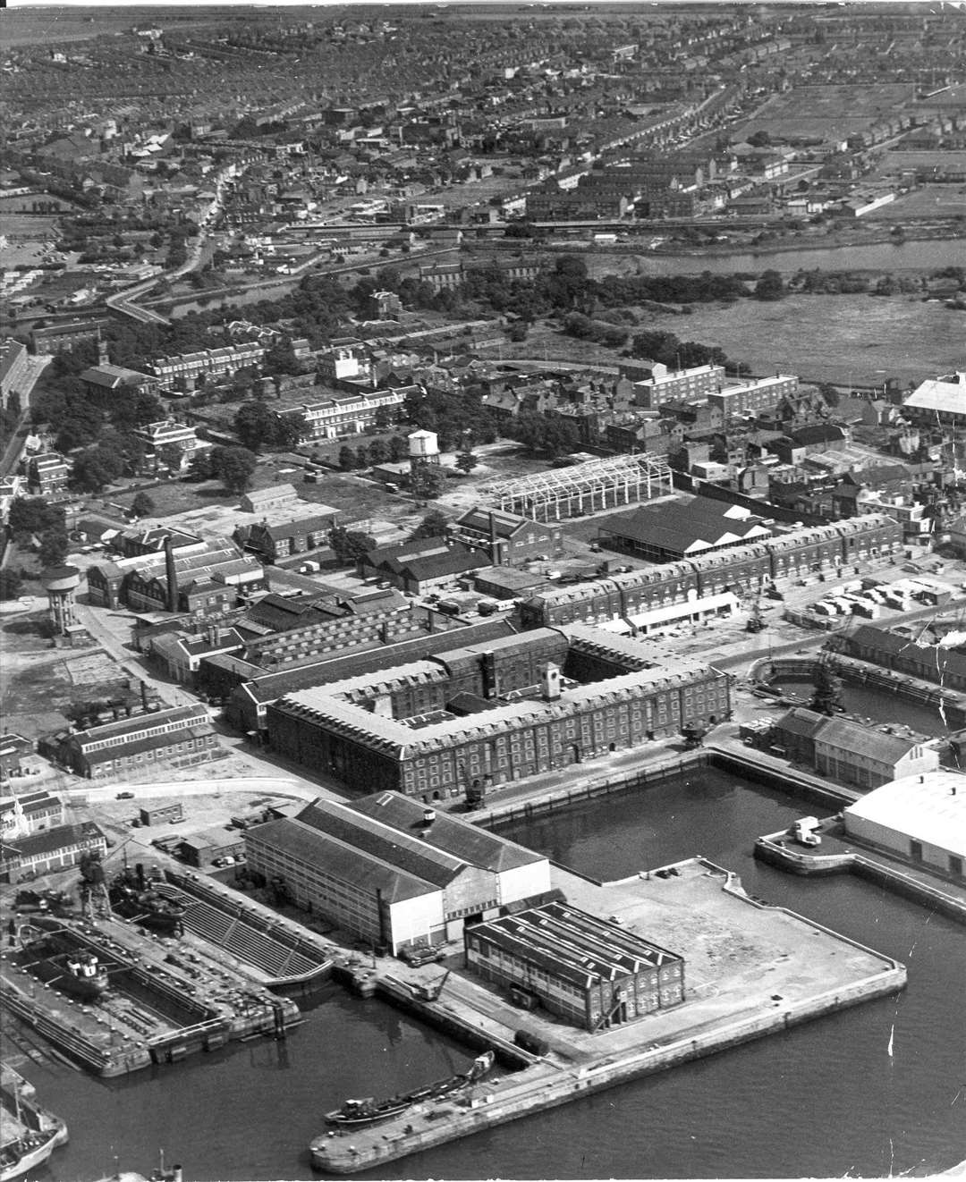
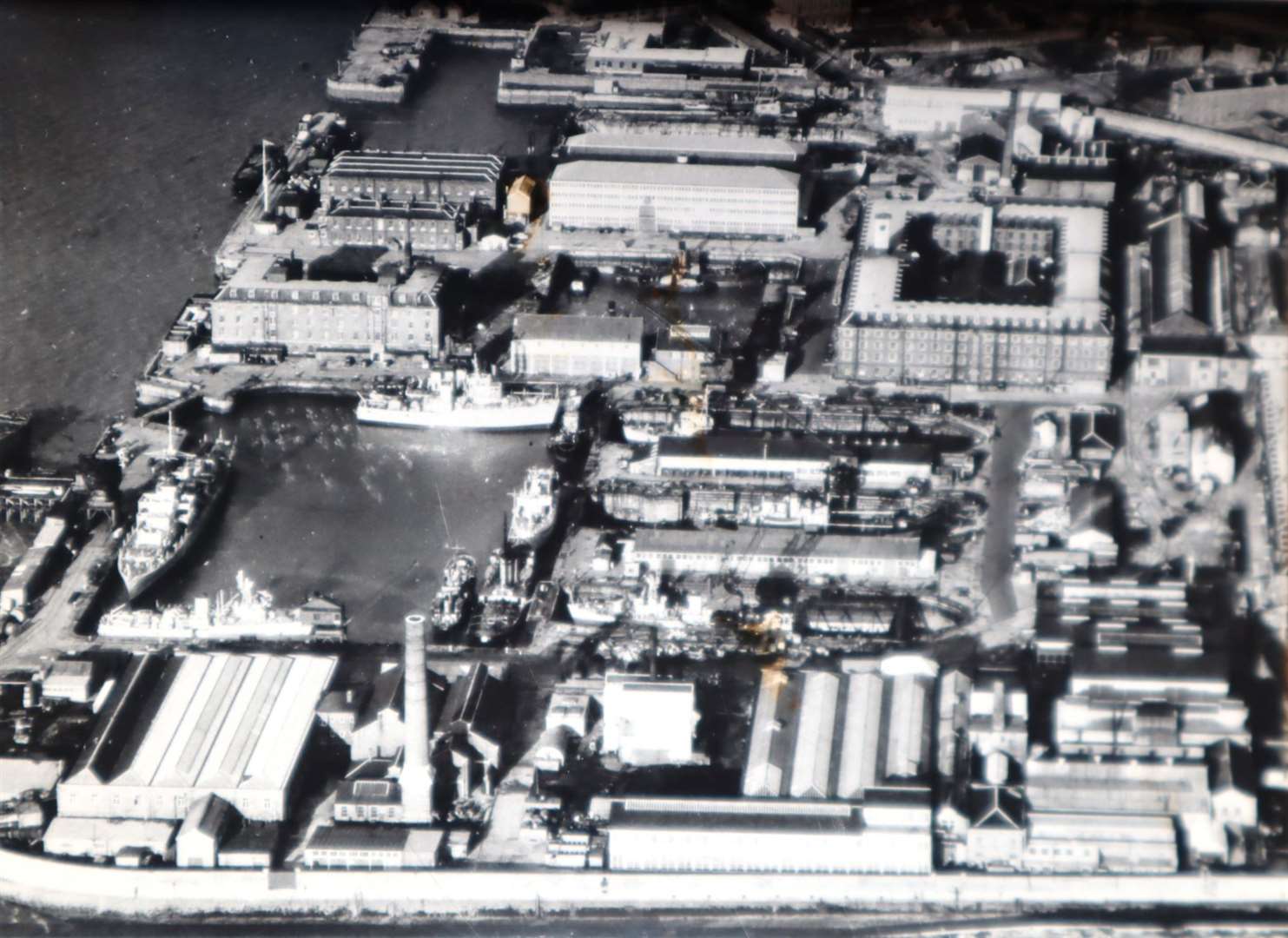
Chatham Dockyard remained operational during the 50s and 60s, yet parts of the site were demolished.
Marines, who were first stationed at the dockyard in 1779, were withdrawn from Chatham in 1950.
The final boats constructed at the site were Oberon-class submarines.
The Ocelot submarine was the last to be built for the Royal Navy, and the final vessel - Okanagan - was built for the Canadian Navy and launched in September 1966.
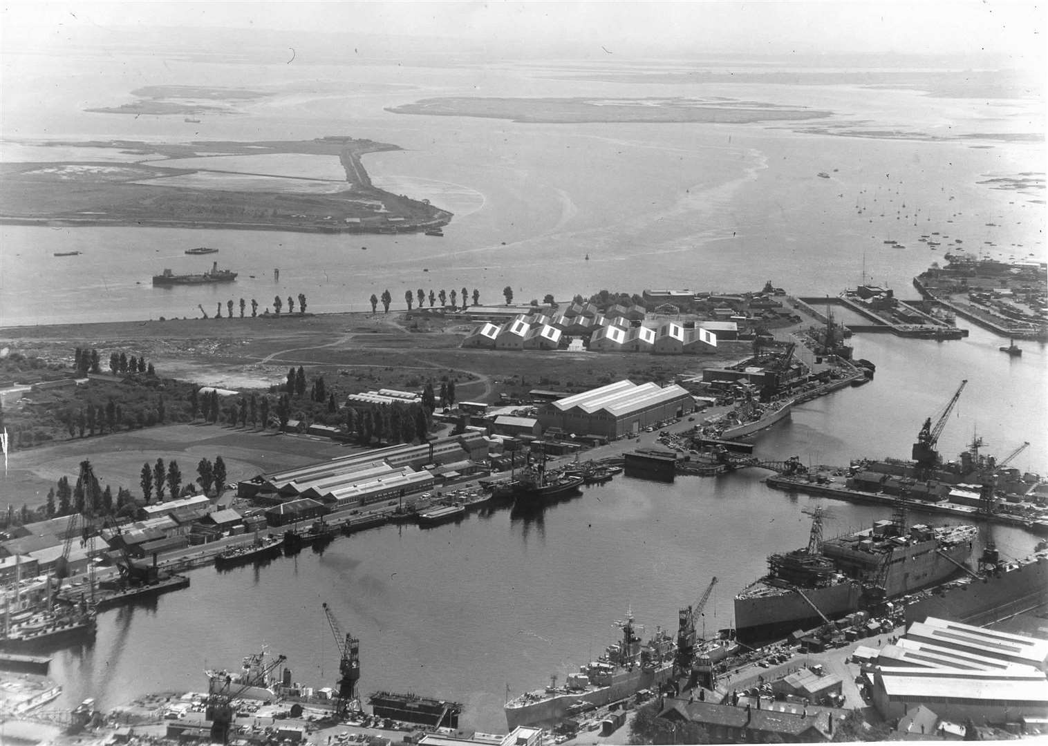
A nuclear submarine refitting complex was built at the docks in 1968.
A little over a decade later, it was decided to shut down the dockyard and it closed in 1984.
In December of 1951 the Chatham Royal Marine Cadet unit suffered a horrendous tragedy in Dock Road, when 24 young cadets were hit by a bus while marching in column to the dockyard.
It is one of Britain's worst-ever road tragedies.
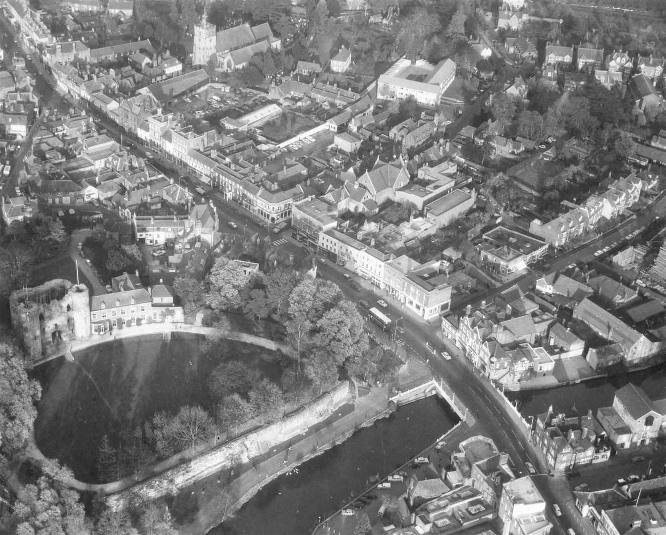
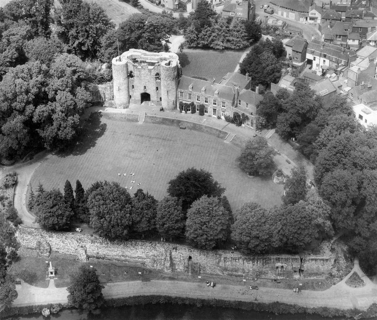
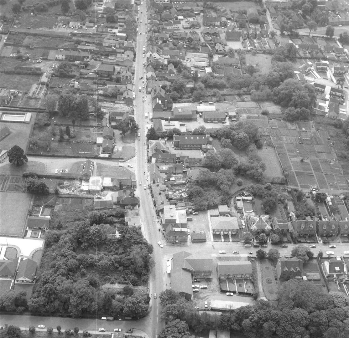
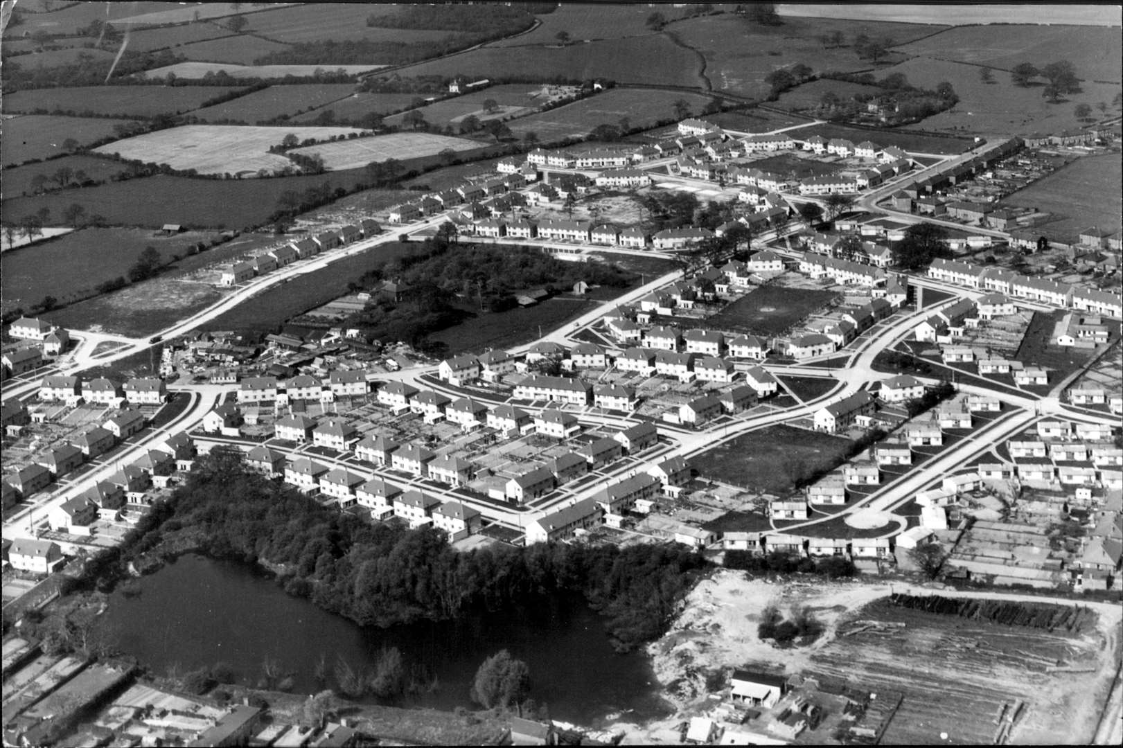
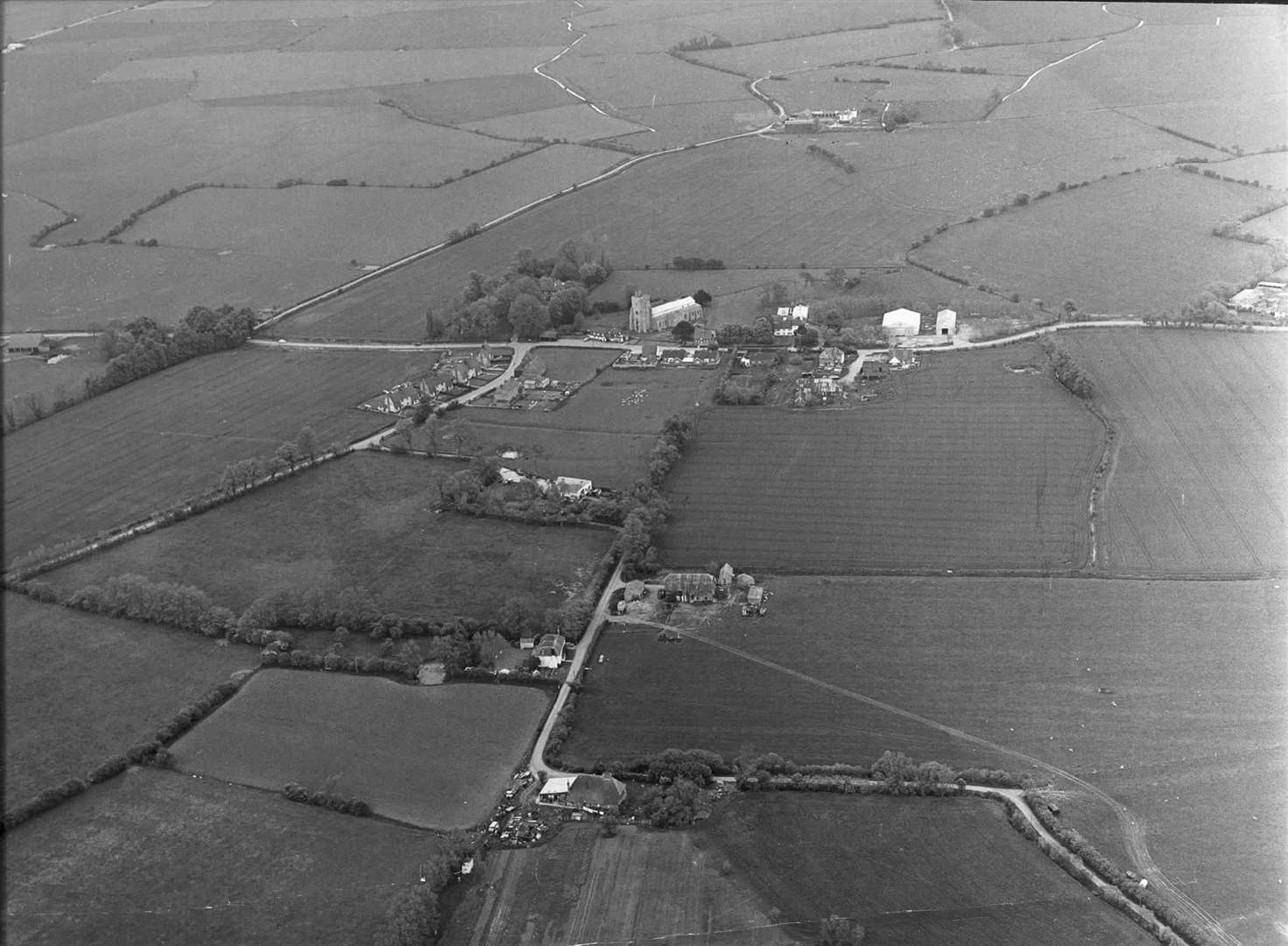
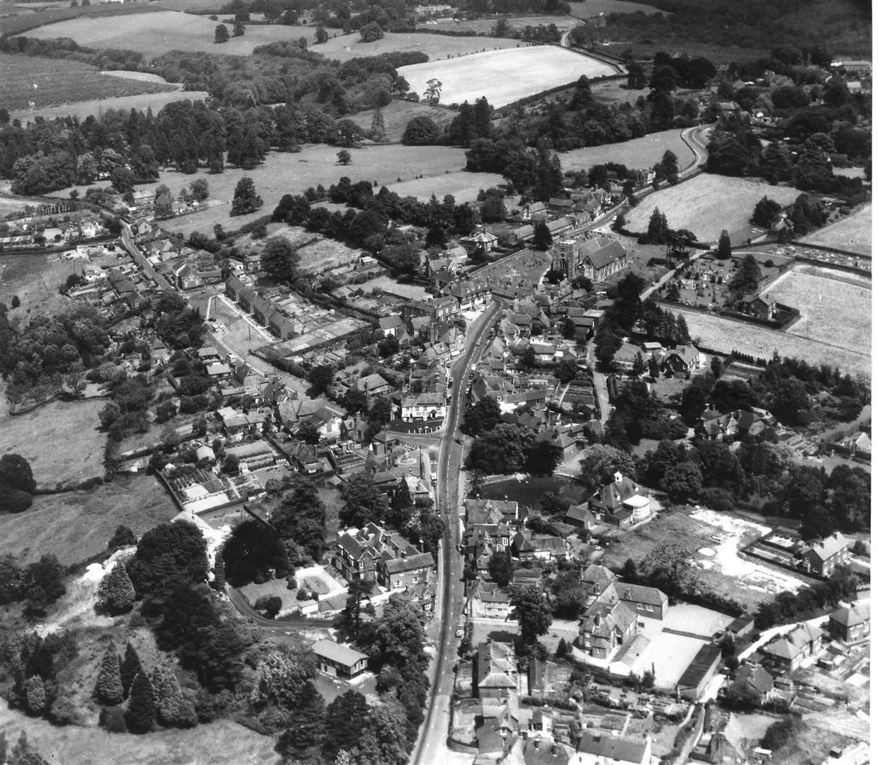
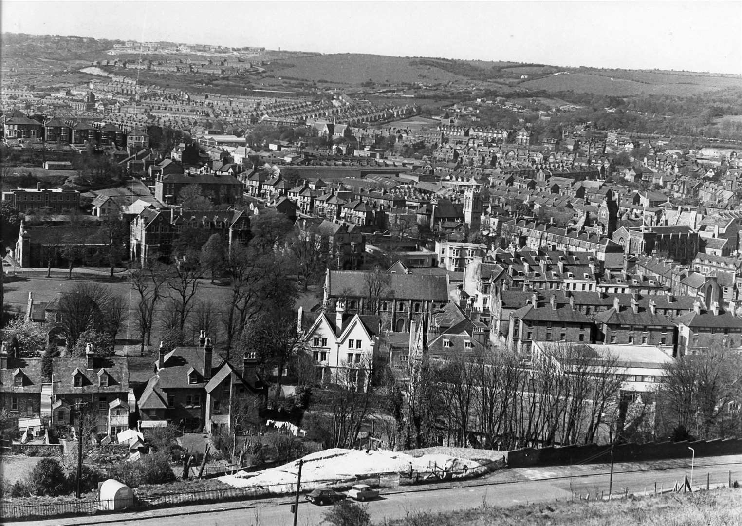
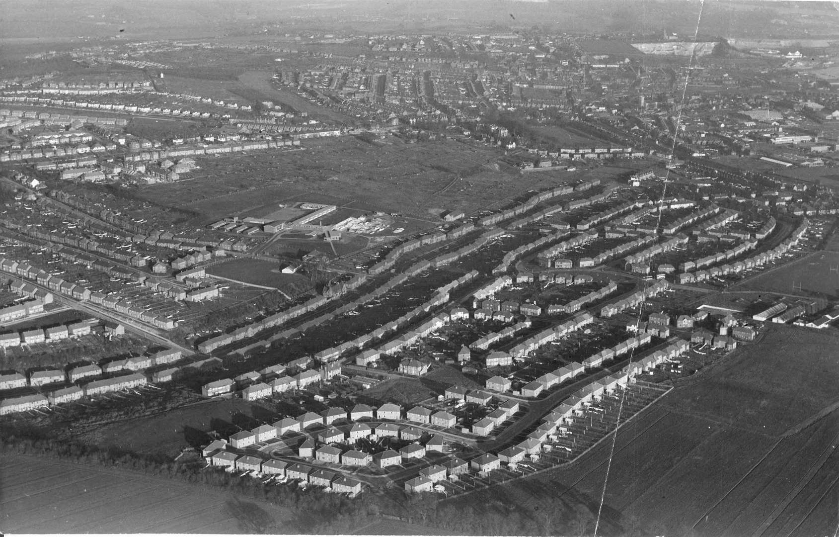
Tonbridge
Tonbridge underwent a huge expansion in the 50s and 60s, with thousands of new homes being built at the north end of the town. Three new churches and four new schools were to be built.
The population jumped by about 20,000 in the space of 20 years.