More on KentOnline
More on KentOnline
Kent is still feeling the after effects of Storm Isha today, which lashed the county with winds of up to 80mph overnight – causing fallen trees and power cuts.
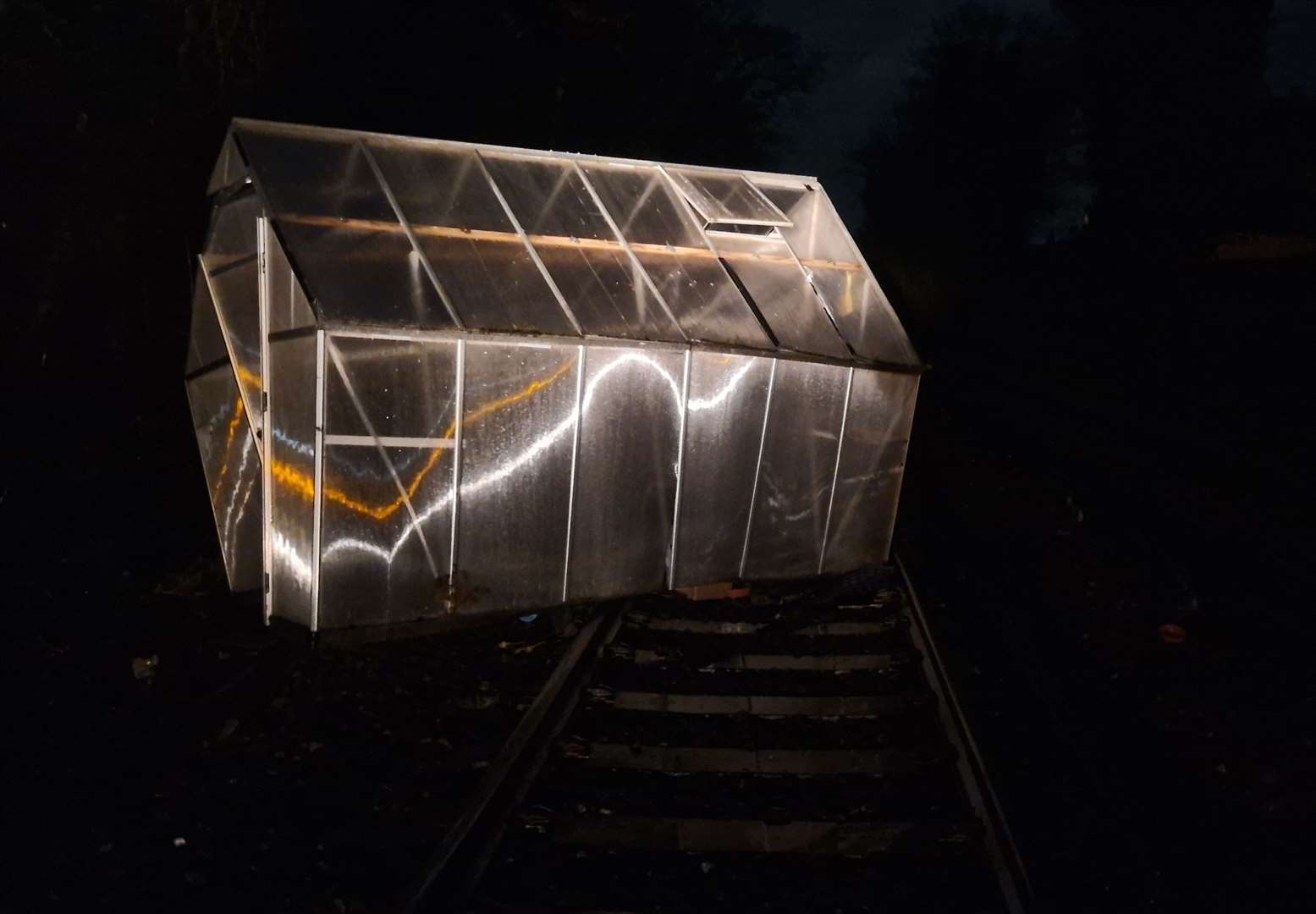
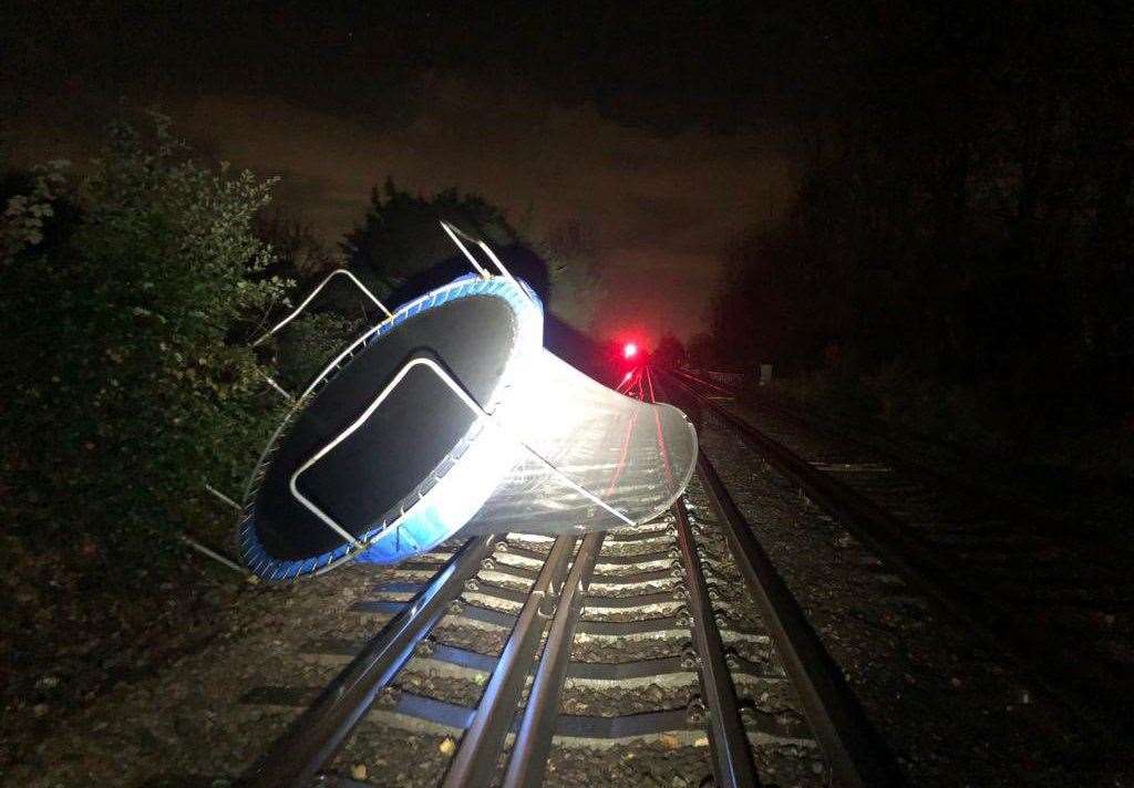
A number of early trains in Kent were cancelled after items including a greenhouse, trampoline, trees and other debris were blown onto the tracks.
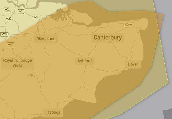
A Met Office amber weather warning was in place for almost the entire county from 6pm yesterday until 6am today, prompting a rare “danger-to-life” warning.
A less severe yellow alert for wind will remain in place until midday.
Overnight, violent winds have been causing havoc on roads, rails and ferries.
Several early trains were cancelled due to a number of obstructions on the railway lines, including a greenhouse blocking the route at Westgate-on-Sea, a trampoline at Rainham and trees at Teynham and Kearsney.
Southeastern shared a picture of the glass structure on the tracks at about 12.30am this morning.
These obstructions have since been cleared, but Southeastern is warning passengers to check their journey before they travel.
Speed restrictions of 50mph were lifted at 6am.
Last night, firefighters were called after a large part of a flat roof was blown onto a pathway in College Road, Margate.
One fire engine attended just after 11pm and crews helped to clear the scene and make sure the area was safe. No injuries were reported.
Also yesterday evening, the southbound QEII Bridge at the Dartford Crossing was closed due to strong winds. It reopened just before 4am.
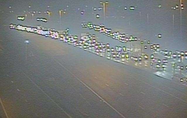
The A249 Sheppey Crossing was also closed in both directions due to the wild weather. It reopened just after 1.30am.
At 10.30pm, one lane of the M20 was closed due to a fallen tree on the London-bound carriageway between J4 A228 Castle Way (Leybourne / Snodland) and J3 M26. It too has reopened.
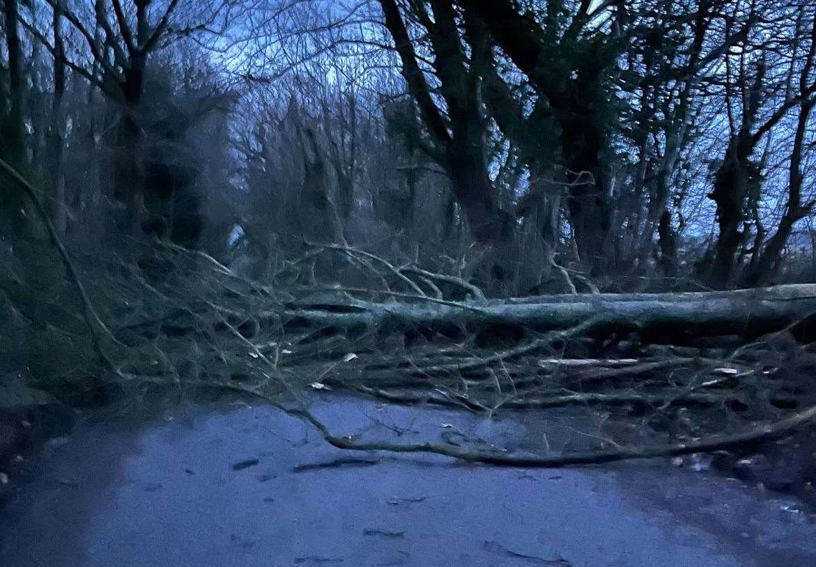
Meanwhile, fallen trees are disrupting many roads in the county this morning.
There is one down on Wittersham Road in Wittersham near Rose Hill. The A274 Biddenden Road is also blocked near Shenley Road (Headcorn Aerodrome) and there is queuing traffic after a fallen tree blocked the A257 in both directions from Nargate Street to Cherville Lane near Wingham.
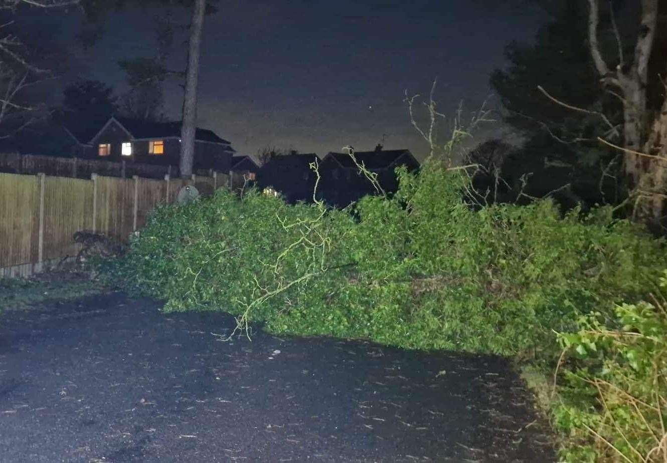
The A225 Riverhill is shut both ways from the A21 Tonbridge By-Pass (Hildenborough / Sevenoaks Turn Off) to St Julian Road also because of a fallen tree and Sandling Lane in Maidstone is blocked near the Becksbourne Close junction due to a fallen tree.
Delays have also been sparked on the A229 at the B2097 Rochester Road after traffic lights on the Lord Lees roundabout failed.
Power cuts have been reported across the county too, with thousands of people affected.
UK Power Networks said 10 postcodes in the Teynham area – between Faversham and Sittingbourne – had an “unexpected” power cut.
Loss of power also saw the sky turn blue for residents across Gravesend and Meopham yesterday evening.
Those living in the area say they were shocked to see the bright flash as it was suspected a power line had gone down just before 9.30pm.
South East Water has also said disruption to water supplies could occur due to the effects of the weather.
In an update today (Januray 22) at around 4.30pm, the water supplier said: “We’re so sorry to customers who may have low tap water pressure or no water this afternoon.
“Due to the power cuts following Storm Isha and a dramatic increase in the number of leaks and bursts on our pipes following the weather warming up, water levels at some of our drinking water storage tanks are running low and as a result, may impact some customers in localised areas.
“Our expert teams are working very hard to keep as many people in supply as possible and where there are issues, ensure normal service is resumed as quickly as possible.
“We have a dedicated incident team in place while we work to resolve restore water supply and have worked through the night to keep our pumping stations and water treatment works operating throughout Storm Isha.
“An incident team was set up and our key water treatment works and pumping stations were switched to operating on generators with additional generators issued where possible.
“We appreciate your patience and understanding whilst we work through these challenges.”
Residents in Coxheath this evening have mentioned receiving little to no water.
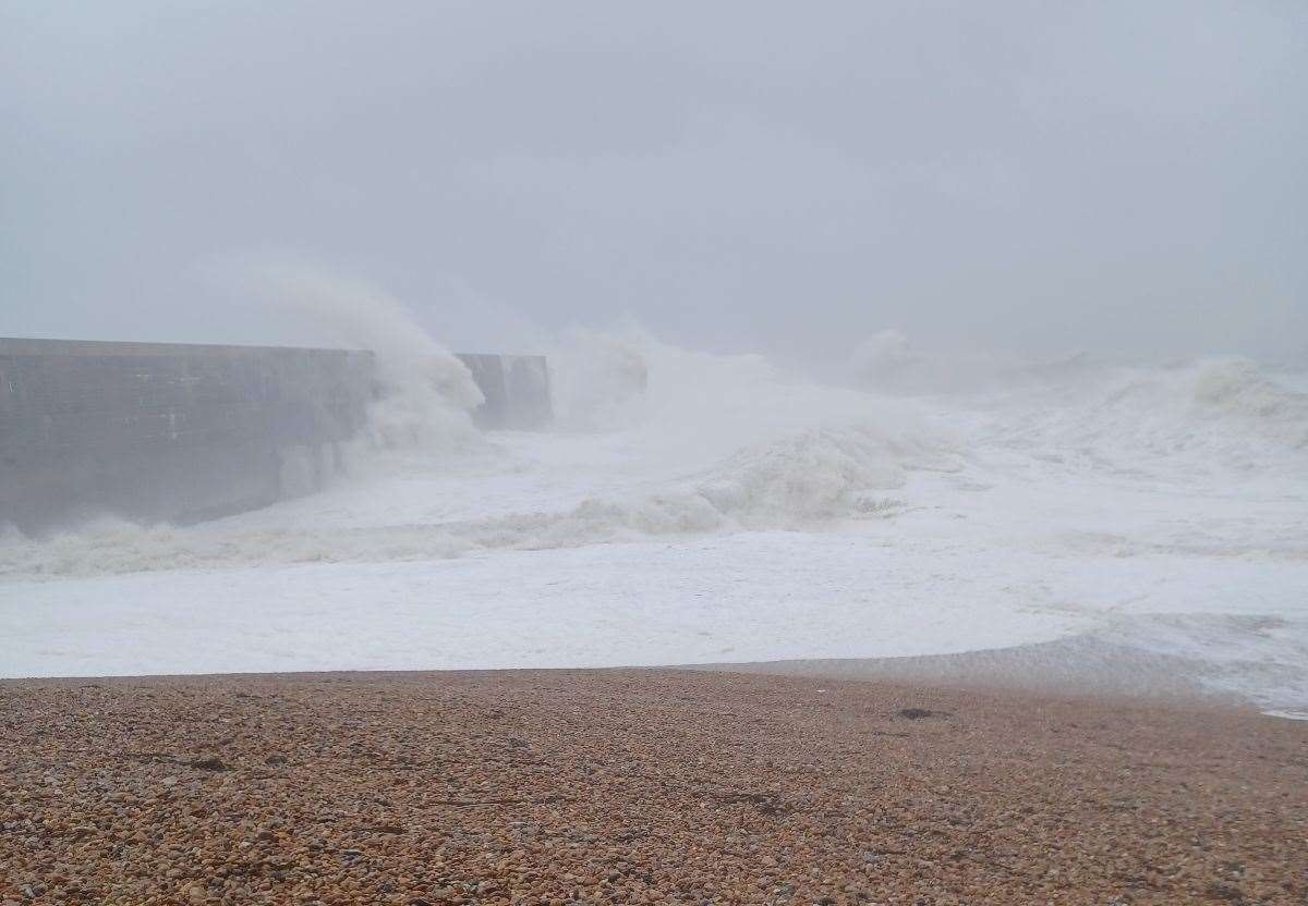
Forecasts on Sunday predicted the fiercest gales to strike at Dover harbour at about 10pm, reaching speeds of 64mph.
But Met Office experts warned it could get even worse.
Chief meteorologist Dan Suri said: “Very strong winds will also develop in the far south east of England, bringing the risk of 70-80mph gusts here too in the early hours of Monday morning.”
On the opposite side of the county, in Tunbridge Wells, a top speed of 55mph was forecast for 9pm.
The Port of Dover described sea conditions on Sunday evening as “very rough”, with “gale force winds, force 9 to 10” and later peaking at gale force 11. By 3.30am conditions had not improved much, with winds at gale force 8.
Meanwhile, P&O Ferries said it was anticipating disruption, adding: “Please plan ahead for your journey and come prepared for a potential long wait.”
But at 3am it said its Dover to Calais crossings were on time. DFDS was reporting delays of two hours last night.
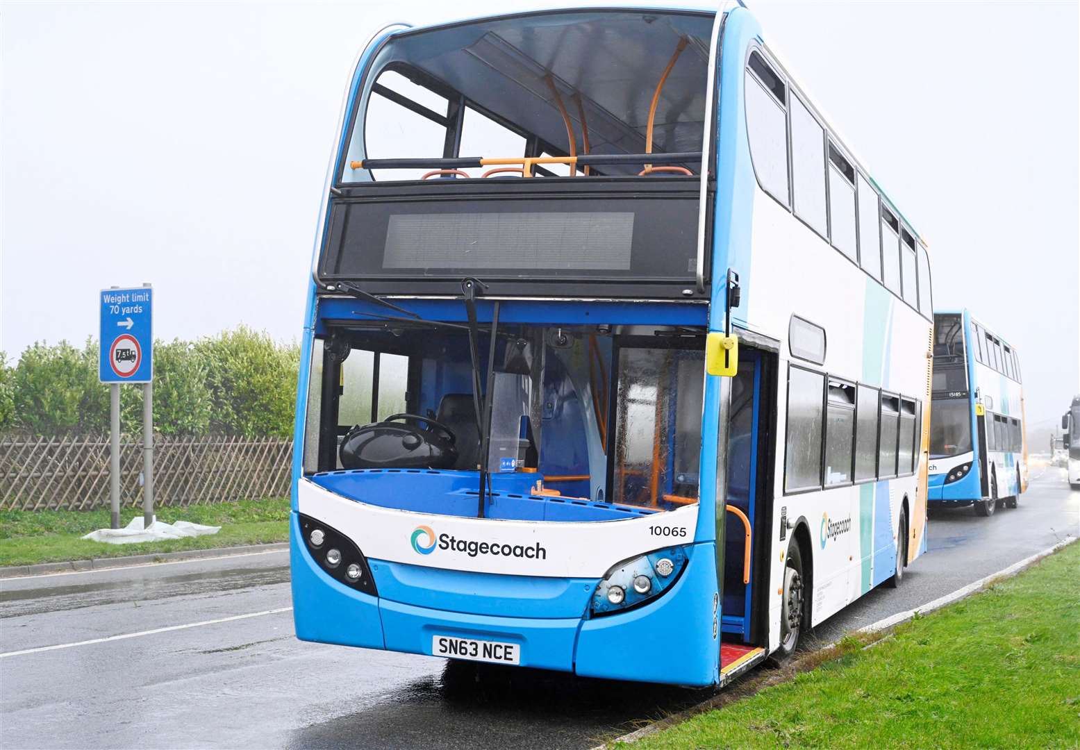
Southeastern had warned of disruption to rail services – especially those serving coastal areas – with speed restrictions of 50mph in place until Monday morning.
The operator is also reminding people to “make sure trampolines and other loose objects are secure to avoid them trying to fly”.
National Highways is also urging drivers to check ahead and plan for disruption to their journeys before they travel.
Its website says: “There is a particularly high risk that high-sided vehicles and other 'vulnerable' vehicles such as caravans and motorbikes could be blown over.”
A Met Office spokesman added: “Some damage to buildings, such as tiles blown from roofs, could happen. Injuries and danger to life from flying debris are possible.
“Power cuts may occur, with the potential to affect other services, such as mobile phone coverage. Injuries and danger to life could occur from large waves and beach material being thrown onto sea fronts, coastal roads and properties
“Some roads and bridges may close. Road, rail, air and ferry services may be affected, with longer journey times and cancellations possible.”
Temperatures will feel much milder than the recent cold with averages around 11C.
In a post on X, formerly Twitter, Kent Fire and Rescue Services said on Sunday morning: “Storm Isha is set to arrive in Kent (and) Medway this afternoon, bringing some very strong winds. Please take extra care if you’re out in the tricky conditions.”
Mr Suri said: “Storm Isha will bring strong winds to the whole of the UK through Sunday and into Monday.
“As the storm starts to move away on Monday morning very strong winds will also develop in the far south east of England, bringing the risk of 70-80mph gusts here too in the early hours of Monday morning. Reduce your speed on the roads, allow more time for your journey and stay safe.”
Here is how the Met Office has advised people to keep safe during the storm:
Items such as bins, plant pots, garden furniture, trampolines and sheds should be secured, while doors and windows should be fastened.
Cars should be parked in a garage if available, or kept away from buildings, trees, walls and fences.
If chimney stacks are tall and in poor condition, beds should be moved from areas directly below, and the Met Office has even recommended that people do not sleep near windows.
It is suggested that people gather torches and batteries and other essential items if there are warnings of power cuts in place.
Checking if a property is at risk of flooding is also advised in areas where a yellow rain warning is in place.
– Travel
People should stay indoors wherever possible, but if they do need to leave their house, steering clear of trees and walls during strong winds is advised.
It is also recommended that drivers grip their steering wheel with both hands and keep more room around the vehicle than usual while travelling.
Checking for transport delays and cancellations is advised ahead of any journey.
– After storm
People should not go near electrical or telephone cables that have been blown down or are still hanging.
They should also steer clear of walls, buildings and trees which appear to have been weakened.
Checking on vulnerable neighbours or relatives is also recommended.


